Mount Baker seen from Goat Lake on Ptarmigan Ridge, Mount Baker Wilderness. North Cascades Washington #73706

Lake Ann Ptarmigan Ridge Mount Baker Wilderness

Lake Ann Ptarmigan Ridge Mount Baker Wilderness

Mount Baker seen from Goat Lake on Ptarmigan Ridge, Mount Baker Wilderness. North Cascades Washington #73706
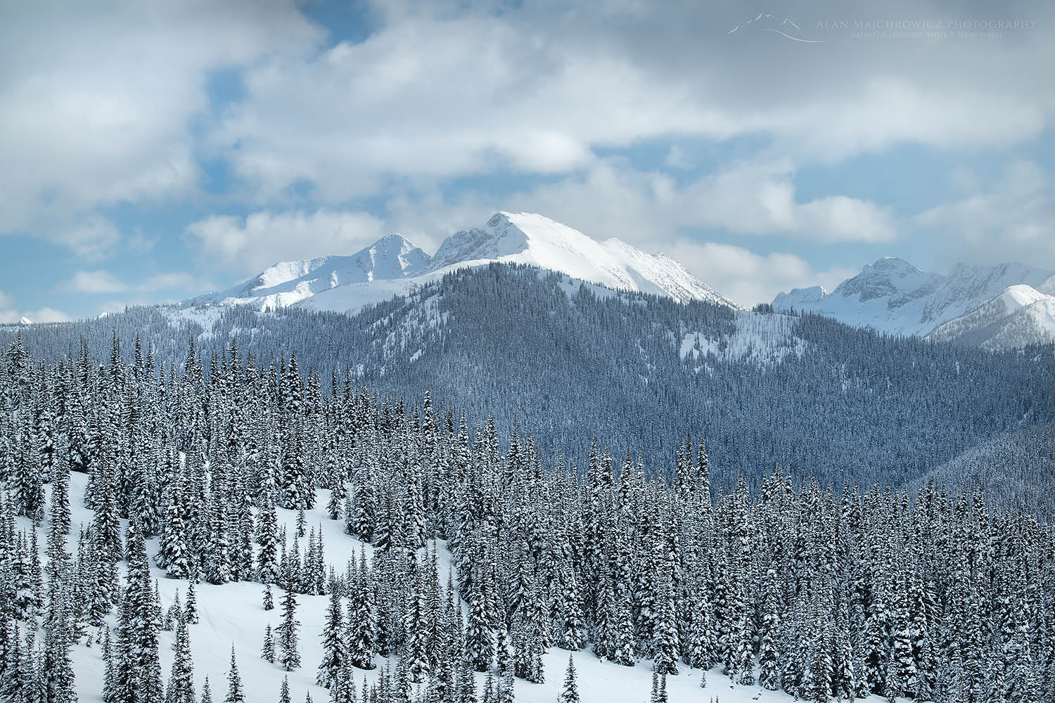
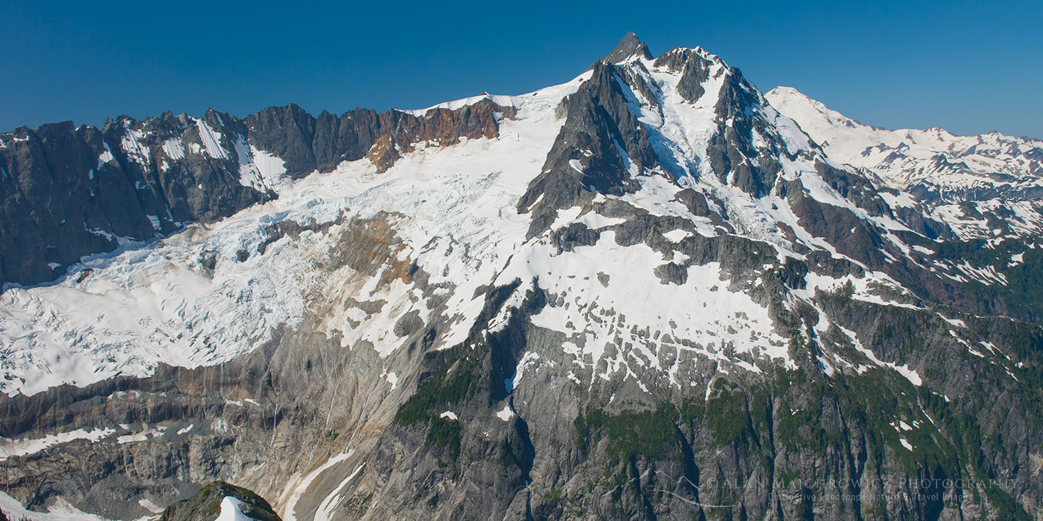
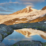
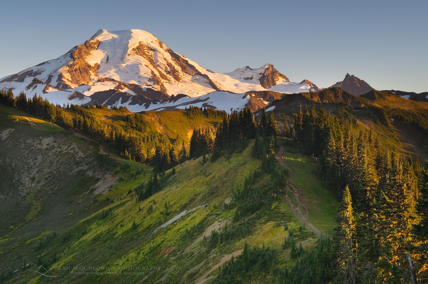
Mount Baker and Goat Lake #73706  Purchase

This post is the next installment of Mount Baker Wilderness Destinations. This time, we will discuss two hikes that start in Heather Meadows, Lake Ann, and Ptarmigan Ridge. These hikes are unusual in the North Cascades since the trailhead is higher up in the sub-alpine. Most trails in the North Cascades involve considerable elevation gain to reach the alpine. Heather Meadows and parts of Mount Rainier National Park are a few areas where trails start high.

Another bonus is that both of these trails lead to close views of Mount Baker and Mount Shuksan. These mountains display two geological features that define the North Cascades, volcanism and complex metamorphic terrane. Even if you’re not a geologist there is plenty of material here to pique your interest in the subject.

Essential Tip: Both of these trails are among the most heavily used in the Northwest. Expect to see plenty of people, every day of the week. Get to the trailhead parking very early in the morning or you may not find a parking spot.

Evening clouds swirling around Mount Shuksan North Cascades, Washington #73588
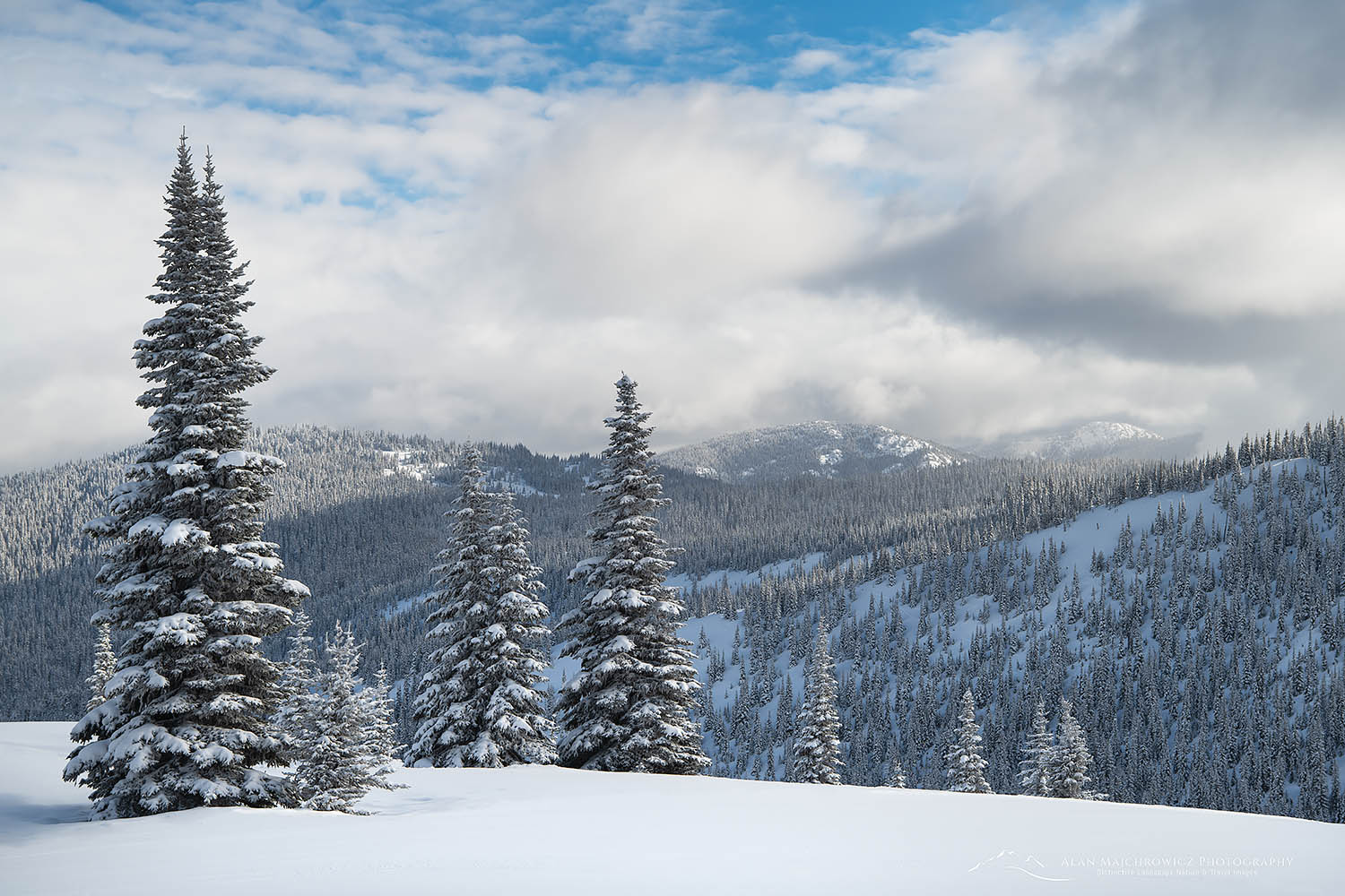
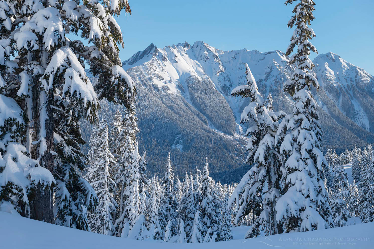
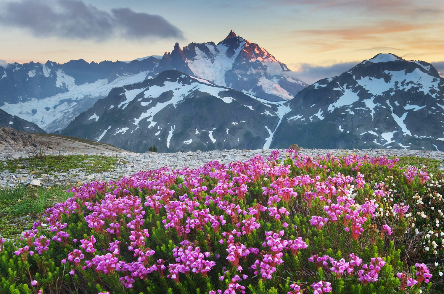
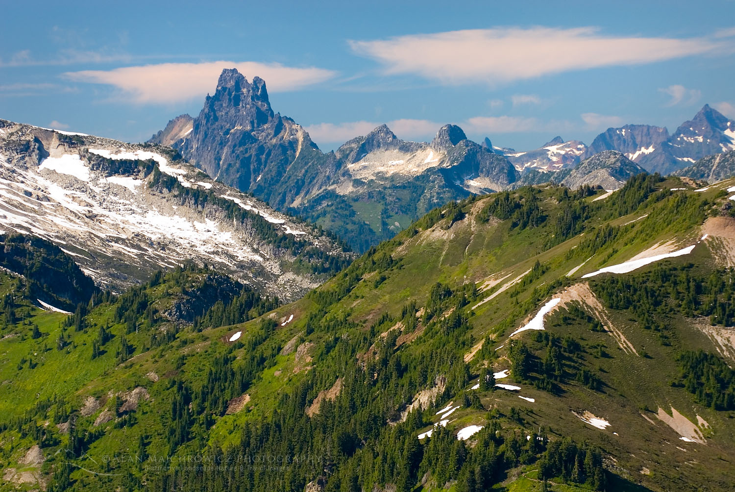
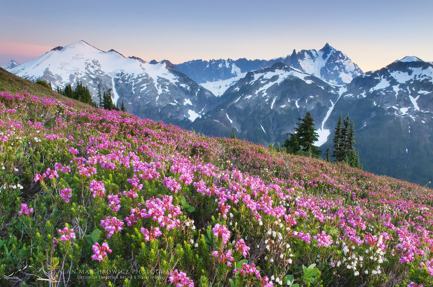
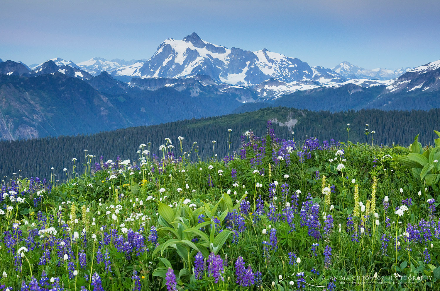
Mount Shuksan seen from Ptarmigan Ridge 73588  Purchase

Ptarmigan Ridge Trail

Length: 9 miles roundtrip to glacier overlook at the Portals
Elevation Gain: 1800′
Getting there:  From Bellingham drive Mount Baker Highway, SR 542, about 58 miles to its end at Artist Point. The last section beyond the ski area usually is not plowed until late June, and some years not until August. If the road is still under snow come back a few weeks later since the trail itself will still be buried in deep snow.

Ptarmigan Ridge is hands down one of the most scenic trails in the Northwest. You would be hard-pressed to find another trail in the North Cascades which travels through the alpine as long as this one. If you hike only the first mile or go all the way to the glaciers of Mount Baker, every step brings fantastic views. That said, this trail is suitable for day-hikes and overnight-night backpacking. It is also one of the approaches for climbing Mount Baker, although it’s probably the longest one. And even in late summer, you’ll see people packing skis and searching for more turns.

Essential Tip:  Due to its elevation and proximity to Mount Baker, the weather maker, this trail is usually deep under snow until mid-August. A few sections never melt out. Crampons or micro-spikes and an ice axe will come in handy for early-season hikers.

Essential Tip:  Do not confuse this trail with the Ptarmigan Traverse. The Ptarmigan Traverse is a climbers-only route which starts south of Highway 20, at Cascades Pass in North Cascades National Park.

Backpackers on Ptarmigan Ridge Trail Mount Baker and Coleman Pinnacle are in the distance. Mount Baker Wilderness, North Cascades Washington #73720
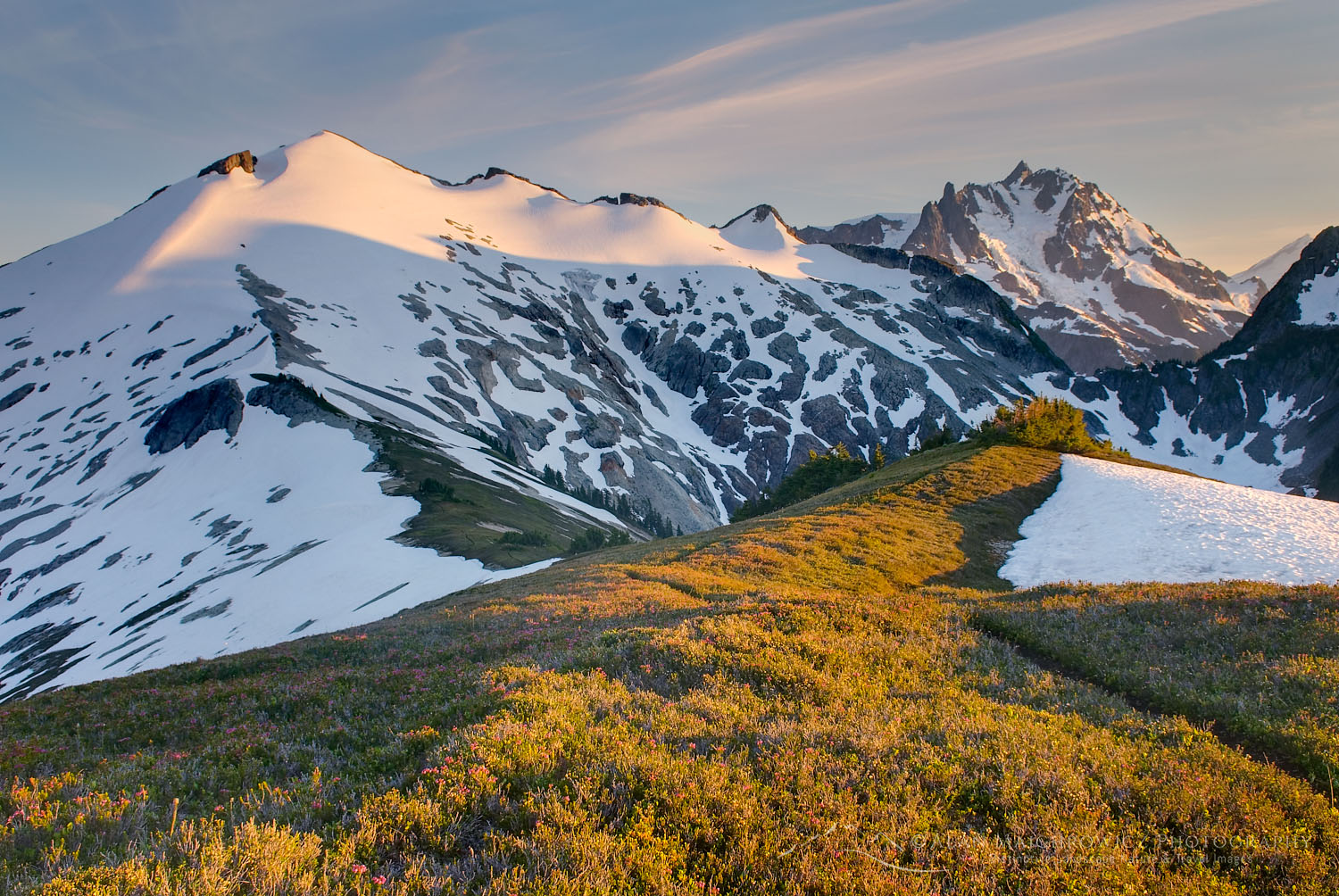
Hikers on Ptarmigan Ridge Trail, Mt. Baker (L), Coleman Pinnacle (R) #73720  Purchase

Hiking Ptarmigan Ridge

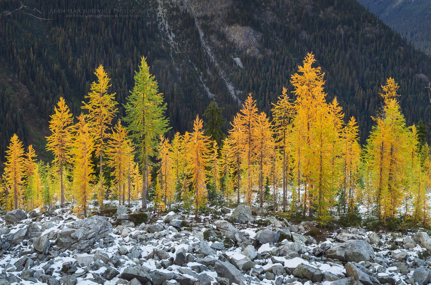
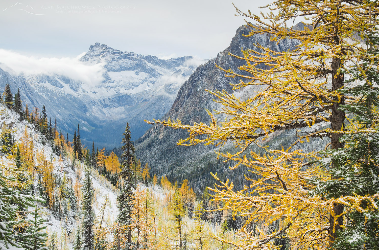
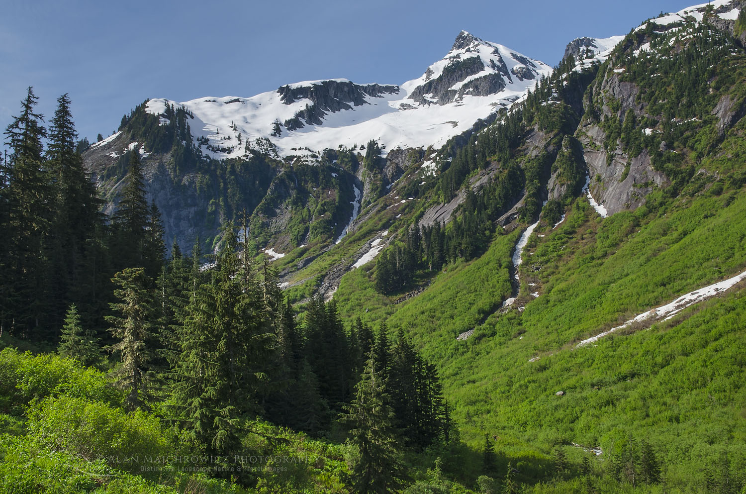
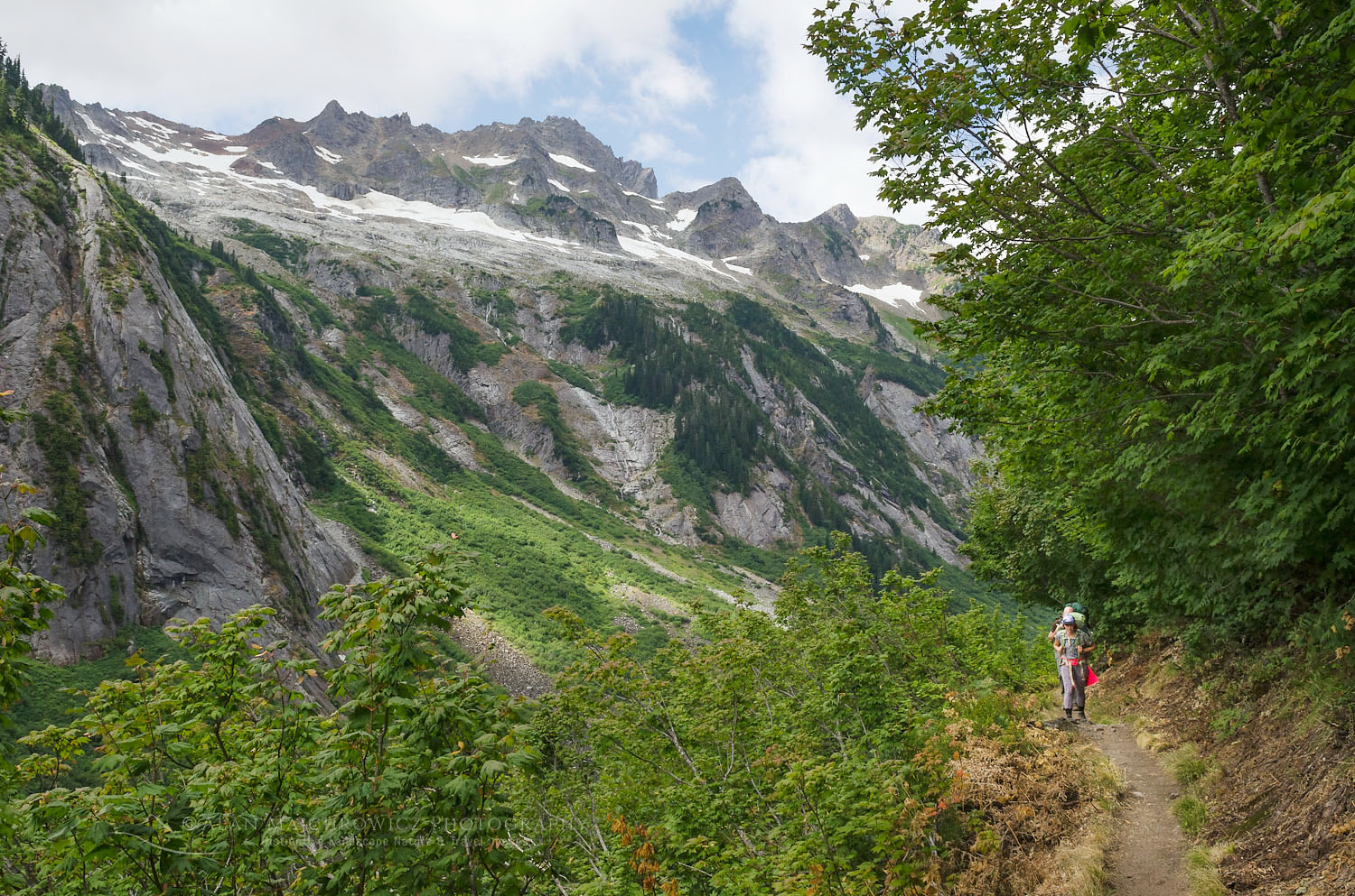
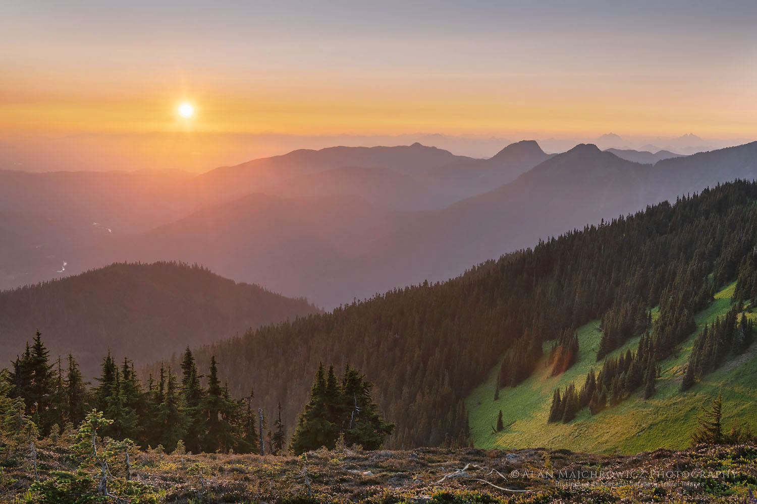
For the first mile, the trail is mostly level and traverses open slopes below Table Mountain. Soon after is a junction with the Chain Lakes Trail, another outstanding hike. Then the trail drops down a few hundred feet and crosses numerous streams before beginning to climb through a vast slope of volcanic rock. This last section, before gaining the ridge again, is usually under snow until late in the season. Just pick the easiest way to the ridge or follow tracks from other hikers.

Gaining the ridge the trail then begins a grand tour winding along ridges in alpine heaven. At around 3.8 miles the trail takes a sharp right turn and starts up a steep grassy slope below Coleman Pinnacle. This is also where you can leave the trail to visit beautiful Goat Lakes, just to the south.

Mount Baker seen from Ptarmigan Ridge, Mount Baker Wilderness. North Cascades Washington #73714
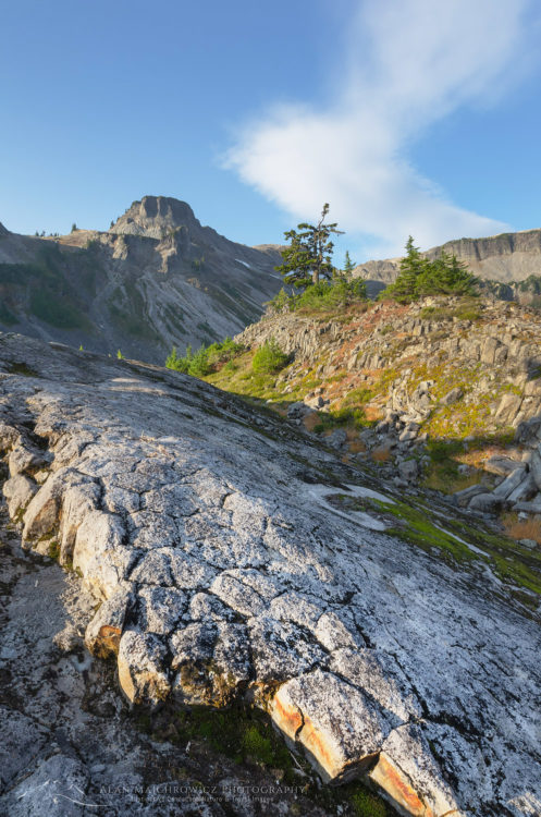
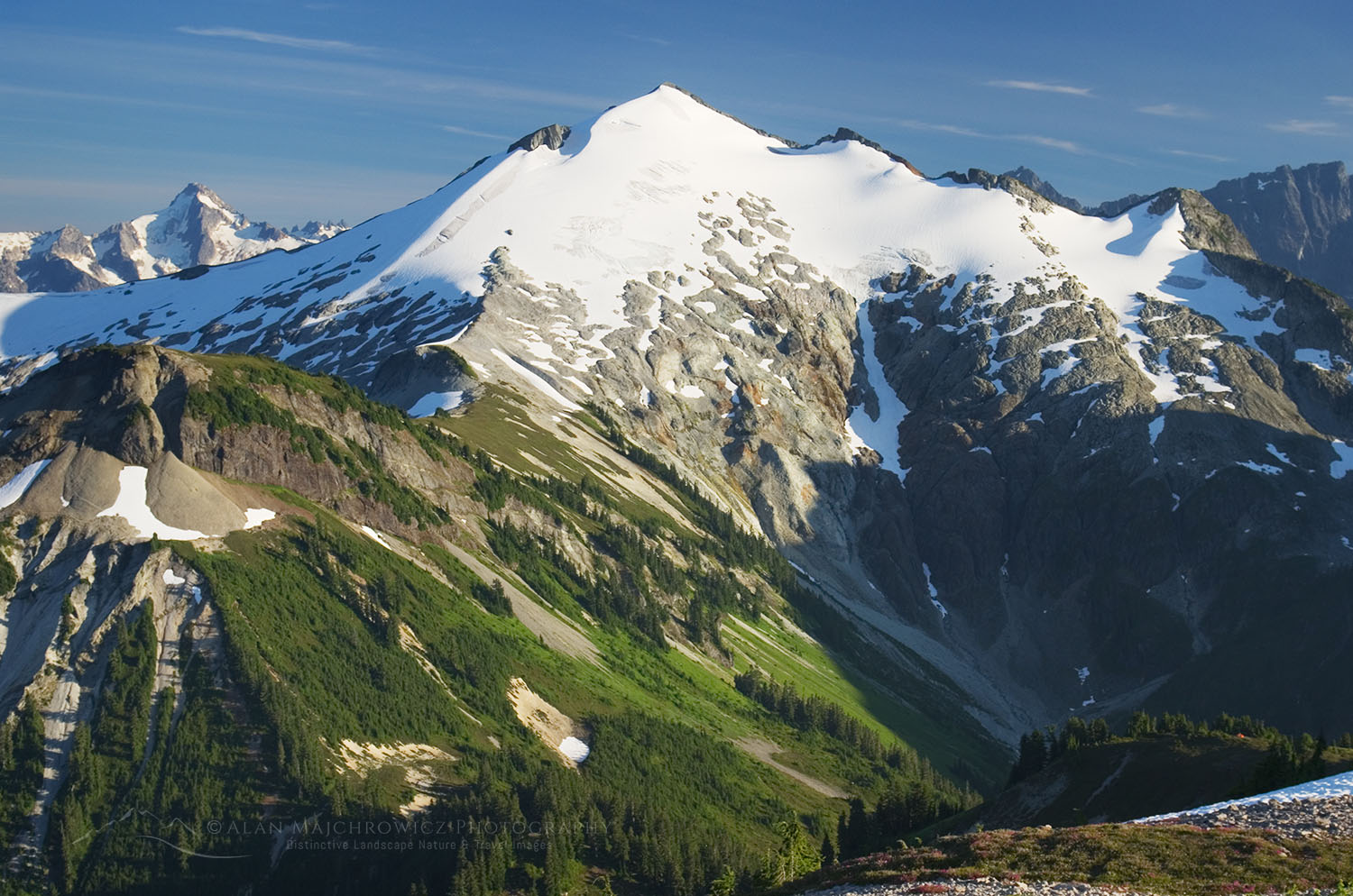
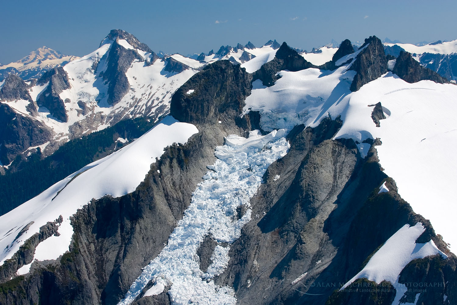
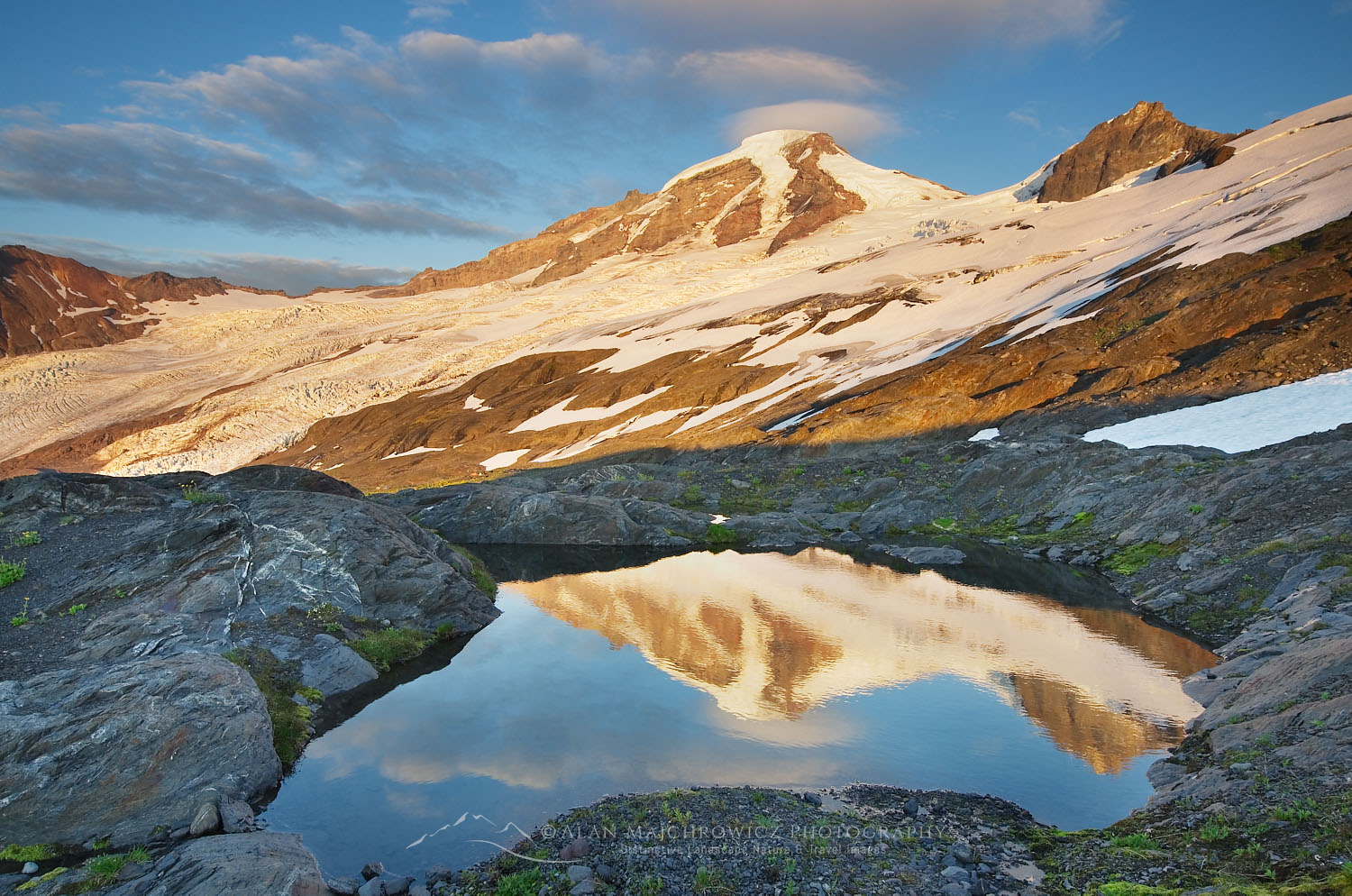
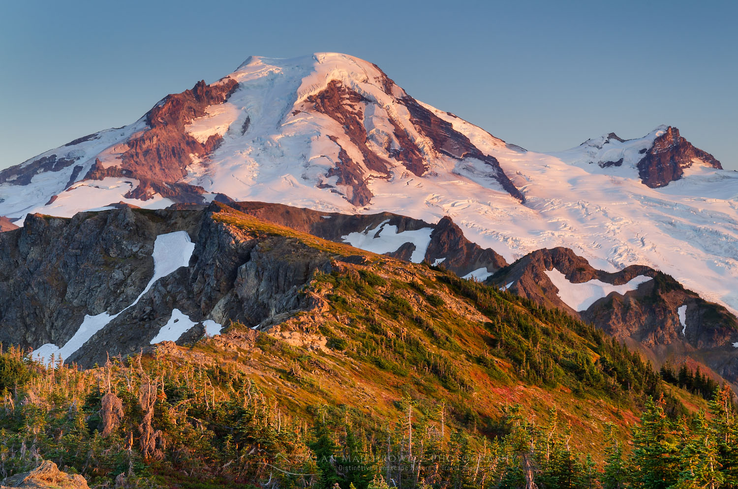
Mount Baker, The Portals are seen as black butte on right #73714  Purchase

The last section crosses a sort of ridge plateau made of volcanic boulders and ash. Some of the best camping spots on the trail are here. Finally, the trail ends just below the Portals, a crumbling volcanic hill. Rough paths climb to the top where there are close-up views of Mount Baker and glaciers in nearly every direction.

This is about as far as a hiker can safely go, and it’s a great spot to have lunch before heading back.

Essential Tip:  Do not attempt to travel on any of the nearby glaciers unless you have the proper equipment and training.

Sunset over Mount Baker at backcountry camp on Ptarmigan Ridge, Mount Baker Wilderness. North Cascades Washington #73634
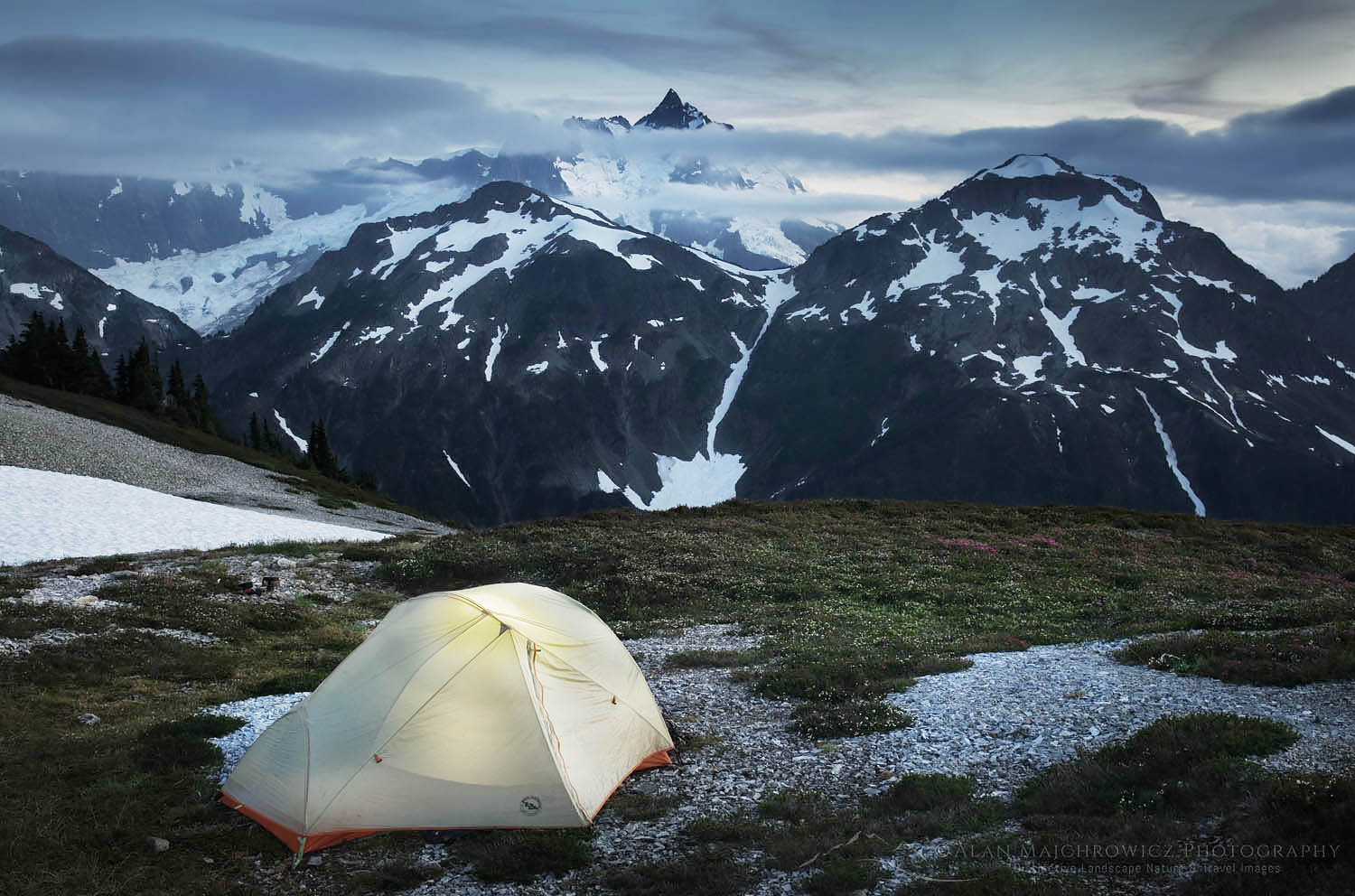
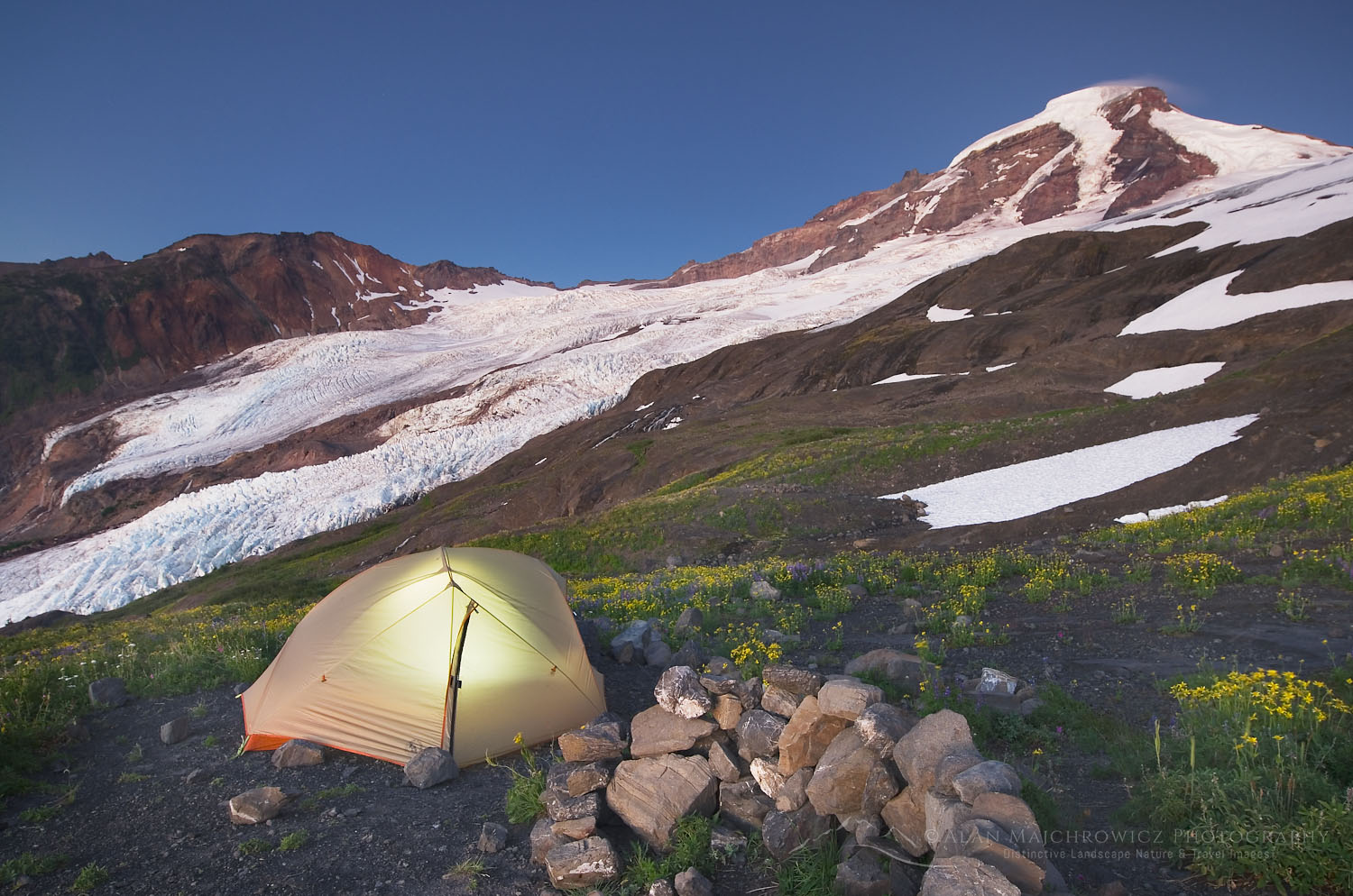
Campsite on Ptarmigan Ridge Mount Baker Wilderness #73634  Purchase

Camping on Ptarmigan Ridge

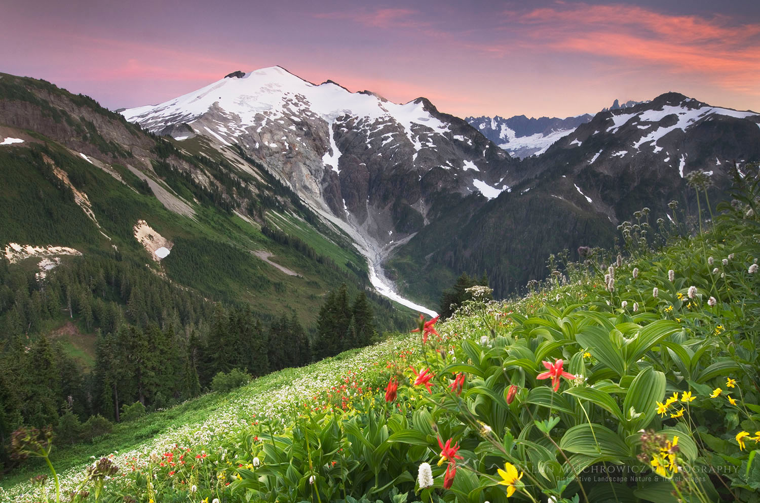
I can’t imagine anyone hiking this trail without thinking of how great it would be to camp somewhere along the ridge. There are only a few sections on the route which are flat enough to spread out a tent. And some of those are close to heavy traffic areas. The best spots are around Goat Lake, about 4 miles in, and at the trail end on the 5790′ volcanic plateau.

For Goat Lake find a faint path heading down and south where the trail veers to the right below Coleman Pinnacle. The first short section is very steep on loose rock, and it’s essential to make sure you’re on the correct path. Once it levels out there are good sites on the way to the lake. Although the lake isn’t far it’s a longer walk than it looks. Also, keep in mind that this is one of those areas that retain snow long into the summer. Some years the lake doesn’t even completely melt out.

Mount Baker sunset seen from Goat Lake on Ptarmigan Ridge, Mount Baker Wilderness. North Cascades Washington #73622
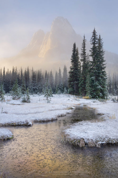
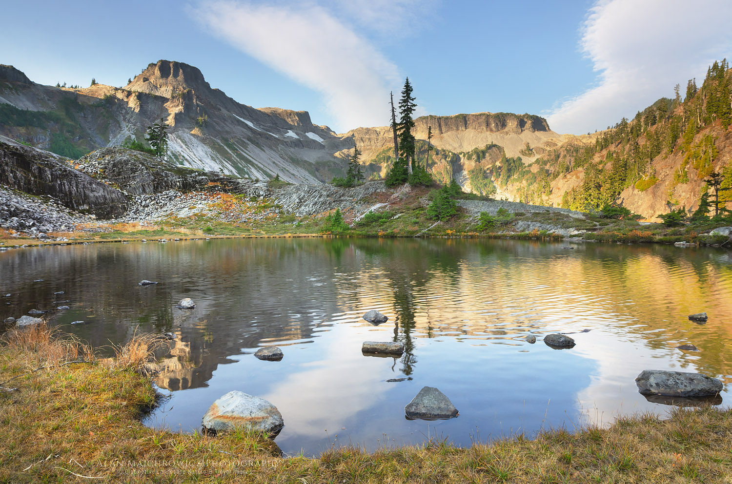
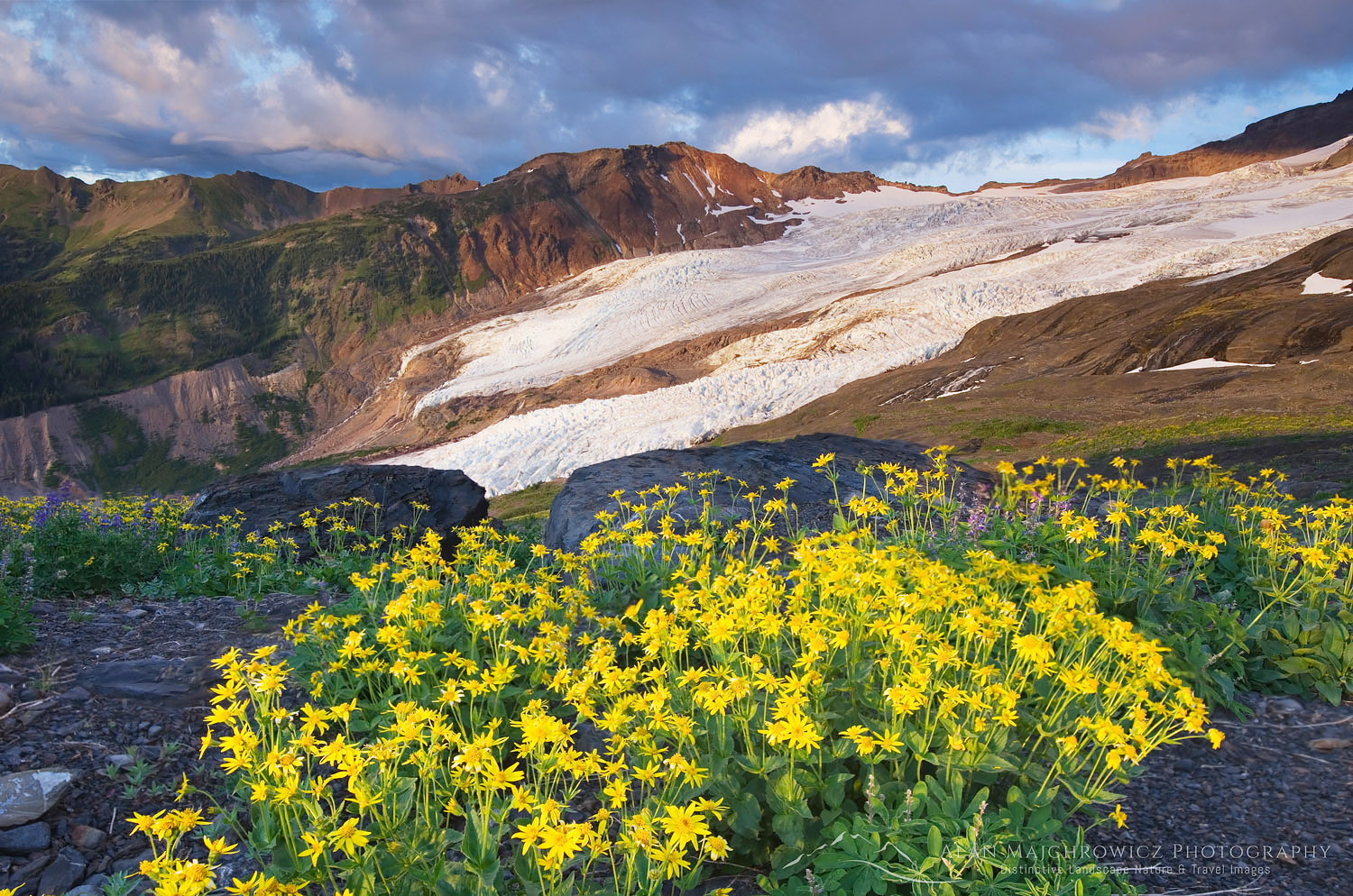
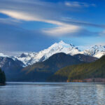
Mount Baker and Goat Lake #73622  Purchase

Photography on Ptarmigan Ridge

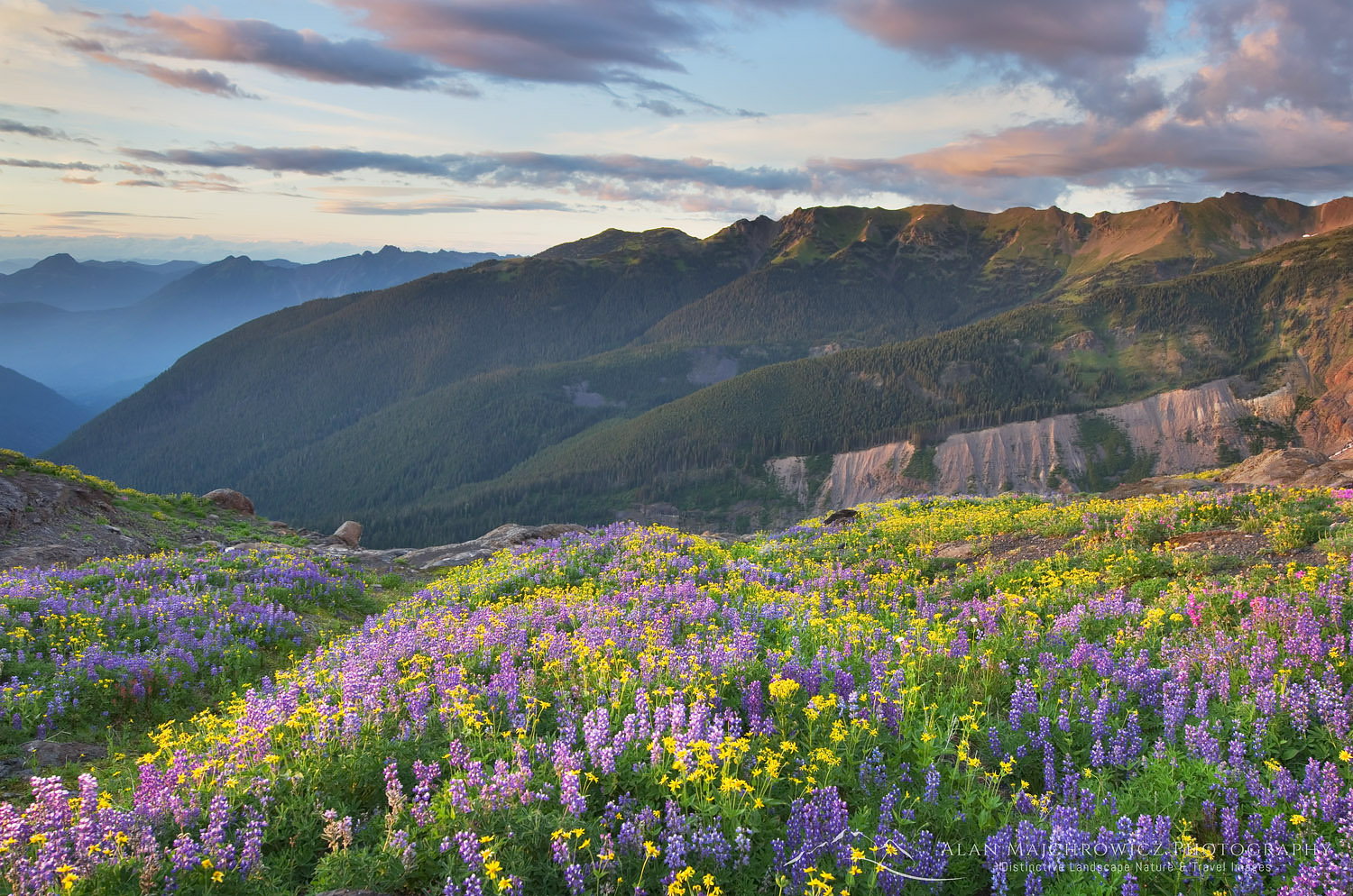
There are excellent photo opportunities along the entire length of the Ptarmigan Ridge Trail. Indeed,  only a few steps from the parking area at Artist Point are some of the most iconic views of Mount Baker and Mount Shuksan.

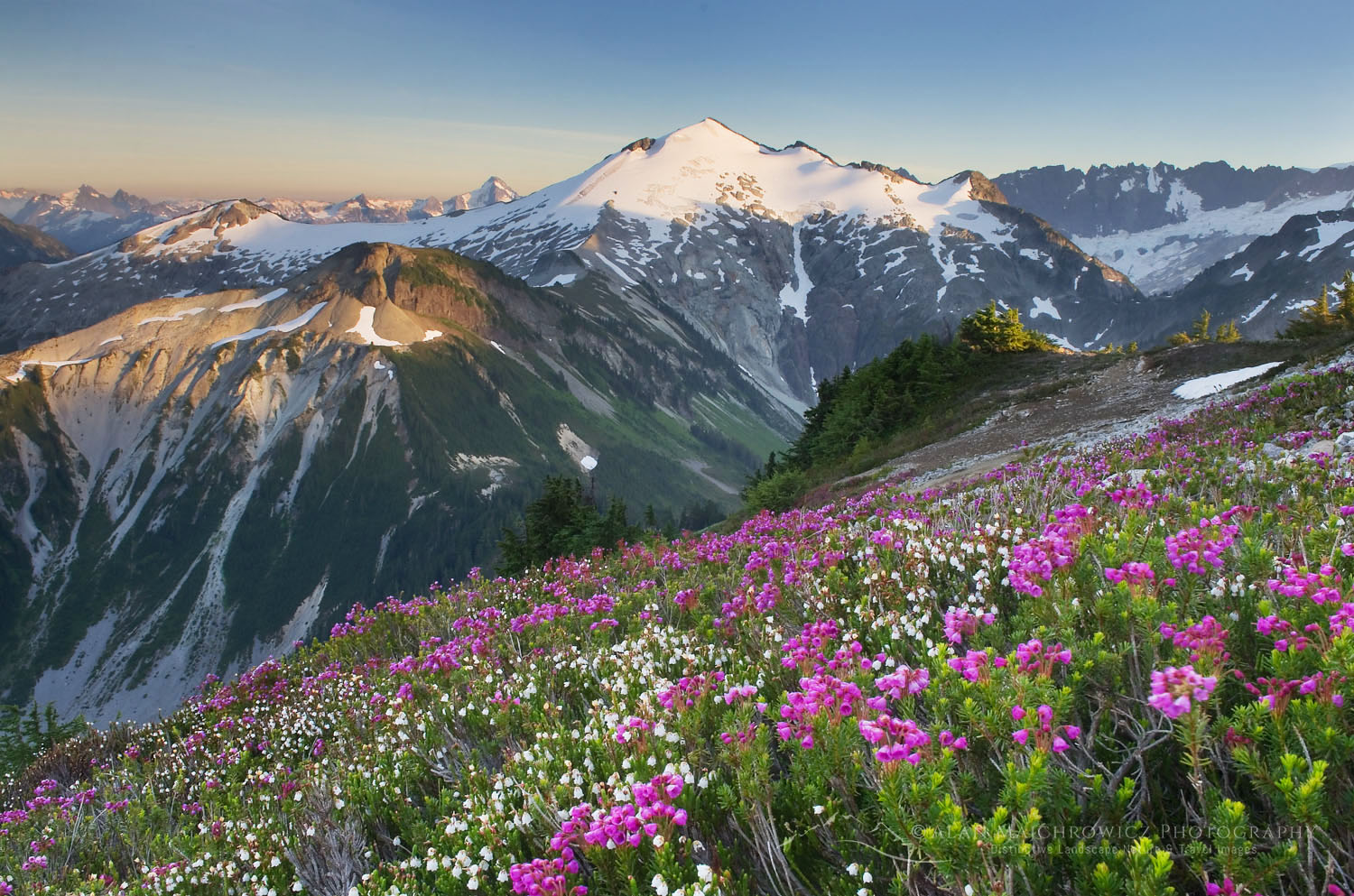
For wildflowers enthusiasts, there are a few areas worth checking out. The first basin beyond the Chain Lakes trail junction has many streams with mossy borders and yellow and purple monkeyflowers. Another good location is the northeast side of Goat Lake. It’s worth mentioning that due to the heavy snowpack, most wildflowers in the area will be late bloomers.

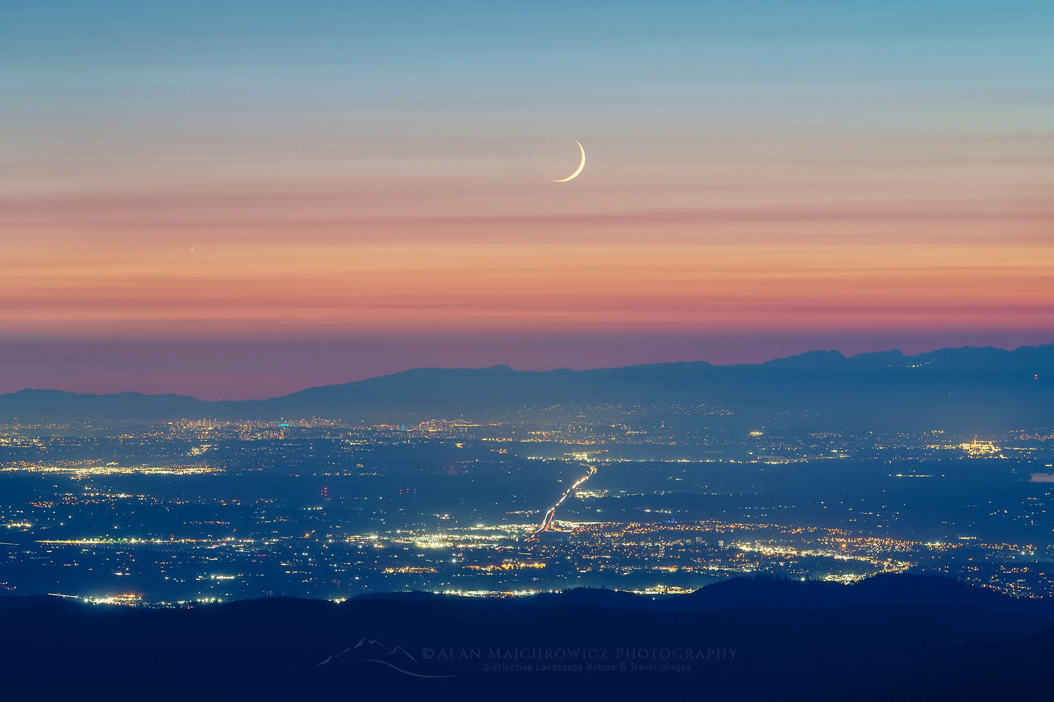
My favorite area for photography is Goat Lake. Spending the night here rewards the photographer with a beautiful evening and morning light. This is also an outstanding location for night photography. Plus, there are plenty of elements around the lake which can you can use in compositions. These include lake reflections of Mount Baker, patterns of ice on the lake, and wildflowers.

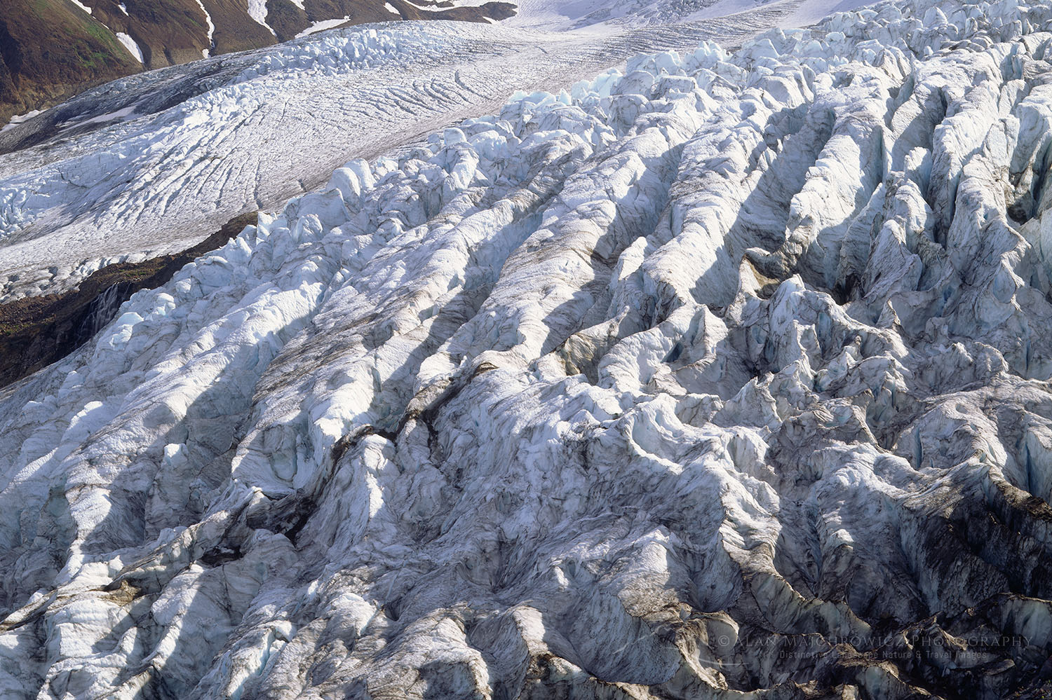
I would suggest bringing along a full kit of lenses, from ultra-wide to medium telephoto. A longer focal length lens can isolate patterns of crevasses on glaciers. And if you’re lucky, a telephoto is useful to catch wisps of steam emanating from the crater below Sherman Peak on Baker.

Mount Shuksan seen from partially frozen Lake Ann, Mount Baker Wilderness, North Cascades Washington #58150Lake Ann and Mount Shuksan #58150   Purchase

Lake Ann

Length: 8 miles roundtrip to Lake Ann / 10 miles roundtrip to Mount Ann
Elevation Gain: 1900′ roundtrip to Lake Ann / 2800′ roundtrip to Mount Ann
Getting there:  From Bellingham drive Mount Baker Highway, SR 542, about 57 miles to Austin Pass. The last section beyond the ski area usually is not plowed until late June, and some years not until August. If the road is still under snow come back a few weeks later since the trail itself will still be buried in deep snow.

About a half mile before the road ends at Artist Point is the small saddle of Austin Pass. This is where the trailhead for Lake Ann is. Parking here is more limited than at Artist Point, so get here early.

Mount Baker Wilderness, North Cascades Washington #58134
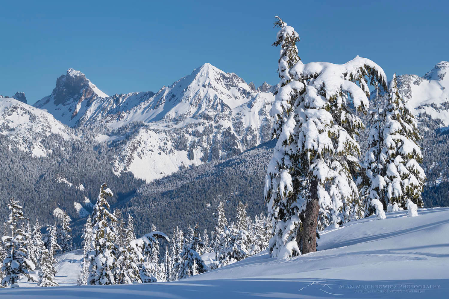
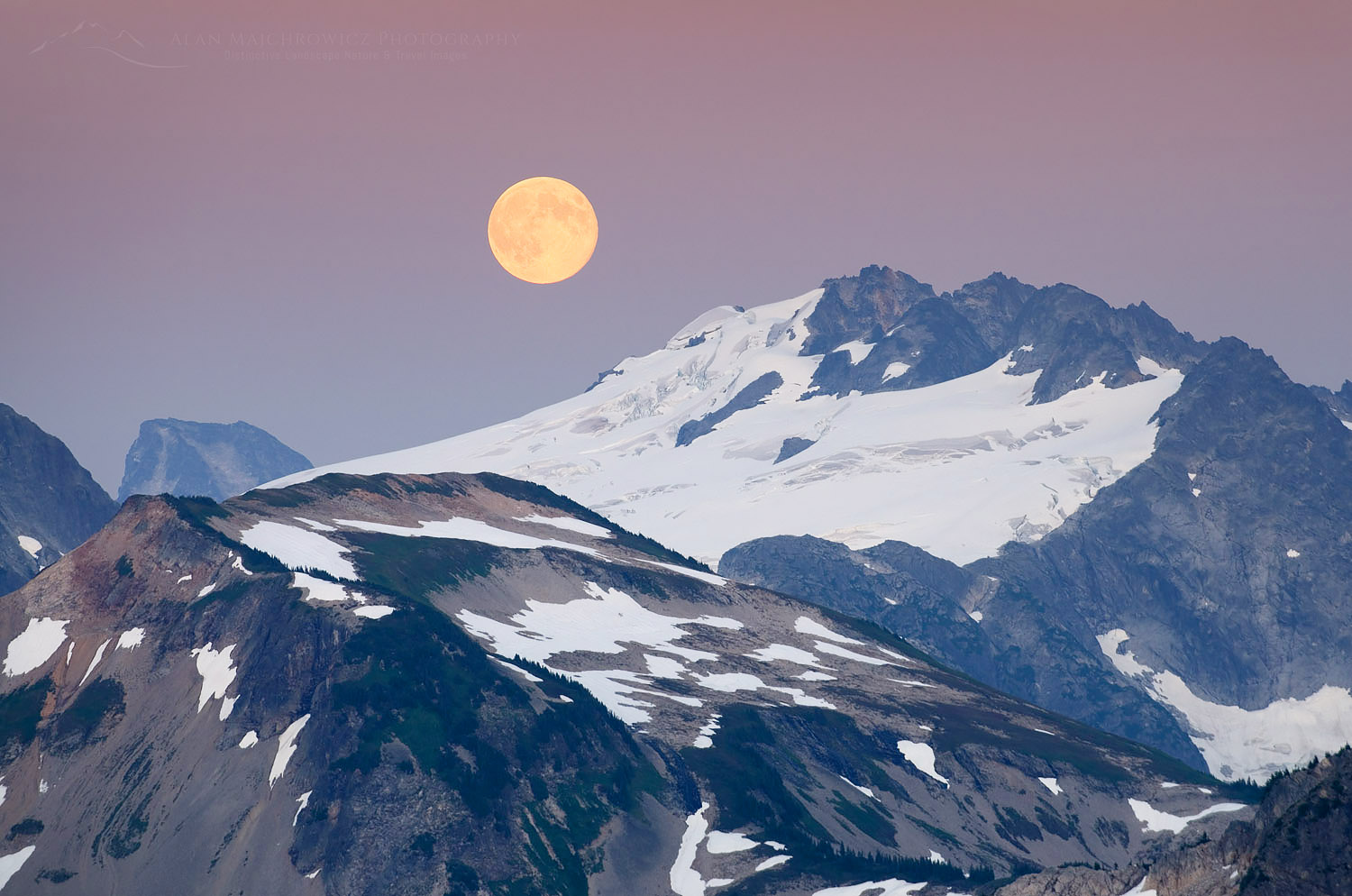
Looking north from summit of Mount Ann #58134  Purchase

The journey begins by dropping about 500′ below the pass into a lovely subalpine basin at the headwaters of Swift Creek. After winding through streams, wildflowers, and rock gardens the trail enters the forest for the next mile or so. The first camping area is at a crossing of Swift creek, where the trail emerges into subalpine meadows.  From here it’s about a 900′ switchback climb to the saddle above Lake Ann. Take your time here as the rocky meadows are very picturesque. This is a perfect place to see and hear pikas among the boulders.

From the saddle, the trail drops into the lake basin. Shortly before arriving at the lake a trail branching off to the left heads to close views of Curtis Glacier. From here you are at the base of Mount Shuksan and can gaze up at its immense walls and hanging glaciers.

Mount Shuksan North Cascades Washington #58136Mount Shuksan and Lower Curtis Glacier #58136  Purchase

Hiking to Mount Ann

While most people only visit Lake Ann on a day hike or camp along its shore, there is more to explore. A worthwhile destination above and to the south of the lake is Mount Ann. From the saddle above Lake Anne climb the steep slope to gain a long ridge. Hike along this ridge to the south side of Mount Ann and pick your way through boulders and up gullies to the small summit.

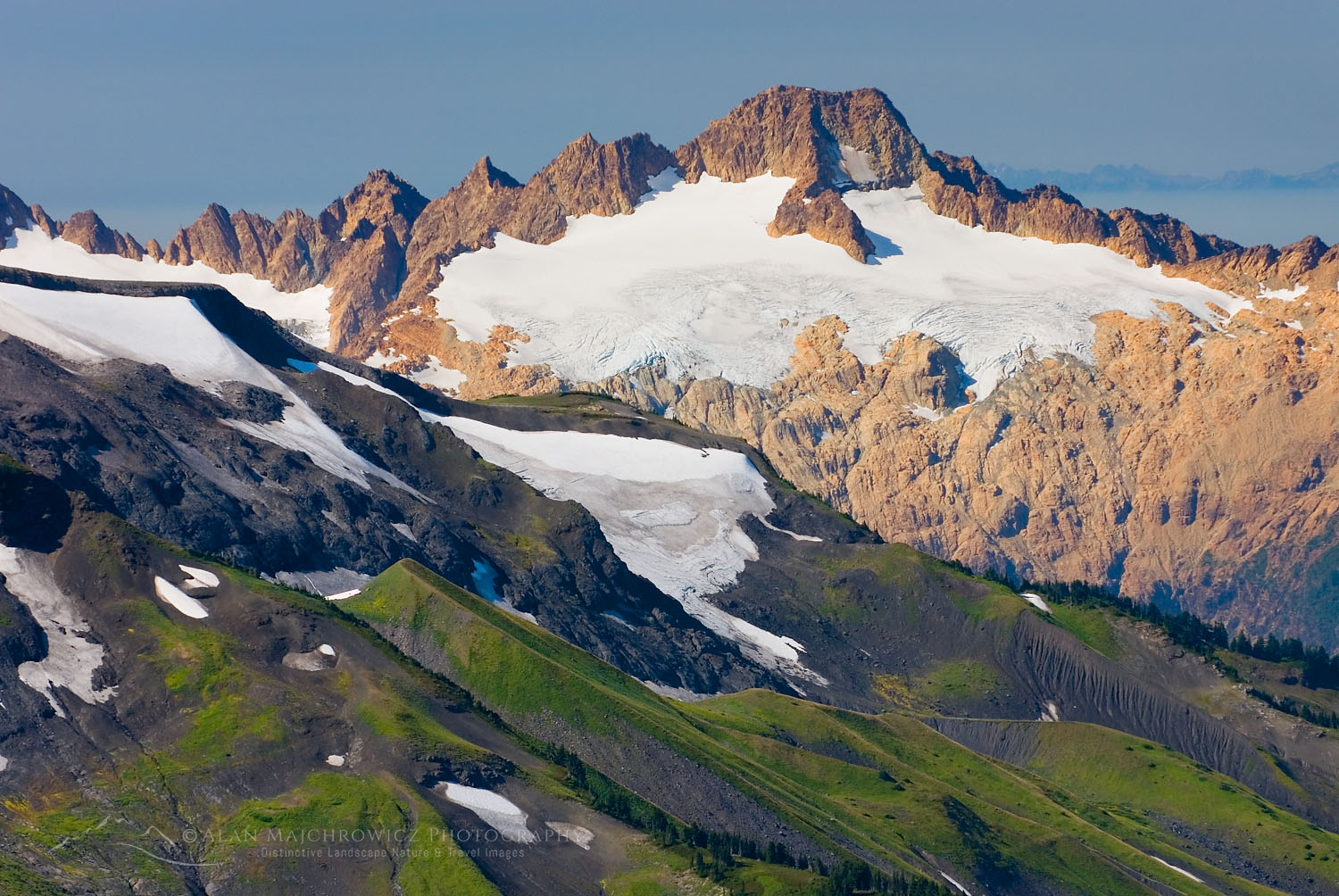
From the summit of Mount Ann impressive views are in every direction. See Shuksan Creek emerging from lower Curtius Glacier. To the west is Mount Baker and the entire length of Ptarmigan Ridge. Looking south are Mount Blum, Hagan Mountain, and Bacon Peak. And far below is Baker Lake. On a clear day, you can see Glacier Peak far to the south, and maybe even Mount Rainier.

Essential Tip:  Just like on Ptarmigan Ridge this trail is usually deep under snow until mid-August. Lake Ann will often have ice on it well into autumn. Crampons or micro-spikes and an ice axe will come in handy for early-season hikers.

Backcountry camp above Lake Ann, Mount Shuksan in the background, Mount Baker Wilderness North Cascades #58125Tent on Ridge above Lake Ann #58128   Purchase

Camping at Lake Ann

An overnight trip to Lake Ann is truly something special. From camps along the lake, the imposing face of Mount Shuksan is so close you can almost touch it. But to find a spot to set up your tent will require some planning and flexibility. The few campsites at Lake Ann are among the most heavily used in the Mount Baker Wilderness.

Essential Tip:  Your best bet would be to arrive on a Sunday or Monday morning, when people are heading home for the week. For a weekend stay, you’ll need to arrive at the lake very early on Friday morning. Later on Friday and Saturday, you’ll probably be out of luck.

Most of the established sites are on the east side of the lake and near its outlet. However, I feel the best sites are on the long ridge of Mount Ann above the lake. I like the view of looking down on the lake with Shuksan as a dramatic backdrop. There are several bare dirt sites on the ridge, and plenty of flat areas on snowpack to set up a tent. As a bonus, you may have the ridge to yourself compared to down at the lake.

Mount Shuksan, Mount Baker Wilderness, North Cascades Washington #58162Mount Shuksan #58162  Purchase

Photography at Lake Ann

A combination of Lake Ann and Mount Shuksan are the main elements for photography. Ice floes on the lake offer some interesting abstract patterns, and there are some small areas of wildflowers. You’ll definitely need a wide-angle lens of around 20mm to fit all of the lake and Shuksan into the frame.

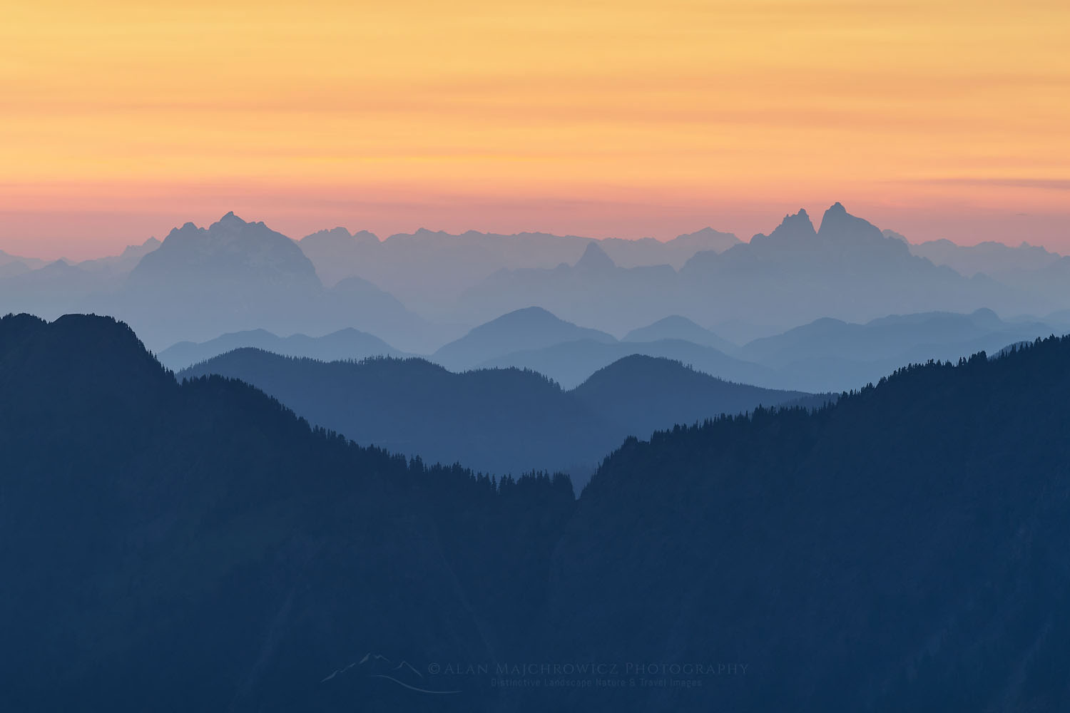
From the ridge above the lake, you also have great views and compositions of Mount Baker. While most hikers prefer sunny blue sky days, clouds and weather can be a photographer’s friend. An ideal situation would be to photograph at Lake Ann, or on Ptarmigan Ridge, as a storm or weather patterns begin to clear. Clouds and fog swirling around jagged peaks give the North Cascades its trademark mysterious and primordial look.

Misty clouds swirling around peaks of the North Cascades in Heather Meadows Recreation Area, Washington #73538b
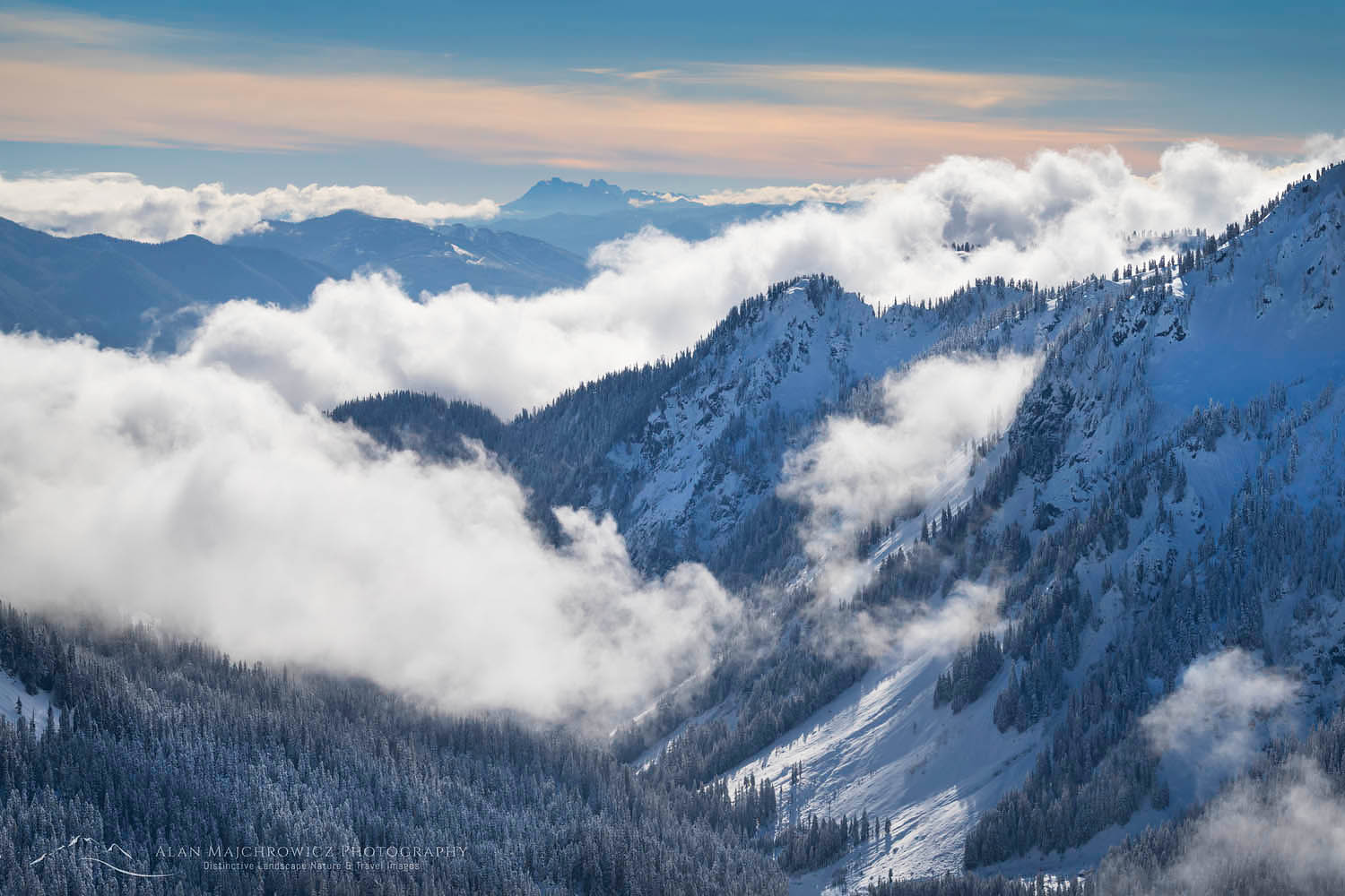
Clearing storm over North Cascades #73538b2  Purchase

More Info for Lake Ann Ptarmigan Ridge

When to go:  Both of these hikes and the North Cascades generally receive more snow than just about anywhere else in the lower 48 states. Most higher elevation trails are under the snowpack until early to mid-July. Of course, you can go sooner but be prepared for some route-finding. Some steeper slopes higher on the ridge may need crampons and an ice axe to negotiate safely.

Most wildflowers don’t appear until late July or early August. The exception would be avalanche lilies that begin to shoot up while still under snow.  By mid-August, most of the snow will be gone and water sources may be an issue for some overnight trips. Late July through August is also the buggiest time of the year.

Both Ptarmigan Ridge and Lake Ann are very popular destinations and receive heavy use. It’s always a good idea to get an early sunrise start if possible. That way, you’ll have the trail to yourself and avoid the day’s heat and bugs.

Permits:  A Northwest Forest Pass or America the Beautiful Pass is required for parking at the trailhead. However, Washington State Discover Passes are not valid. There are currently no additional permits needed for day-hiking or overnight trips.

Gear:  Check my post Backpacking Photography Gear Tips for suggestions and tips on hiking, backpacking, and photography gear.

Photography tips:  Check my post Backpacking Photography Tips for suggestions and tips on what camera gear to bring and for tips on making better photos during your trip.

More information about these hikes can be found on the Mount Baker-Snoqualmie National Forest website.

For more hikes in the Mount Baker Wilderness and North Cascades National Park check out these posts:
Mount Baker Wilderness Destinations
Hannegan Peak Ruth Mountain Mount Baker Wilderness
Whatcom Pass Tapto Lakes North Cascades National Park

Backcountry camp on Ptarmigan Ridge, Mount Baker Wilderness. North Cascades Washington #73641The author at camp on Ptarmigan Ridge #73641

Leave No Trace in the Mount Baker Wilderness

Please Please Please!  Don’t plan a trip to this or any other wilderness area unless you are willing to follow the guidelines of Leave No Trace (LNT). Mount Baker Wilderness and all other wilderness areas throughout the world are under incredible pressure from growing amounts of visitors. Please do your part to help preserve these precious areas for future generations!

To learn more about the principles and practicing LNT please take a few minutes to visit the Leave No Trace Center for Outdoor Ethics. Your children, grandchildren, and the Earth will thank you!

Seven Leave No Trace Principles

  • Plan ahead and prepare.                                       
  • Travel and camp on durable surfaces.                 
  • Dispose of waste properly.                                                                         
  • Leave what you find.                                            
  • Minimize campfire impacts (be careful with fire).
  • Respect wildlife.  
  • Be considerate of other visitors

Thanks for reading, feel free to share this post with your friends and colleagues!

Want to learn more, or have a professional photographer guide you in the field? Then take your Creative Photography to the next level with  Private Instruction and Guided Photo Tours.

Photos appearing in Lake Ann Ptarmigan Ridge Mount Baker Wilderness are available for Commercial Licensing and Fine Art Prints. Click on any image to purchase, or contact me for more info!

Lake Ann Ptarmigan Ridge

Ruth Mountain and Hannegan Peak Wildflowers North Cascades Washington #54332

Hannegan Peak Ruth Mountain Mount Baker Wilderness

Hannegan Peak Ruth Mountain Mt Baker Wilderness

Ruth Mountain seen from Hannegan Peak, Mount Baker Wilderness North Cascades #54364Ruth Mountain seen from Hannegan Peak #54364  Purchase

The North Cascades is a mountain range with some of the most rugged and dramatic scenery in the lower 48 states. In its northwest corner is the Mount Baker Wilderness. And within this wilderness are two destinations that represent the best of the North Cascades, Hannegan Peak, and Ruth Mountain. Both routes pass among old-growth forests, wildflower meadows, and rushing streams and waterfalls. Both peaks have tremendous open views of rugged mountains and glaciers. And while Hannegan Peak is a moderate hike, Ruth Mountain is more difficult, adding some mountaineering adventure to the mix.

Both destinations utilize the scenic Hannegan Pass trail for access, the starting point for many wilderness adventures. Among them include ascending Hannegan Peak, Ruth Mountain, or continuing on into North Cascades National Park. The latter option leads into some of the wildest parts in the North Cascades. In this post we’ll explore the first two options.

Essential Tip: In summer the Hannegan Pass Trail can be one of the buggiest in all of the North Cascades. I’ve been on this trail several times when the black flies are so thick it’s like something out of an Arctic horror story. While other times there were very few flies. It’s usually best to start out very early in the morning to beat the heat and flies.

Essential Tip: The area around Hannegan Pass has a long history of encounters with black bears. Hang your food or better yet use bear-proof canisters.

Ruth Creek Valley from Hannegan Pass Trail, North Cascades Washington #58067Ruth Creek Valley from Hannegan Pass Trail #58067  Purchase

Hiking the Hannegan Pass Trail

Access to the trailhead is via Hannegan Pass Road, Forest Service Road 32. Towards the end of the road you get a real sense that the Ruth Creek Valley is something special. In the last mile the road passes avalanche gullies with glimpses up to rugged Nooksack Ridge. Early in the season the road here is often blocked with piles of snow and huge trees brought down avalanches. Check with the Forest Service in advance for road conditions.

The large trailhead parking area is usually filled with cars and is often a bustle of activity. Even before daybreak there are often parties sorting through gear for the long climb up to Ruth Mountain and other destinations. You’ll also see groups with large packs giddy with excitement ready to start long trips into the National Park.

Hannegan Pass Trail, Mount Baker Wilderness, North Cascades Washington #61790Backpackers on Hannegan Pass Trail #61790  Purchase

It’s a little less than a five-mile hike to Hannegan Pass on a well-maintained trail. Along the way, there are plenty of opportunities to pause and take in the scenery. Most notably is a spot about two miles in which traverses through an open rocky area with cascading streams. This is where the snowy bulk of Ruth Mountain first comes into view. Somehow the view up and down the wild valley has a primordial feel to it. Unless you are in a hurry, and you definitely shouldn’t be, this is a prime spot to take a short rest.

The last mile or so the trail re-enters the forest and begins climbing to the Hannegan Pass. About a half-mile below the pass is a small camp area among streams and small meadows. The trail then switchbacks up through a few open meadows thick with wildflowers. The pass itself can be a bit of a let down though since it has a limited view. However, this is where the real adventure begins!

Ruth Mountain and wildflower meadows on Hannegan Peak, North Cascades Washington #54332Wildflowers on summit of Hannegan Peak #54332  Purchase

Hannegan Peak

Continuing on the trail beyond the pass will take you to the Copper Ridge trail, or down the Chilliwack River trail, and on to Whatcom Pass. Both of these destinations are in the North Cascades National Park and will require permits for overnight trips.

For Hannegan Peak take the path which branches off to the left at Hannegan Pass. This steep but easy trail climbs 1000′ in a little over a mile to the summit of Hannegan Peak.  Soon after leaving the pass the trail opens up into beautiful meadows thick with wildflowers. Also along the way are those stupendous views you were expecting below at the pass.

Mount Shuksan and pink heather on Hannegan Peak, North Cascades Washington #54307Pink Heather on Hannegan Peak #54307  Purchase

Upon arriving at the summit of Hannegan Peak you are greeted by amazing views in every direction. Looking south is the snowy pyramid of Ruth Mountain. To the right of Ruth is Mountain Shuksan and sprawling Jagged Ridge above Nooksack Cirque. Following the crest of Nooksack Ridge to the southwest is Mount Baker and its cloak of glaciers.

Copper Ridge and Copper Mountain are north of the summit in the National Park. Beyond them, across the border in British Columbia is the fantastic fang-like Slesse Mountain, Mount Rexford, and the Illusion Peaks. They are part of the northern limit to the North Cascades. Finally to the east is Mount Redoubt, then Mount Challenger, and the northern part of the Picket Range.

One can sit here all day with a map attempting to identify all the mountains in these views. Another fun pastime is to watch climbers slowly ascend the snowy slopes of Ruth Mountain. It’s also common to watch some of them ski back down in summer.

Backcountry camp on Hannegan Peak overlooking Mount Shuksan, North Cascades Washington #54316Camping on Hannegan Peak #54316  Purchase

Camping on Hannegan Peak

While most people day-hike to the summit of Hannegan Peak, overnight trips are extremely rewarding. Although the summit and adjacent ridge are fairly broad, established campsites are sparse. The best site is within a circle of stunted trees on the summit. However, this site is almost always taken. It can also be busy since this is where most day-hikers stop to have lunch.

Follow the ridge west below the summit for several more established sites. If you can’t find any open sites then your best option is to set up camp on snow or scree. There are also one or two spots halfway down the trail to Hannegan Pass. Snowfields are the only source of water anywhere above Hannegan Pass.

Ruth Mountain Mount Baker Wilderness North Cascades Washington #54325Ruth Mountain, Point 5930′ bottom left  #54325 Purchase

Ruth Mountain

Looking out to Ruth Mountain from Hannegan Peak, it is easy to dream of a visit to its summit. And standing on top of Ruth Mountain is an experience you’ll remember your entire lifetime. Ruth is also one of the few peaks in the area that is within the reach of the average hiker with the proper gear.

Essential Tip:  Hiking to the summit of Ruth, or even only to the ridge below the glacier, traverses some difficult sections. Turn around when the terrain goes beyond your comfort level.

If you have time and energy after Hannegan Peak you can also include a climb up Ruth Mountain as part of your trip. Some people summit both Hannegan and Ruth as part of a day trip but that’s a lot to take in for one day. I would recommend an overnight camp on one and do the other the next day. Or you can always come back on a separate trip.

This trip starts at Hannegan Pass. But some parties opt to begin from the small camp area just before reaching Hannegan Pass. Route-finding and complex terrain make this approach more difficult.

From Hannegan Pass travel south about a 1/4 mile on a path to the first obstacle, a wickedly steep climb below Point 5930′. This short section will test your mettle as it ascends straight up a muddy rocky slope. Branches and roots are often needed to pull yourself up. At the top you’ll traverse east across and over the north side of Point 5930′. There is some mild exposure on this stretch and is usually covered in snow late into the season. This is a good place to use your crampons and ice axe. As you cross over to the south side of Point 5930′ a good trail appears which you can follow all the way to the base of Ruth’s snowfields.

Ruth Mountain and Mount Shuksan from Point 5930 North Cascades Washington #17110Ruth Mountain and Mount Shuksan from Point 5930′   #17110  Purchase

Camping and Climbing Ruth Mountain

There are good campsites along the open ridge extending between Ruth and Point 5930′. But perhaps the best site is at the summit of the Point itself. From there you’re close to Ruth and can also take in a better view of Mount Shuksan than from Hannegan Peak.

The climb/hike up Ruth is fairly straightforward. There is about 1400′ of ascent from the base ridge to the summit. Basically, you follow the pick the easiest way straight up to the summit pyramid, on a sort of spine on the snow. Traveling too far to the right or left crosses more dangerous areas on the glacier. Stay clear of a large wedge-like rock which usually has some hidden crevasses and bergschrunds nearby.

Most descriptions of climbing Ruth advise crampons, ice axe, and ropes due to hidden crevasses. On my solo trip, I wore crampons and carried an ice axe. However, I saw people ascending without either, and none were roped together. And at least one person was wearing just running shoes.

Mount Shuksan with view of the Nooksack Cirque seen from summit of Ruth Mountain, North Cascades #17151Mount Shuksan and Nooksack Cirque #17151  Purchase

The summit offers some of the most eye-popping jaw-dropping views in the North Cascades. Dominating the view is the incredible Nooksack Glacier below Jagged Ridge, tumbling into the wilds of Nooksack Cirque. From here Mount Shuksan with its hanging glaciers and Nooksack Tower is even more awe-inspiring than the classic view from Heather Meadows. Closer up is Icy Peak, a kind of compact version of the bigger peaks of the range. West is the fantastic Picket Range and Mount Challenger. Looking north is Hannegan Peak and Slesse Mountain in the distance.

Slesse Mountain and Hannegan Peak, North Cascades Washington #17196Slesse Mountain (L) and Hannegan Peak (R, foreground) #17196  Purchase

If you enjoy a threadbare bivouac there is just enough room on the summit to spend the night. But make sure the weather is in your favor. On your way down make sure to follow the same route and don’t stray left onto the broad glacier face.

Icy Peak and Mount Blum from Ruth Mountain, North Cascades Washington #17168Icy Peak, Mount Blum (L), and Glacier Peak (L, in distance) #17168

If You Go

Hannegan Peak
Length:  From trailhead parking,  10.5 miles roundtrip to summit
Elevation Gain:  3100′ to summit

Ruth Mountain
Length:  From trailhead parking,  12 miles roundtrip to summit
Elevation Gain: 4000′ to summit
Essential Tip:  This trip is best made in late spring or summer. After the winter snowpack has melted the bare ice of the glacier makes travel more dangerous. Also, on cold nights the snow can harden up and become very icy.

Getting there:  From Bellingham drive Mount Baker Highway (SR 542) 46 miles to Hannegan Pass Road (FR 32),  just before the Nooksack River bridge.  At 1.3 miles take a left and follow the road 5.4 miles to the Hannegan Pass trailhead parking lot. There are some primitive campsites and a shelter at the trailhead.

Full moon rising over Mount Challenger, North Cascades National Park Washington #54366Full moon over Mount Challenger #54366  Purchase

Hiking and Photography Info for Hannegan Peak and Ruth Mountain

When to go:  Both of these hikes and the North Cascades generally receive more snow than just about anywhere else in the lower 48 states. Most higher elevation trails are under the snowpack until early to mid-July. Of course, you can go sooner but be prepared for some route-finding. Some steeper slopes higher on the ridge may need crampons and an ice axe to negotiate safely.

Most wildflowers don’t appear until late July or early August. The exception would be avalanche lilies that begin to shoot up while still under snow.  By mid-August, most of the snow will be gone and water sources may be an issue for overnight trips. Late July through August is also the buggiest time of the year.

The Hannegan Pass Trail is very popular and receives heavy use due to the multiple destinations it accesses. It’s always a good idea to get an early sunrise start if possible. That way, you’ll have the trail to yourself and avoid the day’s heat and bugs.

Permits:  A Northwest Forest Pass or America the Beautiful Pass is required for parking at the trailhead. However, Washington State Discover Passes are not valid. There are currently no additional permits needed for day-hiking or overnight trips.

Gear:  Check my post Backpacking Photography Gear Tips for suggestions and tips on hiking, backpacking, and photography gear.

Photography tips:  Check my post Backpacking Photography Tips for suggestions and tips on what camera gear to bring and for tips on making better photos during your trip.

More information about these hikes can be found on the Mount Baker-Snoqualmie National Forest website.

Information on climbing Ruth Mountain can be found at Summitpost.org

For more hikes in the Mount Baker Wilderness and North Cascades National Park check out my posts:
Mount Baker Wilderness Destinations
Lake Ann Ptarmigan Ridge Mount Baker Wilderness
Whatcom Pass Tapto Lakes North Cascades National Park

Ruth Mountain and Mount Shuksan Hannegan Peak, North Cascades Washington #54339Pink Heather on Hannegan Peak #54339 Purchase

Leave No Trace in the Mount Baker Wilderness

Please Please Please!  Don’t plan a trip to this or any other wilderness area unless you are willing to follow the guidelines of Leave No Trace (LNT). Mount Baker Wilderness and all other wilderness areas throughout the world are under incredible pressure from growing amounts of visitors. Please do your part to help preserve these precious areas for future generations!

To learn more about the principles and practicing LNT please take a few minutes to visit the Leave No Trace Center for Outdoor Ethics. Your children, grandchildren, and the Earth will thank you!

Seven Leave No Trace Principles

  • Plan ahead and prepare.                                       
  • Travel and camp on durable surfaces.                 
  • Dispose of waste properly.                                                                         
  • Leave what you find.                                            
  • Minimize campfire impacts (be careful with fire).
  • Respect wildlife.  
  • Be considerate of other visitors

Thanks for reading, feel free to share this post with your friends and colleagues!

Want to learn more, or have a professional photographer guide you in the field? Then take your Creative Photography to the next level with  Private Instruction and Guided Photo Tours.

Photos appearing in Hannegan Peak Ruth Mountain are available for Commercial Licensing and Fine Art Prints. Click on any image to purchase, or contact me for more info!

Hannegan Peak Ruth Mountain Mt Baker Wilderness

Mount Baker, seen from Heliotrope Ridge, Mount Baker Wilderness Washington #54421

Mount Baker Wilderness Destinations

Mount Baker Wilderness Destinations

Mount Baker, seen from Heliotrope Ridge, Mount Baker Wilderness Washington #54421Mount Baker seen from Heliotrope Ridge  #54421  Purchase

With winter waning and spring just around the corner, a hiker’s thoughts turn to hatching trip ideas for the summer. Lately, I’ve been busy working on updating my website where I constantly come across memorable photos from past trips. Almost instantly I start making plans to revisit that place. One of my favorite destinations is the Mount Baker Wilderness, which just happens to be almost in my backyard.  And because of this over the years I’ve explored nearly all of its trails on day hikes and overnight backpacking trips.

The North Cascades contains one national park and several wilderness areas, all of which have their unique elements.  Among them, the Mount Baker Wilderness is the most northwestern. Because the Mount Baker Wilderness receives a huge amount of rain and snow its main features are cool dense old-growth forests and active glaciers. In the center of it all is Mount Baker, a 10,786′ dormant volcano covered in massive glaciers.

Wildflower meadows on Heliotrope Ridge, Mount Baker Wilderness Washington #54537Heliotrope Ridge Wildflowers #54537  Purchase

Hiking in the Mount Baker Wilderness

If there is one thing that can characterize the North Cascades it would be rugged terrain. Its valleys are steep and deep, with junglelike forest undergrowth. The alpine is steep and rocky with large snowfields and glaciers barring the way for most casual hikers. Without trails hiking into these mountains would be a grueling ordeal.

Fortunately, the Mount Baker Wilderness has many trails leading to some of the most breathtaking scenery in North America. However, all but a few start low and involve large amounts of elevation gain to reach those views. In this post, I’ll discuss two of the more scenic destinations, along with tips to make your hike more enjoyable.

Both of the trails in this post receive a LOT of traffic. If you are looking for solitude it would be hard to find it on these trails. There are plenty of other trails and little-known routes which are less crowded, and some trails where you’ll be mostly on your own. However, these are generally more difficult in nature, and some may require route-finding skills.

Bastille Ridge and Coleman Glacier from meadows onHeliotrope Ridge, Mount Baker Wilderness North Cascades Washington #54533Coleman Glacier and Heliotrope Ridge Wildflowers #54533  Purchase

Mount Baker Wilderness Heliotrope Ridge Trail

Length: 5.5 miles roundtrip to glacier overlook
Elevation Gain: 1400′  to overlook and about 2300′ to climber’s camps
Getting there:  From Bellingham drive Mount Baker Highway 34 miles to Forest Service Road 39, Glacier Creek Road, then another eight miles to a large parking area.

Heliotrope Ridge trail is one of the main approach routes for climbing Mount Baker. And for that reason, you’ll be sharing the trail with plenty of climbers and skiers. It’s also very popular with day-hikers whose destination is the close-up view of Coleman Glacier. This is one of the few places outside of Mount Rainier National Park where you can easily hike to the edge of a massive glacier.

The well-built trail initially travels through a forest of beautiful old-growth trees and crosses several rushing streams. Around two miles in is the site of Mount Baker Clubs‘ long gone Kulshan Cabin. Only one or two rotting timbers and a conspicuous opening in the forest remain.  From here the forest begins to open up and soon you come to a junction with the Hogsback climbing route and the Heliotrope Ridge /Glacier Overlook trail.

Crevasses on the lower parts of the Coleman Glacier, Mount Baker North Cascades Washington #565Coleman Glacier on Mount Baker  #565  Purchase

Coleman Glacier Overlook

Taking the left fork brings you to the Coleman Glacier overlook. You’ll first need to cross Heliotrope Creek, which except for late in the season is always a rushing torrent.

Essential Tip: During the early part of the hiking season the creek is covered in snow. As the season progresses this snow bridge becomes thinner, and it is easy to break through and get caught in the stream underneath. Use utmost caution during, especially on warm days.

From the crossing, it is a short walk to the edge of the moraine overlooking Coleman Glacier. At first, your eyes will be glued to the massive crevasses in front of you. Then slowly you’ll follow the ice higher and higher to the bulky summit of Mount Baker. It’s an amazing view you won’t soon forget. It’s easy to just sit here all day taking it in, and there’s nothing wrong with that at all!

Tent illuminated at climbers camp on Heliotrope Ridge, Mount Baker Wilderness Washington #54432Heliotrope Ridge Camp #54432  Purchase

Above the Hogsback

After taking in the glacier view, or if you’re doing an overnighter, head back down the trail to the junction with the Hogsback Ridge trail. This super steep trail takes you to climber’s camps adjacent to more snowfields and glaciers. The campsites here have outstanding views of Mount Baker. This is also a great place to view wildflowers and mossy meltwater streams.

North Twin Sisters Mountain in the North Cascades. This mountain is a massive and rare occurence of Dunite rock (peridotite rock from the Earth's mantle) uplifted to the Earth's surface. Mount Baker Wilderness Washington #24451Twin Sisters Range North Cascades #24451  Purchase

Wandering west and up from here the terrain is mostly over barren rock and boulders. But it is also the way to a relatively easy route up to a ridge with views down into the Thunder Glacier basin. The crest of this ridge is shattered volcanic rock resembling something from Mordor. There are one or two small spots here to set up a tent for the ultimate overnight stay. From here you can also take in outstanding views of the Twin Sisters Range. This route is over permanent snowfields which may harbor hidden crevasses. Because of this, it’s a good idea to bring crampons, an ice axe, and a partner for this section.

Sunset on Mount Baker from Skyline Divide, Mount Baker Wilderness, North Cascades Washington #49891Skyline Divide Mount Baker Wilderness  #49891  Purchase

Mount Baker Wilderness Skyline Divide Trail

Length:  9 miles roundtrip to end of the ridge
Elevation Gain:  2500′ to end of the trail
Getting there:  From Bellingham drive Mount Baker Highway 34 miles to Forest Service Road 39, then 12 miles on FR 37

Another extremely popular trail and destination is the ridge of Skyline Divide. Like the Heliotrope Ridge, the star attraction of this trail is Mount Baker. However, once above the treeline, the Skyline Divide trail travels for a greater distance along a pleasant ridge with wide-open views in every direction.

Part of the adventure on this hike is the access road. The road branches off almost immediately after turning onto Glacier Creek Road (FR 39). It then travels about 12 miles from the intersection to the trailhead over some of the worst potholes you’ll ever see. The worst section is on the first flat miles along the Nooksack River. There are plenty of narrow sections along the climb so be alert for oncoming vehicles. There is almost always at least one car speeding recklessly down the road.

Essential Tip: This is a very heavily used trail and trailhead parking is usually at a premium, every day of the week. To avoid oncoming cars and obtain a parking spot leave very early in the morning.

Mount Shuksan seen from wildflower meadows of Skyline Divide, Mount Baker Wilderness Washington #53322Mount Shuksan from Skyline Divide #53322  Purchase

During the first two miles, the trail is moderately steep as it gains 1500′ through fragrant old-growth forest to the open ridge. The last half mile or so switchbacks through pretty meadows dense with False Hellebore (Corn Lily) and Valerian. Suddenly breaking through the woods onto the ridge crest can be a shock. The views in every direction are some of the most spectacular in the entire Pacific Northwest.

To the south is the massive white bulk of Mount Baker, east is Mount Shuksan, and the heart of the North Cascades. North is Church Mountain and Excelsior Ridge, and beyond are the Coast Mountains of British Columbia. West is the Salish Sea, SanJuan Islands, Vancouver Island, and the city of Vancouver.

Mount Baker seen from wildflowers meadows on Skyline Divide, Mount Baker Wilderness North Cascades Washington #54245Moon over Mount Baker from Skyline Divide #54255  Purchase

Hiking on Skyline Divide

Aside from the great views and enjoyable ridge hiking wildflowers are a big attraction. Early in the season just after the snow melts clear the first meadow is a carpet of yellow avalanche lilies. Time your trip well because these pretty flowers don’t last long.

After reaching the first ridge meadow the trail is a bit of a roller coaster. Passing the second of several knolls along the ridge it smooths out a bit and the views continue to improve. For the next two miles, every step takes you closer to Mount Baker. Along the way are more patches of wildflowers and a trail junction that drops to meadows of Deadhorse Creek, below Chowder Ridge. Take this trail if you want some solitude, however, the views of Mount Baker soon become obscured.

North Cascades seen from Skyline Divide, Mount Baker Wilderness Washington #53264Skyline Divide in the foreground, Mount Baker Wilderness #53264  Purchase

The last section of the trail climbs higher and higher to a small flat ridge immediately adjacent to Chowder Ridge. Just when you thought the views couldn’t get any better, they do! In front of you is a wild subalpine valley below Bastille Ridge with the Glaciers of Mount Baker seemingly close enough to touch. This is about as far as a hiker can travel, continuing on to Chowder Ridge requires some scrambling skills.

Sunset from Skyline Divide. Mount Baker Wilderness, North Cascades Washington #71746Sunset from Skyline Divide #71746  Purchase

Spending the Night on Skyline Divide

There are several great spots for camping along the ridge, but water can be a limiting factor. After the snow melts there are no dependable water sources. Although if you camp higher up near the end there are usually some permanent patches of snow.

It is absolutely essential that you choose a well-established site on bare ground. Do not under any circumstances camp on vegetation. Over the years I’ve seen the fragile vegetation and wildflowers slowly disappear under the boots and tents of thoughtless hikers.

Sunset on Mount Baker from Skyline Divide, Mount Baker Wilderness, North Cascades Washington #49922Mount Baker at sunset from upper Skyline Divide #49922  Purchase

Wherever you choose to set up camp you’ll be in for a visual treat. As the sun goes down the colors of glaciers on Mount Baker progress from white to yellow, to orange, and finally to pinks and purples. In the eastern sky after sunset look for the beautiful glow of the Belt of Venus over Mount Shuksan. This is the shadow of the Earth moving across the sky.

Look to the west and watch the sunset over the Salish Sea, turning the water to brilliant gold. And although you probably came to escape civilization you’ll be mesmerized watching the lights of Vancouver turn on and glitter in the twilight.
Of course, you’ll need a clear sky for all this, but it’s just as captivating watching clouds and fog swirl among the peaks.

Crescent moon over Vancouver British Columbia #71787New Moon and Venus over Vancouver #71787  Purchase

Tips for Hiking in the Mount Baker Wilderness

When to go: Both of these hikes and the North Cascades generally receive more snow than just about anywhere else in the lower 48 states. Most higher elevation trails are under the snowpack until early to mid-July. Of course, you can go sooner but be prepared for some route-finding. Some steeper slopes higher on the ridge may need crampons and an ice axe to negotiate safely.

Most wildflowers don’t appear until late July or early August. The exception would be avalanche lilies that begin to shoot up while still under snow.  By mid-August, most of the snow will be gone and you may need to pack in your own water for an overnight trip.

Skyline Divide is a particularly nice destination in early fall. The crowds are smaller and the meadows begin to take on some lovely fall color. A light early snowfall can also provide a dramatic effect on the surrounding mountains.

Permits:  A Northwest Forest Pass or America the Beautiful Pass is required for parking at the trailhead. However, Washington State Discover Passes are not valid. There are currently no additional permits needed for day-hiking or overnight trips.

Gear:  Check my post Backpacking Photography Gear Tips for suggestions and tips on hiking, backpacking, and photography gear.

Photography tips:  Check my post Backpacking Photography Tips for suggestions and tips on making better photos on your trip.

More information about these hikes can be found on the Mount Baker-Snoqualmie National Forest website.

For more hikes in the Mount Baker Wilderness and North Cascades National Park check out these posts:
Hannegan Peak Ruth Mountain
Lake Ann Ptarmigan Ridge Mount Baker Wilderness
Whatcom Pass Tapto Lakes North Cascades National Park

Twilight over North Cascades from Skyline Divide Mount Baker Wilderness Washington #71773Coast Range of British Columbia from Skyline Divide #71773  Purchase

Leave No Trace in the Mount Baker Wilderness

Please Please Please!  Don’t plan a trip to this or any other wilderness area unless you are willing to strictly follow the guidelines of Leave No Trace (LNT). Mount Baker Wilderness and all other wilderness areas throughout the world are under incredible pressure from growing amounts of visitors. Please do your part to help preserve these precious areas for future generations!

To learn more about the principles and practicing LNT please take a few minutes to visit the Leave No Trace Center for Outdoor Ethics. Your children, grandchildren, and the Earth will thank you!

Seven Leave No Trace Principles

  • Plan ahead and prepare.                                       
  • Travel and camp on durable surfaces.                 
  • Dispose of waste properly.                                                                         
  • Leave what you find.                                            
  • Minimize campfire impacts (be careful with fire).
  • Respect wildlife.  
  • Be considerate of other visitors

Thanks for reading, feel free to share this post with your friends and colleagues!

Want to learn more, or have a professional photographer guide you in the field? Then take your Creative Photography to the next level with  Private Instruction and Guided Photo Tours.

All photos appearing in Mount Baker Wilderness Part 1 are available for Commercial Licensing and Fine Art Prints. Click on any image to purchase, or contact me for more info!

New Additions: Mount Rainier Olympic National Parks, North Cascades

Paradise Wildflower Meadows Mount RainierParadise Meadows Mount Rainier #73268  Purchase

Update: New Additions images have been moved to the following pages: Mount Rainier National Park, Olympic National Park, and Washington

The summer of 2021 has been challenging, to say the least. Record-breaking heat waves, devastating wildfires, widespread smoke, crowded parks, and the persistent COVID thing. There was so much hope that this summer would offer a return to normalcy. Well, it is better than last year, but not much.

I can usually plan and complete successful photography trips by having various backup locations in mind. Mostly for when conditions are less than optimal. However, this year the wildfire season started much earlier than usual, and by early July thick smoke was present over all my primary and most backup locations. That is except one.

Sunrise over Mount Rainier seen from Reflection Lake, Rosy Spirea (Spirea splendens) is in the foreground. Mount Rainier National Park Washington #73108orMount Rainier from Reflection Lake #73103  Purchase

Backup Plans:  Mount Rainier

So far NW Washington has been, for the most part, lucky to escape all the wildfire smoke. So that gave me the opportunity to visit some great locations closer to home.  In particular, I was able to make a long-overdue trip to Mount Rainier National Park. For many years I’ve put off photographing Mount Rainer for various reasons. Mainly because in August I’m usually off on more ambitious trips out of state, or in Canada. But also because of the summer crowds. And the necessity of having to drive through all the Seattle and Tacoma congestion to get there.

Diablo Lake, North Cascades WashingtonDiablo Lake, North Cascades #71713  Purchase

In addition to a very successful trip to Mount Rainier, several other locations made it on my list. These included Olympic National Park, Diablo Lake, Heather Meadows, and Skyline Divide in the North Cascades. Summer isn’t over yet so hopefully, there will be several more trips to be made before fall arrives.

For a more in-depth selection check out the Washington, Mount Rainier, and Olympic National Parks Galleries.

Old Growth Douglas Fir tree Olympic National ParkHeart O’ the Hills, Olympic National Park #71873  Purchase

Crescent moon over Vancouver British ColumbiaMoon over Vancouver British Columbia #71787 Purchase

Photos appearing in New Additions: Mount Rainier Olympic National Parks, North Cascades are available for Commercial Licensing and Fine Art Prints. Click on any image to purchase, or contact me for more info!

Mount Shuksan from Baker Lake North Cascades

North Cascades Photography Workshop

North Cascades Photography Workshop

Mount Shuksan from Baker Lake North CascadesMount Shuksan and Baker Lake #53550

Join me for a two-day workshop on creative visualization in the North Cascades.  Hosted by the North Cascades Institute, the Pacific Northwest’s premier organization for environmental learning. This will be a hybrid workshop, with the first part being a full day in the field. The second part will be an online Zoom session where we will discuss techniques of photo editing and processing.

The field segment will be a full day of photographing in the beautiful Old Growth forests along Baker Lake in the North Cascades. The lake sits below the towering summits of Mount Baker and Mount Shuksan. Along the way, we will pass numerous streams flowing through a cool and fragrant forest of giant firs and cedars. Along with an understory lush with ferns and wildflowers there will be plenty of subject matter to work with.

Hidden Creek. Baker Lake Trail, North Cascades WashingtonHidden Creek North Cascades #65030  Purchase

During our time in the field, we will discuss and learn composition techniques. We will also explore focus stacking, exposure stacking, macro photography, and more. Above all, we will learn to develop and express personal visions of the surrounding environment. In the online Zoom session, we will discuss and learn various editing and processing techniques to help convey creative your experience.

Although this workshop touches on some basic technical aspects of photography the focus will be on creativity and visualization. Participants should possess a working knowledge of their cameras. Participants should also have a basic understanding of image editing apps.

Due to pandemic restrictions, the field portion will be limited to eight participants.


Western Wake-robin (Trillium ovatum)Trillium #53779  Purchase

Suggested Photography Equipment

  • DSLR  is preferred but any camera will be acceptable
  • Wide-angle to short telephoto lens
  • Polarizing filter
  • Tripod
  • Remote shutter release

Sunrise over Mount Baker (elevation 10,778 feet (3,285 m) and Baker Lake, North Cascades WashingtonMount Baker from Baker Lake  #53562  Purchase

North Cascades Photography Workshop

Purcell Mountains Larches British Columbia

North Cascades Larch Madness

North Cascades Larch Madness

Purcell Mountains Larches British ColumbiaWestern Larch (Larix occidentalis) #25781  Purchase

Just about everybody knows that some of the best fall colors can be found in New England, or for that matter just about anywhere east of the Mississippi. The Colorado Rockies and California Sierra have their own spectacular displays of aspens, And even the Southwest can put on a good show with their cottonwoods. But in comparison, the Pacific Northwest isn’t exactly known for dazzling fall color.

Those not familiar with the Northwest may not know about the magical displays of yellow and gold put on by two kinds of trees. I’m referring to the Lyall’s or Subalpine Larch and the Western Larch. The needles of these two unusual coniferous trees turn a brilliant gold every fall before they are shed. Both varieties grow in very specific areas. And with the right lighting, they can put just about any Vermont forest to shame. But you’ll have to do your homework and legwork to find the best displays. In this post, I’ll be concentrating on the subalpine larch variety.

Liberty Bell Mountain North CascadesLiberty Bell Mountain North Cascades  #64568  Purchase

Locating the Subalpine Larch

The Lyall’s Larch resides in subalpine and alpine areas, generally above 5500′ on colder northeast-facing slopes, in a narrow band from the eastern slopes of the North Cascades to the Purcell and Selkirk Mountains of British Columbia. They can also be seen in the Canadian Rockies, with Lake Louise roughly being their northern limits.

In the North Cascades, you’ll have to do some hiking to get to see the best displays. Some spots, like the Enchantments of the Alpine Lakes Wilderness, demand a strenuous multi-day trek gaining over 5000′ feet of elevation along the way. Although there are some more accessible areas, such as hikes around Rainy Pass and Washington Pass on North Cascades Highway.

Hiking and photographing during the peak larch season on a calm sunny day is an experience you won’t soon forget. The sky at this altitude can be an intense blue contrasting beautifully against the vibrant gold of the trees. Tolkien fans will easily associate this experience with the Lord Of The Rings chapter on Lothlorien.

Pasayten Wilderness larches, North CascadesPasayten Wilderness North Cascades  #56448  Purchase

Timing Is Everything

Aside from finding and hiking to the desired location timing and weather is crucial. The Lyall’s Larch generally starts turning color in the last week of September. The colors peak in the first week of October and are gone by the middle of the month. The peak of the season can last anywhere from two days to a week, depending on the weather.

Since the needles of this tree are very soft and delicate, once they start changing color they can easily fall off in a wind rain, or snowstorm. Of course, this is also the time of year when the weather can be very unpredictable. However, seeing the larches on a clear day just after fresh snow can be a very rewarding experience.

Lake Ann North CascadesLake Ann North Cascades  #64599  Purchase

A good plan would be to stay in a prime location for several days near some lakes. Clear sunny weather followed by cloudy weather and then a light dusting of snow is optimal. This happened to me one year when visiting the Purcell Mountains of B.C. After six days I came away with a wide variety of alpine landscape images. I was a bit nervous on the last day since it was snowing heavily. I wasn’t sure if my vehicle at the trailhead would be snowed in! It turned out to be a close call, several more inches could have prevented my escape.

Leave No Trace

And now for a short lecture. Larches grow in sensitive easily damaged alpine environments.  With an ever-growing crush of people seeking them out, these areas can soon show signs of overuse. As I’ve been saying in previous posts, don’t even think about visiting a wilderness area unless you are prepared to follow the guidelines of Leave No Trace (LNT). All wilderness areas throughout the world are under incredible pressure from growing amounts of visitors. So please do your part to tread lightly and help preserve these precious areas for future generations!

To learn more about the principles and practicing LNT please take a few minutes to visit the Leave No Trace Center for Outdoor Ethics. Your children and grandchildren will thank you!

Seven Leave No Trace Principles

  • Plan ahead and prepare.                                       
  • Travel and camp on durable surfaces.                 
  • Dispose of waste properly.                                                                         
  • Leave what you find.                                            
  • Minimize campfire impacts (be careful with fire).
  • Respect wildlife.  
  • Be considerate of other visitors.

Purcell Mountains Larches British ColumbiaPurcell Mountains Larches British Columbia  #25762  Purchase

If you enjoyed reading North Cascades Larch Madness please share it with your friends and family.

Also, check out Methow Valley Fall Foliage for more fall photography locations!

All photos appearing in North Cascades Larch Madness are available for Commercial Licensing and Fine Art Prints. Click on any image to purchase, or contact me for more info!

Castle Peak North Cascades

Manning Park Winter Photography

Manning Park Winter Photography

Castle Peak North CascadesCastle Peak North Cascades #64796  Purchase

Last week I made a trip to Manning Provincial Park for winter photography and skiing fun. Weather forecasts were for cold temperatures and a good amount of fresh snow. Perfect conditions to make some new winter photos.

Manning Provincial Park is a large park in southern British Columbia. It encompasses the northern reaches of the North Cascades Mountains, along the U.S. Washington State border. On the U.S. side, the mountains present a rugged appearance with high jagged peaks. However, in Manning Park, the range mellows out into high mountains with more rounded summits. Just north of the park the North Cascades ends, and gives way to the Thompson Plateau.

Gibson Pass Ski Area, Manning Provincial ParkGibson Pass Ski Area Lifts  #64771  Purchase

Skiing Manning Park

In summer hikers in Manning Park can find some great trails offering high views and meadows of wildflowers. In winter the park offers a network of cross-country ski trails in addition to the small Gibson Pass downhill ski area. Backcountry skiers and snowshoers can also find fresh snow and solitude on the Fat Dog ski route to the Brothers Mountain group.

On this trip, I took advantage of both the Nordic trails and downhill ski runs. Manning Park’s Gibson Pass Ski Area offers a bit of a unique experience in the Pacific Northwest. Most ski areas in this region receive a copious amount of heavy wet snow, often referred to as Cascade Concrete. Manning Park, on the other hand, often has colder powdery snow, due to its more inland location.

A few other things set Manning apart. For one it has a laid-back retro feel perfect for families and avoiding adrenaline junkies. Also, while the big resorts like Whistler Blackcomb charge a staggering $180 (Canadian) for a single lift ticket, Manning charges only $59 (Canadian). Plus, there are usually no lift lines. On my recent midweek visit, I skied directly onto the chair each time! The downside to these benefits is that there are only two chair lifts, with only one operating in midweek. The vertical drop is a modest 1400′.

North Cascades Winter, Manning Provincial ParkManning Park in Winter  #64780  Purchase

Winter Photography in Manning

While the Nordic trails are fun, they usually don’t offer much in the way of landscape photography. Therefore I made a point of taking advantage of the views offered from the top of the ski lifts. From the ridge top, the views south into the Washington North Cascades are very good. The two dominant peaks in that direction are Hozomeen Mountain and Castle Peak. Further off west are the jagged peaks of Mount Spickard, Mox Peaks, and the northern Pickets, in North Cascades National Park. To the north are the rounded summits of Three Brothers and Big Buck Mountains.

To photograph the twin summit towers of Hozomeen and the Pickets you’ll want to be on the ridge top early in the morning. However, unless you hike up to the ridge before dawn you’ll be limited by the ski lift schedule. The lifts open at 9:00 so you’ll miss the sunrise. Of course, depending on lighting and snow conditions you can still make good photos throughout the day. If you want to get to the top only for the views, you can purchase a one-trip lift ticket.

Later in the afternoon both Castle and Frosty Mountains will begin to receive warmer light. Note that until late spring the north faces of Castle and Hozomeen will be mostly in shadow.

North Cascades Winter, Manning Provincial ParkManning Park in Winter  #64783  Purchase

Timing is Everything

While having great light is always imperative in photography, another important consideration for winter photography is timing the snow conditions. In winter most of the landscape will have a blanket of snow over it. However, trees and forests without snow on them will become black holes for light against all that white.

In my opinion and experience, the best conditions can be had just after a storm dumps fresh snow on the trees. This sounds simple and obvious, but it can be tricky. Often in the Northwest, a warmer wet snowstorm is followed by sunny conditions, which melt snow off tree branches very quickly. That pristine scene can be gone within a few hours!

Frosty Mountain North Cascades British ColumbiaFrosty Mountain Manning Park  #64791  Purchase

Colder drier locations such as the Rockies present another dilemma. The snow can be so cold and dry that very little to no snow may adhere to tree branches. Unlike the coastal Northwest where wet snow acts like glue on everything. In cold locations and conditions, a slight breeze can also remove the snow as easily as warm sunshine.

In the end, winter photography can be more fickle than photographing spring wildflowers or perfect autumn colors. Depending on weather patterns where you live or are able to travel, there may be only a couple of good opportunities a season. So keep a close eye on those forecasts and be ready to go at a moment’s notice!

North Cascades Winter, Manning Provincial ParkManning Park in Winter  #64778  Purchase

If You Go to Manning Park

Driving time to Manning Park is about 4.5 hours north of Seattle, and two hours from Vancouver. Winter camping is available, as are RV hookups at Gibson Pass Ski Area. Manning Park Resort also offers excellent lodge and cabin facilities, along with a restaurant grocery store, and gas. Cell phone signal is limited to the immediate lodge area.

Want to Learn More?

Would you like to learn more about photographing in Manning Park and or winter photography? I offer full-day, half-day, and multi-day photo tours and instruction. Check out my Private Instruction/Tours page for more info, or contact me directly. I would love to help you take your photography to the next level and shoot like a pro!

Mount Shuksan in winter North Cascades

Photographing Heather Meadows Winter Landscapes

Photographing Heather Meadows Winter Landscapes

Mount Shuksan in winter North CascadesMount Shuksan From Austin Pass #64716  Purchase

Heather Meadows Recreation Area is located adjacent to the Mount Baker Wilderness in the North Cascades. Magnificent scenery and numerous hiking trails are the highlights of this special place. In summer visitors can drive to Artist Point on Kulshan Ridge for incredible views of Mount Baker in one direction, and Mount Shuksan in the other. Further down is one of the most iconic mountain scenes in the world, Mount Shuksan reflected in Picture Lake.

In winter Heather Meadows is just as popular a place to visit. The adjacent Mount Baker Ski Area is open, and throngs of backcountry skiers and snowboarders search for untouched powder. January usually provides some breaks in the winter storms, so it’s a good time to make the trip up.

I’ve been visiting Heather Meadows in winter for over twenty years. Mostly for photography but also for the pure exhilaration of the views and crisp cold air. Even though I’ve skied up to Artist Point on Kulshan ridge numerous times I always find something new to photograph. Different lighting conditions and reshaping snow pack will always dress up the scene in a new way. All the photos in this post were made a few weeks ago on a crisp day in late January.

Mount Shuksan in winter North CascadesMount Shuksan and snowdrift Kulshan Ridge #64337  Purchase

Up near the ridge you can find wonderful shapes and patterns in the ever changing snowdrifts. If you are lucky enough to visit just after a heavy storm you’ll also see old growth mountain hemlock trees encased in snow and ice. Also, if you are extraordinarily lucky you may get a glimpse of a steam plume from Mount Baker’s volcanic crater glowing in the evening light!

Swift Creek Valley North Cascades WashingtonSwift Creek Valley from Kulshan Ridge #64728  Purchase

Winter Travel Gear Tips

If you go there are a few things to keep in mind. Snowshoes, backcountry skis, or split-board snowboards are the most efficient means of getting around. Skinny cross country skis, or booting it in for even a short distance from the parking lot is exhausting in the deep snow, you’ll be drenched in sweat within minutes. Artist Point is less than two miles and 900′ elevation gain from the parking lot. However, with all your extra winter travel gear that distance can seem much longer.

Don’t even think of going  during poor weather! Whiteout conditions, heavy wet snow, and increased avalanche danger does not make for an enjoyable outing. It seems every year there a couple of fatalities directly attributed to those types of conditions. The main route up to Artist Point and Kulshan Ridge is usually safe from avalanches. However, under certain conditions a few areas can  be dangerous.

I won’t get into too much detail regarding essentials, but make sure you take the following:

  • Extra warm clothes, it can be windy and much colder on the ridge.
  • Plenty of liquids to stay hydrated
  • High energy snacks
  • Insulated pad to sit on
  • Avalanche beacon, probe, shovel, and knowledge of how to use them.
  • Knowledge of current weather and avalanche forecasts
  • A partner, especially important if you’re new to the area in winter, or venture beyond Artist Point
  • Common Sense!

Nooksack Ridge in winter North Caascades WashingtonNooksack Ridge from Heather Meadows #64748  Purchase

Photo Gear and Tips

Just like photographing wildflowers in spring or colorful fall foliage, winter photography is all about timing. Maybe even more so. I’m always on the lookout for good conditions. Such as after a good storm covers the trees and peaks in a fresh blanket of snow. Of course it must not be too warm or the snow will quickly melt off the trees and leave them black silhouettes against the white snow.

Photographing from Artist Point, Mount Baker is best photographed in the early morning. Mount Shuksan is best photographed in late afternoon to evening. For Shuksan late winter or early spring is preferred, since the angle of the sun won’t be as low. You’ll get more light on the glaciers then.

For lower down in Heather Meadows morning light can be optimal. Some of the best conditions I’ve seen here are when low clouds or fog are just beginning to lift.

Backcountry skiing North Cascades WashingtonBackcountry skier and tracks North Cascades #64732  Purchase

If you are envisioning untouched pristine snow in your photos you’ll have to get there very early, and immediately after a good snowfall. Backcountry skiing and riding has exploded over the years. Therefore, even the most remote and steepest backcountry terrain is tracked out by midmorning. It’s now nearly impossible to make a photo anywhere in the Heather Meadows area without numerous tracks everywhere.

Before digital I often trekked the meadows and up to the ridge with a 4×5 large format camera, and all its the weighty accessories. Several times I even did it with a full overnight winter pack! Digital has simplified and lightened the load somewhat. Here are a few basic items I always bring along.

  • Tripod
  • Polarizing filter
  • Some form of remote release
  • Plenty of microfiber lens cleaning clothes, you will drop things in the snow!
  • Extra batteries

Want to Learn More?

Would you like to learn more about winter photography? I offer full day, half day, and multi-day photo tours and instruction. Check out my Private Instruction/Tours page for more info, or contact me directly. I would love to help you take your photography to the next level and shoot like a pro!

American Border Peak and Mount Larrabee in winterCanadian Border peak and Larrabee Peak #64754  Purchase

Liberty Bell Mountain North Cascades

New Images Autumn North Cascades

New Images Autumn North Cascades

Liberty Bell Mountain North CascadesLiberty Bell Mountains, North Cascades  #64469  Purchase

My final group of images from 2018 is now online and ready for viewing. As with the past several new releases I have added a selection of highlights to the New Images Gallery. You can see even more by visiting the Washington Gallery or searching by keyword/location.

This past year I have been very fortunate to have been able to visit some exciting new locations in the Midwest and the Appalachian Mountains. However, it somehow seems fitting that the year is finishing up with a successful fall trip on my home turf. Washington Pass and Rainy Pass along North Cascades Highway are two of the most scenic sections of the state. This area holds many fond memories for me, so I’ll jump at any chance I can get to photograph there. On this most recent visit in early October, I was lucky to have both fresh snowfall and sub-alpine larches at their peak color.

Liberty Bell Mountain North CascadesLiberty Bell Mountain from Washington Pass Overlook  #64568  Purchase

The other location included in this set is even closer to home, Heather Meadows Recreation Area. Just an hour up the road, I’ve been there many dozens of times, for photography, skiing, and hiking. This area of easy access can be very crowded in every season. So on this occasion, I hiked the Ptarmigan Ridge trail on a quiet Monday in spectacular fall weather. The next morning I photographed near the ski area just as a few clouds drifted in to herald a change of weather.

Alpine Larches North CascadesSub-alpine Larches North Cascades  #64608  Purchase

Cutthroat Pass Larches, North CascadesBlack Peak and sub-alpine larches, North Cascades  #64521  Purchase

Table Mountain North Cascades WashingtonHeather Meadows Recreation Area #64649  Purchase

Heather Meadows in autumn North CascadesTable Mountain, Heather Meadows Recreation Area  #64642  Purchase


Whatcom Peak North Cascades National Park

Whatcom Peak North Cascades National Park

Whatcom Peak North Cascades

Whatcom Peak North Cascades National ParkTapto Lake North Cascades National Park  #61501  Purchase

Here are a few more images from last year’s trip to Whatcom Pass in North Cascades National Park. After going through my files recently I noticed that these images were still in the “sketching” phase of processing. Sometimes looking back at images over time sheds new light on interpreting the feel of subject matters.

To read more about this special place read my earlier post on Whatcom Pass and Tapto Lakes. Now I’m off for several day photographing back at Washington Pass along North Cascades Highway.

Whatcom Peak North Cascades National ParkWhatcom Peak North Cascades National Park  #61502  Purchase

Whatcom Peak North Cascades National ParkTapto Lakes Basin North Cascades National Park  #61515  Purchase