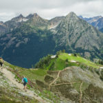
Whatcom Pass Tapto Lakes North Cascades National Park
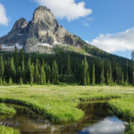
 Mount Challenger, North Cascades National Park #61740
Several weeks ago I was finally able to make a return visit to Whatcom Pass and Tapto Lakes. In the heart of North Cascades National Park, Whatcom Pass is the quintessential North Cascades wilderness. It rises out of deep untouched forest valleys to jaw-dropping views of rugged glacier-clad peaks. From Part 1
Exploring Tapto Lakes North Cascades Basin
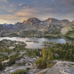
Tapto Lakes is one of those locations that many hikers dream about visiting. Remote, high in the subalpine, and surrounded by rugged snowcapped peaks, the lakes have all the features of a classic backpacking destination. Tapto Lakes sits in a basin about 800′ above Whatcom Pass. The basin contains a large lake and several smaller lakes set in a heather-filled subalpine meadow. The basin is shaped somewhat like an amphitheater, with the main show being the stupendous views of Mount Challenger and Whatcom Peak. Situated in a designated cross-country zone by the park service, with a permit you are free to camp anywhere among the lakes, though with a few caveats.
After investing two days of hard work into reaching the lakes I woke up rested and refreshed. Content on not having to hike anywhere with a full pack I took in the view and planned my day. Of course, since my main reason for being here was landscape photography I woke up early to survey the light. I had already identified several excellent spots to run to in the event of some great morning light. Unfortunately, this wasn’t the case on my first morning, so I had lots of leisure time to explore all the lakes.
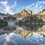
My usual modus operandi is to spend most of the day scouting out and lining up possible compositions. I then try to assign a priority to them and work from the top down when the lighting becomes appropriate. My first evening had some very nice light, enabling me to photograph some classic reflections of Whatcom Peak.
 Whatcom Peak, North Cascades National Park #61499 Purchase
The View North
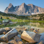
On my second day, I decided to move camp to a higher location. My map showed a very small lake not far away in its small talus-fringed basin on Red Face Mountain. It appeared to offer even more commanding views, along with quick access to a ridge on Red Face Mountain. The short hike up was worth it. The lake still had some snow along one side and also had some good composition qualities. I quickly found an excellent spot to set up camp, after which I hiked up to the ridge.
Bear Mountain and Reveille Lakes, North Cascades National Park #61536 Purchase
As I crested the ridge I was presented with incredible views of the wild peaks to the north. Dominating the views were Bear Mountain and the jagged needle-like spires of Mox Peaks and Silver Peaks. Far below the precipitous and crumbling ridge were the turquoise-colored Reveille Lakes. All of this territory was completely devoid of trails, a true wilderness only accessible to the most determined mountaineers. I sat there for quite some time, contemplating how fortunate I was to be in such a special place. I got up after a while and headed back down the slope, wondering if I’d ever return.
Waiting for Light at Tapto Lakes North Cascades
Back down at the lake, the day was wearing on and it was time to set up some compositions. Some clouds had moved in and were swirling around the summits of nearby peaks. I was hoping they wouldn’t completely sock in everything before sunset. I moved to the back of the lake where Whatcom Peak cast a nice reflection in the still waters. Waiting to see what would happen I photographed a series of images in which the clouds and reflection created a sort of Rorshach effect. Although the light didn’t have a dramatic saturation of the color, I did like some of the subtle pastel tones. All in all, it was a very satisfying day.
Whatcom Peak cloud reflection, North Cascades National Park #61603 Purchase
Whatcom Peak cloud reflection, North Cascades National Park #61630 Purchase
Middle Lakes
The next day feeling that I had accomplished my goals and not wanting to overly duplicate images, I packed up and moved on. A bit east of Tapto Lakes are a few more small lakes, the most accessible being Middle Lakes. I decided to spend my last day here before heading back. Climbing back up to the ridge I turned and bid a somewhat sad goodbye to the lakes I had dreamed of revisiting all those years.
Middle Lakes turned out to be an easy short mile or so further, there was only a steep rock slope to cross to add a bit of excitement. When I reached upper Middle Lake I found the setting to be somewhat desolate. Surrounded by steep slopes on three sides and a boulder field at the outlet, there didn’t seem to be any good campsites. I moved on to check out the lower lake. The lower lake was more attractive, but it too afforded little flat ground for camping. However, when scouting for campsites I noticed an odd mound near the lake outlet with intense iron-red soil. There appeared to be a spring emanating from the mound. The main spring had formed small red mineral terraces similar to Mammoth Hot Springs in Yellowstone. I felt the water but it was cool to the touch.
Mineral Spring, North Cascades National Park #61666 Purchase
Swirling clouds over Challenger Glacier, North Cascades National Park #61711 Purchase
Camping at Middle Lakes
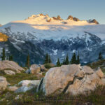
I ultimately found a nice spot for the night among boulders and heather meadows with a commanding view of Mount Challenger. For a mountain with such an imposing glacier, it seemed that its elevation should be more than 8236′. During my entire stay in the area, I noticed nearly constant clouds near its summit. Apparently, for such a modest height Mount Challenger tends to make its own weather, partly explaining the huge glacier. For most of that afternoon and evening, I enjoyed and photographed a show of mists whimsically curling around the summit. To commemorate my trip to this special place I made several photos of my campsite, including a couple with the tent illuminated.
 Illuminated tent and Mount Challenger, North Cascades National Park #61751 Purchase
Hiking Out from Tapto Lakes North Cascades
The next day it was time to head out, retracing my steps down to Whatcom Pass and into the Chilliwack River Valley. Although I was filled with a deep sense of accomplishment and satisfaction, I was also sad to say goodbye. I faced a long day of hiking filled with retrospection on this and my first trip to Whatcom Pass many years back. Once again a highlight was riding the cable car across the river. After around ten miles I reached Copper Creek Camp, tired with plenty of hot spots on my heels and toes. The next day I faced the stiff climb back up to Hannegan Pass and then the final miles out to the trailhead where my truck waited.
Nearing the pass I began to meet more hikers. Many of them were just beginning trips similar to mine. You could easily see the excitement on their faces, anticipating the wonders that were waiting for them. Of course, I stopped to chat and helped stoke their excitement by passing on some of the highlights from my trip. Then it was down the pass for the last five miles of the trip. Although I was out of North Cascades National Park and in the Mount Baker Wilderness, it was easy to sense civilization was close. I began to see more people on a wider well maintained trail. I got back to my truck in a few hours, in a parking lot that had dozens of cars in it.
Tired but happy I began to drive home. I began thinking about how soon I might get a chance to go back to Whatcom Pass.
Campsite on Red Face Mountain, Whatcom Peak in the distance #61589 Purchase
Leave No Trace
Please, Please, Please! Don’t plan a trip to this or any other national park, monument, or wilderness area unless you are prepared to follow Leave No Trace guidelines (LNT). National parks and wilderness areas worldwide are under incredible pressure from the growing number of visitors. So, please do your part to help preserve these precious areas for future generations!
Please visit the Leave No Trace Center for Outdoor Ethics to learn more about LNT’s principles. Your children and grandchildren will thank you!
LEAVE NO TRACE SEVEN PRINCIPLES
1. Plan and Prepare
2. Travel and Camp on Durable Surfaces
3. Dispose of Waste Properly
4. Leave What You Find
5. Minimize Campfire Impacts
6. Respect Wildlife
7. Be Considerate of Other Visitors
© Leave No Trace: www.LNT.org
Learn about how to protect the places we love to photograph
Visit the Nature First Website

All photos appearing in Cirque of the Towers Wind River Range are available for Commercial Licensing and Fine Art Prints. Click on any image to purchase, or contact me for more info!
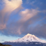
Whatcom Pass Tapto Lakes North Cascades National Park Part 2
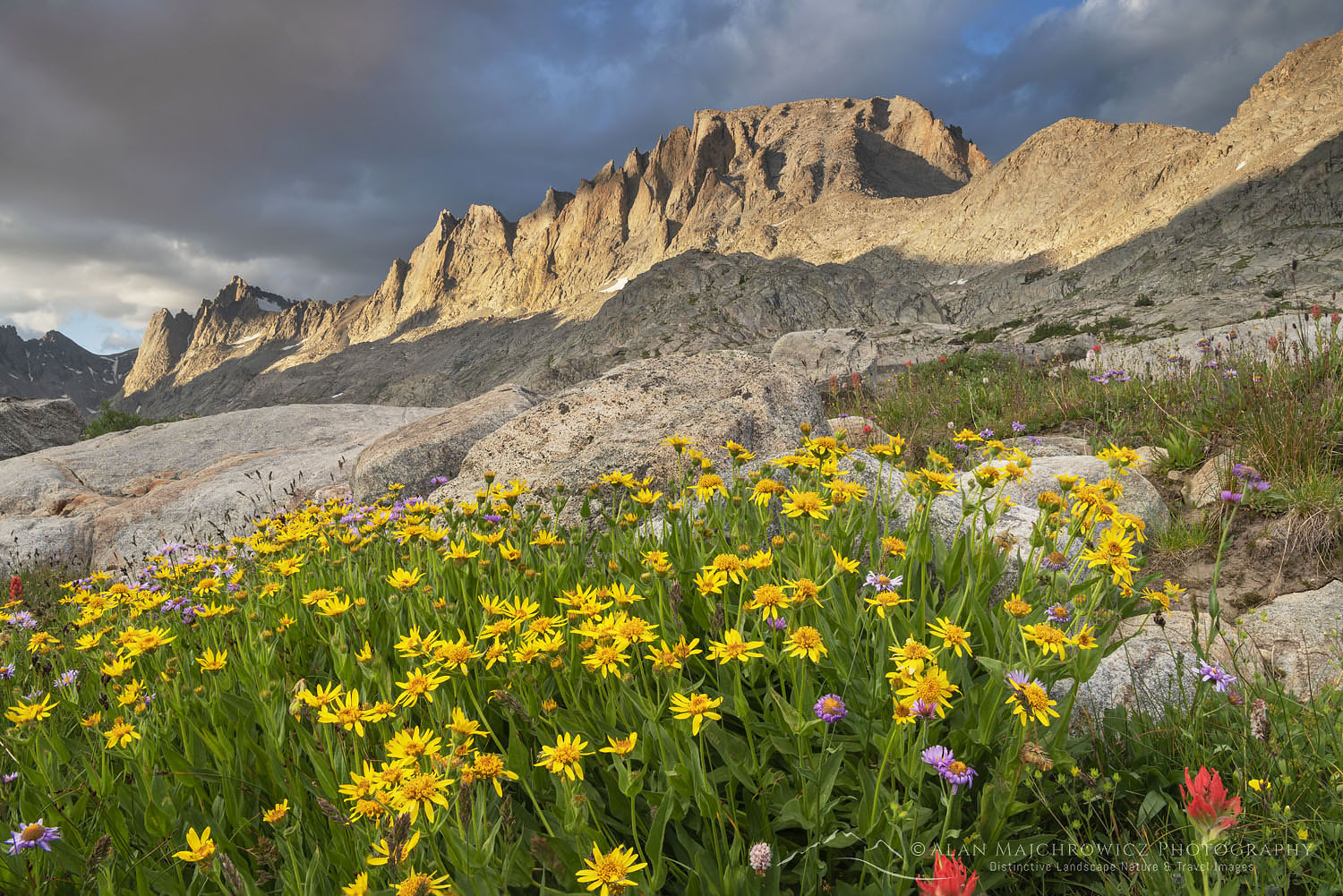
 Titcomb Basin Wildflowers #66559 Purchase
 Squaretop Mountain #66997 Purchase
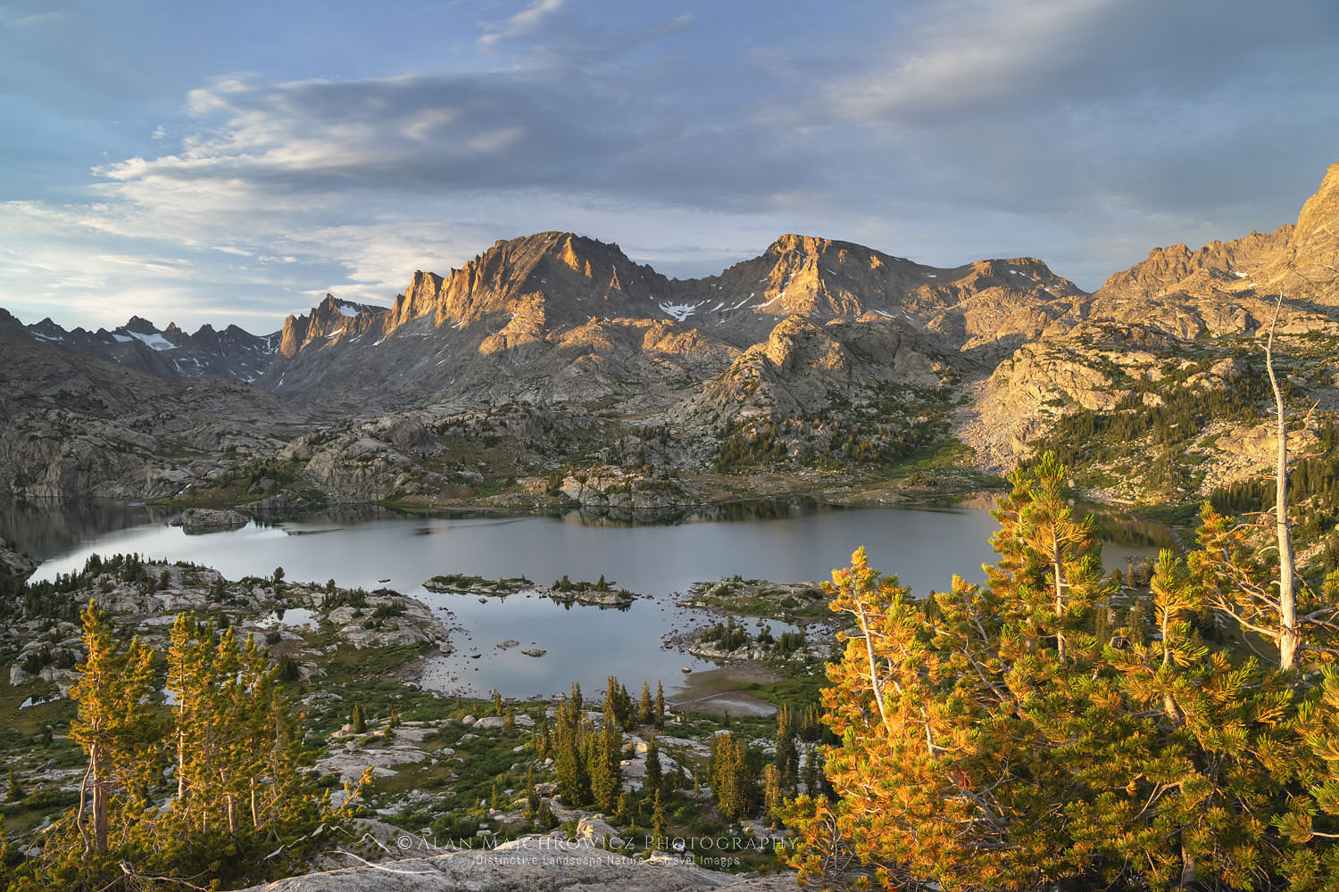 Island Lake #66368 Purchase
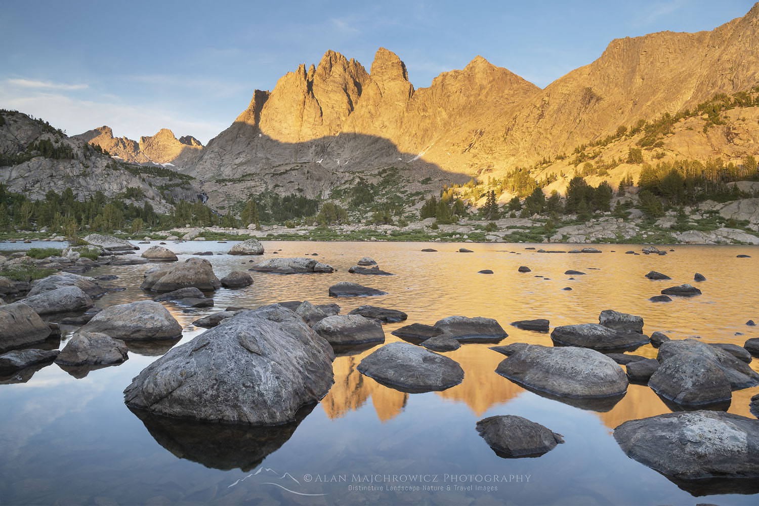 Mount Bonneville #66273 Purchase
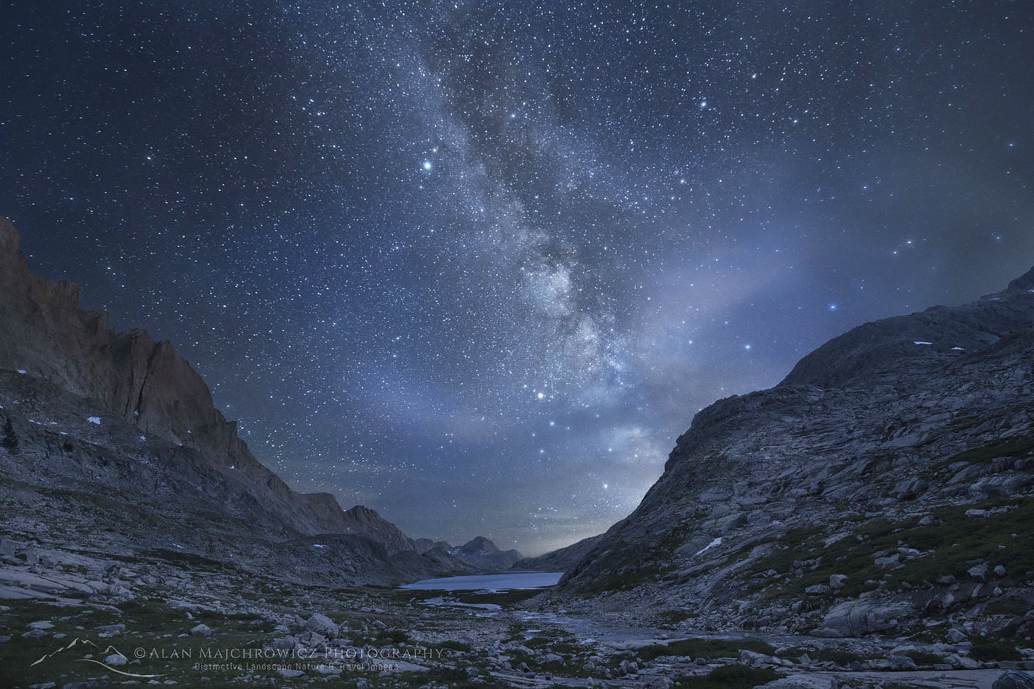 Milky Way over Upper Titicomb Basin #66741 Purchase


 Mount Challenger, North Cascades National Park #61740


 Liberty Bell Mountain North Cascades #61365