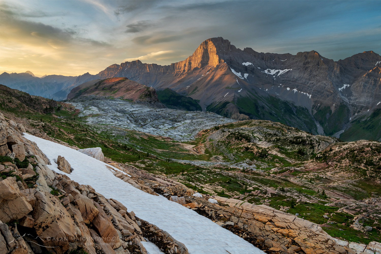
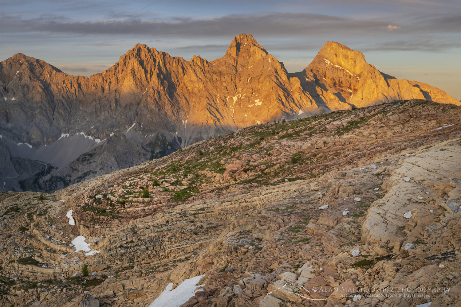
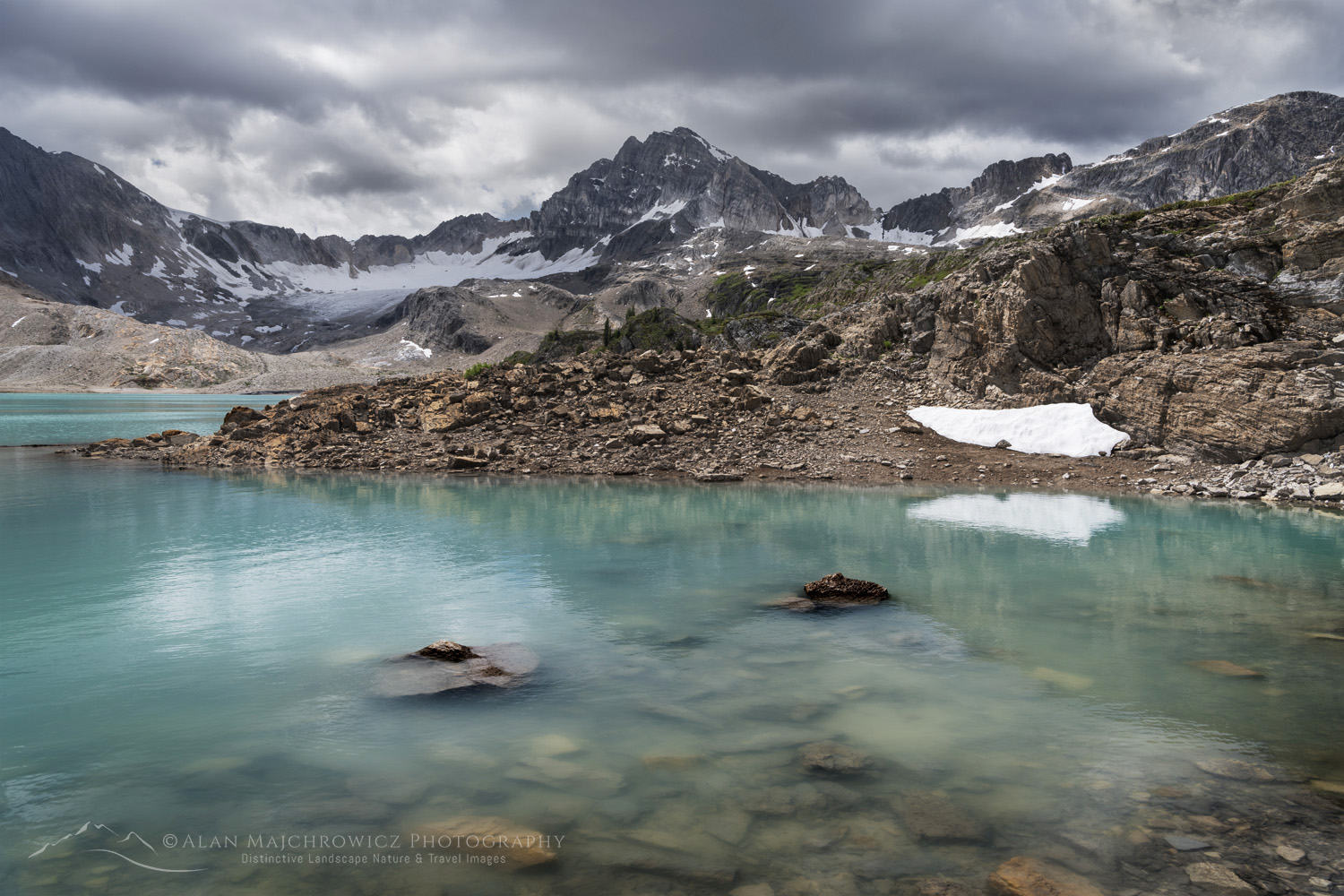
Sunrise over Bow Lake, with Crowfoot Mountain in the distance. Banff National Park. Alberta, Canada #88692

Canadian Rockies Photography Series

Canadian Rockies Photography: The Basics
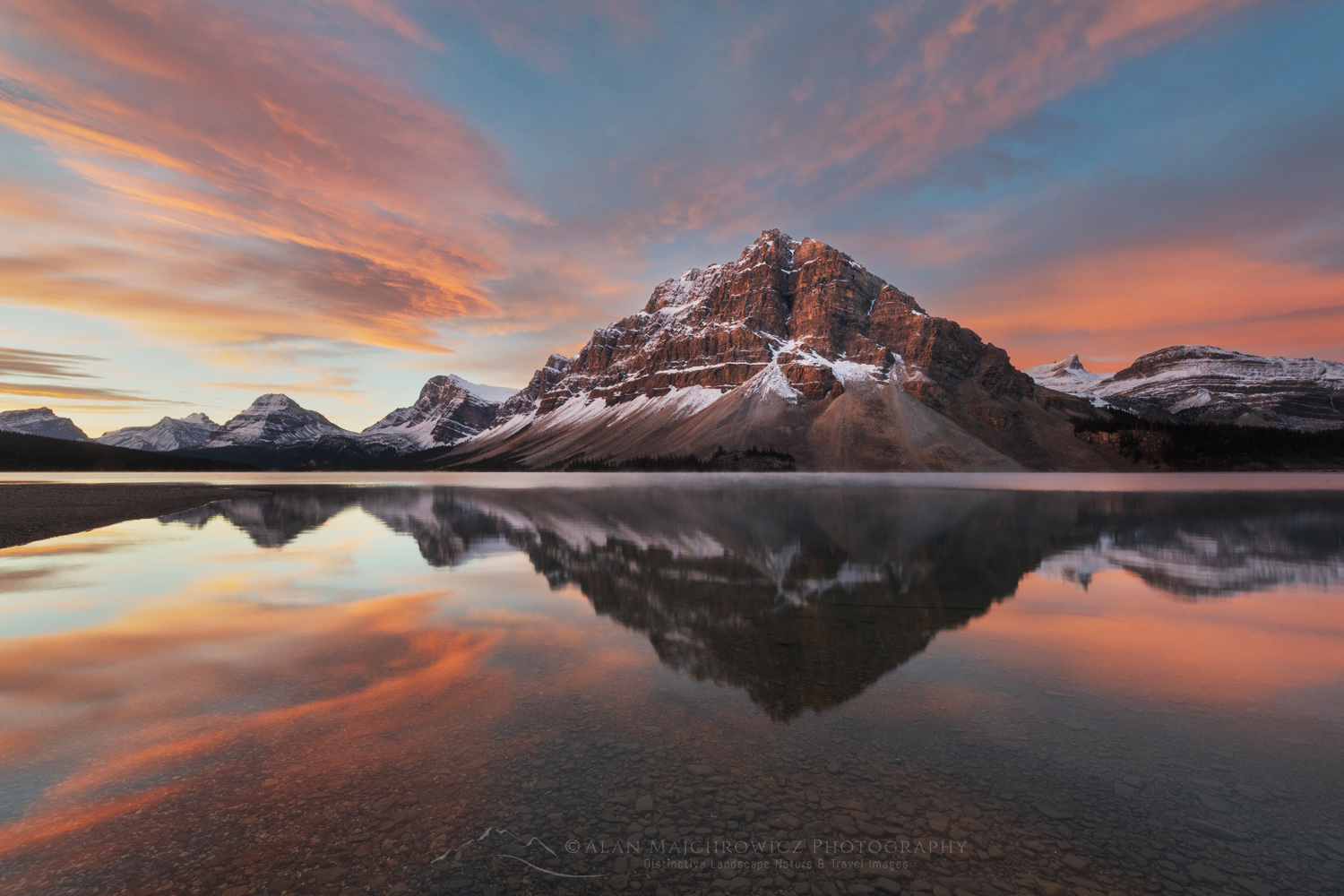
Sunrise over Bow Lake, with Crowfoot Mountain in the distance. Banff National Park. Alberta, Canada #88692 Canadian Rockies PhotographyBow Lake Banff National Park #88692  Purchase

A quick look at a map of Western Canada reveals range upon range of magnificent mountains, many crowned with impressive glaciers. But one range famously stands out among them all. Straddling the border of British Columbia and Alberta are the jaw-dropping Canadian Rockies. There are few mountain ranges on Earth that can equal the magnificence of these mountains. For landscape and nature photographers, these mountains offer a lifetime of endless photographic opportunities.

As a result, on a first visit to the Canadian Rockies, a photographer may be overwhelmed by the scenery and ask, “Where do I start?” An excellent question. And hopefully I can provide some answers and tips for your first, or next, Canadian Rockies photography tour.

Pro Tip: The Canadian Rockies encompass a staggering amount of jaw-dropping scenery. Therefore, don’t expect to see and photograph everything in one visit, even if you have months available. Make a general tourist-style first visit or two, then return over and over to explore more locations.
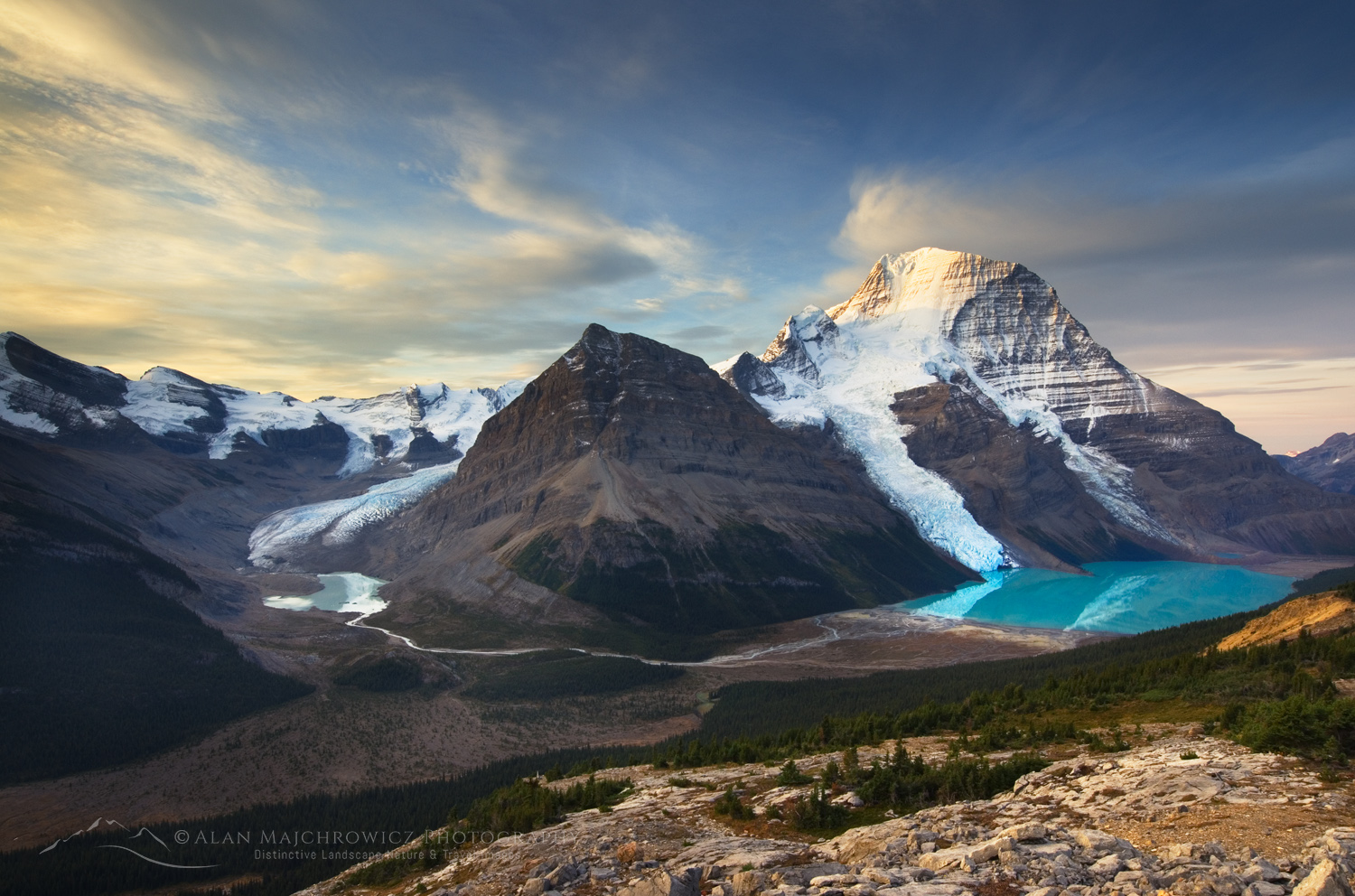
Mount Robson, highest mountain in the Canadian Rockies, seen from Mumm Basin, Mount Robson Provincial Park British Columbia #54646 Canadian Rockies PhotographyMount Robson #54646  Purchase

Where are the Canadian Rockies?

Geographically, the Canadian Rockies extend from the U.S. border in Montana, in the south, to the Yukon Territory in the north. However, the most famously stunning section lies in the southern half of the range, at approximately 51º north. Here, the border with Alberta and British Columbia lies roughly along the continental divide. The northern edge of the section in this post is Mount Robson Provincial Park, and the southern edge is Kananaskis Country.
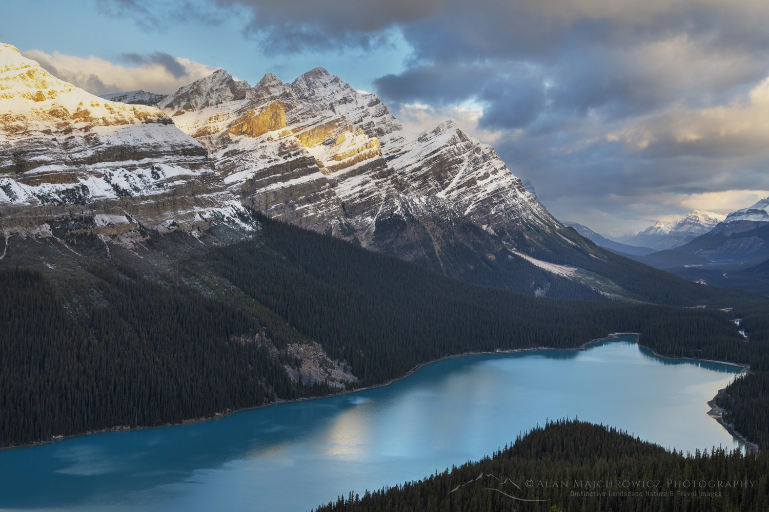
Peyto Lake at sunrise after a fresh dusting of autmn snow. Banff National Park. Alberta, Canada #88877Peyto Lake Banff National Park #88877  Purchase

Within this area, the Canadian Rockies receive protected status by means of an interconnecting web of both National and Provincial parks. Listed below, from north to south, are the main parks.

  • Mount Robson Provincial Park, British Columbia
  • Willmore Wilderness Park, Alberta
  • Jasper National Park, Alberta
  • Banff National Park, Alberta
  • Yoho National Park, British Columbia
  • Kootenay National Park, British Columbia
  • Height of the Rockies Provincial Park, British Columbia
  • Mount Assiniboine Provincial Park, British Columbia
  • Kananaskis Country, Alberta; Peter Lougheed Provincial Park, Spray Valley Provincial Park, Bow Valley Provincial Park, Sheep River Provincial Park

When to go on a Canadian Rockies Photography Trip

The short answer is any time of year! Most parks are open year-round, although with limited access and facilities in winter. Summer is glorious, but the crowds are also at their peak.
Glacier on Mount Andromeda in winter, seen from Icefields Parkway. Jasper National Park Alberta Canada #82187Columbia Icelfields in winter #82187  Purchase

  • Winter: This is a spectacular season for photography in the Canadian Rockies. If you are prepared to work in cold temperatures, the rewards are no crowds to contend with and magical winter wonderland scenery. Most of the main roads are open and maintained for winter driving, including the Icefields Parkway. However, only a few campgrounds remain open in winter. Also, for photographing beyond the roadside, you’ll need snowshoes or skis to get around.
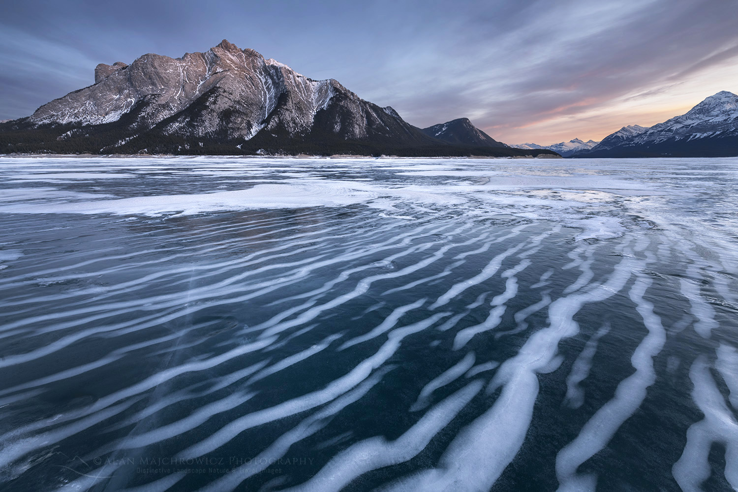
Striped patterns of snow frozen in the surface of Abraham Lake Alberta Canada #82406cAbraham Lake #82406c  Purchase

  • Spring: This is also a good time for a photography trip. Days are longer and warmer, and tourism is light. The mountains still have an attractive cloak of snow, and the lowlands are beginning to green up. However, most higher trails will still be under deep snow.
  • Summer: This is peak season; the mountains, lakes, and valleys are nothing short of magnificent. However, a summer photography tour, both front and backcountry, requires careful planning far in advance. Summer sees the greatest number of tourists, with campgrounds, hotels, and lodges reserved months or years in advance. Most scenic viewpoints run out of parking very early in the morning, some requiring shuttle reservations.
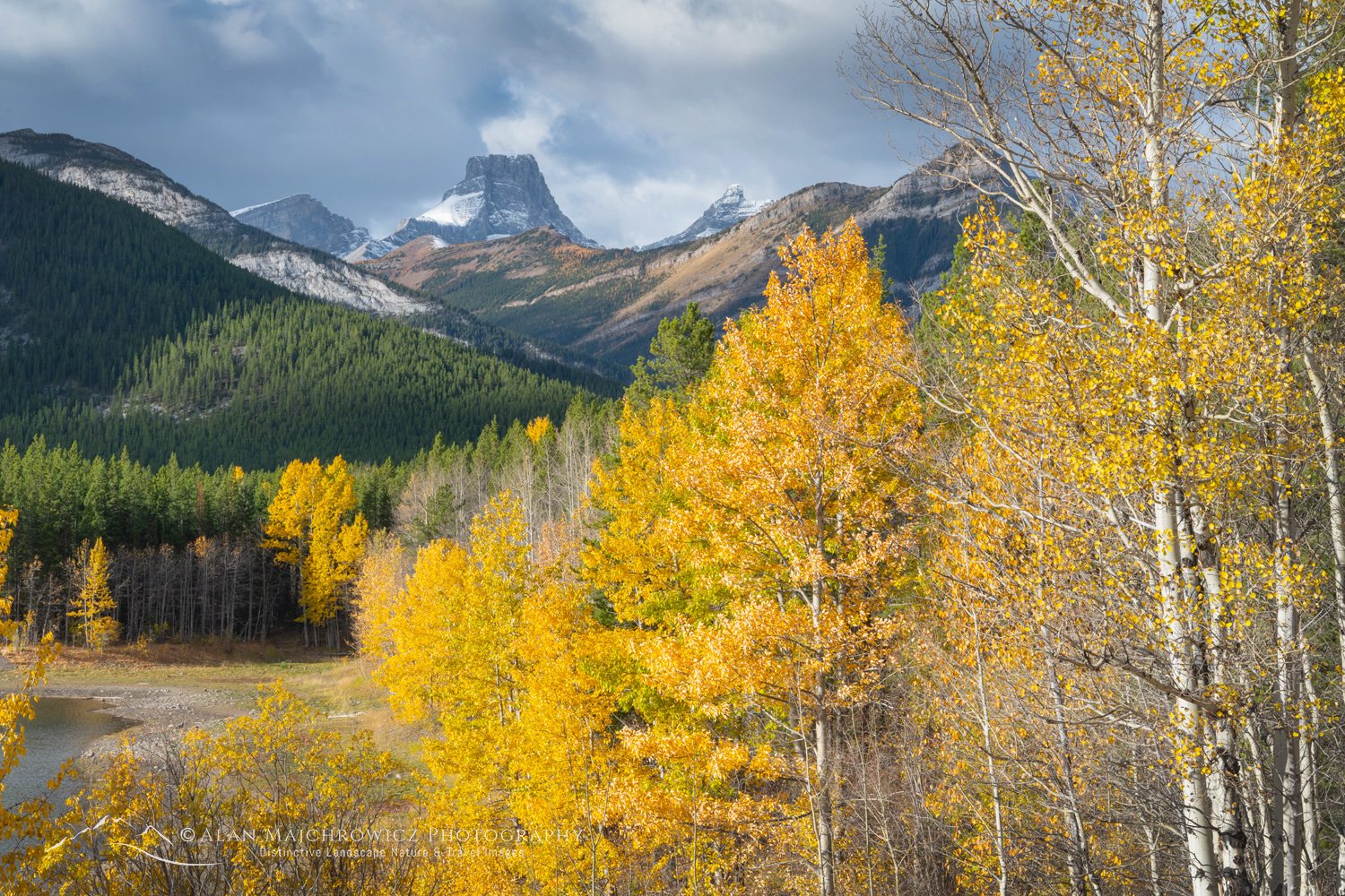
Wedge Pond surrounded by aspens and cottonwood trees in golden fall foliage. Kananaskis Country in the Canadian Rockies Alberta Canada #81538Kananskis Country fall foliage #81538  Purchase

  • Fall: My favorite season for Canadian Rockies Photography. The days are still warm, with chilly nights and mornings. Weather patterns are unsettled and can bring fresh dustings of snow followed by beautiful sunny days. And, of course, there is fall foliage. Fall travel has increased in popularity over the years, so most parks can still be crowded.
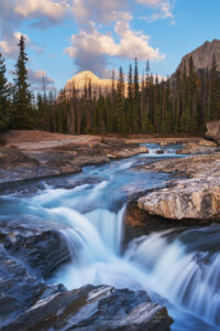
Natural Bridge Waterfall on the Kicking Horse River. Yoho National Park in the Canadian Rockies. British Columbia Canada #81715Yoho National Park #81715  Purchase

Where to go on a Canadian Rockies Photography Trip

That can be a very difficult question, and it depends on your photography goals. Do you want to photograph the most iconic images of the Canadian Rockies? Do you want to escape the crowds and backpack into seldom-photographed places? Or do you want to stick to roadside viewpoints and easy nature trails?

Excellent roads and backcountry trails are present in all of the parks listed above. But some parks offer better access to easy frontcountry landscapes. Others, such as Mount Robson and Height of the Rockies Provincial Parks, are mainly backcountry wilderness trip destinations. Below are some suggestions for your first few visits.
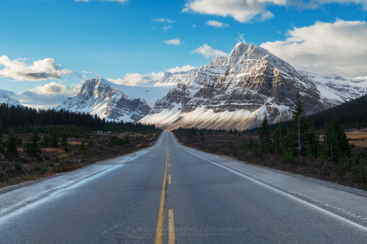
Icefields Parkway at Bow Summit. Crowfoot Mountain is in the distance. Banff National Park. Alberta, Canada #88889Icefields Parkway Banff National Park #88889  Purchase

Frontcountry

  • Icefields Parkway: Jasper and Banff National Parks. This is one of the most iconic and scenic drives in North America, one you’re guaranteed to do over and over again. This scenic drive highlights some of the most dramatic scenery in the Canadian Rockies. Start at Jasper in the north or Lake Louise in the south. Spend an entire day taking it all in, and make notes for returning to the places that interest you the most.
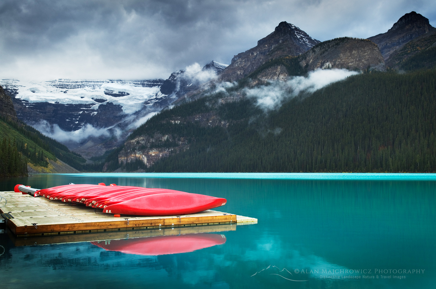
Red canoes on dock, Lake Louise, Banff National Park #54792Lake Louise Banff National Park #54792  Purchase
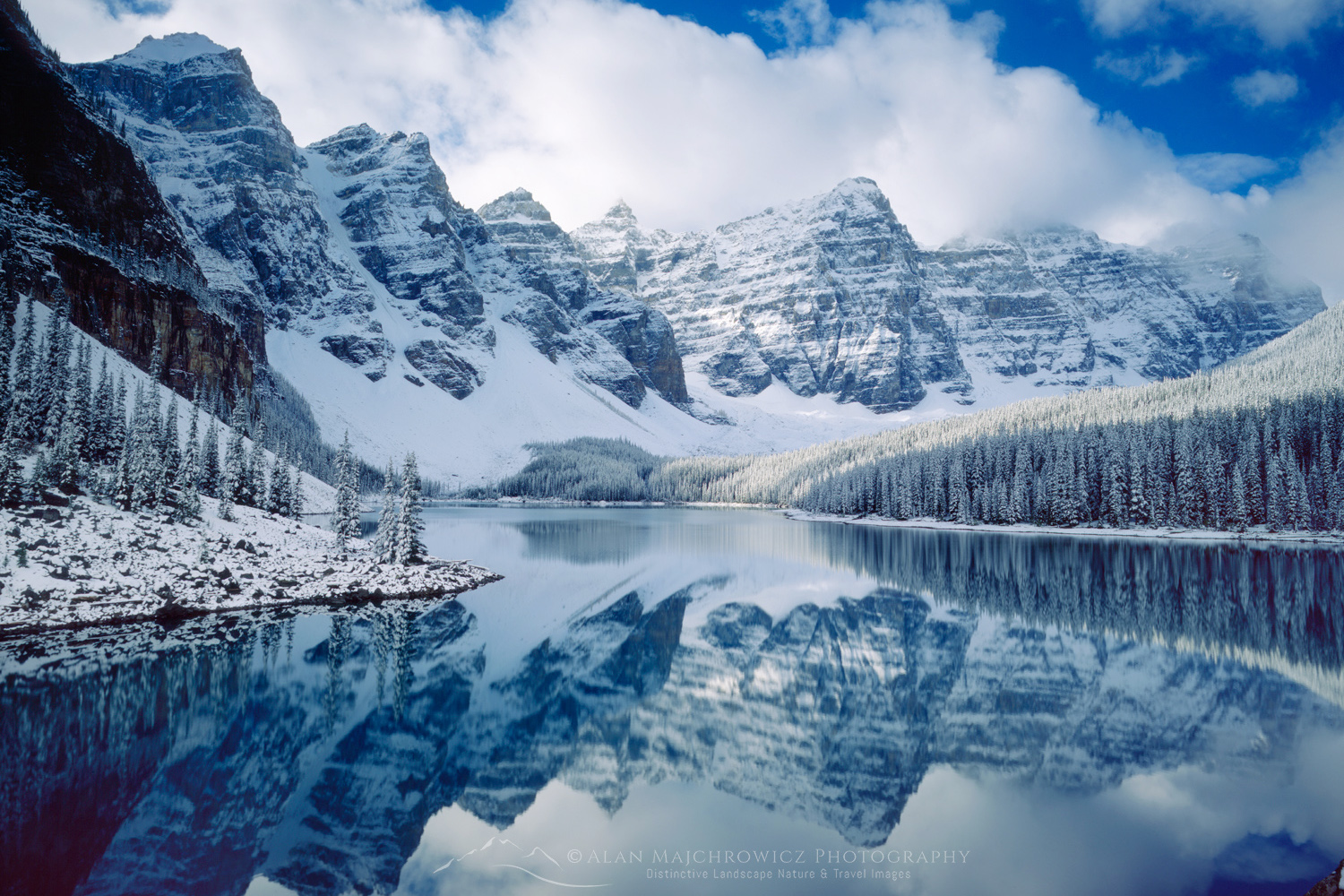
Autumn snowfall on Moraine Lake, Banff National Park Alberta Canada #4100Moraine Lake Banff National Park #4100  Purchase

  • Lake Louise Area: This is certainly the nexus for most photographers starting out photographing the Canadian Rockies. Lake Louise and Moraine Lake are especially notable for two of the most identifiable locations on Earth. These two lakes appear around the world on screensavers, tourist ads, packaging, and everything in between. That said, it will feel like every tourist in the world is with you, trying to photograph them.
  • Bow Valley Scenic Parkway: In contrast to Lake Louise, this is a quiet alternative to the Trans-Canada Highway.  This scenic drive has access to Johnston Canyon, Morant’s Curve viewpoint, and others. In the fall, this can be a good place to photograph aspens and elk herds.
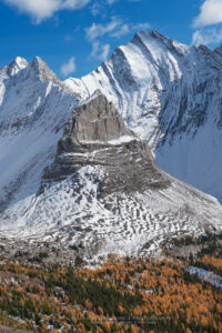
Arethusa Cirque Peter Loughheed Provincial Park, Kananaskis Country Canadian Rockies Alberta Canada #81582Kananaskis Country #81582  Purchase

  • Kananaskis, Highway 40 and Smith-Dorrien Trail: SimiKananaskis Country, or “K” Country, is also where many locals go to escape the crowds of the bigger parks. This is one of the best locations for fall photography. While there are some good photo ops along the roads, some of the best photography is up the trails. Both roads can be combined for a scenic loop. But be aware that the Smith-Dorrien Road section of the western half is unpaved gravel.
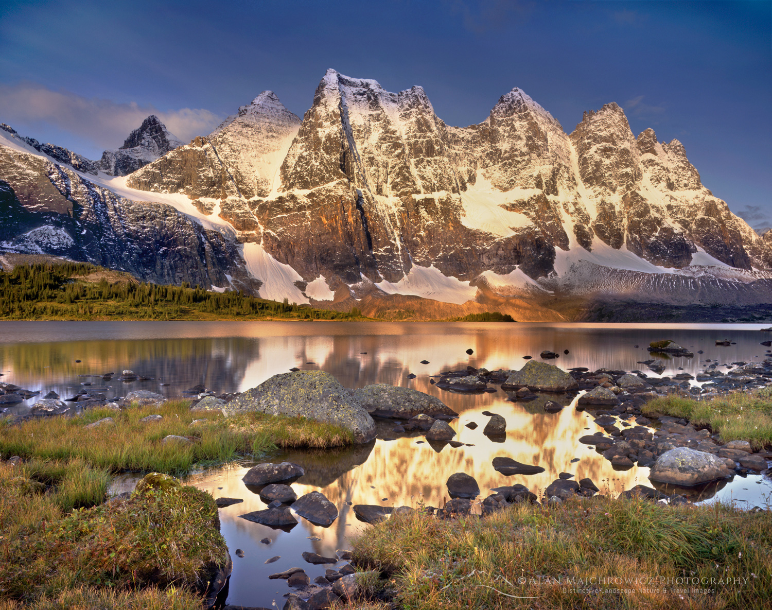
The Ramparts from Amethyst Lake in the Tonquin Valley Jasper National Park Alberta Canada #3055Tonquin Valley Jasper National Park #3055  Purchase

Backcountry

Below are some of the top backcountry locations for landscape photography. All require committing several days of backcountry travel to make a photography trip worthwhile. And all of them require permit reservations months in advance. I will describe them in detail in future blog posts.

  • Berg Lake Trail, Mount Robson Provincial Park
  • Tonquin Valley, Jasper National Park
  • Skoki Loop, Banff National Park
  • Lake O’Hara, Yoho National Park
  • Rock Wall Trail, Kootenay National Park, British Columbia
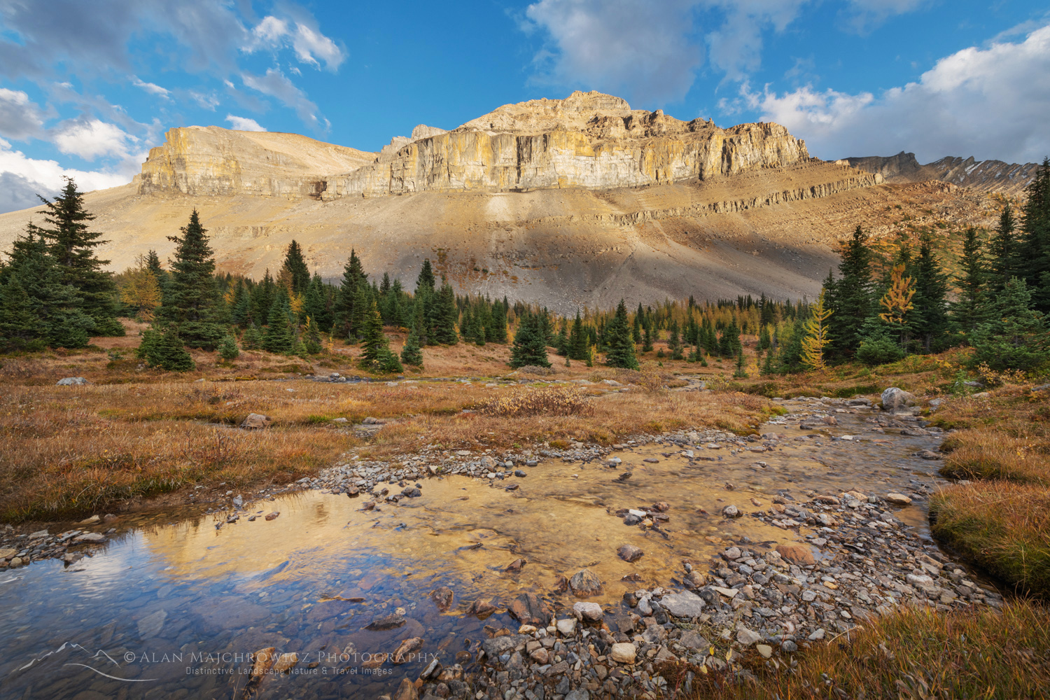
Redoubt Mountain and Corral Creek. Banff National Park, Alberta, Canada #88568Skoki Loop Banff National Park #88568  Purchase

Basic Tips for Canadian Rockies Photography

Below are several tips that would apply to most photography trips in the Canadian Rockies

  • Get up very early; Morning light rules. The vast majority of locations, especially around Lake Louise and the Icefields Parkway, photograph best in morning light. However, many also photograph well in evening light under the right conditions.
  • Planning Patience and Persistance: Follow these three Ps is especially important for successful landscape and nature photography. Always Plan what and where and when you want to photography. Then, be patient and wait for the best light and weather conditions. And finally, be persistent, you may have to return over the course of several days or years to be rewarded with the scene you envision.
  • Avoid the crowds; Photograph during golden hours. Any time between 8:00 a.m. and 6:00 p.m. is likely to be packed with tour buses and cars. Anyway, experienced photographers know the best times of day are generally the morning and evening golden hours. This is also when most of the tourists are either just waking up or calling it a day.
  • Focus on only a few locations: As I mentioned earlier, this is a big area with amazing photo ops around every turn. It’s easy to try to fit everything into one trip. Consequently, it’s best to pick one area or subject and dedicate your available time to it.
  • Make Reservations Early: I can’t stress this enough. Hotels and lodges often book out at least six months in advance. Most campsites, front and backcountry, are reservation-only. Moreover, they get reserved within minutes of becoming available. And some, most notably, like at Lake O’Hara, are reserved through lottery only. Therefore it is always advisable to have several alternative options ready.
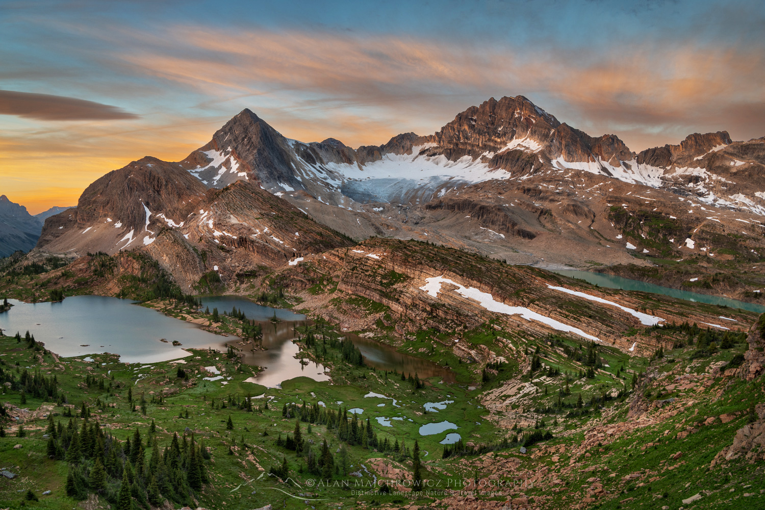
Limestone Lakes basin, Height of the Rockies Provincial Park British Columbia #86593Height of the Rockies Provincial Park #86593  Purchase

Useful Links for a successful Canadian Rockies Photography Trip

Thank you for reading, and if you found this post to be enjoyable and informative, please feel free to share it with friends and family!

All photos appearing in Canadian Rockies Photography are available for Commercial Licensing and Fine Art Prints
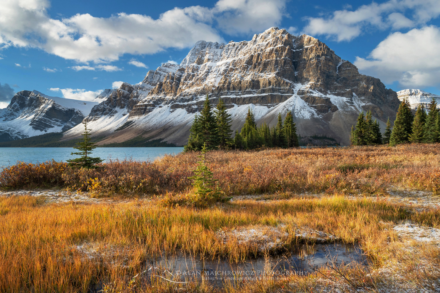
Autumn foliage along Bow Lake, with Crowfoot Mountain in the distance. Banff National Park. Alberta, Canada #88924 Canadian Rockies PhotographyBow Lake Banff National Park #86593  Purchase

Leave No Trace

Please, Please, Please!  Don’t plan a trip to this or any other national park, monument, or wilderness area unless you are prepared to follow Leave No Trace guidelines (LNT). National parks and wilderness areas worldwide are under incredible pressure from the growing number of visitors. So, please do your part to help preserve these precious areas for future generations!

Please visit the Leave No Trace Center for Outdoor Ethics to learn more about LNT’s principles. Your children and grandchildren will thank you!

LEAVE NO TRACE SEVEN PRINCIPLES

1. Plan and Prepare
2. Travel and Camp on Durable Surfaces
3. Dispose of Waste Properly
4. Leave What You Find
5. Minimize Campfire Impacts
6. Respect Wildlife
7. Be Considerate of Other Visitors
© Leave No Trace: www.LNT.org
Learn about how to protect the places we love to photograph
Visit the Nature First Website

Nature First the alliance for responsible nature photography

Fine Art Landscape and Nature Photography by Alan majchrowicz

Gwillim Lakes, with Gregorio Peak in the distance. Valhalla Provincial Park, West Kootenays British Columbia Canada #80912

Purcell and Selkirk Mountains British Columbia

Purcell and Selkirk Mountains British Columbia

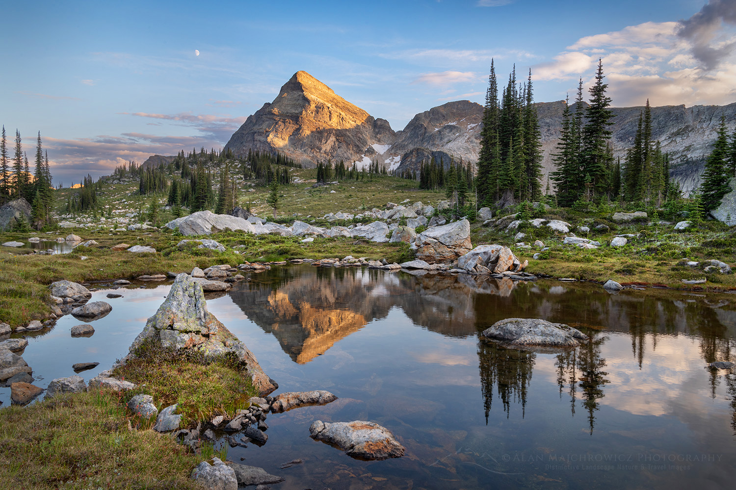
Gwillim Lakes, with Gregorio Peak in the distance. Valhalla Provincial Park, West Kootenays British Columbia Canada #80912 Purcell and Selkirk MountainsValhalla Provincial Park #80912  Purchase

The Purcells and Selkirks are two mountain ranges in southeast British Columbia. Together with the Monashees, they are part of the greater Columbia Mountains. These ranges, along with the western flanks of the Rockies, lie within the region known as the Kootenays. However, the Kootenays are more than just lofty wild peaks clad in glaciers. Its numerous valleys contain large fjord-like lakes and quaint small towns with vibrant art communities. Because the nearby and more famous Canadian Rockies draw most of the tourist crowds, the Kootenays remain relatively quiet and unknown.  Outdoor enthusiasts visiting the Kootenays will consequently find them refreshingly unspoiled.

The Purcells and Selkirks, while nearly abutting each other, are two geologically and visually different ranges. They contain two national parks, numerous provincial parks, one wilderness conservancy, and more impressive peaks and glaciers than you can shake a stick at. Also, between these protected areas are vast stretches of wild wilderness. All could easily qualify for national park status.

Gwillim Lakes, with Drinnan Peak in the distance. Valhalla Provincial Park, West Kootenays British Columbia Canada #80929 Purcell and Selkirk MountainsValhalla Provincial Park #80929  Purchase

Recreation in the Purcell and Selkirk Mountains

For hikers, backpackers, climbers, and backcountry skiers, the Kootenays offer freedom rapidly disappearing in parks and wilderness areas everywhere. With a few exceptions, such as Glacier National Park and Bugaboo Provincial Park, no permits or fees are required.  Just show up at a trailhead and enjoy the freedom of the hills.

The Purcell and Selkirk Mountains also have many sub-alpine meadows with beautiful stands of Alpine or Sub-Alpine Larch (Larix lyallii). If the words Larch Madness have you racing for your gear,  you’ll love the Kootenays. The North Cascades, while having many of the best larch locations, can be ridiculously overcrowded. Or even out of reach due to strict permitting systems. But in the Kootenays, finding a beautiful spot and having it all to yourself is easy.

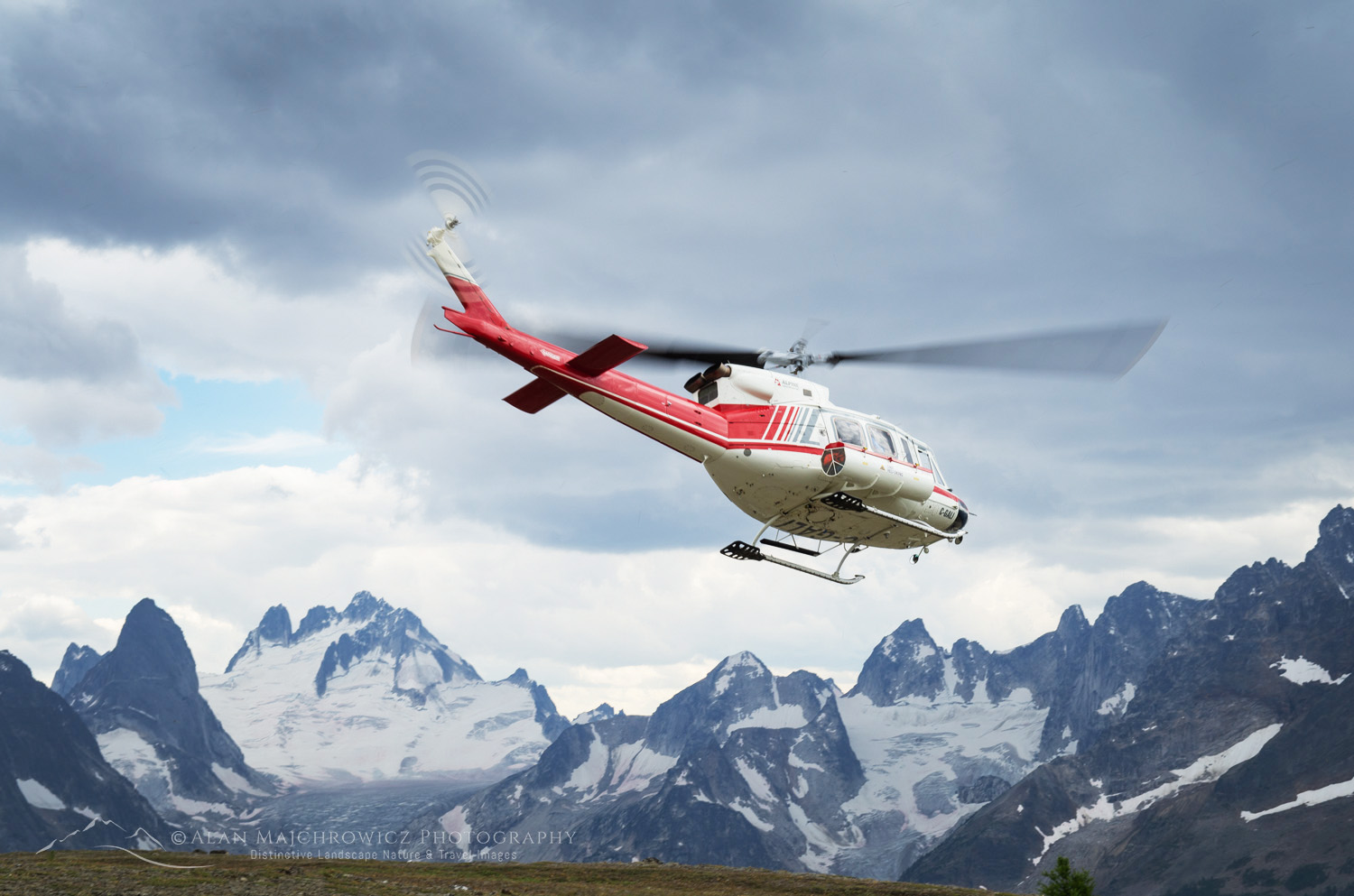
Helicopter lifting off Rocky Point Ridge, Bugaboos in the distance. Bugaboo Provincial Park, Purcell Mountains British Columbia. #62947Heli-hiking in Bugaboo Provincial Park #62947  Purchase

There are, of course, a few downsides to consider when planning a trip to the Kootenays. Several areas are popular destinations for the heli-hiking and heli-skiing crowd.  Canadian Mountains Holidays (CMH) is one of several with luxury lodges in the Selkirks and Purcells. It can be very disappointing to grunt and sweat your way into a beautiful alpine basin only to hear the constant thumping of helicopters. Or even worse, unknowingly setting up a camp next to a landing area.

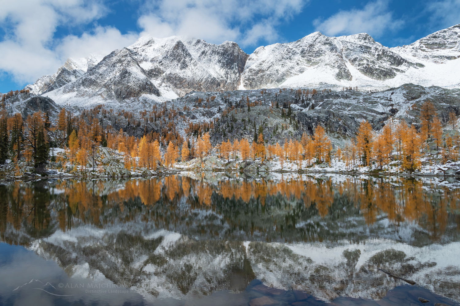
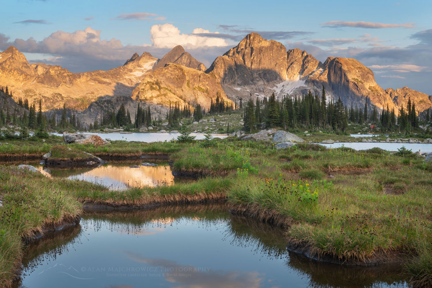
Mount Monica and Alpine Larches (Larix lyallii) are reflected in a lake at Monica Meadows. Purcell Mountains British Columbia Canada #81331Purcell Mountains Larches #81331  Purchase

Photography Tips for the Purcell and Selkirk Mountains

  • For photographing Sub-Alpine Larch (Larix lyallii), the last half of September through the first week of October is the best time to visit. However, conditions and timing are different every year.
  • Try and time a larch photography trip to include a fresh dusting of snow.
  • Scouting is an essential technique for better photography. Always scout out the best locations in advance by spending the day thoroughly exploring the area. Make notes of the best spots and how long it will take to reach them in the morning and evening golden hours.

Alpine Larches (Larix lyallii) in peak fall color reflected in a lake in Monica Meadows. Purcell Mountains British Columbia Canada #81435Purcell Mountains Larches #81435  Purchase

  • Always allow enough time to photograph in the morning and evening golden hours. Also, try and plan for a multi-day trip to take advantage of different lighting conditions.

More Photography tips:  Check my post Backpacking Photography Tips for suggestions and tips on what camera gear to bring and for tips on making better photos during your trip.

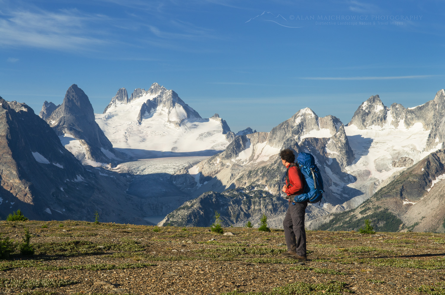
Backpacker admiring view on Rocky Point Ridge. Howser Towers, Vowell Glacier, and Northern Bugaboos in the distance. Bugaboo Provincial Park Purcell Mountains British Columbia. #62896Backpacking in Bugaboo Provincial Park #62896  Purchase

Hiking/Backpacking Purcell and Selkirk Mountains

When planning a trip to the Kootenays, consider road access and trail conditions. Trailhead access can involve a long drive on gravel roads that are often very narrow and bone-jarringly rough. While most don’t require a 4×4 vehicle, they usually require high clearance.

For those accustomed to hiking along well-maintained trails in the Pacific Northwest, a hike in the Kootenays can be an eye-opener. Many trails receive little or no maintenance and are merely rough routes over roots, rocks, and boulders, with no switchbacks.

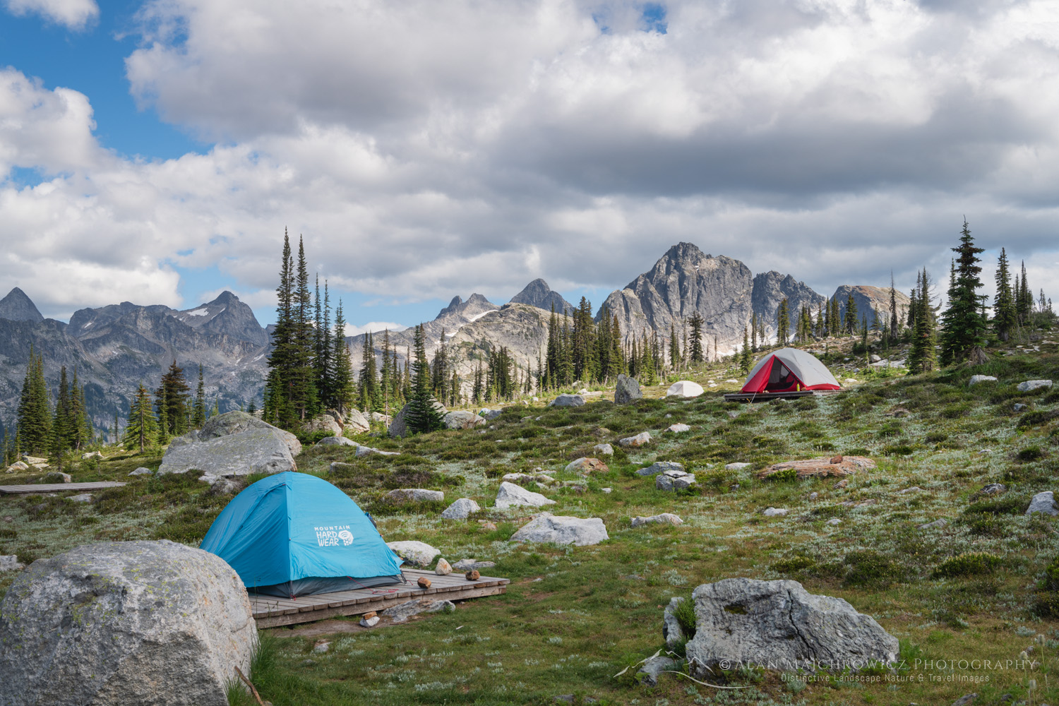
Gwillim Lakes backcountry camp. Valhalla Provincial Park, West Kootenays British Columbia Canada #80758Valhalla Provincial Park backcountry camp #80758  Purchase

Provincial and National parks in the Kootenays often have designated backcountry camp areas. They may include hardened tent sites, outhouses, cooking areas, and bear-proof food lockers.

Porcupines and Vehicles

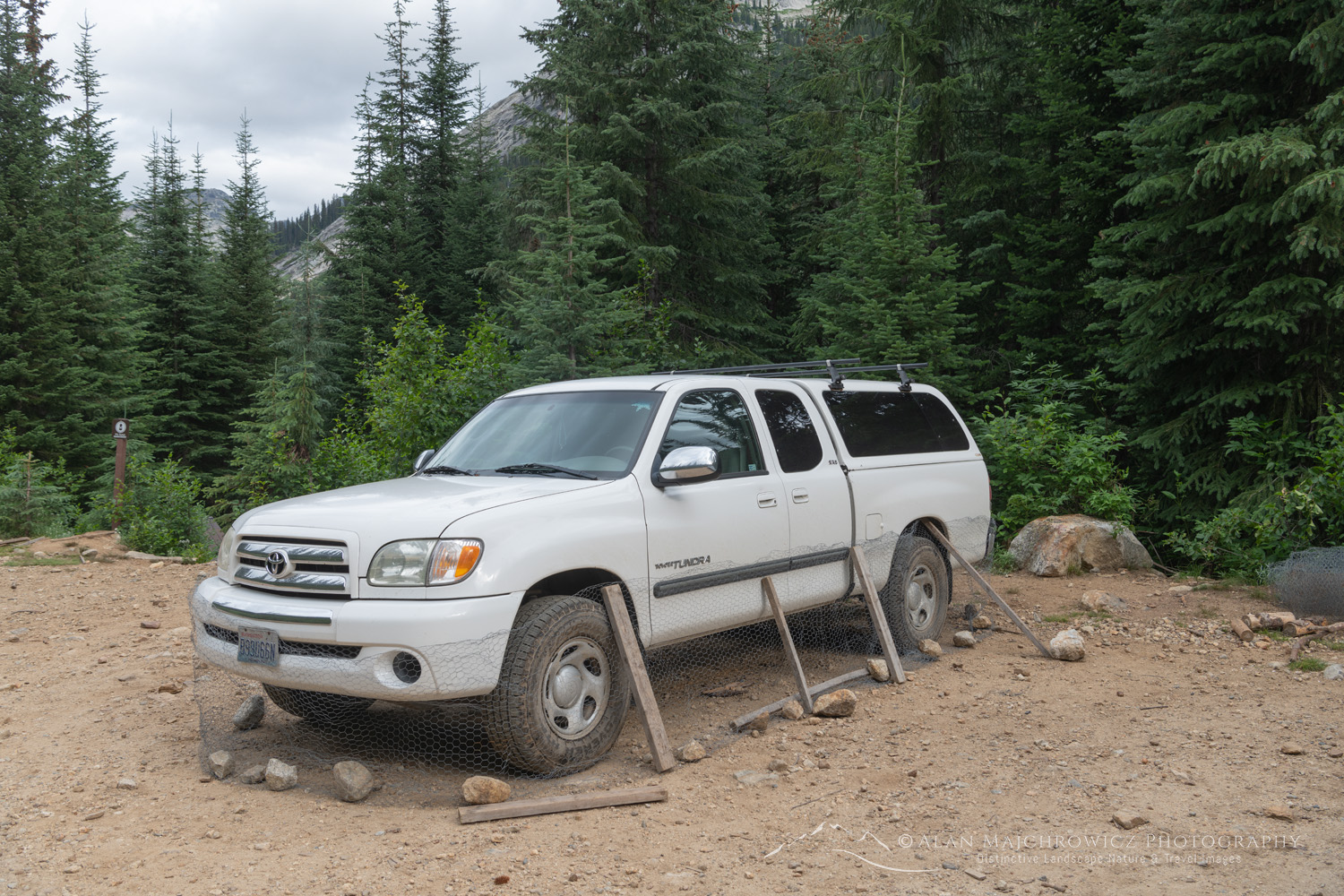
One interesting quirk about the Kootenay Region is the presence of chicken wire at many trailheads. Local wisdom advises wrapping vehicles in chicken wire to prevent porcupines from munching on rubber components. I always bring this up with others at trailheads. Most people say they’ve never had an issue, and a few testify to seeing porcupines at trailheads.

Porcupine prevention Kootenays, British Columbia #80731  Purchase

Not all trailheads have chicken wire available, and it’s debatable if it’s an issue worth worrying about. However, if there is chicken wire, then wrap your vehicle. But if there is none, then don’t worry about it. Also, position rocks and sticks to prevent the critters from getting underneath the wire.

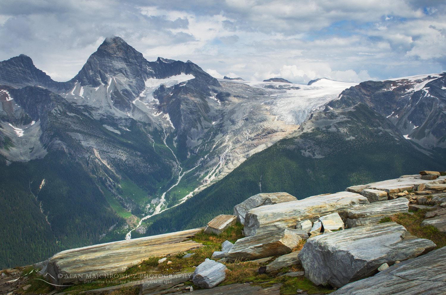
Mount Sir Donald and seen from Abbott Ridge. Selkirk Mountains Glacier National Park British Columbia #62838Glacier National Park British Columbia #62838  Purchase

Getting There

If you’re traveling from western Washington or Lower Mainland British Columbia, you can expect a long circuitous drive. Aside from Glacier National Park at Rogers Pass on the Trans-Canada Highway, there isn’t a fast direct route to the Kootenays. Most destinations require driving up and down long valleys and often require free ferry rides across lakes. Plan for a full day of driving to get to the trailhead. Then, get a fresh start the next morning. And that’s not bad since you’ll be traveling through beautiful scenery. You’ll also get a chance to experience the local vibe.

Lastly, you’ll appreciate that the Kootenays are home to several commercially operated hot springs. Sprinkled throughout the region, they are just the thing after a rewarding trip into the mountains.

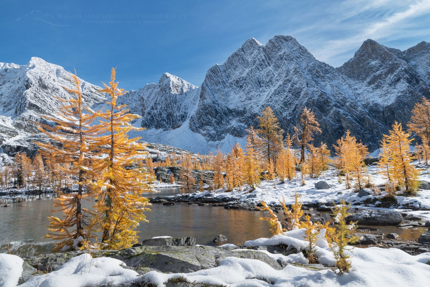
Alpine Larches (Larix lyallii) in peak fall color after fresh snowfall. Mount Amen-Ra is in the distance. Purcell Mountains British Columbia Canada #81305Purcell Mountains Larches #813051  Purchase

For more in-depth info check out West Kootenay Hiking, and also the excellent guidebook: Hikes Around Invermere and the Columbia Valley by Aaron Cameron and Matt Gunn

Below are a few of the more notable destinations. Of course, I have several favorite hikes but you’ll have to discover those on your own, like I did!

Glacier National Park (not the one in Montana)
Valhalla Provincial Park
Bugaboo Provincial Park

Sunset over ponds below Mount Monica. Purcell Mountains British Columbia Canada #80997Purcell Mountains British Columbia #80997  Purchase

Leave No Trace

Please, Please, Please!  Don’t plan a trip to this or any other national park, monument, or wilderness area unless you are prepared to follow Leave No Trace guidelines (LNT). National parks and wilderness areas worldwide are under incredible pressure from the growing number of visitors. So, please do your part to help preserve these precious areas for future generations!

Please visit the Leave No Trace Center for Outdoor Ethics to learn more about LNT’s principles. Your children and grandchildren will thank you!

LEAVE NO TRACE SEVEN PRINCIPLES

1. Plan and Prepare
2. Travel and Camp on Durable Surfaces
3. Dispose of Waste Properly
4. Leave What You Find
5. Minimize Campfire Impacts
6. Respect Wildlife
7. Be Considerate of Other Visitors
© Leave No Trace: www.LNT.org

Learn about how to protect the places we love to photograph
Visit the Nature First Website
Nature First the alliance for responsible nature photography


All photos appearing in Purcell and Selkirk Mountains British Columbia, are available for Commercial Licensing and Fine Art Prints. Click on any image to purchase, or contact me for more info!

Gwillim Lakes, with Gregorio Peak in the distance. Valhalla Provincial Park, West Kootenays British Columbia Canada #80819Valhalla Provincial Park #80819  Purchase

Purcell and Selkirk Mountains British Columbia

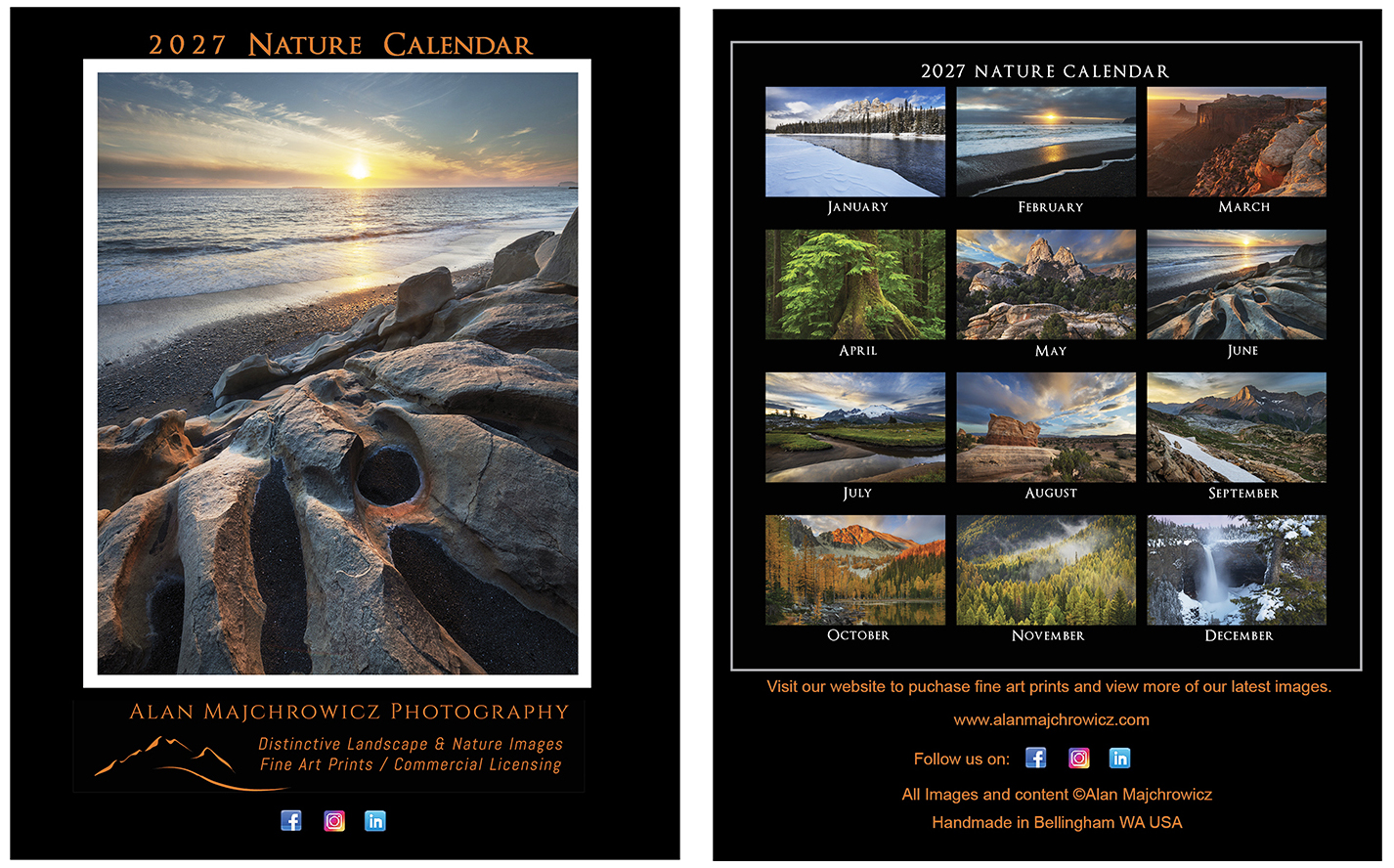
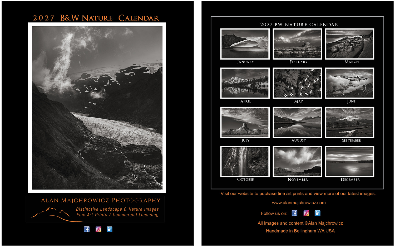
2027 Desktop Nature Calendar

2027 Desktop Nature Calendars

2027 Desktop Nature Calendars

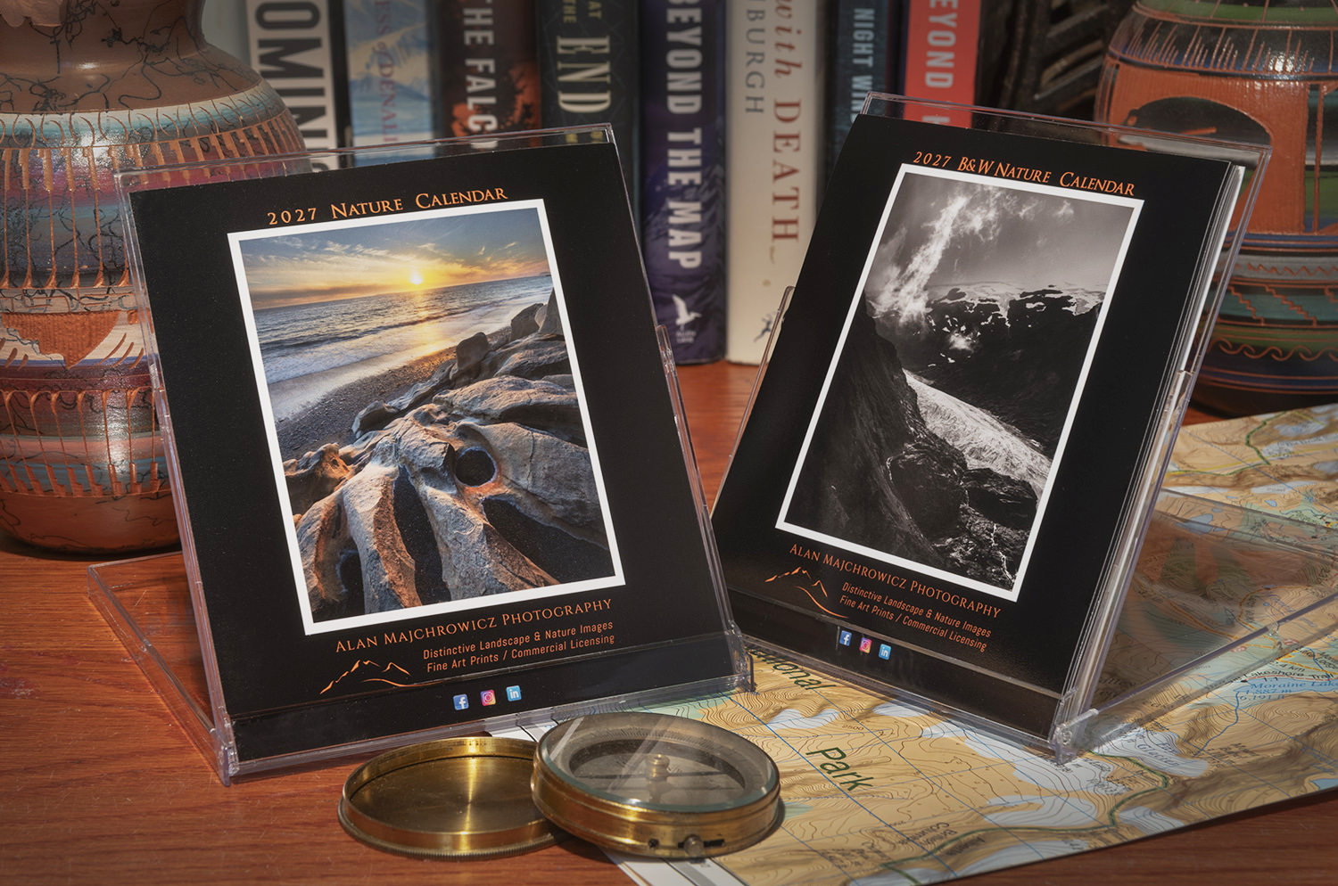
The all-new 2027 Desktop Nature Calendars are now ready and available for purchase! This year, you can choose from color or black-and-white!

These calendars are ideal for offices and other small spaces, making them great gifts for friends and clients. Contact us to discuss customizing them with your company name or logo, and receive special pricing for bulk quantities.

2027 Desktop Nature Calendars. Presented in a CD jewel case, they're perfect for offices, kitchen counters, and nightstands.Order Color Calendar2027 Desktop Nature Calendar. Presented in a CD jewel case, they're perfect for offices, kitchen counters, and nightstands.Order Black and White Calendar

Order your 2027 Desktop Nature Calendars now by clicking either image!
Handmade and still only $19.00  with Free Shipping!*

* U.S. destinations only, please
Purchase

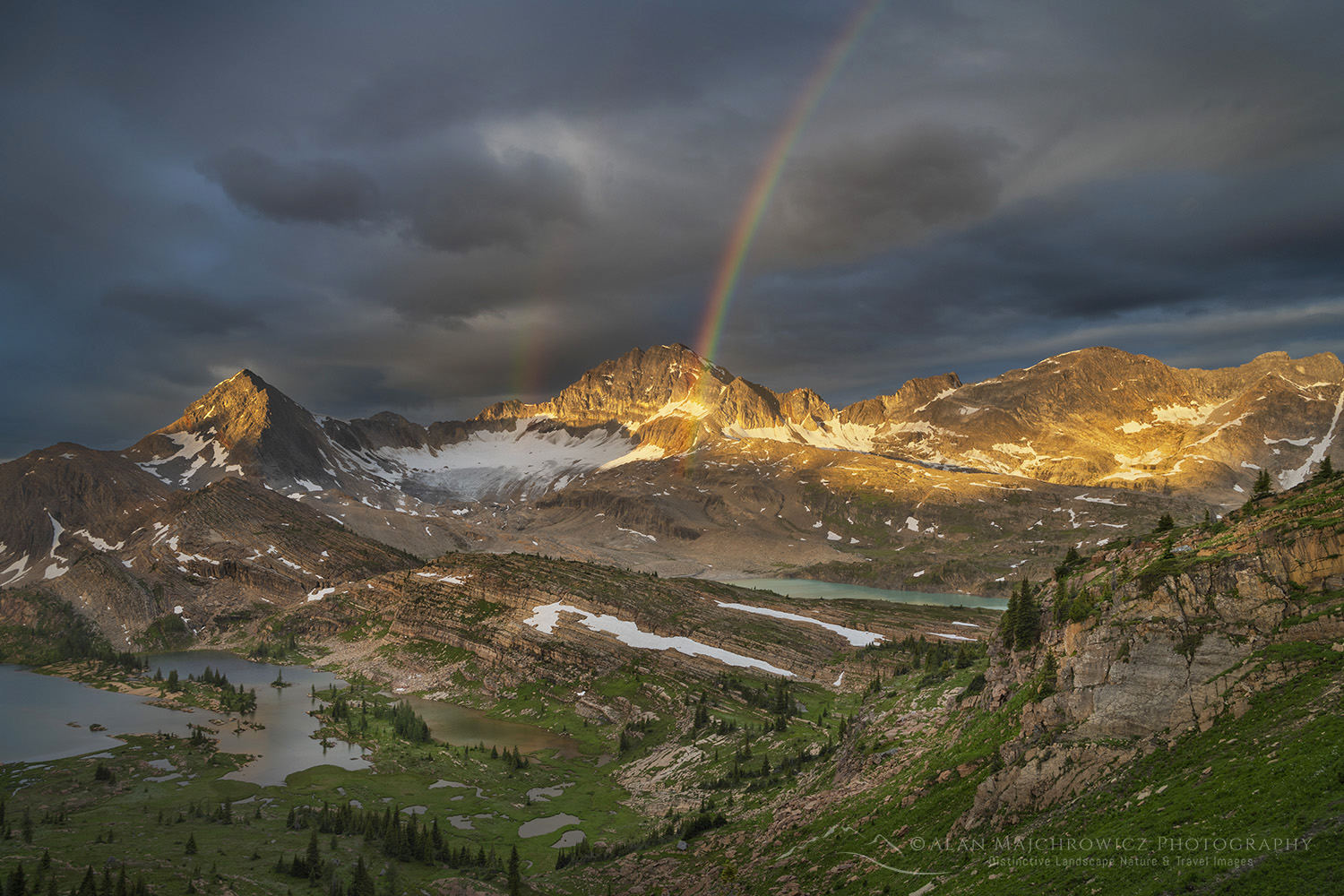
Sunrise rainbow over Limestone Lakes Basin. Height of the Rockies Provincial Park British Columbia

Limestone Lakes Height of the Rockies Provincial Park: Part 2

Sunrise rainbow over Limestone Lakes Basin. Height of the Rockies Provincial Park British Columbia Limestone Lakes Height of the RockiesRainbow over Limestone Lakes, Height of the Rockies Provincial Park #86474  Purchase

Limestone Lakes Height of the Rockies Provincial Park: Part 2

Limestone Lakes Height of the Rockies Provincial Park is one of the few places in the Canadian Rockies where a person can experience true solitude. And, it is also an exception in an era of reservations, lotteries, and fees for backpacking trips. As of 2026, there are no fees, reservations, or even a registration needed for a trip of any length.

Of course, as I mentioned in part one of this series, there are reasons for this. Limestone Lakes is not an easy backpacking destination. And it is too far and involved for a day-hike. However, for those willing to commit at least three days and lots of sweat, it is a dream destination.

So, let’s start the second half of the trip, where part one left off.

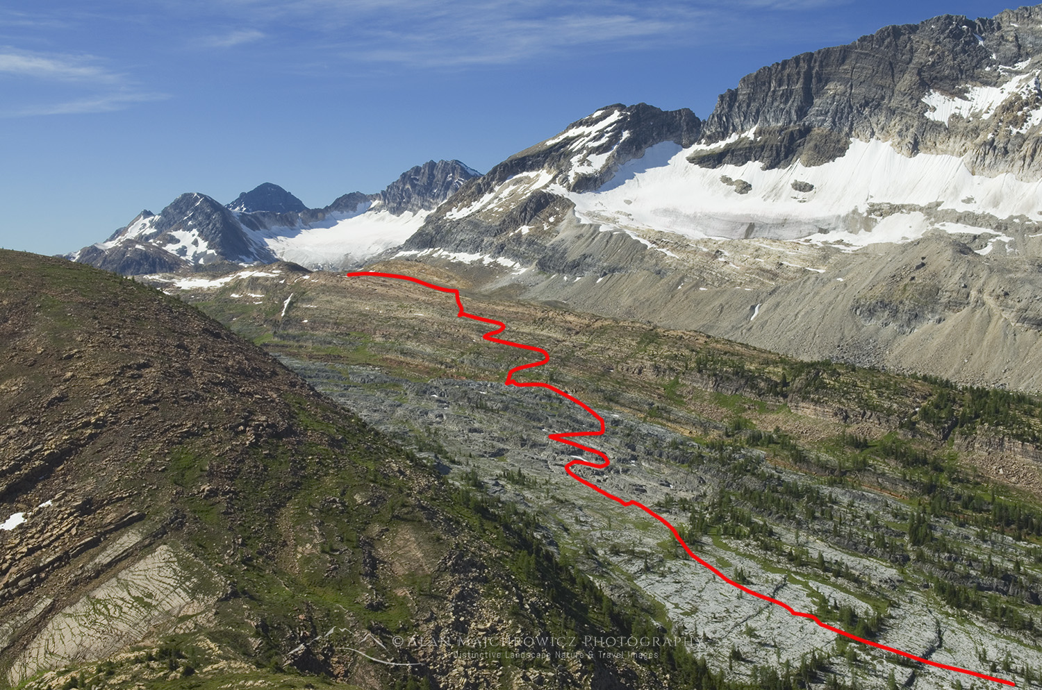
Route to Limestone Lakes Basin, Height of the Rockies Provincial Park British ColumbiaView of the route (red line) from the nub

Limestone Lakes, Cross Country Route-Finding

After leaving Sylvan Pass and ascending to the summit of the 8300′ nub, you get a great view of the route to Limestone Lakes. This is a good spot to rest and take a few moments to commit the scene to memory. Basically, you’ll need

to descend into the open upper valley and travel southwest and over numerous ascending ledges and cliffs to a pass overlooking the lakes basin. The route is always in the open and, using common sense, it is fairly obvious. A GPS can come in handy, but not necessary.

The first difficulty is getting down to the valley. Start descending southwest to a small meadowy pass. There may be faint glimpses of a trail here. Then head west until cliffs bar the way. At this point, you’ll need to find negotiable ledges while heading in a northwest direction. Take your time to scout out the best route. Eventually, the cliffs and ledges become easier, and the valley is reached. About 800′ below the summit of the nub. It’s a bit heartbreaking to realize that all the elevation you just lost will need to be regained again, and more.

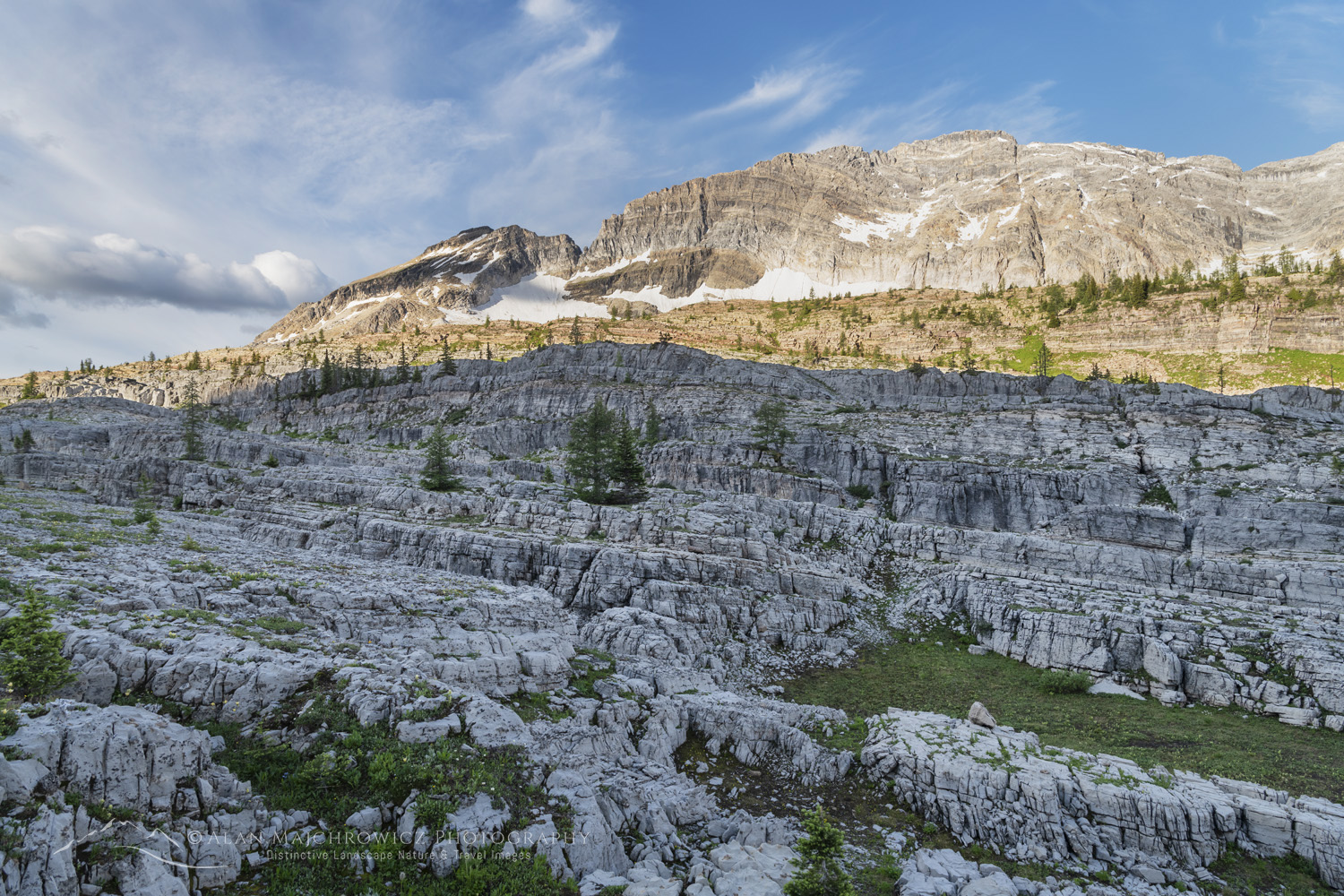
Broken cliffs of limestone Height of the Rockies Provincial Park British ColumbiaLimestone terraces #86598 Purchase

Crossing the Karst Terrain

Once in the valley, it is worth dropping your pack to take some time searching for the start of the alternate route to the Joffre Creek trail on your way out. Here is where a GPS will really come in handy, since it can be very frustrating and time-consuming to find the correct spot. The start of the very faint trail is about where the subalpine meets the forest, and it will travel northeast along the base of the nub.

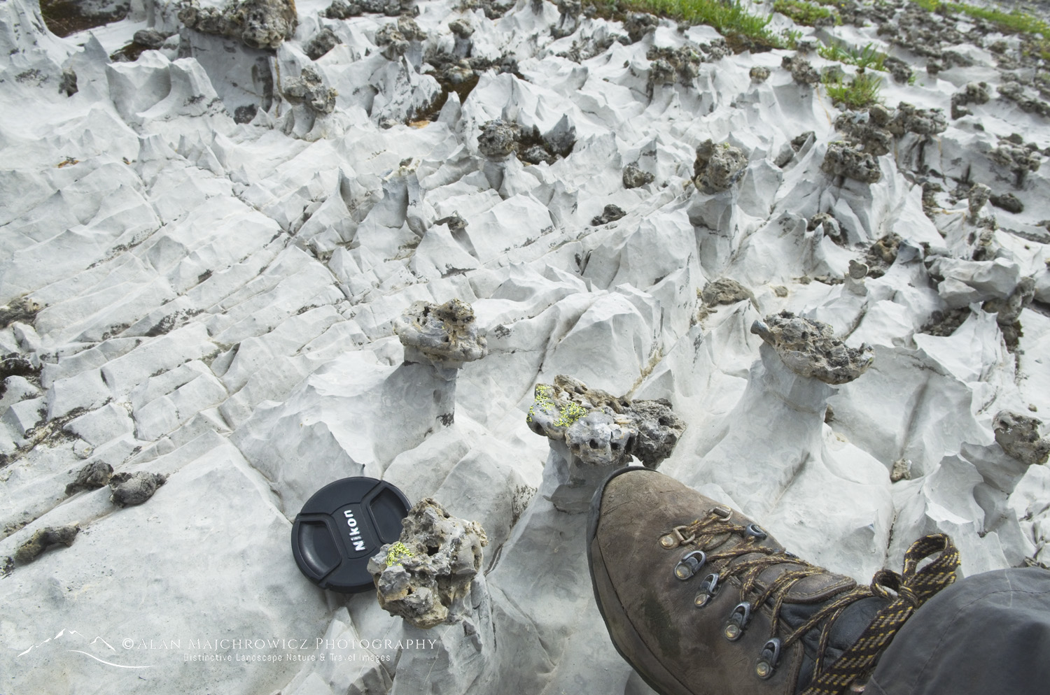
After locating the return trail, memorize it or take a photo before proceeding to the lakes. Now turn and head southwest across an increasingly broken terrain with lots of prickly limestone needles, fissures, and blocks. Fans of The Lord of the Rings will easily associate this section with the Emyn Muil. 

Sharp karst features in limestone, Height of the Rockies Provincial Park British ColumbiaSharp limestone formations

There are cairns seen sporadically throughout this area, but they’re often far apart and not always reliable. Make a general heading towards the limestone terraces, keeping a sharp eye out for the easiest passages up and through them.

If you are attempting to reach the lakes in one day, the terraces will be the most tiring part of the day. Here, seemingly easy passages through the cliffs will dead-end. Backtracking can be frequent, and when cresting one terrace, there always seems to be another to negotiate. Finally, after topping the last terrace, the terrain becomes easier, and you hike south to a talus pass.

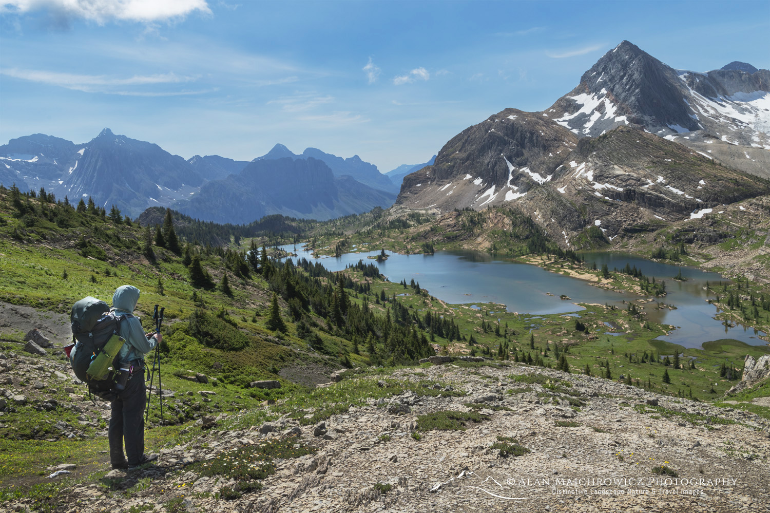
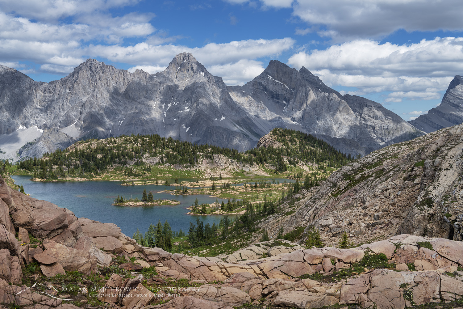
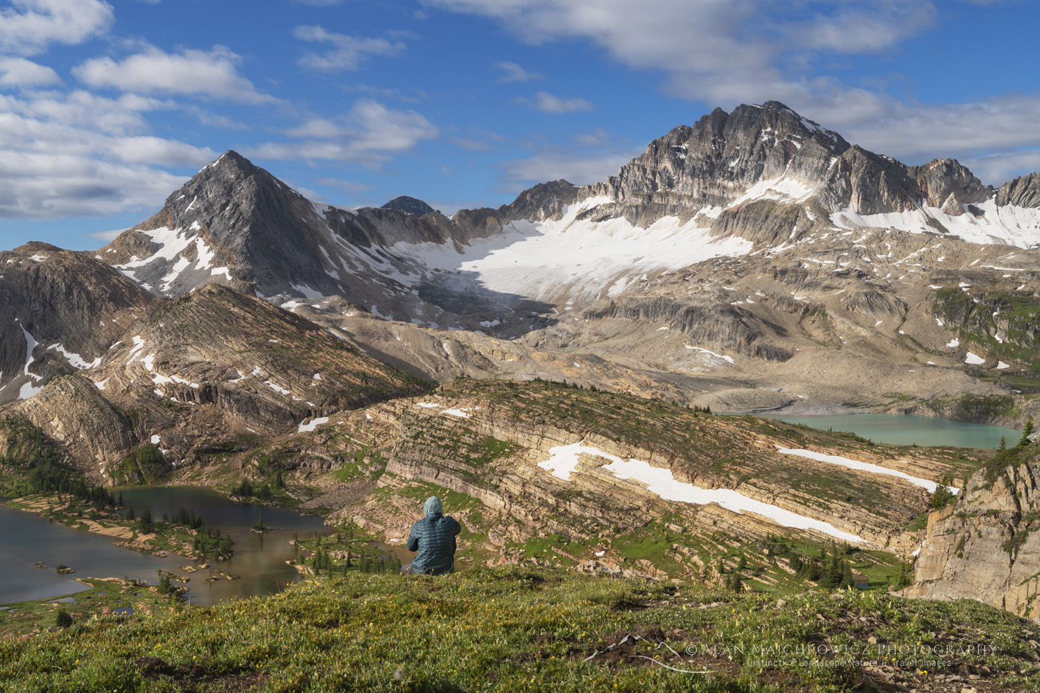
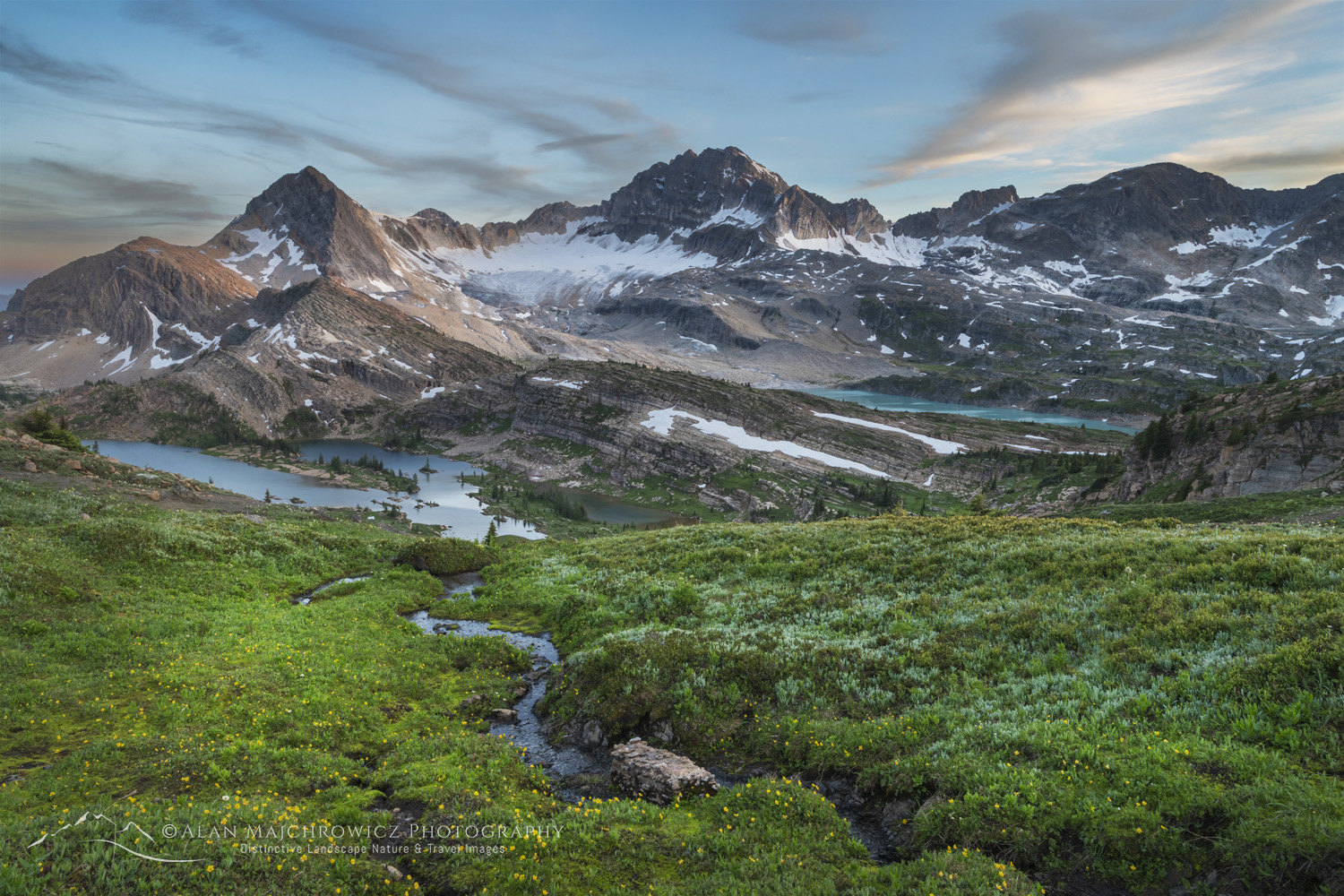
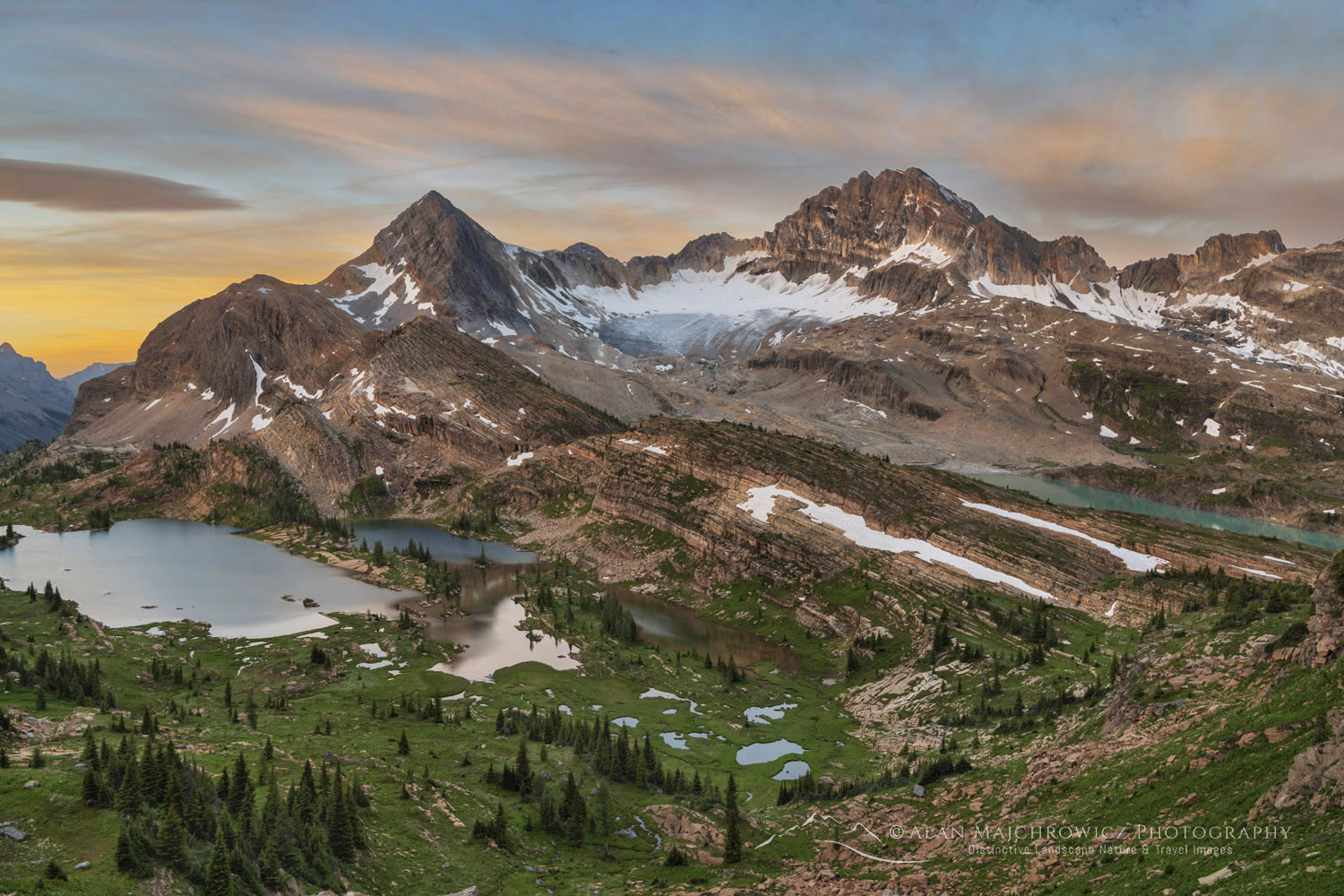
Upon reaching this pass, take in the majestic view you worked so hard to see. Spread out before you is the Limestone Lakes basin. Below are the sparkling lower lakes, and to the right is the turquoise glacial middle lake. Backing it all up are the multiple summits and glaciers of Russell Peak. Truly a breathtaking scene!

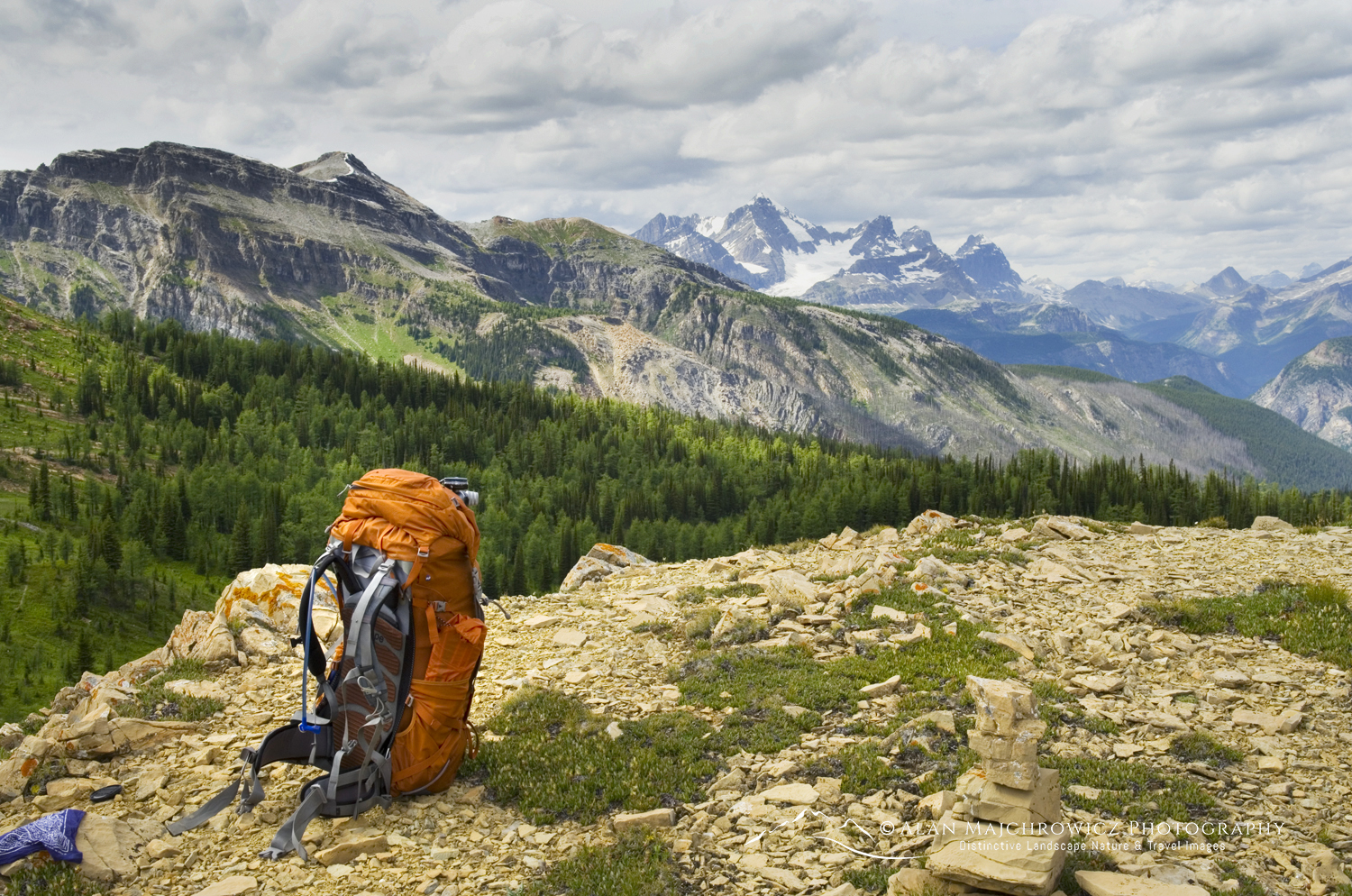
Backpacker overlooking Limestone Lakes Height of the Rockies Provincial Park British ColumbiaFirst view of Limestone Lakes #86390  Purchase

Limestone Lakes Base Camp

Choosing a base camp can be a difficult decision. There are no established camps anywhere in the area. You are pretty much free to camp wherever you like, except of course directly on fragile meadows. My choice was to find a spot high above the lakes. There you can enjoy the broad view directly from your tent. And exploration of all the lakes is within easy reach.

Note that while the lower lakes look very attractive, camping there among the meadowy wetlands will be more buggy. You’ll also need to climb back up to reach the other lakes. On the other hand, there may be very few water sources at camps above the lakes. This is especially true in late summer when snow patches are gone, and meadow creeks are dried up.

Mount Joffre seen from Limestone Lakes Basin in Height of the Rockies Provincial Park British ColumbiaJoffre Peak from Limestone Lakes #86453 Purchase

Exploring Limestone Lakes

From a higher camp, there are several areas to choose from. Being a photographer, lighting conditions always dictate my decisions. The entire area receives good golden-hour light in both morning and evening. However, the peaks east along the Divide are better in the evening hours.

My first exploration after setting up camp was hiking east and higher from the pass. There are a few more broken ledges to climb before the view opens up to a jaw-dropping view over fascinating karst terrain and the Continental Divide. Before you is a terrain of broken limestone terraces reminiscent of a Roman Coliseum. Looking northeast is the imposing bulk of Joffre Peak, beyond the route and nub you just crossed.

Karst formations in Limestone Lakes Basin Height of the Rockies Provincial Park“Coliseum” limestone ledges and the Continental Divide #86451 Purchase

If you have only one full day at the lakes, I suggest first heading down to the scenic turquoise middle lake, then continuing a little higher to the west lakes. The entire area is wide open, crossing up and down meadowy ledges. One of the joys of exploring here is discovering numerous ponds and small cascading creeks.

Middle Limestone Lake. Limestone Lakes Height of the Rockies Provincial Park British ColumbiaMiddle Limestone Lake #86503  Purchase

Small lake draining into a sinkhole in Limestone Lakes Basin Height of the Rockies Provincial ParkLake draining into sinkhole #46177 Purchase

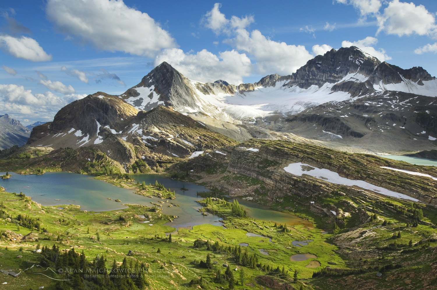
Lower Limestone Lakes. Limestone Lakes Basin. Height of the Rockies Provincial Park British ColumbiaLower Lakes and peaks of the Continental Divide #86545  Purchase

On my first visit, I came across a small lake in this area that was draining into a subterranean cavity. Was there an expansive glittering cave under my feet? Who knows? But on my second visit, I was unable to locate this oddity again.

Hiking east is a wonderful broad and open ridge separating the middle from the lower lakes. This ridge is very obvious from the first high view of the basin. It would also make an excellent base or second-day camp. If I ever go back again, I’ll definitely stay here a night or two! The view with the lower lakes backed by the peaks of the Divide is unforgettable.

Hiker overlooking Limestone Lakes Basin in Height of the Rockies Provincial Park British ColumbiaTaking in the view of Limestone Lakes #86476  Purchase

The Return Route

After taking in the sights, it’s easy to see why I highly recommend staying at Limestone Lakes for at least two days. It’s such a shame to work so hard to get there and not have enough time to thoroughly enjoy it.

It is also easy to see why it is essential to have good weather throughout the trip. Recrossing all that open terrain with confusing ledges in rain or snow, with poor visibility, would be a nightmare. Not to mention the long, wet slog back down the valley trail.

Getting back to the spot where the alternate trail enters the forest can be frustrating. Even with careful route-finding and a GPS, the trail is elusive. When it is located, the trail still periodically disappears in the first mile or so. Eventually, the trail becomes more obvious and well-trod. However, it is always very rough with many frustrating ups and downs and numerous downed trees to cross.

At times, it may seem that going back the same way you came, over the nub, would have been easier. But then the path enters familiar supalpine forest, and the Joffere Creek trail junction appears.

It’s a bit of a bittersweet moment knowing that nearly all your hard work is nearly over, but the beauty of Limestone Lakes is now a memory.

Limestone Lakes Basin. Height of the Rockies Provincial Park British ColumbiaParting view of Limestone Lakes and Russell Peak #86460  Purchase

If You Go to Limestone Lakes Height of the Rockies:

Trip length: 30 miles, round trip
Elevation Gain: 5600′
Permits: None needed as of 2026
Wildlife:
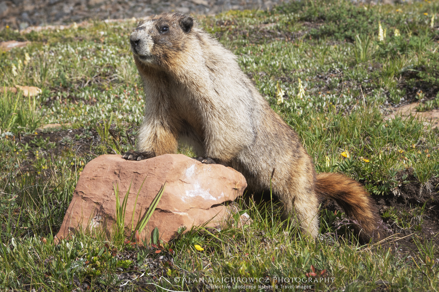
On both of my trips, I saw nothing more than marmots. However, that doesn’t mean bears are absent. The entire length of the Canadian Rockies is grizzly bear country. There are very few trees available to hang food bags in the lakes basin. Bear canisters are advised.

References:  Height of the Rockies Provincial Park
Mat Gunn’s excellent guidebook: Hikes Around Invermere & the Columbia River Valley.

Read:
Limestone Lakes Height of the Rockies Provincial Park Part 1

For tips on preparing for a backpacking and or photography trip to Limestone Lakes, check out these posts:

Backpacking Photography Gear Tips

Backpacking Photography Tips

Leave No Trace

Please, Please, Please!  Don’t plan a trip to this or any other national park, monument, or wilderness area unless you are prepared to follow Leave No Trace guidelines (LNT). National parks and wilderness areas worldwide are under incredible pressure from the growing number of visitors. So, please do your part to help preserve these precious areas for future generations!

Please visit the Leave No Trace Center for Outdoor Ethics to learn more about LNT’s principles. Your children and grandchildren will thank you!

LEAVE NO TRACE SEVEN PRINCIPLES

1. Plan and Prepare
2. Travel and Camp on Durable Surfaces
3. Dispose of Waste Properly
4. Leave What You Find
5. Minimize Campfire Impacts
6. Respect Wildlife
7. Be Considerate of Other Visitors
© Leave No Trace: www.LNT.org

Learn about how to protect the places we love to photograph
Visit the Nature First Website
Nature First the alliance for responsible nature photography

All photos appearing in this post are available for Commercial Licensing and Fine Art Prints. Click on any image to purchase, or contact me for more info!

Limestone Lakes Height of the Rockies Provincial Park: Part 2

Limestone Lakes basin, Height of the Rockies Provincial Park, British Columbia #86593

Limestone Lakes Height of the Rockies Provincial Park Part 1

Evening light over Russel Peak and Limestone Lakes in Height of the Rockies Provincial Park British Columbia Limestone LakesRussell Peak and Limestone Lakes  #86593  Purchase

Limestone Lakes Height of the Rockies Provincial Park

Limestone Lakes, in Height of the Rockies Provincial Park, is a dream destination for backpackers and photographers who really want to get away from it all. In today’s era of advance reservations, lottery-style permits, and crowds, this location offers a taste of wilderness freedoms rarely seen anymore. Here, in the middle of the Canadian Rockies, you can experience a level of solitude amid grand landscapes seldom found outside the most remote locations on Earth.

Height of the Rockies Provincial Park is a small, little-known park in the Canadian Rockies. It is located on the west side of the continental divide, just southwest of Mount Assiniboine. There are a couple of reasons for the park being so little-known. The first is its remote location. The main access to the park is an unpaved road about 40 miles in length. Although the road is generally in good shape for ordinary vehicles, it is a very long and dusty drive.

Another reason is the park’s relatively few maintained trails. These trails are mostly user-maintained and are often little more than routes.  Reaching the fabulous alpine areas requires lots of work and determination. Limestone Lakes is, perhaps, the main destination in Height of the Rockies Provincial Park, which is accessed by one of those trails.

Evening light over Russel Peak and Limestone Lakes in Height of the Rockies Provincial Park British Columbia Limestone LakesLower Limestone Lakes and Russell Peak #86447 Purchase

Limestone Lakes Difficulty Level

*Before I go any further, I must impress the fact that a trip to Limestone Lakes is definitely not for novices to backpacking or wilderness travel.  However, those who are accustomed to cross-country wilderness travel and mountaineering will find the trip relatively easy. From the first step at the trailhead, the entire trip is an arduous undertaking. About half of the distance is on a long, steep, brushy, and poorly maintained trail. In some long sections, it is merely a boot-beaten route. The second half is an unmarked cross-country route across difficult alpine terrain.

A reasonable trip to Limestone Lakes would require at least three days. Given that, to truly explore and enjoy this magnificent location would require four to six days.

To this date, I have made two wonderfully memorable trips to Limestone Lakes. The first trip was solo, and the second was to guide a fellow wilderness lover. Through both trips, I have learned a few lessons that I can pass on to others wishing to visit this area.

Height of the Rockies Provincial Park View north to the Royal Group from Sylvan Pass

When to Visit Limestone Lakes

Early July through mid-September are optimum times to visit Limestone Lakes. By early July, the alpine areas are generally snow-free, but creek crossings can still be challenging. September will see the end of flying insects, but there is an increasing risk of early-season snow.

I won’t get into specific details regarding elevations, distances, or GPS coordinates. I don’t use a GPS or other wilderness travel apps, although most will find tham handy. I’ve always relied on plain paper maps and common sense wilderness travel skills, acquired over many years of hiking and backpacking. However, readers will get a good general overview of what to expect.

For more details, please refer to the Height of the Rockies Provincial Park website and Mat Gunn’s excellent guidebook: Hikes Around Invermere & the Columbia River Valley.

Hoary Marmot (Marmota caligata) Height of the Rockies Provincial Park British ColumbiaA local resident of Limestone Lakes #86491 

Pro Tip:  Do not attempt this trip in poor weather! During my most recent trip, it rained for the first two days, and the trail to Sylvan Pass was a nightmare. The hip-high brush was dripping wet, and within minutes, we were soaked to the skin. After miles of this misery, we arrived at a campsite below Sylvan Pass, nearly hypothermic.

In addition, by the time you reach the lakes basin, you are a long way from your vehicle in a vast trail-less alpine arena. Limestone Lakes is not an enviable place to be stuck in case of poor weather with limited visibility! Plan very carefully and be prepared! And don’t forget that in case of bad weather there is nor shame in bailing!

View south from Sylvan Pass, Height of the Rockies Provincial Park British Columbia CanadaLooking south from Sylvan Pass

Joffre Creek Trail

The trailhead is located at the end of the long drive on the Palliser River Road. Here is where the fun starts. The trailhead kiosk sports an enticing photo of the beautiful Limestone Lakes Basin. It also states the trail itself begins a short way up the road on the left, amidst an old burn. It’s very easy to miss this poorly marked spot. And, on my second visit, we couldn’t find it and opted to continue where the trail started on my previous trip. This then entailed a bit of bushwhacking and route-finding.

Whether you find the true trail or not, your second obstacle, and possibly a deal-breaker for some, is crossing Joffre Creek. There once was a sturdy bridge crossing the creek. But nature has a way of obliterating man’s designs. Where there once was a pretty creek running through a dense forest, there now is a wide expanse of downed trees and channels choked with rocks and boulders. Needless to say, there is no longer a bridge.  Unless a log jam is found, travellers will need to ford a swift and often deep creek over hidden slippery rocks.

Once on the other side of Joffre Creek, you’ll need to locate the beginning of the true trail. There may be cairns marking it, but if you cross up or downstream, the trail can be difficult to find. It is imperative to travel southeast near the creek to locate it. The start of the Palliser River Trail is also here, so if you start hiking a trail in a northerly direction, you’re on the wrong one.

After a short level stretch through the forest, the trail begins climbing up to the pass in earnest. For the next seven miles, it continues relentlessly up to Sylvan Pass. Along the way, several long, very steep sections are encountered, another major creek crossing, long, marshy boot-soaking stretches, and lots of thick brush where the trail can’t even be seen.

Since this trail receives only a minimum of maintenance, hikers will also encounter plenty of downed trees and other obstacles to negotiate.

It is also important to note that the only suitable campsite before Sylvan Pass is at about the halfway mark. If you get a late start, this would be the place to stop. It is right on the trail just before a long marshy stretch. If you decide to base-camp here and day-hike to Limestone Lakes, you’re still in for a long, arduous day, with little opportunity to enjoy the lakes basin.

Joffre Peak andSylvan Pass, Height of the Rockies Provincial Park, British Columbia, CanadaJoffre Peak and Sylvan Pass, bottom center

Sylvan Pass and Alternate Route

After about 6 miles of hiking, hikers will reach a trail junction where an important decision must be made. At this junction, you are just entering the subalpine zone, with trees beginning to thin out. Here, you can either continue another mile or so on the trail to Sylvan Pass, or take the right-hand junction to an alternate route to Limestone Lakes.

The first option to Sylvan Pass is my personal recommendation. It involves more elevation gain and route-finding, but it is all above timberline and definitely more scenic. It also offers an excellent view of the route across the karst plateau, which you must cross to reach the lakes. On the downside, after climbing the nub above the pass, hikers will need to descend considerably and negotiate some moderate ledges and cliffs to enter the extensive karst basin.

On the other hand, the alternate route at the junction is a bit more direct, but it involves lots of ups and downs. In addition, it is a very rough trail, nearly always in the forest, and, in addition, affords no views. I recommend taking the Sylvan Pass route on the way in and the alternate route on the way out.

Continuing along the trail to Sylvan Pass, the terrain finally opens up into a pleasant sub-alpine meadow. There are very few established sites to pitch a tent, therefore choose a spot in the trees away from the fragile meadows. From here, Sylvan Pass is visible, about one-half mile further up from the meadows.

 Height of the Rockies Provincial Park, British Columbia, Canada8300′ nub seen from Sylvan Pass

Sylvan Pass to the Karst Plateau

Upon reaching Sylvan Pass, you are rewarded with a beautiful vista of rugged mountains, glaciers, and valleys. From here, your route is all cross-country route-finding, except for a few, although possibly misleading cairns.

After a brief rest at the pass, hike west up steep, loose talus to the summit of the 8300′ nub. Catch your breath and take in your first views to the southwest of Russell Peak and Limestone Lakes Basin. From here, you have approximately five miles of pure alpine wilderness to negotiate.

Continue to the lakes in:
Limestone Lakes Height of the Rockies Provincial Park Part 2

 Height of the Rockies Provincial Park, British Columbia, Canada Limestone LakesFirst view of Russell Peak (far left in distance) from the nub

Limestone Lakes Basic Info:

Trip length: 30 miles, round trip
Elevation Gain: 5600′
Permits: None needed as of 2026
Wildlife:
On both of my trips, I saw nothing more than marmots. Although this may be true, it doesn’t mean bears are absent. The entire length of the Canadian Rockies is grizzly bear country. There are very few trees available to hang food bags in the lakes basin. Bear canisters are advised.

References:  Height of the Rockies Provincial Park
Mat Gunn’s excellent guidebook: Hikes Around Invermere & the Columbia River Valley.

For tips on preparing for a backpacking and or photography trip to Limestone Lakes, check out these posts:

Backpacking Photography Gear Tips

Backpacking Photography Tips

Leave No Trace

Please, Please, Please!  Don’t plan a trip to this or any other national park, monument, or wilderness area unless you are prepared to follow Leave No Trace guidelines (LNT). National parks and wilderness areas worldwide are under incredible pressure from the growing number of visitors. So, please do your part to help preserve these precious areas for future generations!

Please visit the Leave No Trace Center for Outdoor Ethics to learn more about LNT’s principles. Your children and grandchildren will thank you!

LEAVE NO TRACE SEVEN PRINCIPLES

1. Plan and Prepare
2. Travel and Camp on Durable Surfaces
3. Dispose of Waste Properly
4. Leave What You Find
5. Minimize Campfire Impacts
6. Respect Wildlife
7. Be Considerate of Other Visitors
© Leave No Trace: www.LNT.org

Learn about how to protect the places we love to photograph
Visit the Nature First Website
Nature First the alliance for responsible nature photography

All photos appearing in this post are available for Commercial Licensing and Fine Art Prints. Click on any image to purchase, or contact me for more info!

Limestone Lakes Height of the Rockies Provincial Park: Part 1

Wildflowers on Heliotrope Ridge, Mount Baker, Coleman, and Roosevelt glaciers are in the distance. Mount Baker Wilderness, North Cascades #87108

Photo Highlights of 2025

Photo Highlights of 2025

Yes, it’s time to look back and reflect on the past year, and share my Photo Highlights of 2025. The photos in this collection represent some of my favorite images from the past twelve months.

These images stand out in my mind because they represent moments when light, composition, and personal inspiration came together, resulting in an overwhelming connection with the natural world. For me, these are essential elements that lend an image greater depth and meaning.

So here are my selections. Please feel free to comment and or vote on your favorite. And, of course, all of these photos are available as beautiful fine art prints suitable for your home or office.

Thank you so much for viewing. I hope you, your family, and friends have a joyous new year filled with peace and prosperity!

Arrowleaf Balsamroot (Balsamorhiza sagittata) growing in meadows of the Methow Valley, North Cascades Washington #85716 Photo Highlights of 2025#1 Wildflowers in the Methow Valley, Washington #85716 Purchase

Liberty Bell Mountain is seen from the snow-covered meadows of Washington Pass. North Cascades, Washington #85814 Photo Highlights of 2025#2 Liberty Bell Mountain, North Cascades  #85814  Purchase

False Hellebore or Corn Lily (Veratrum viride) Mount Baker Wilderness. Mt. Baker-Snoqualmie National Forest North Cascades Washington #85968#3 False Hellebore, or Corn Lily #85968  Purchase

Oak Fern (Gymnocarpium dryopteris) Glacier National Park British Columbia #86076#4 Oak Ferns #86076  Purchase

Mount Joffre seen from Limestone Lakes Basin in Height of the Rockies Provincial Park British Columbia #86453#5 Mount Joffre, Height of the Rockies Provincial Park #86453  Purchase

Sunrise rainbow over Limestone Lakes Basin. Height of the Rockies Provincial Park, British Columbia #86474#6 Limestone Lakes, Height of the Rockies Provincial Park #86474  Purchase

Icebergs are stranded on debris at the ice-marginal lake of Kaskawulsh Glacier. Ä’äy Chù (Slim's River) West, Kluane National Park, Yukon #86720#7 Kluane National Park, Yukon Territory #86720  Purchase

Bear Glacier Provincial Park, British Columbia #86942 Photo Highlights of 2025#8 Bear Glacier Provincial Park, British Columbia #86942  Purchase

Wildflowers on Heliotrope Ridge, Mount Baker, Coleman, and Roosevelt glaciers are in the distance. Mount Baker Wilderness, North Cascades #87108 Photo Highlights of 2025#9 Mount Baker Wilderness, North Cascades #87108  Purchase

Subalpine Larches (Larix lyallii) displaying golden autumn foliage at Crater Lakes, along the Sawtooth Crest. North Cascades, Washington #87296#10 Subalpine Larches, North Cascades #87296b  Purchase

Western Larches (Larix occidentalis) in autumn foliage. Glacier National Park, Montana #87663#11 Western Larches, Glacier National Park #87663  Purchase

Autumn snow along the Middle Fork Flathead River. Glacier National Park, Montana #87367 Photo Highlights of 2025#12 Middle Fork Flathead River, Montana #87367  Purchase

All photos appearing in this post are available for Commercial Licensing and Fine Art Prints. Click on any image to purchase, or contact me for more info!

Nature First the alliance for responsible nature photographyLearn about how to protect the places we love to photograph
Visit the Nature First Website

Photo Highlights of 2025

Russell Peak and Limestone Lakes Basin, Height-of-the-Rockies Provincial Park, British Columbia, Canada #46109

Summer Photography Adventures 2025

Summer photography adventures are just around the corner, and this summer’s itinerary includes many exciting locations. The general plan is to begin in late June and return somewhere in the beginning of September. It’s an ambitious schedule, and if all goes well, I’ll be returning with many new and spectacular images. However, as always, unforeseen circumstances and weather may alter some planned destinations.

Russell Peak and Limestone Lakes Basin, Height-of-the-Rockies Provincial Park, British Columbia, Canada #46109 Summer Photography Adventures 2025Limestone Lakes Basin. British Columbia  #46109

After a few short warm-up trips in the North Cascades, I will travel to British Columbia, Alberta, Yukon, the Northwest Territories, and Alaska. Many of these locations will involve multi-day backpacking to outstanding and remote locations. And, if all goes as planned, it will even include a short dip in the Arctic Ocean!

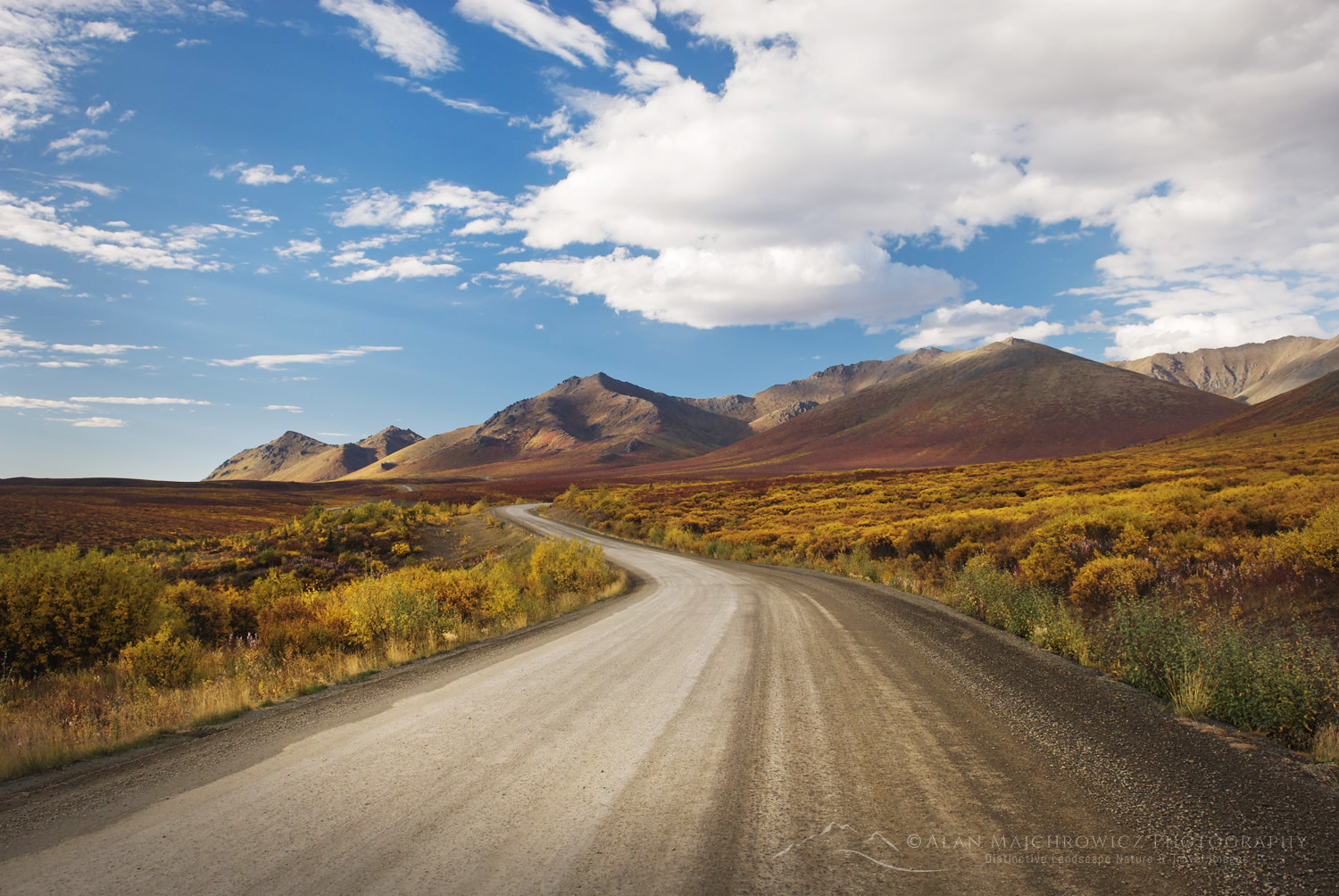
The Dempster Highway winds its way through the Ogilvie Mountains, Tombstone Territorial Park, Yukon, Canada #15390Dempster Highway, Yukon Territory #15390

Summer Photography Adventures Special Fine Art Print Offer 

Would you like to be a part of the Summer Photography Adventures? For a limited time, you can receive a free 11×14 signed fine art print of any image made during this trip! Click this link to take advantage of and learn more about this unique opportunity.

Summer Photography Adventures Locations:

Sunset alpenglow over Russell Peak and Limestone Lakes Basin, Height-of-the-Rockies Provincial Park, British Columbia, Canada #46245 Summer Photography Adventures 2025Limestone Lakes Basin. British Columbia  #46245

Canadian Rockies/Purcells/Selkirks

The first destinations of this leg will be in the Selkirk and Purcell Mountains of British Columbia. Most of these destinations are familiar, as I’ve made many trips to those areas. Next on the schedule will be a seven-day backpacking trip to Limestone Lakes, a spectacular but seldom-visited corner of the Canadian Rockies.

  • Glacier National Park, Hermit Meadows *
  • Silent Lake, Purcell Mountains *
  • Whirlpool Lake, Purcell Mountains *
  • Bugaboos, Purcell Mountains *
  • Limestone lakes, Height of the Rockies Provincial Park **
  • Kananaskis Country
  • Icefields Parkway, Banff and Jasper National Parks

* Overnight Backpacking
** Multi-day Backpacking

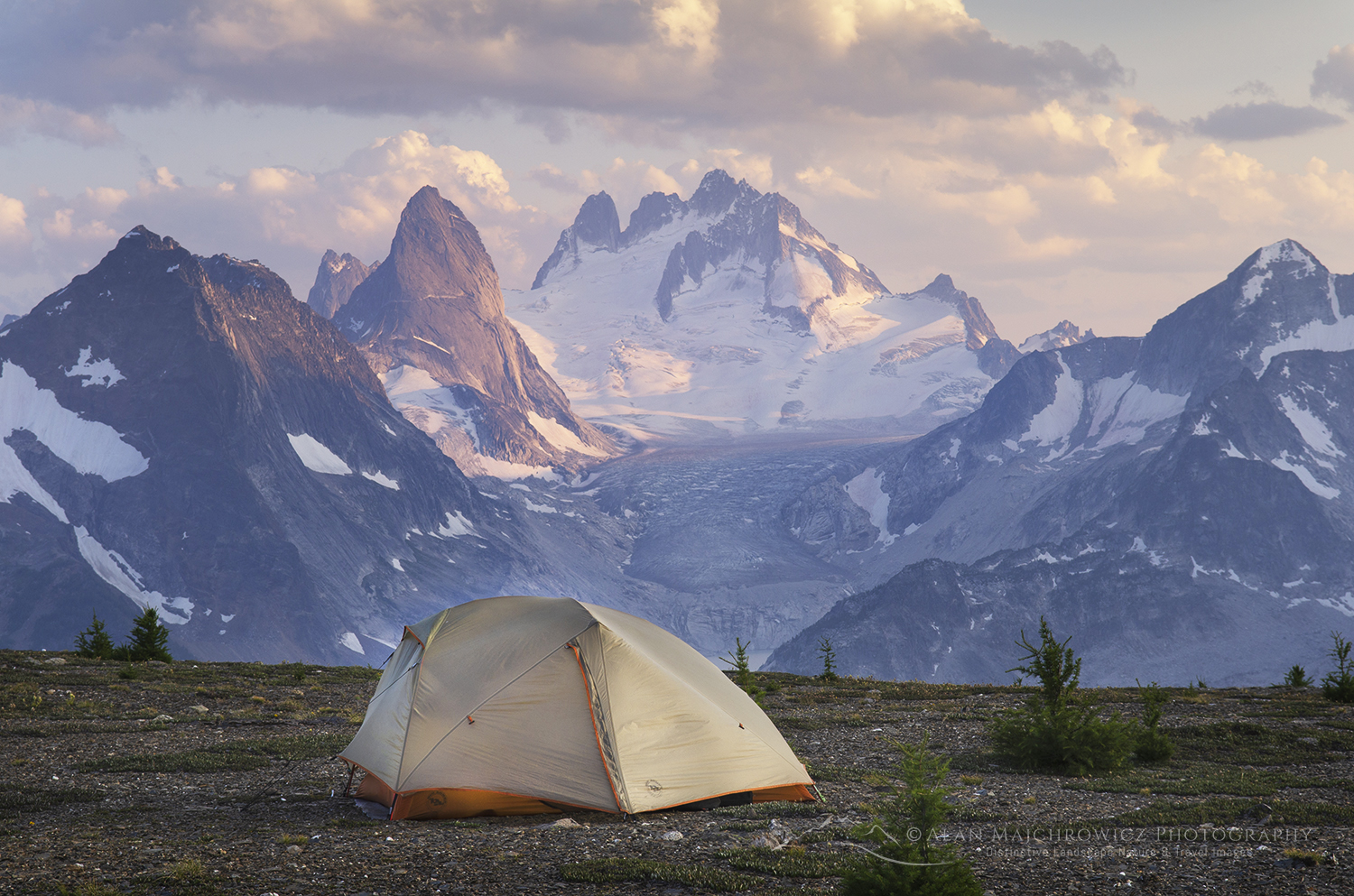
Tent at backcountry camp on Rocky Point Ridge. Howser Towers Vowell Glacier in the distance. Bugaboo Provincial Park, Purcell Mountains, British Columbia. #62962Bugaboos, British Columbia #62962

Northern Canadian Rockies

The second leg of Summer Photography Adventures will take me to the Northern Rockies of British Columbia. This will be my first visit to this remote and wild region of the Canadian Rockies, and I’m excited to have the opportunity to photograph there! This region has a true feeling of immense and raw wilderness that is increasingly rare in destinations further south. And being this far north, there are few roads and established trails.

  • Tumbler Ridge UNESCO Global Geopark
  • Wokkpash Valley, Stone Mountain Provincial Park **
  • Muncho Lake Provincial Park

** Multi-day Backpacking

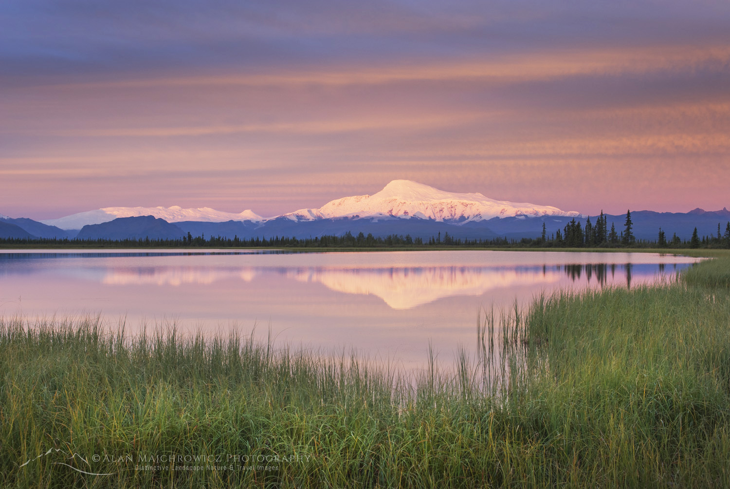
Mount Sanford 16,237 ft (4,949 m) Wrangell-St. Elias National Park, Alaska #14339Mount Sanford, Wrangell St.-Elias National Park #14339

Wrangell-St. Elias National Park, Alaska

Wrangell-St. Elias is a National Park I’ve wanted to return to for many years. On my only visit there, I was awestruck at the raw and wild nature of the landscape and mountains. Even more than the Northern Rockies in British Columbia, Wrangell is an immense park, nearly devoid of roads and trails. Aside from the McCarthy area, getting around the park requires chartering air taxis or grueling cross-country travel across rivers, marshes, and glaciers.

I plan to include the Nabesna Road and McCarthy/Kennecott area. Topping off the visit will be a flightseeing trip over the park’s spectacular glaciers and mountains.

  • Nabesna Road, Mount Sanford, and Wrangell Mountains viewpoints
  • Kennecott Glacier*
  • Flightseeing over Wrangell and St. Elias Ranges

* Overnight Backpacking

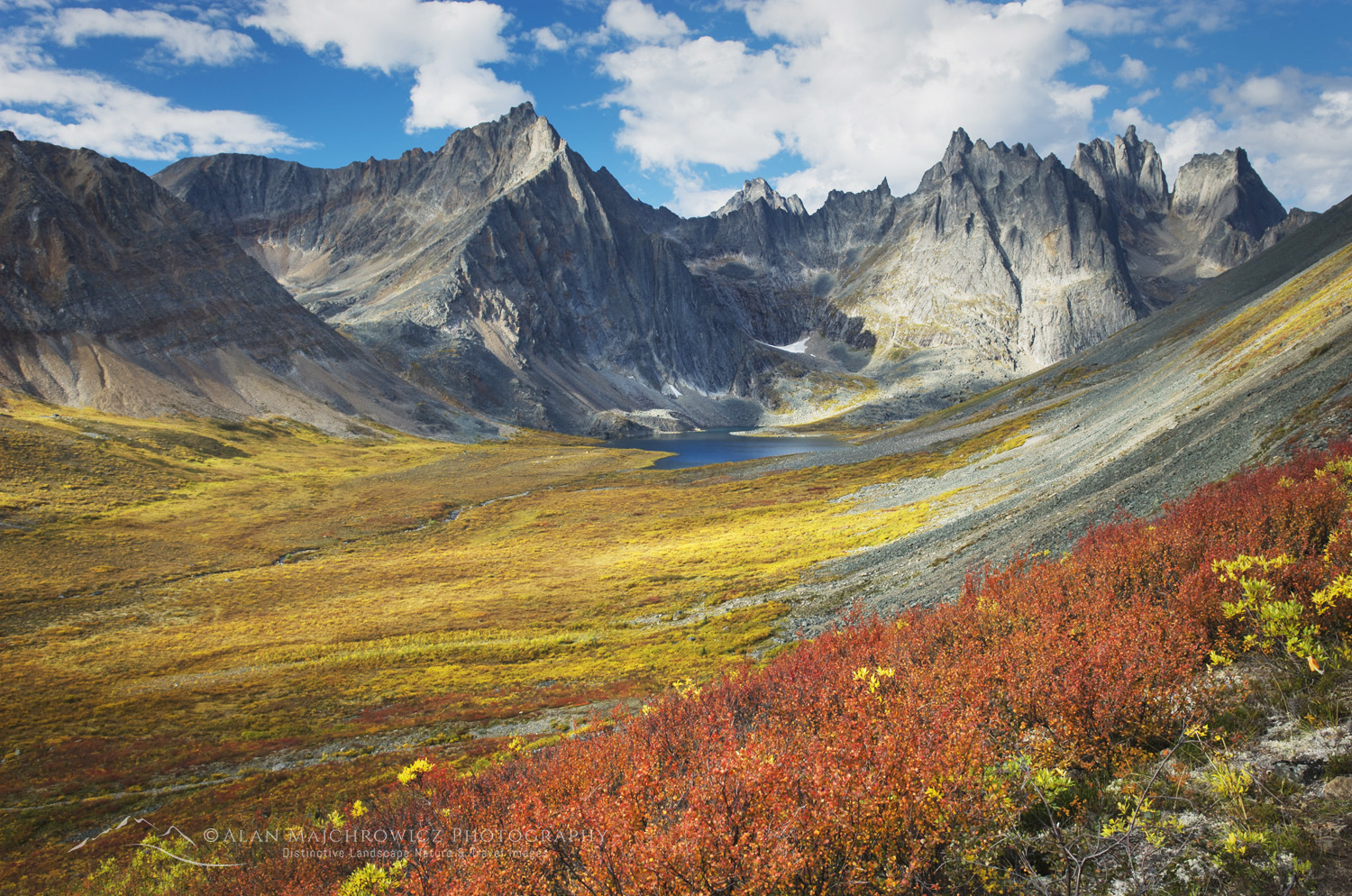
Grizzly Creek valley displaying tundra in full autumn color, Tombstone Territorial Park Yukon Canada #15190Tombstone Territorial Park #15190

Yukon and Northwest Territories

This last leg of the trip promises to be the most exciting, Yukon Territory and the Arctic. After topping up supplies in Dawson City, the route will travel north for 740km along the Dempster Highway to Inuvik, Northwest Territories. But it won’t stop there; another 147km on the Tuktoyaktuk Highway will take me to the shores of the Arctic Ocean! Seeing, dipping in, and even tasting the waters of the Arctic has been a lifelong dream of mine. So I’m beyond excited to have this experience!

However, before reaching this epic conclusion, I have a backpacking trip reserved in Tombstone Territorial Park. This spectacular park is located just a few degrees south of the Arctic Circle and features towering granite spires rising above the tundra and boreal forest.

My multi-day backpacking trip in the park and the drive up the Dempster highway is scheduled to coincide with the peak of fall color in late August. During this period, the tundra is ablaze in yellow, orange, and red, rivalling the best autumn displays of New England.

  • Dawson City
  • Tombstone Territorial Park **
  • Dempster Highway
  • Pingo Canadian Landmark, Tuktoyaktuk Highway
  • Arctic Ocean, Tuktoyaktuk, Northwest Territories

** Multi-day Backpacking

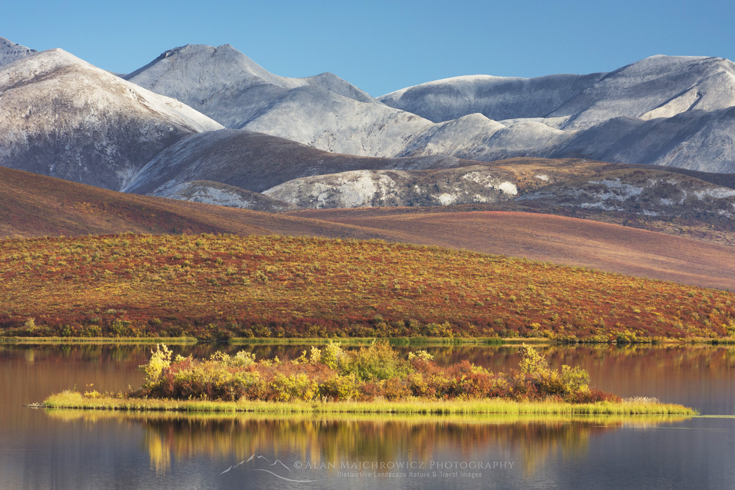
Lake in the Blackstone Plateau reflected clouds and hills of the Ogilvie Range, Yukon, Canada #15390 Summer Photography Adventures 2025Ogilvie Mountains Yukon Territory #15390

All photos appearing in this post are available for Commercial Licensing and Fine Art Prints. Click on any image to purchase, or contact me for more info!


Learn about how to protect the places we love to photograph
Visit the Nature First Website
Nature First the alliance for responsible nature photography

Summer Photography Adventures 2025

Mount Sanford 16,237 ft (4,949 m) Wrangell-St. Elias National Park, Alaska #14339

Summer Fine Art Print Offer 

Summer Fine Art Print Offer: Would you like to be part of the Summer Photography Adventures Tour? Of course, you can follow my trip progress on Facebook and Instagram. But for a limited time, you can also own a free fine art print of your choice from any of the destinations!

Check out the Summer Photography Adventures blog post to learn more about the exciting locations I’ll visit and photograph over the next few months.

Mount Sanford 16,237 ft (4,949 m) Wrangell-St. Elias National Park, Alaska #14339 Summer Fine Art Print Offer Wrangell-St. Elias National Park, Alaska #14339

How it works

From June 1 to September 1, 2025, purchase any style print 16″x24″ or larger from my website and receive a Free 11″x17″ signed Hahnemühle Photo Rag print of any image made during the trip.

Then, at checkout, enter the following code: summer 25

After the trip’s conclusion and return to the office, I will begin editing and processing the new images. When a selection of the best new photos is uploaded to the website, an announcement will be sent out. Participants can then choose their free print from among the latest images.

All photos appearing in this post are available for Commercial Licensing and Fine Art Prints. Click on any image to purchase, or contact me for more info!


Learn about how to protect the places we love to photograph
Visit the Nature First Website
Nature First the alliance for responsible nature photography

Summer Fine Art Print Offer

Photographing City of Rocks National Reserve

Photographing City of Rocks National Reserve

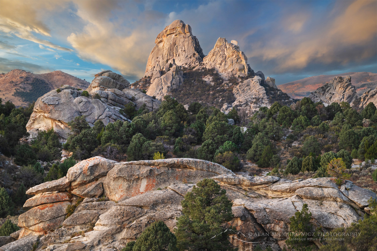
Twin Sisters, City Of Rocks National Reserve, Idaho #84405The Twin Sisters, City of Rocks, Idaho #84405  Purchase

In southern Idaho, near the Utah border, is a small but fascinating area of granite spires and monoliths. Although sometimes known as “Silent City,” its official name is City of Rocks National Reserve. The National Park Service and Idaho State Parks and Recreation administer this remote park on the northern edge of the Great Basin.

Over the years, City of Rocks has become a magnet for rock climbers looking to test their skills on the smooth granite. In addition, hikers, campers, and photographers are also finding the City of Rocks a quiet, out-of-the-way alternative to larger and more popular parks.

The City of Rocks is also an important historical site. Between 1843 and 1882, nearly a quarter-million pioneers traveled through here on the California Trail. The Silent City was often a brief stopover on the long, arduous journey to California. Some pioneers even left their names on rock faces, and they remain visible today.

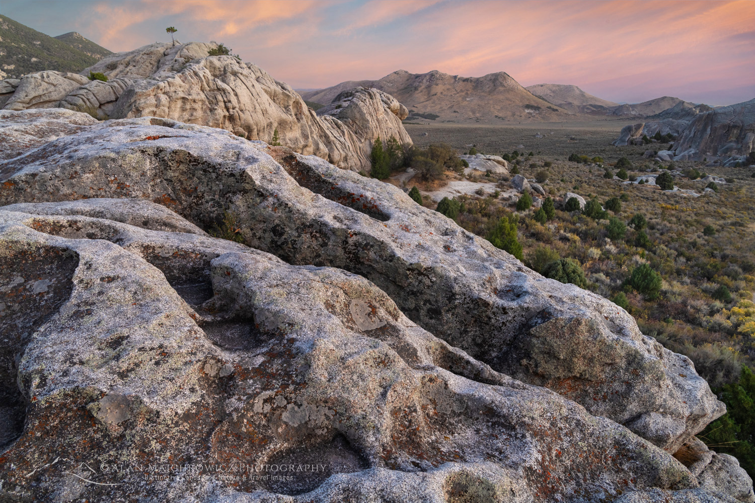
Eroded granite, City Of Rocks National Reserve Idaho #84384City of Rocks National Reserve #84384  Purchase

Photographing City of Rocks

City of Rocks has been on my must-visit list for several years. This year, I was finally able to photograph there since it was conveniently on the way to Great Basin National Park.

New visitors may find that the City of Rocks resembles Joshua Tree National Park in southern California in several ways. Both have similar rock formations and are extremely popular with climbers. Both also have cozy campsites tucked away among the rocks, which require reservations.

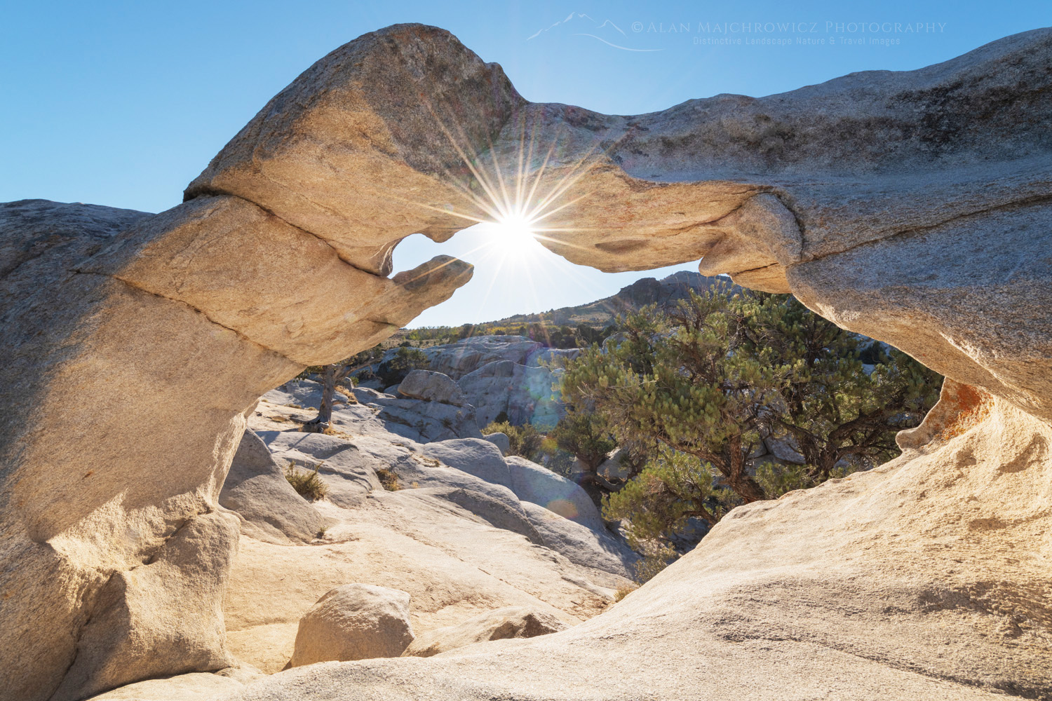
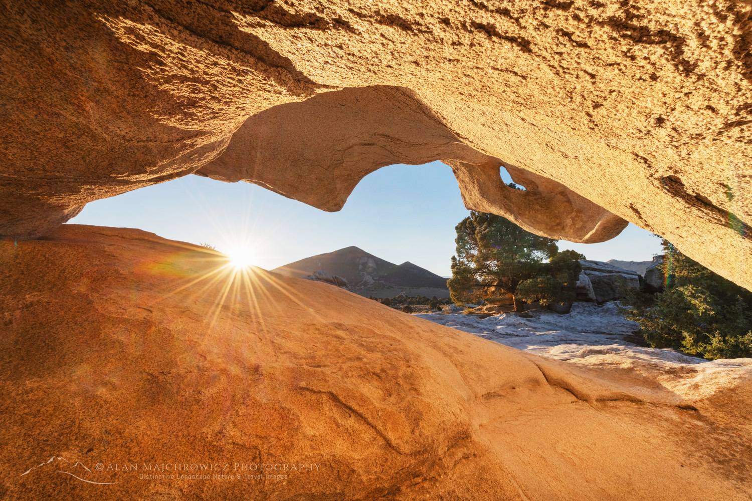
Window Arch, #84328Window Arch, City of Rocks #84384  Purchase

Window Arch, City Of Rocks National Reserve Idaho #84321Window Arch, City of Rocks #84321  Purchase

Photographers will find quite a bit of subject matter to explore. In addition to general landscape compositions, there is plenty of abstract rock detail and nature study material. There is even a small natural arch to check out. In addition, the central Silent City area is small enough to explore within a few hours.

An ideal strategy for photography in the City of Rocks is to reserve a campsite for a few days in the main area of the rocks. Just walking among the campsites will reveal many interesting spots for photography. During the day, when lighting conditions may be poor, take this opportunity to scout the area either on one of the trails or by hiking along the road.

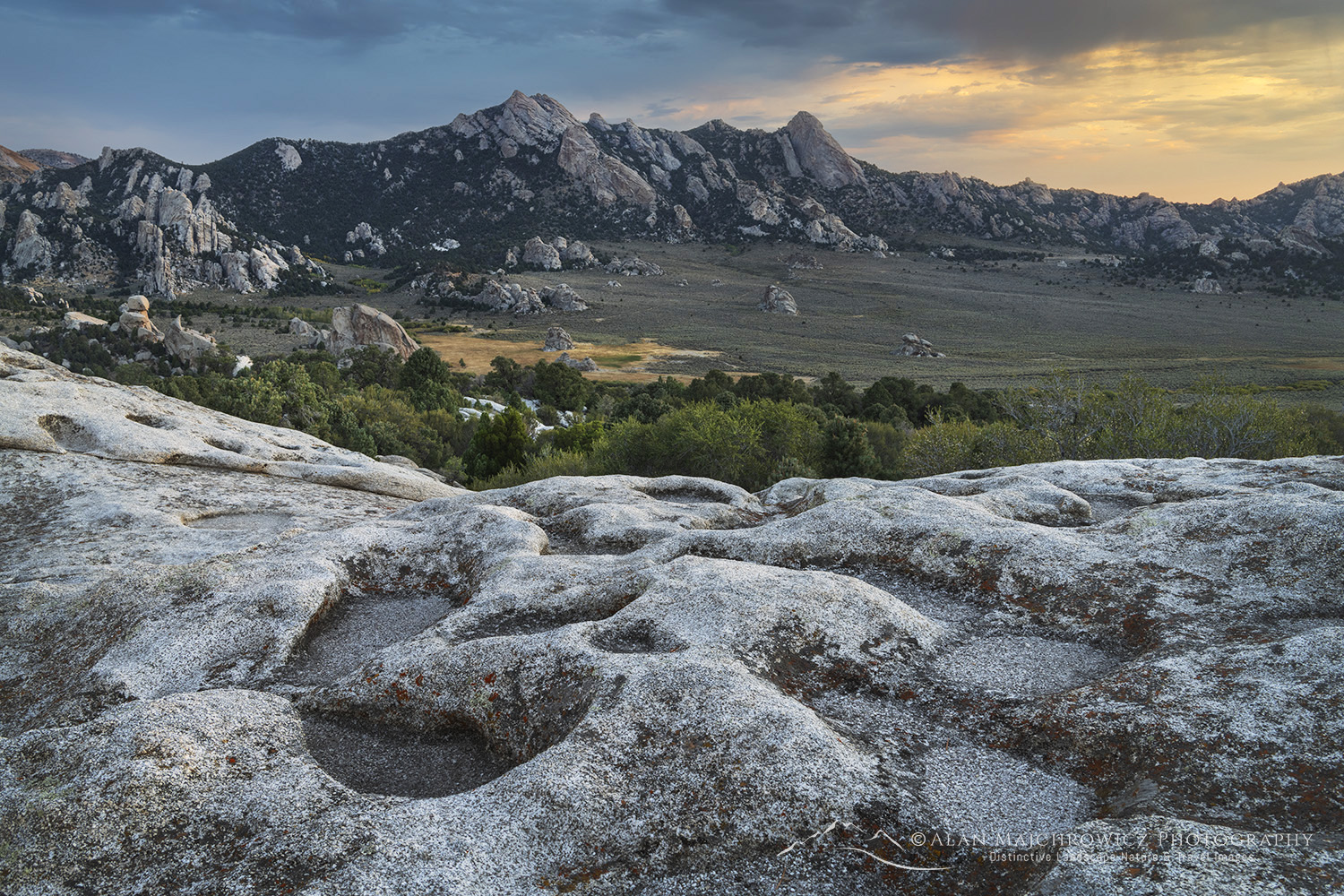
There are eroded potholes on the top of many of the rock formations. Following rain, these potholes will be filled with water and can be used for foreground reflections in compositions.

Eroded granite, City Of Rocks National Reserve Idaho #84346City of Rocks National Reserve #84346  Purchase

Essential Tips for Photographing City of Rocks

  • Scouting is an essential, but often overlooked, technique for better photography. Always scout out the best locations in advance by spending the day thoroughly exploring the area. Make notes of the best spots and also how long it will take to reach them in the morning and evening golden hours
  • Always allow enough time. One of the most important considerations when planning a photography trip to any location is time.  Good photography rarely results from a hurried schedule. Likewise, chasing light is stressful, stay in one place and let the light come to you!
  • No fees are required for entry into the City of Rocks National Reserve.
  • Free campsites are available outside of the reserve on BLM land. However, these sites do not have water, restrooms, or other amenities.
  • Cell service and WiFi are generally non-existent in the reserve. Although the visitor center parking lot has a decent signal.
  • Fuel and basic groceries are available near the visitor center in Almo, Idaho. The nearest major town is Burley, Idaho, about 50 miles away.

City Of Rocks National Reserve Idaho #84437City of Rocks National Reserve #84437  Purchase

Leave No Trace

Please, Please, Please!  Don’t plan a trip to this or any other national park, monument, or wilderness area unless you are prepared to follow Leave No Trace guidelines (LNT). National parks and wilderness areas worldwide are under incredible pressure from the growing number of visitors. So, please do your part to help preserve these precious areas for future generations!

To learn more about the principles and practicing LNT please take a few minutes to visit the Leave No Trace Center for Outdoor Ethics. Your children and grandchildren will thank you!

LEAVE NO TRACE SEVEN PRINCIPLES

1. Plan Ahead and Prepare
2. Travel and Camp on Durable Surfaces
3. Dispose of Waste Properly
4. Leave What You Find
5. Minimize Campfire Impacts
6. Respect Wildlife
7. Be Considerate of Other Visitors
© Leave No Trace: www.LNT.org

Learn about how to protect the places we love to photograph
Visit the Nature First Website
Nature First the alliance for responsible nature photography


Eroded granite, City Of Rocks National Reserve Idaho #84418City of Rocks National Reserve #84418 Purchase

All photos appearing in Photographing City of Rocks Idaho are available for Commercial Licensing and Fine Art Prints. Click on any image to purchase, or contact me for more info!

Photographing City of Rocks Idaho

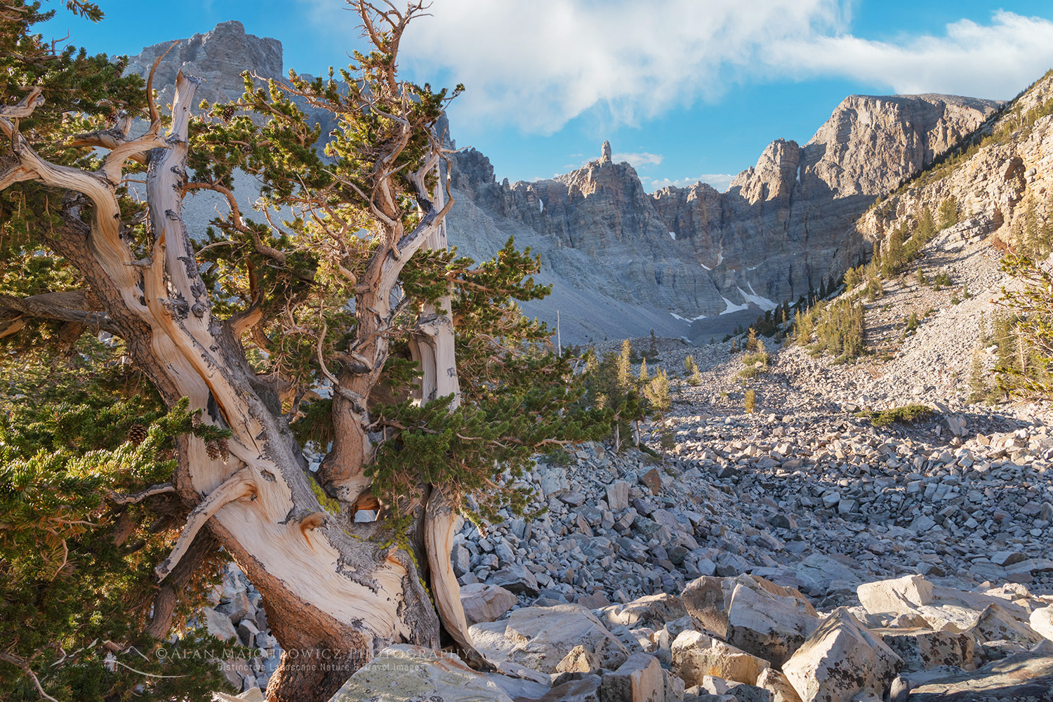
Bristlecone Pine (Pinus longaeva) below Wheeler Peak. Great Basin National Park Nevada #84480

Photographing Great Basin National Park

Photographing Great Basin National Park

Bristlecone Pine (Pinus longaeva) below Wheeler Peak. Great Basin National Park Nevada #84475Wheeler Bristlecone Pine Grove #84475  Purchase

In the vast network of U.S. National Parks and Monuments, Great Basin National Park is one many photographers overlook. That’s unfortunate since this obscure national park has much to offer landscape and nature photographers.

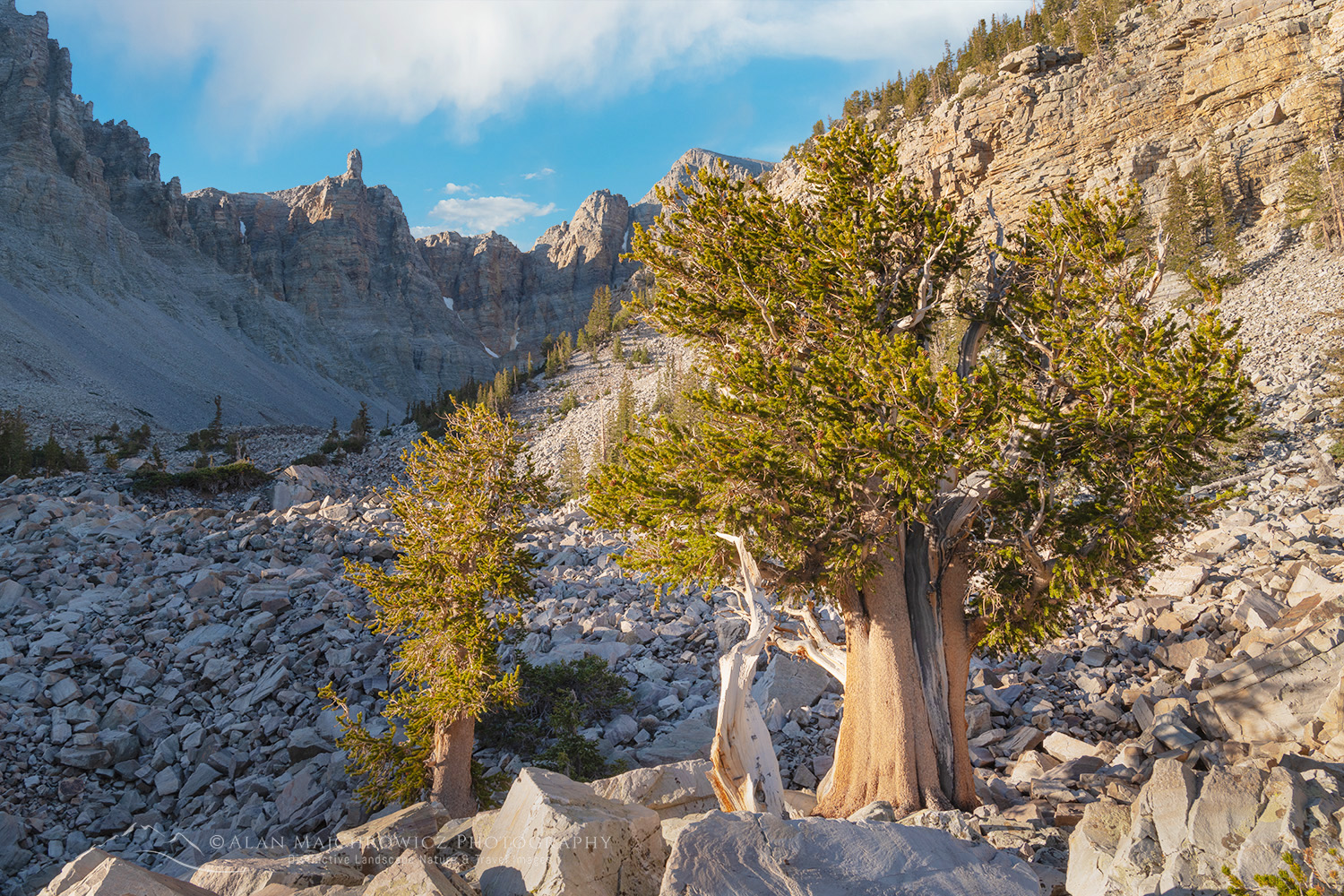
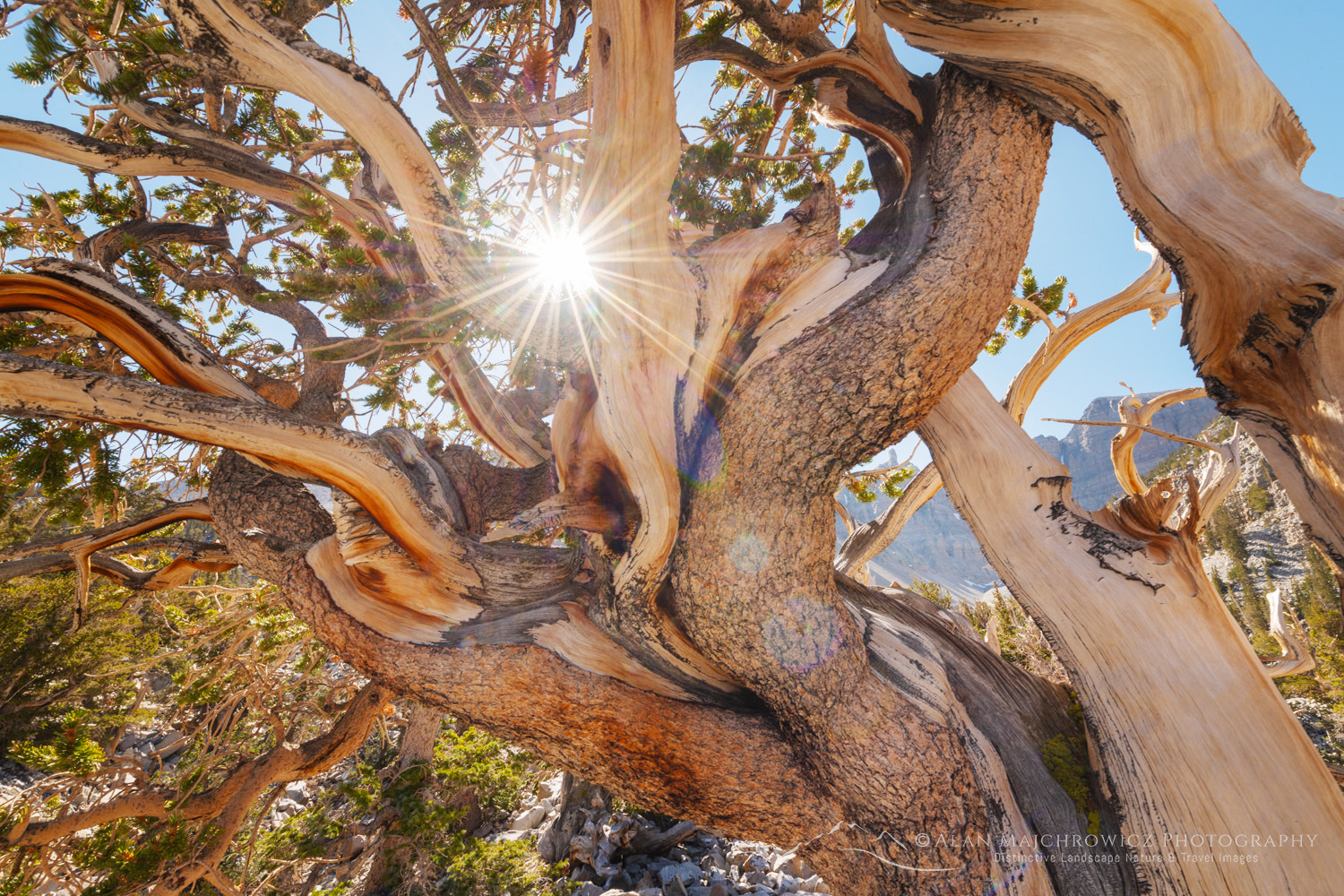
Great Basin has a wonderful diversity of environments to explore and photograph. From sagebrush foothills characteristic of the Great Basin ecosystem to 13,000′ Wheeler Peak. In addition, the park is one of the few places where a visitor can easily walk among ancient Great Basin Bristlecone Pines, the longest-living species of tree on Earth.

And if that isn’t enough, the park hosts an extensive system of limestone caves. The most well-known and accessible is Lehman Caves, with several guided tours available.

Photographers on tours of the famous national parks of Utah can easily include Great Basin National Park in their itinerary. The park is near the eastern border of Nevada and is a 3.5-hour drive to Zion and a 5-hour drive to Moab.

Bristlecone Pine (Pinus longaeva) below Wheeler Peak. Great Basin National Park Nevada #84480Wheeler Bristlecone Pine Grove #84480  Purchase

Wheeler Bristlecone Pine Grove

For most people Photographing Great Basin National Park, the Wheeler Peak Scenic Drive tops the list of activities. This windy mountain road travels 12 miles to climb to its end at 10,000 feet. Along the way, it traverses lower sagebrush foothills, ponderosa pine forests, aspen groves, and the subalpine zone. There are many scenic pullouts along the way.

At the end of the scenic driver are trails leading to the Wheeler Bristlecone Pine Grove, Glacier Basin, Alpine Lakes Loop, and the summit of Wheeler Peak. All of the trails are relatively easy, except for the long hike to Wheeler Peak. The Wheeler Peak campground is also here, at the end of the road.

There are two ways to see the Bristlecone pines. The first is to take the Bristlecone Trail and reach the grove in about 1.5 miles. The other, longer but more interesting and scenic is the Alpine Lakes Loop, at 4.1  miles this trail passes through alpine forests and lakes before reaching the grove and returning to the car park.

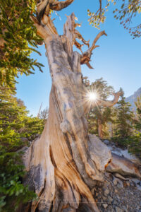
Ancient Bristlecone Pine (Pinus longaeva) below Wheeler Peak. Great Basin National Park Nevada #84489Bristlecone Pine Great Basin National Park #84489  Purchase

Photographing the Bristlecone Pine Grove

The loop trail through the grove is only about .1 miles long. Place along the trail are several very informative interpretive signs. There are several large interesting trees to photograph on the trail. However, the grove is extensive and some of the best compositions and trees are further off the trail. The main trail leads to Glacier Basin and more bristlecones, although the best opportunities are near the loop.

The terrain here is mostly bare broken rock and boulders, so there is little fear of trampling soil or plants. However, it is challenging walking, as the rocks and boulders are sharp and unstable. Watch your footing and stow gear in your pack.

Twisted branches Bristlecone Pine (Pinus longaeva) below Wheeler Peak. Great Basin National Park Nevada #84507Bristlecone Pine Great Basin National Park #84489  Purchase

Essential Photography Tips:

  • The most challenging aspect of photographing the pines is light. The surrounding peaks cast long shadows during morning and evening golden hours. Therefore, it is difficult to photograph the pines bathed in warm light.
  • The elevation at the grove is over 10,000 feet, so expect to work in cold temperatures, harsh winds, and glaring sunlight.
  • Grand compositions, which include trees, peaks, and sky are numerous but will require extensive scouting to reveal the best aspects.
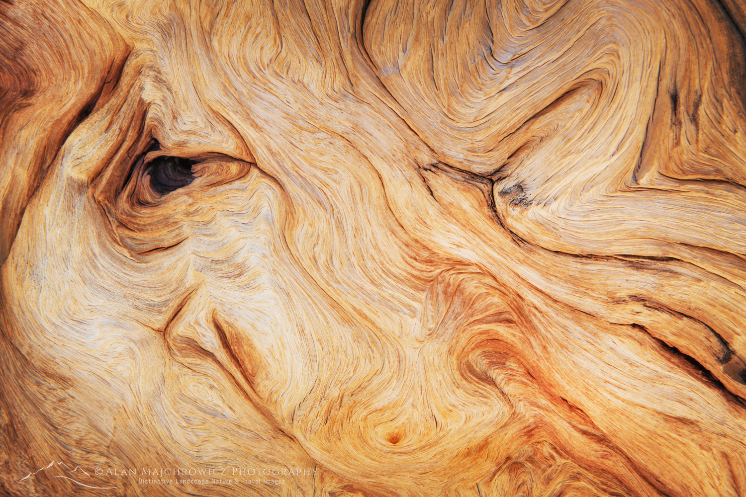
  • My favorite compositions are the trees themselves. Specifically, the weathered wood and twisted limbs are fascinating nature studies, and should not be overlooked.
  • Scouting is an essential, but often overlooked, technique for better photography. Always scout out the best locations in advance by spending the day thoroughly exploring the area. Make notes of the best spots and how long it will take to reach them in the morning and evening golden hours
  • Allow enough time. One of the most important considerations when planning a photography trip to any location is time.  Good photography rarely results from a hurried schedule. Likewise, chasing light is stressful, stay in one place and let the light come to you!

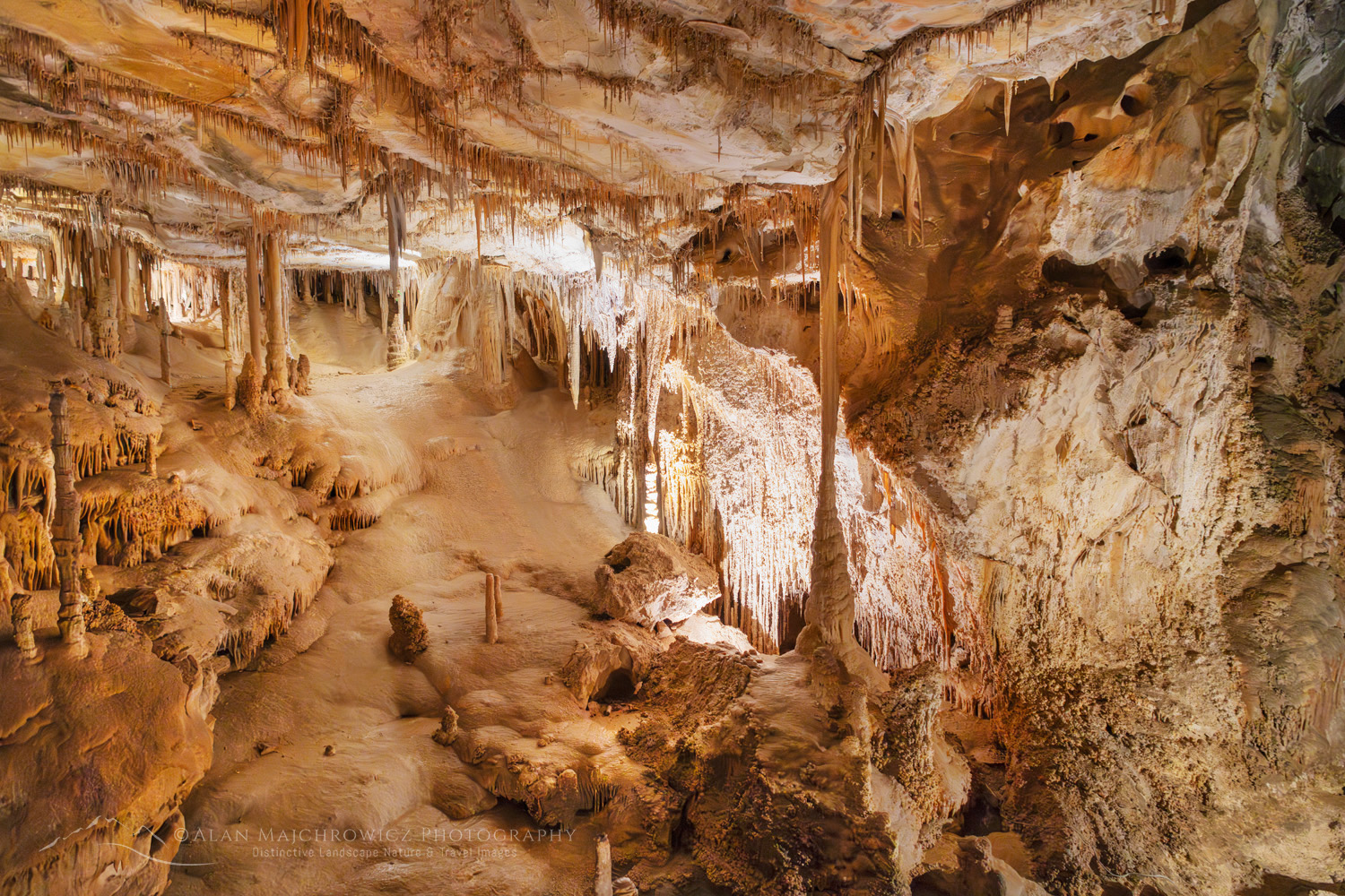
Parachute shield formations, a type of speleothem. Lehman Cave Great Basin National Park Nevada #84465Lehman Cave Great Basin National Park #84465  Purchase

Lehman Caves

On my first visit to Great Basin National Park, it was surprising to learn that the park has an extensive system of living limestone caves. In fact, according to the park’s website, there are 40 caves within its boundaries.

Lehman  Cave is the only cave in the park open to the public, and, as a lifelong fan of cave tours, it was exciting signing up for one. The Parachute Shield tour is the main tour, which lasts 60 minutes and takes visitors past fascinating speleothems, and historic areas.

Lehman Cave Great Basin National Park #84470Lehman Cave Great Basin National Park #84465  Purchase

Essential photography tips:

  • As of this writing no bags, purses, fanny packs, backpacks, or camera bags are allowed in the cave. The park website doesn’t explicitly mention tripods, but likewise, I’m guessing those aren’t allowed either.
  • Because of the above regulations, you will need to carefully assess what camera and lenses will be appropriate for cave photography. I suggest a wide to medium zoom, around 24-70mm on a full-frame body
  • Since you will be photographing without a tripod set your iso very high. You’ll need to play around to find the best setting. I was able to achieve good results as low as 2500 iso, and in a few instances as high as 10,000
  • Since you’ll be using a high iso, you can effectively reduce excess noise in post-processing with AI noise reduction.
  • Although I rarely use one, I recommend wearing a camera strap. Caves can have tight spots and drop-offs, and along with other visitors justling about, it would be easy to drop your camera.
  • To prevent the spread of White Nose Syndrome among bats, screening is especially important and mandatory.

Lehman Cave Great Basin National Park #84469Lehman Cave Great Basin National Park #84465  Purchase

Practical Tips for Photographing Great Basin National Park

When to go: While the park is open year-round summer and fall are optimum times for photography. Winter and spring will limit being able to get up high to photograph bristlecone pines.

Lodging: There are only a few small motels in the town of Baker,  just outside the park. Consequently, you’ll need to check availability in advance.

Camping: This is your best option for staying in the park. There are several park campgrounds with Wheeler Peak and upper and lower Lehman campgrounds being the most popular.  Although, as with just about every other park, you’ll need to make reservations ahead of time. There are some first come first serve options in the park, though.

There are plenty of options for free random camping on BLM land near the park. However, these areas may be too far away to be practical.

Food and Gas: Bristlecone General Store in Baker has fuel and basic supplies. Because the park is fairly distant from the nearest major town, it’s best to arrive with everything you may need for your stay, including food and ice.

Abstract patterns in detail of Bristlecone Pine (Pinus longaeva) wood. Great Basin National Park Nevada #84590 Photographing Great Basin National ParkBristlecone Pine Great Basin National Park #84590 Purchase

Leave No Trace

Please, Please, Please!  Don’t plan a trip to this or any other national park or wilderness area unless you are prepared to follow the guidelines of Leave No Trace (LNT). National parks and wilderness areas throughout the world are under incredible pressure from growing amounts of visitors. So, please do your part to help preserve these precious areas for future generations!

To learn more about the principles and practicing LNT please take a few minutes to visit the Leave No Trace Center for Outdoor Ethics. Your children and grandchildren will thank you!

LEAVE NO TRACE SEVEN PRINCIPLES

1. Plan Ahead and Prepare
2. Travel and Camp on Durable Surfaces
3. Dispose of Waste Properly
4. Leave What You Find
5. Minimize Campfire Impacts
6. Respect Wildlife
7. Be Considerate of Other Visitors
© Leave No Trace: www.LNT.org

Learn about how to protect the places we love to photograph
Vist the Nature First Website
Nature First the alliance for responsible nature photography


Also, check out these other National Park posts!
Glacier National Park/ Boulder Pass
North Cascades/Whatcom Pass
Mount Rainer/Paradise Meadows
Grand Teton National Park/PhotographyTrip Planning

Abstract patterns in detail of Bristlecone Pine (Pinus longaeva) wood. Great Basin National Park Nevada #84556 Bristlecone Pine Great Basin National Park #84556 Purchase

All photos appearing in Photographing Great Basin National Park are available for Commercial Licensing and Fine Art Prints. Click on any image to purchase, or contact me for more info!

Photographing Great Basin National Park