Mount Challenger, North Cascades National Park

Whatcom Pass Tapto Lakes North Cascades National Park Part 2

Whatcom Pass Tapto Lakes North Cascades National Park
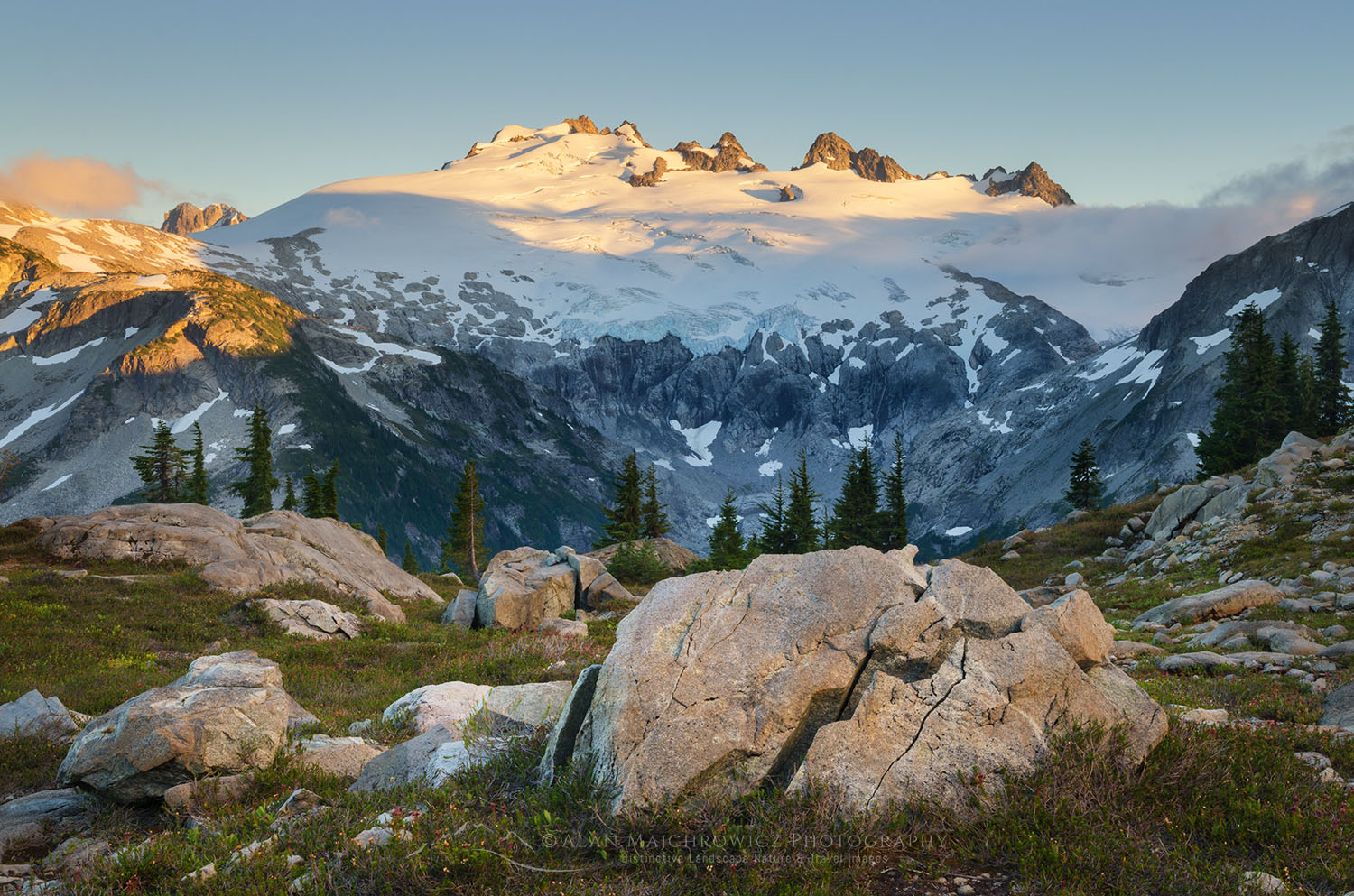
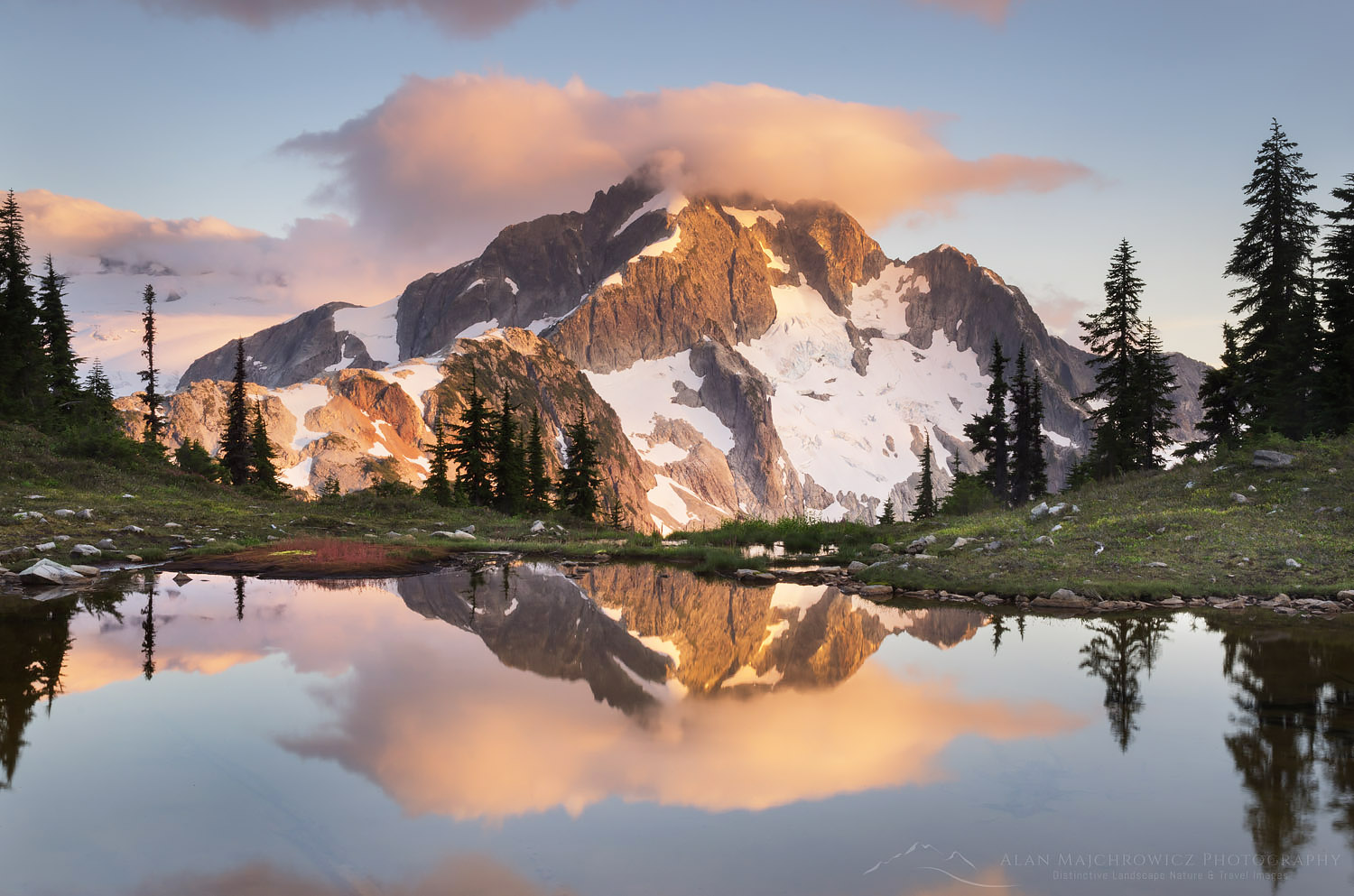
Mount Challenger, North Cascades National ParkMount Challenger, North Cascades National Park  #61740  

Several weeks ago I was finally able to make a return visit to Whatcom Pass and Tapto Lakes. In the heart of North Cascades National Park, Whatcom Pass is the quintessential North Cascades wilderness. It rises out of deep untouched forest valleys to jaw-dropping views of rugged glacier-clad peaks. From Part 1

Exploring Tapto Lakes North Cascades Basin

Tapto Lakes is one of those locations that many hikers dream about visiting. Remote, high in the subalpine, and surrounded by rugged snowcapped peaks, the lakes have all the features of a classic backpacking destination. Tapto Lakes sits in a basin about 800′ above Whatcom Pass. The basin contains a large lake and several smaller lakes set in a heather-filled subalpine meadow. The basin is shaped somewhat like an amphitheater, with the main show being the stupendous views of Mount Challenger and Whatcom Peak. Situated in a designated cross-country zone by the park service, with a permit you are free to camp anywhere among the lakes, though with a few caveats.

After investing two days of hard work into reaching the lakes I woke up rested and refreshed. Content on not having to hike anywhere with a full pack I took in the view and planned my day. Of course, since my main reason for being here was landscape photography I woke up early to survey the light. I had already identified several excellent spots to run to in the event of some great morning light. Unfortunately, this wasn’t the case on my first morning, so I had lots of leisure time to explore all the lakes.

My usual modus operandi is to spend most of the day scouting out and lining up possible compositions. I then try to assign a priority to them and work from the top down when the lighting becomes appropriate. My first evening had some very nice light, enabling me to photograph some classic reflections of Whatcom Peak.
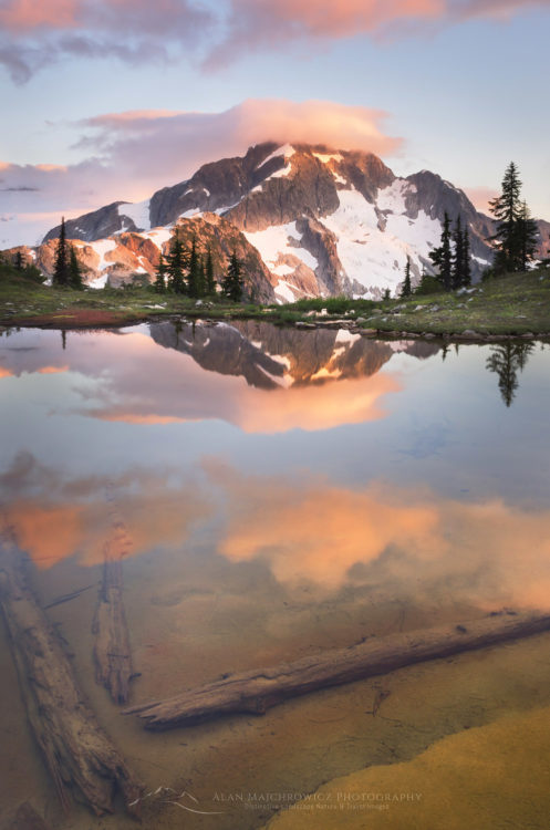
Whatcom Peak North Cascades National ParkWhatcom Peak, North Cascades National Park  #61499    Purchase

The View North

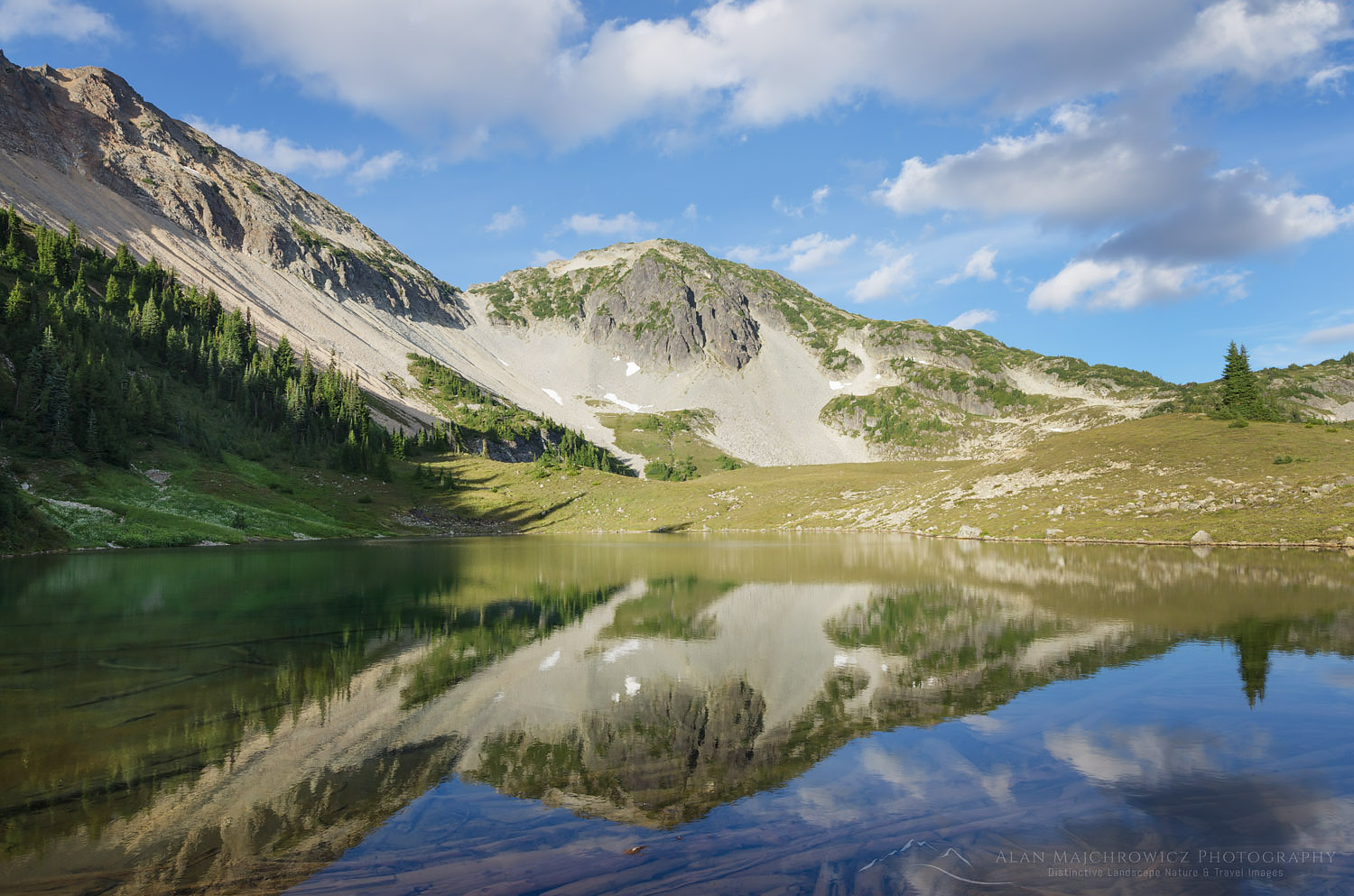
On my second day, I decided to move camp to a higher location. My map showed a very small lake not far away in its small talus-fringed basin on Red Face Mountain. It appeared to offer even more commanding views, along with quick access to a ridge on Red Face Mountain. The short hike up was worth it. The lake still had some snow along one side and also had some good composition qualities. I quickly found an excellent spot to set up camp, after which I hiked up to the ridge.
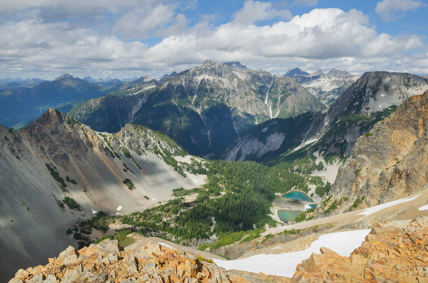
North Cascades National ParkBear Mountain and Reveille Lakes, North Cascades National Park  #61536    Purchase

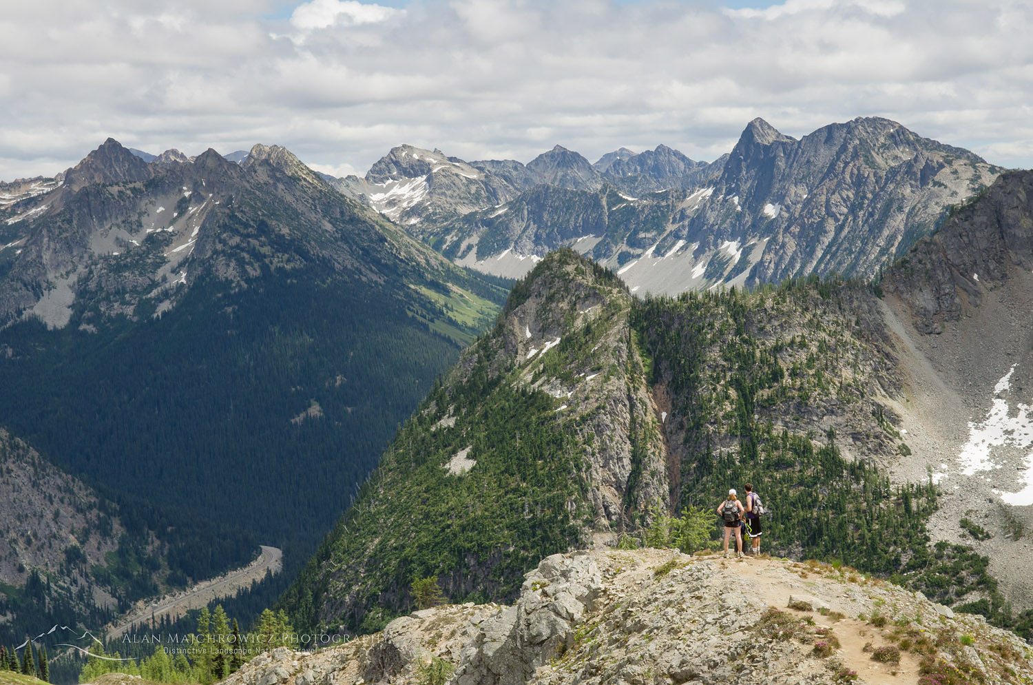
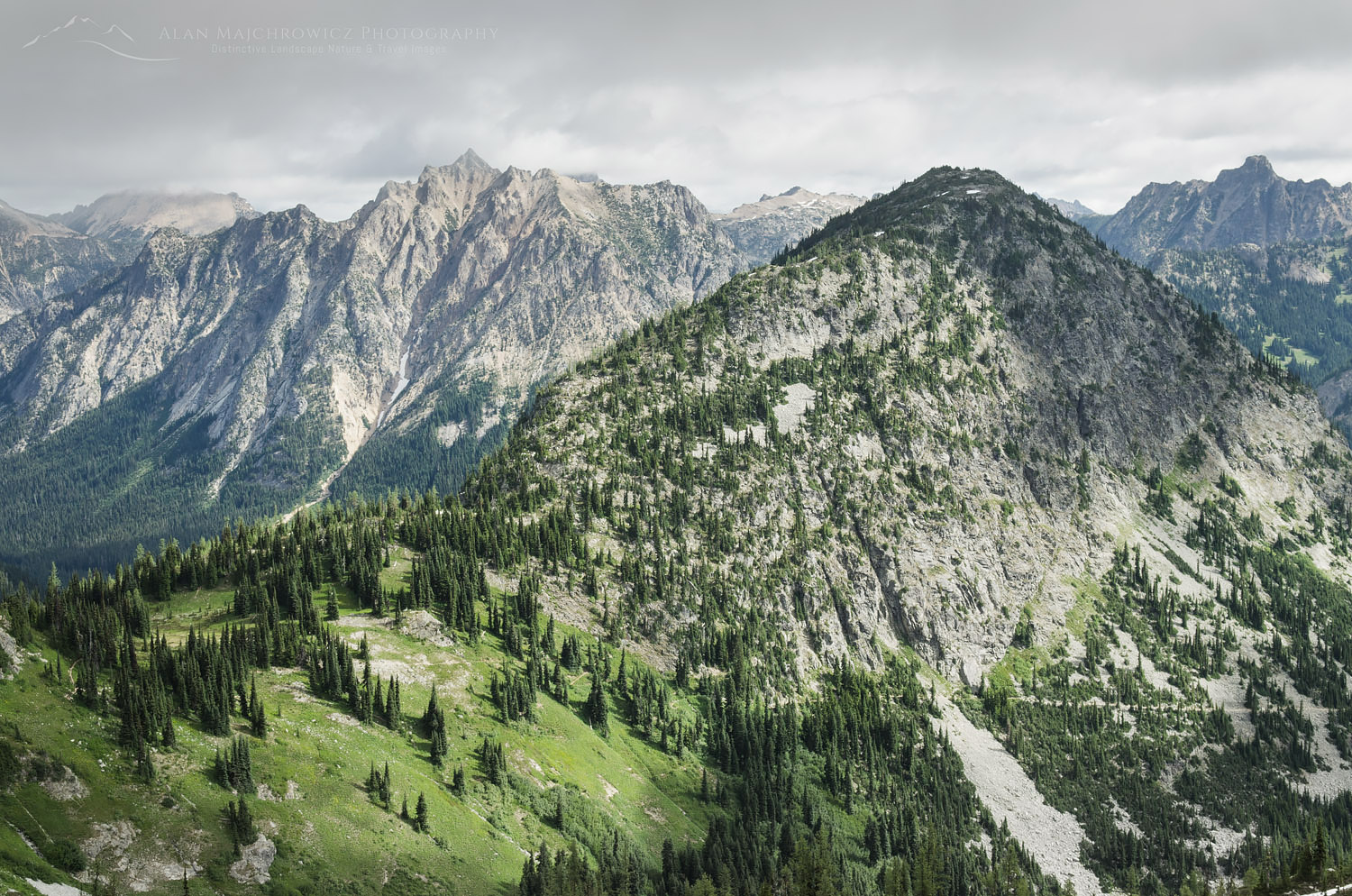
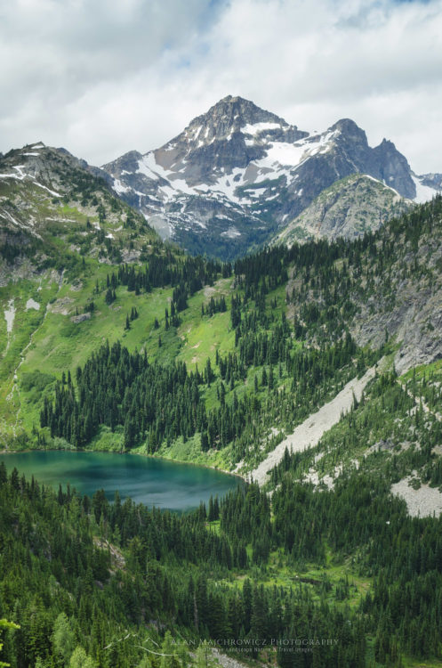
As I crested the ridge I was presented with incredible views of the wild peaks to the north. Dominating the views were Bear Mountain and the jagged needle-like spires of Mox Peaks and Silver Peaks. Far below the precipitous and crumbling ridge were the turquoise-colored Reveille Lakes. All of this territory was completely devoid of trails, a true wilderness only accessible to the most determined mountaineers. I sat there for quite some time, contemplating how fortunate I was to be in such a special place. I got up after a while and headed back down the slope, wondering if I’d ever return.

Waiting for Light at Tapto Lakes North Cascades

Back down at the lake, the day was wearing on and it was time to set up some compositions. Some clouds had moved in and were swirling around the summits of nearby peaks. I was hoping they wouldn’t completely sock in everything before sunset. I moved to the back of the lake where Whatcom Peak cast a nice reflection in the still waters. Waiting to see what would happen I photographed a series of images in which the clouds and reflection created a sort of Rorshach effect. Although the light didn’t have a dramatic saturation of the color, I did like some of the subtle pastel tones. All in all, it was a very satisfying day.
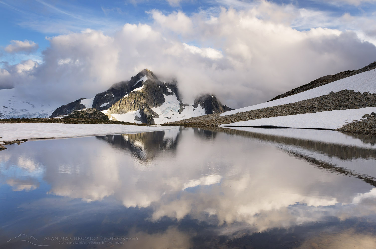
Whatcom Peak reflection North CascadesWhatcom Peak cloud reflection, North Cascades National Park  #61603    Purchase
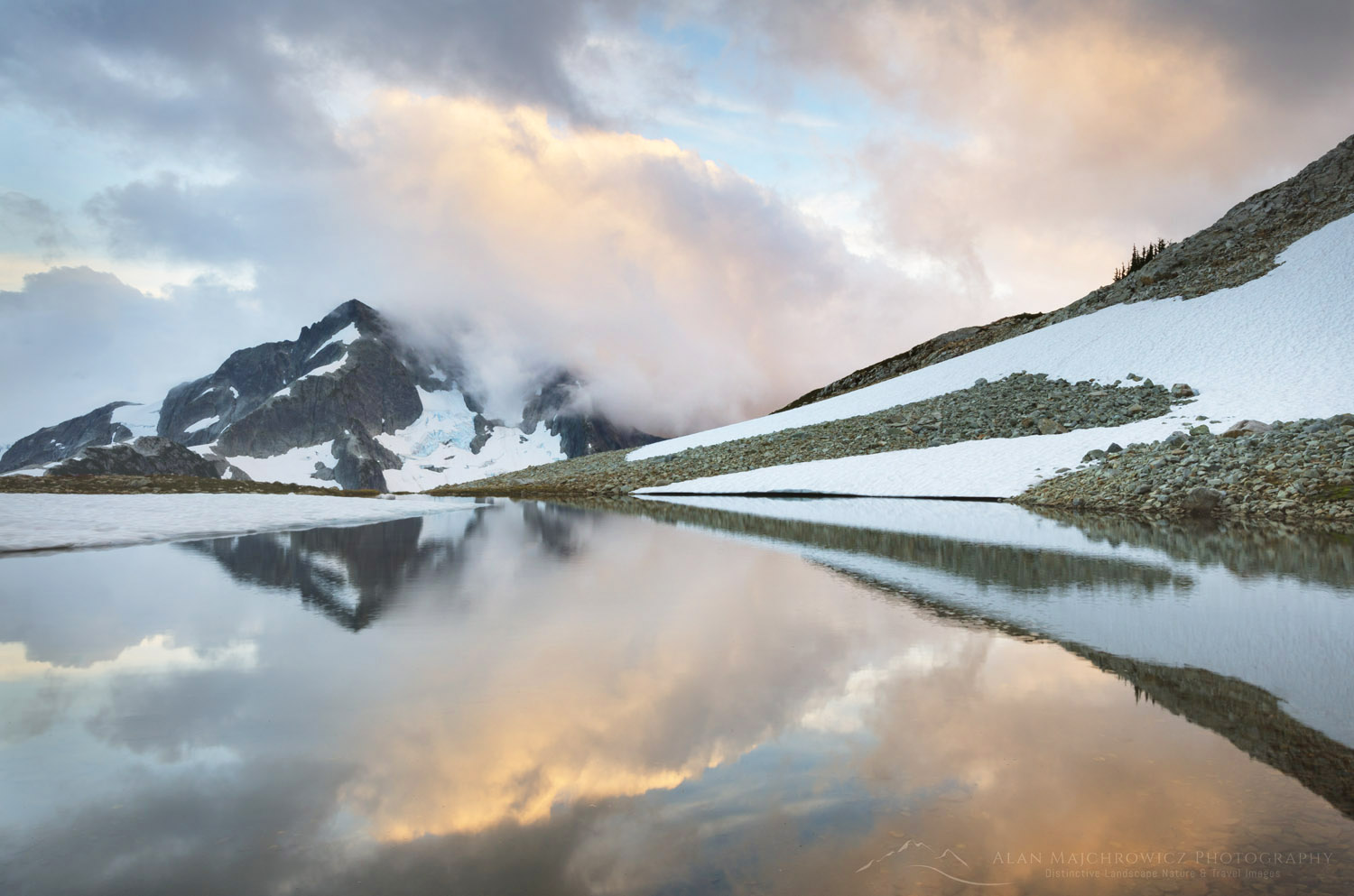
Whatcom Peak reflection North CascadesWhatcom Peak cloud reflection, North Cascades National Park  #61630    Purchase

Middle Lakes

The next day feeling that I had accomplished my goals and not wanting to overly duplicate images, I packed up and moved on. A bit east of Tapto Lakes are a few more small lakes, the most accessible being Middle Lakes. I decided to spend my last day here before heading back. Climbing back up to the ridge I turned and bid a somewhat sad goodbye to the lakes I had dreamed of revisiting all those years.

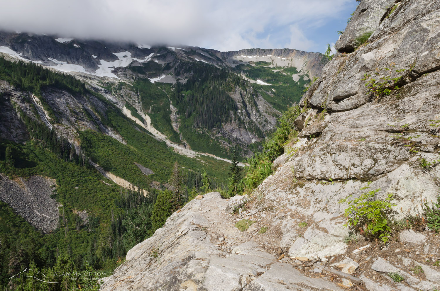
Middle Lakes turned out to be an easy short mile or so further, there was only a steep rock slope to cross to add a bit of excitement. When I reached upper Middle Lake I found the setting to be somewhat desolate. Surrounded by steep slopes on three sides and a boulder field at the outlet, there didn’t seem to be any good campsites. I moved on to check out the lower lake. The lower lake was more attractive, but it too afforded little flat ground for camping. However, when scouting for campsites I noticed an odd mound near the lake outlet with intense iron-red soil. There appeared to be a spring emanating from the mound. The main spring had formed small red mineral terraces similar to Mammoth Hot Springs in Yellowstone. I felt the water but it was cool to the touch.
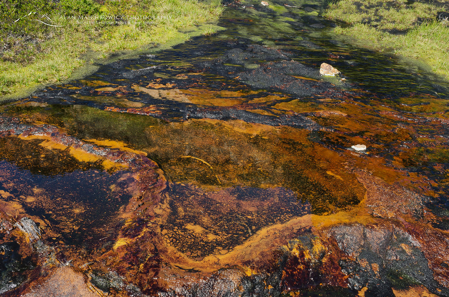
Mineral spring North CascadesMineral Spring, North Cascades National Park  #61666    Purchase
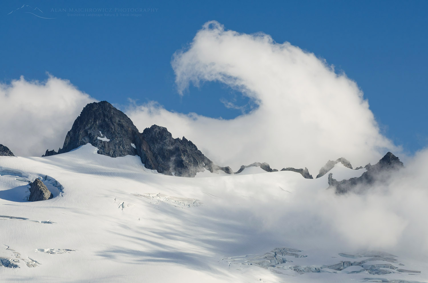
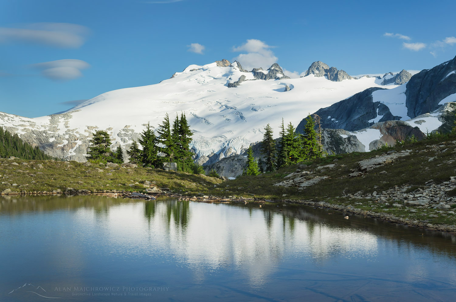
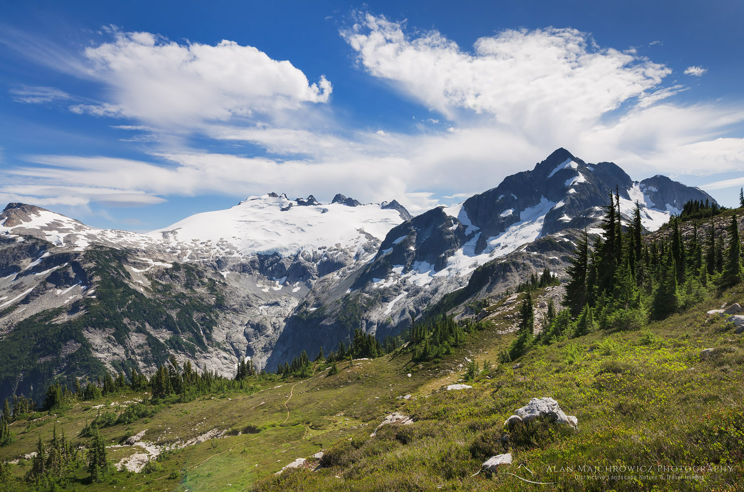
Mount Challenger North Cascades National ParkSwirling clouds over Challenger Glacier, North Cascades National Park  #61711    Purchase

Camping at Middle Lakes

I ultimately found a nice spot for the night among boulders and heather meadows with a commanding view of Mount Challenger. For a mountain with such an imposing glacier, it seemed that its elevation should be more than 8236′. During my entire stay in the area, I noticed nearly constant clouds near its summit. Apparently, for such a modest height Mount Challenger tends to make its own weather, partly explaining the huge glacier. For most of that afternoon and evening, I enjoyed and photographed a show of mists whimsically curling around the summit. To commemorate my trip to this special place I made several photos of my campsite, including a couple with the tent illuminated.
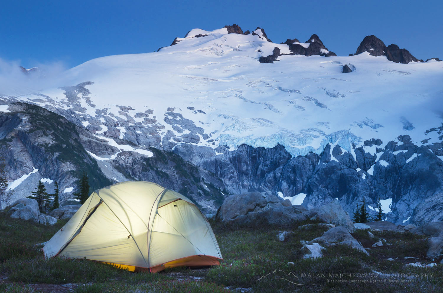
Backcountry camp North Cascades National ParkIlluminated tent and Mount Challenger, North Cascades National Park  #61751    Purchase

Hiking Out from Tapto Lakes North Cascades

The next day it was time to head out, retracing my steps down to Whatcom Pass and into the Chilliwack River Valley. Although I was filled with a deep sense of accomplishment and satisfaction, I was also sad to say goodbye. I faced a long day of hiking filled with retrospection on this and my first trip to Whatcom Pass many years back. Once again a highlight was riding the cable car across the river. After around ten miles I reached Copper Creek Camp, tired with plenty of hot spots on my heels and toes. The next day I faced the stiff climb back up to Hannegan Pass and then the final miles out to the trailhead where my truck waited.

Nearing the pass I began to meet more hikers. Many of them were just beginning trips similar to mine. You could easily see the excitement on their faces, anticipating the wonders that were waiting for them. Of course, I stopped to chat and helped stoke their excitement by passing on some of the highlights from my trip. Then it was down the pass for the last five miles of the trip. Although I was out of North Cascades National Park and in the Mount Baker Wilderness, it was easy to sense civilization was close. I began to see more people on a wider well maintained trail. I got back to my truck in a few hours, in a parking lot that had dozens of cars in it.

Tired but happy I began to drive home. I began thinking about how soon I might get a chance to go back to Whatcom Pass.
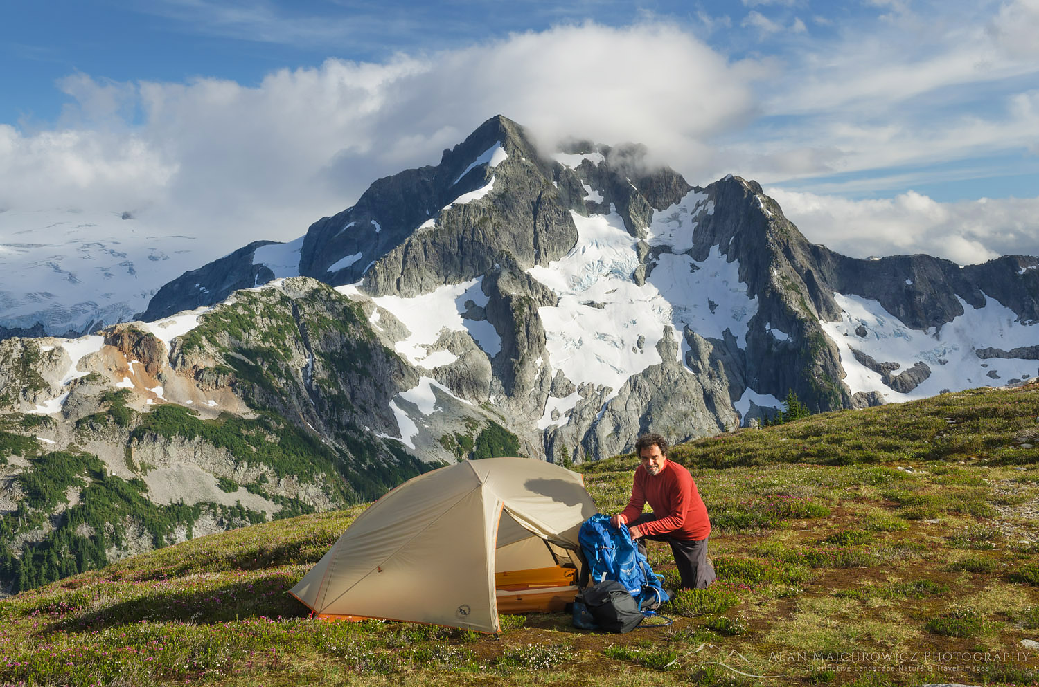
Backcountry Camp North Cascades National ParkCampsite on Red Face Mountain, Whatcom Peak in the distance #61589    Purchase

Leave No Trace

Please, Please, Please!  Don’t plan a trip to this or any other national park, monument, or wilderness area unless you are prepared to follow Leave No Trace guidelines (LNT). National parks and wilderness areas worldwide are under incredible pressure from the growing number of visitors. So, please do your part to help preserve these precious areas for future generations!

Please visit the Leave No Trace Center for Outdoor Ethics to learn more about LNT’s principles. Your children and grandchildren will thank you!

LEAVE NO TRACE SEVEN PRINCIPLES

1. Plan and Prepare
2. Travel and Camp on Durable Surfaces
3. Dispose of Waste Properly
4. Leave What You Find
5. Minimize Campfire Impacts
6. Respect Wildlife
7. Be Considerate of Other Visitors
© Leave No Trace: www.LNT.org

Learn about how to protect the places we love to photograph
Visit the Nature First Website

Nature First the alliance for responsible nature photography


All photos appearing in Cirque of the Towers Wind River Range are available for Commercial Licensing and Fine Art Prints. Click on any image to purchase, or contact me for more info!

Whatcom Pass Tapto Lakes North Cascades National Park Part 2
Whatcom Peak North Cascades National Park

Whatcom Pass Tapto Lakes North Cascades National Park Part 1

Whatcom Pass Tapto Lakes North Cascades National

Whatcom Peak North Cascades National Park Whatcom Pass Tapto LakesWhatcom Peak reflected in Tapto Lake # 61497    Purchase

A Long Awaited Journey

Everyone has a place they dream of, somewhere that holds a special spot in their heart. At some point in their lives, usually at a young age, they see a picture or read a story about a place that for various reasons grabs their imagination. They carry it with them over the years and hope someday for the chance to visit it in person. For me, it has always been mountain wilderness. And not just any run-of-the-mill mountain wilderness. It had to have a primordial feel. Dark mysterious forests, raging rivers, and rugged peaks with jagged rock summits jutting out from expansive glaciers. For me, the North Cascades fit the bill perfectly. It was this vision that drew me to Whatcom Pass many years ago.

Mount Challenger, North Cascades National Park Whatcom Pass Tapto LakesChallenger Mountain, North Cascades National Park  #61459    Purchasert 1

Several weeks ago I was finally able to make a return visit to Whatcom Pass and Tapto Lakes, in North Cascades National Park. In the heart of the park, Whatcom Pass is quintessential North Cascades wilderness. It rises out of deep untouched forest valleys to jaw-dropping views of rugged glacier-clad peaks. Far away from any road town or cell signal. My first visit was way back in the late eighties and I’ve been wanting to go back ever since. There have been many reasons for my delayed return, not least of which is the long tiring hike accompanied by swarms of flying insects.

Unlike most backpacking trips this one has a few major ups and downs in addition to covering lots of miles. On the first day climbs a pass and then descends deep into another valley. The next day you must climb up to another pass, then higher to the lakes basin. In all, you’ll cover around 40+ miles and about 8500′ of elevation, including side trips, before returning to the trailhead. A very strong hiker could make it in two days, most people allow three to four days. My primary goal was for photography and relaxation so I gave myself six days to accomplish this trip. Aside from the photography thing I always feel that if you work so hard to get someplace why hurry to leave? Take your time to relax and enjoy the surroundings!

Hannegan Pass trail North CascadesHannegan Pass Trail through Ruth Creek Valley, Mount Baker Wilderness  #54291    Purchase

Hiking to Hannegan Pass

On the first day, I made an early start, hoping to make it through the brushy Ruth Creek Valley before the black flies awoke. It’s about five miles and 2000′ up to Hannegan Pass, along a very scenic trail that sees very heavy foot traffic. I’ve been up this trail to the pass nearly a dozen times and never get tired of the open views of rugged Nooksack Ridge. About halfway up you begin to see snowcapped Ruth Mountain guarding the head of the valley. Ruth Mountain itself is a popular destination for hikers climbers and skiers in the early season. Although I’m not much of a mountaineer I managed to hike up the glacier to the summit several years back. From the top, you get an incredible view of Mount Shuksan and its glaciers spilling into Nooksack Cirque. Truly awe-inspiring!

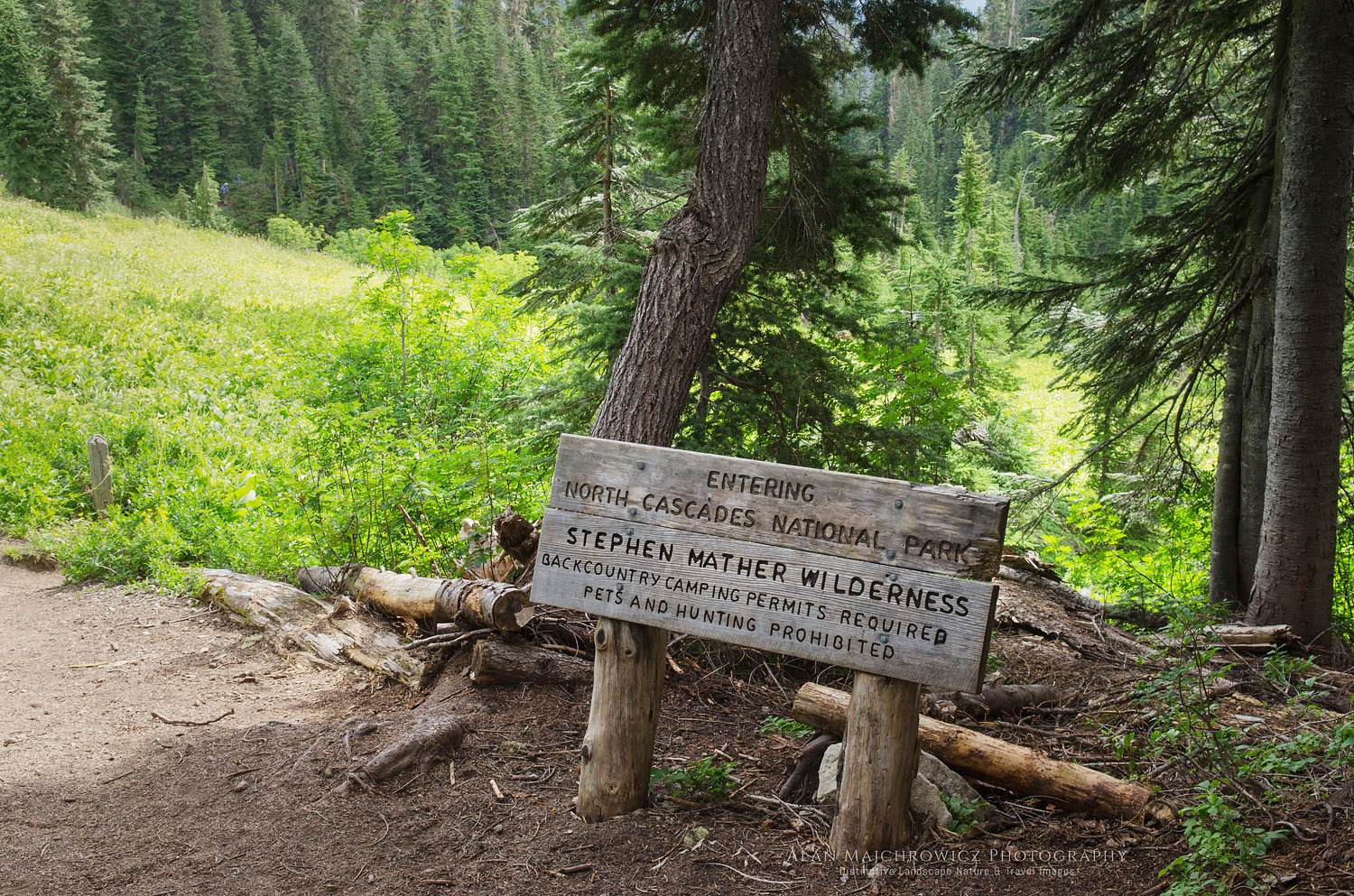
North Cascades National Park entrance signEntering the park #61415    Purchase

Down the Chilliwack Valley

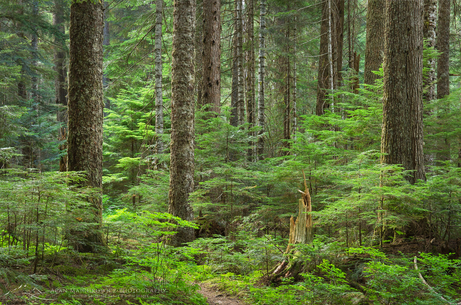
On reaching Hannegan Pass I took a rest to have a snack and dry off my sweat-soaked shirt. I also chatted with a group of volunteers that were part of a trail maintenance crew. From here it’s all downhill into the wild Chilliwack River Valley, losing all that hard-won elevation. Shortly after leaving the pass I finally entered North Cascades National Park, as indicated by a weather beaten-wooden sign. The hike down into the valley is through a beautiful untouched fragrant forest of silver fir, mountain hemlock, and grand fir. The feeling here of true wilderness is very tangible, even the trail seems wilder. From the pass, I needed to travel another five miles to the U.S. Cabin camp, my first night’s destination.

Old growth forest North CascadesOld-growth forest Chilliwack River Valley, North Cascades National Park  #61421    Purchase

Ten miles is about my limit for hiking with a full multi-day pack, so I was glad to reach the camp and set up my tent. Amazingly there were very few bugs so far and I was able to relax and eat dinner along the river unmolested. I was even able to make a few photos of the impressive forest at this camp. That night I turned in early in anticipation of a grueling hike the next day. I had to hike another seven miles and over 3000′ up to my next and ultimate destination, Tapto Lakes above Whatcom Pass.

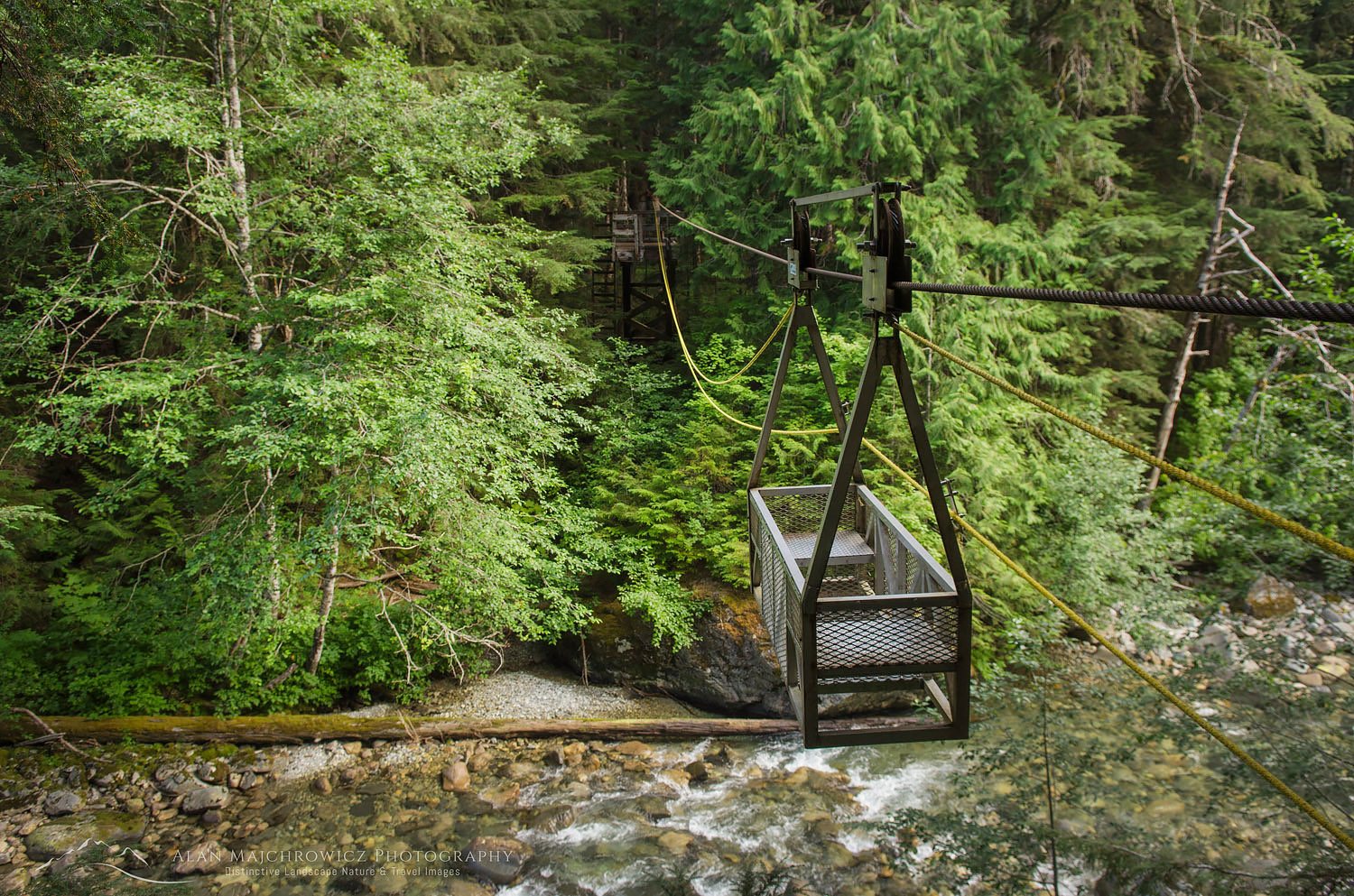
The next morning I again got up early to hit the trail. The first stop of the day was the unique crossing of the Chilliwack River via a hand-operated cable car. I don’t know how common these contraptions are but for most hikers, it’s a highlight of their trip. Later in the season crossing the river on foot wouldn’t be very hard, but why pass up such an interesting experience? Two hikers and their packs can fit in the car which is operated by pulling on a rope. It’s pretty easy getting across the first half since the cable sags down a bit.  After that, you begin to pull your weight up to the opposite side. By the time I got the car docked on the platform, my arms were pretty tired from pulling. Of course, I had to make sure I got a few photos before moving on.

Cable car North Cascades National ParkChilliwack River cable car, North Cascades National Park  #61427    Purchase

Climbing to Whatcom Pass Tapto Lakes

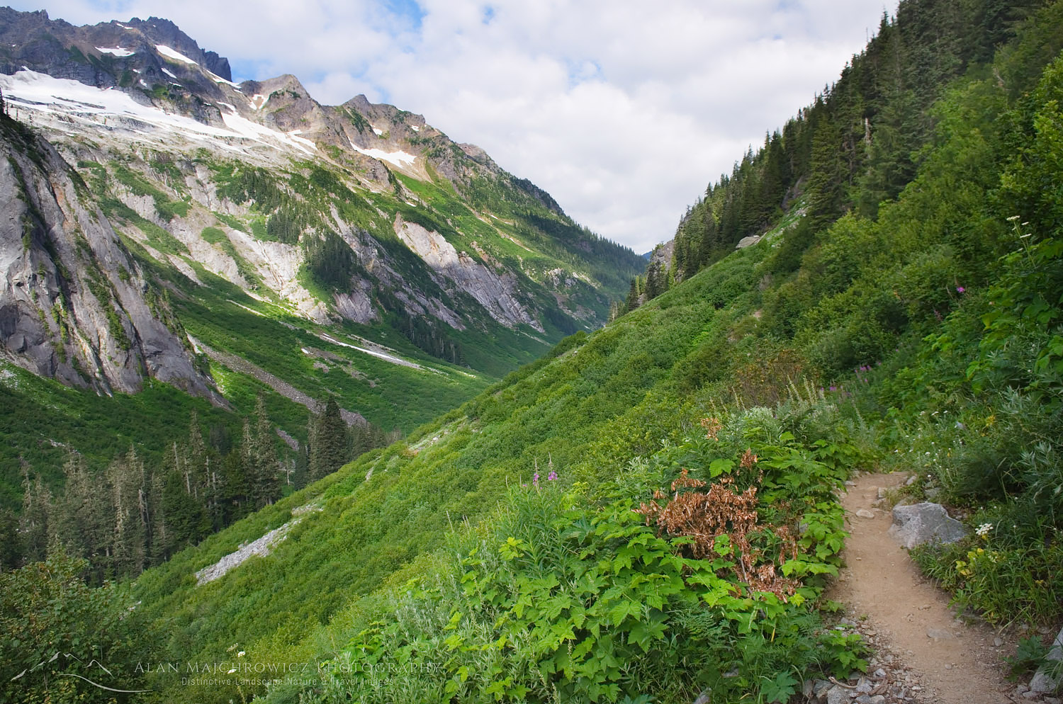
After the river crossing, it’s back to work again on the trail, which now goes through a very brushy section. Years ago, on my first visit, the chest-high brush was covered in morning dew. After half an hour of hiking, I was soaking from the waist down. A few miles later the climb to Whatcom Pass begins in earnest. The trail begins to rise from the valley bottom and gradually views open up to rugged Easy Ridge. After what seems like an eternity Whatcom Peak comes into view and the terrain begins to take on a subalpine look. I arrived at Whatcom Pass exhausted and again drenched in sweat from the climb.

Brush Creek Trail near Whatcom Pass North Cascades National ParkWhatcom Pass Trail, North Cascades National Park  #61764    Purchase

I still had another mile and 800 feet of elevation to travel to my camp at Tapto Lakes. At this point, I was wiped out and wasn’t sure if I could make it. The trail to the lakes is more like a climber’s route, with sections so steep you need to pull yourself up by roots and branches. While deciding if I had the energy I spoke with a few other backpackers doing the cross-park hike to Ross Lake. Like me, they spent the whole morning climbing up to Whatcom Pass. However, they only paused briefly to take in the views before heading down again into the adjacent valley.

Again I thought to myself, what’s the point in all the work if you hurry past the best parts? The previous day I met a woman doing the Pacific Northwest Trail. This 1200-mile-long trail starts at Glacier Park in Montana and ends at the Pacific Ocean. Like the Pacific Crest, Continental Divide, and Appalachian trails, you need to hike a set number of miles each day to complete it. During our brief conversation, I couldn’t help admiring her determination and stamina. At the same time, I also felt a bit sorry for her that she needed to hurry through such beauty to stay on schedule.

Mount Challenger North Cascades Whatcom Pass Tapto LakesChallenger Mountain and Whatcom Peak, North Cascades National Park  #61443    Purchase

At Tapto Lakes

By this time I felt physically and mentally rested enough to slog up to reach my camp at Tapto Lakes. Taking it very slowly, the climb proved easier than I anticipated. Soon enough the views exploded to include Mount Challenger and the imposing rock buttresses of Whatcom Peak. A short 200′ descent into the basin brought me to beautiful Tapto Lakes. The day was still young so I took my time and leisurely explored the area to find the best campsite. The only other people there was a small group staying at the pass below. They had day hiked up to the lakes to take in the views and a quick dip in the frigid lake waters. When they left I had the entire place all to myself!

Time to rest and take it all in, and do nothing but marvel at the rugged beauty that spread before my eyes. At last, I returned to the place that held my imagination spellbound for nearly 28 years.

Coming up in part two: Exploring and photographing at Tapto Lakes.    Click here to read part two

Tapto Lakes North Cascades National ParkTapto Lake, North Cascades National Park  #61455    Purchase

Read Part 2 here!

Leave No Trace

Please, Please, Please!  Don’t plan a trip to this or any other national park, monument, or wilderness area unless you are prepared to follow Leave No Trace guidelines (LNT). National parks and wilderness areas worldwide are under incredible pressure from the growing number of visitors. So, please do your part to help preserve these precious areas for future generations!

Please visit the Leave No Trace Center for Outdoor Ethics to learn more about LNT’s principles. Your children and grandchildren will thank you!

LEAVE NO TRACE SEVEN PRINCIPLES

1. Plan and Prepare
2. Travel and Camp on Durable Surfaces
3. Dispose of Waste Properly
4. Leave What You Find
5. Minimize Campfire Impacts
6. Respect Wildlife
7. Be Considerate of Other Visitors
© Leave No Trace: www.LNT.org

Learn about how to protect the places we love to photograph
Visit the Nature First Website
Nature First the alliance for responsible nature photography


All photos appearing in Cirque of the Towers Wind River Range are available for Commercial Licensing and Fine Art Prints. Click on any image to purchase, or contact me for more info!

Whatcom Pass Tapto Lakes North Cascades National Park Part 1

Marriott Basin trail Coast Mountains British Columbia

Coast Mountains

How to tell if you’re hiking in the Coast Mountains trail of British Columbia:

  1. State of the art bridges over creek crossing
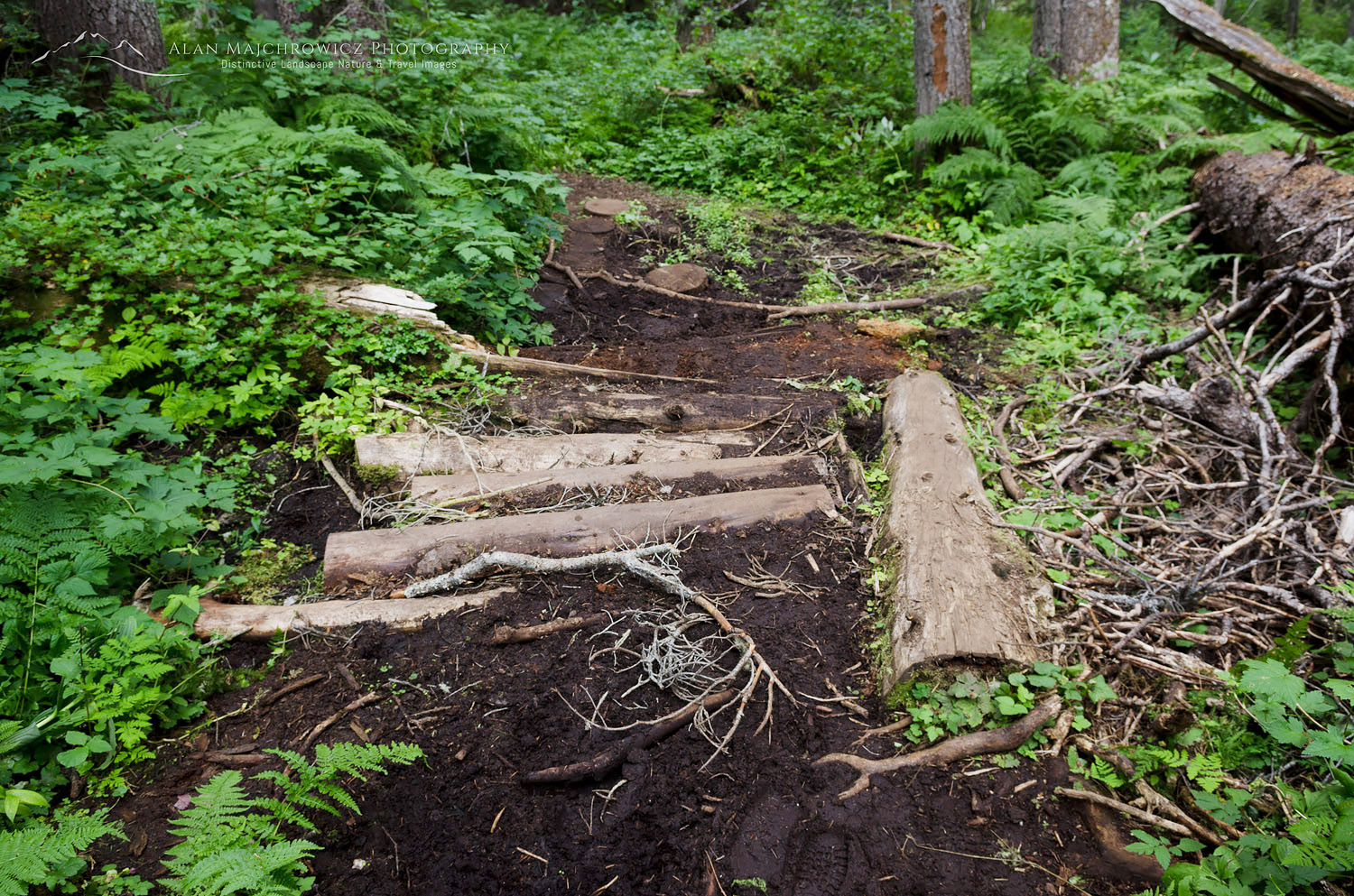
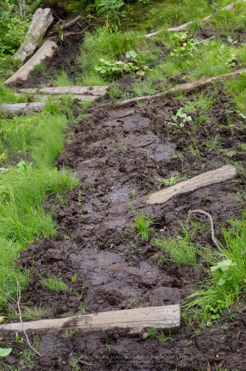
  2.  Deep mud with slippery logs and branches strategically placed for optimum ankle twisting

I actually love these types of trails, there’s a sense of  true wilderness about them, unlike some of the crowded super highway trails found in Washington and Oregon. These pics are from a few days ago during a visit to Marriott Basin in the Coast Mountains.

I have lots of new photos in the works from this and my previous trip to North Cascades National Park. Stay tuned you’re going to love them!!

Marriott Basin trail Coast Mountains British Columbia


Marriott Basin trail Coast Mountains British Columbia

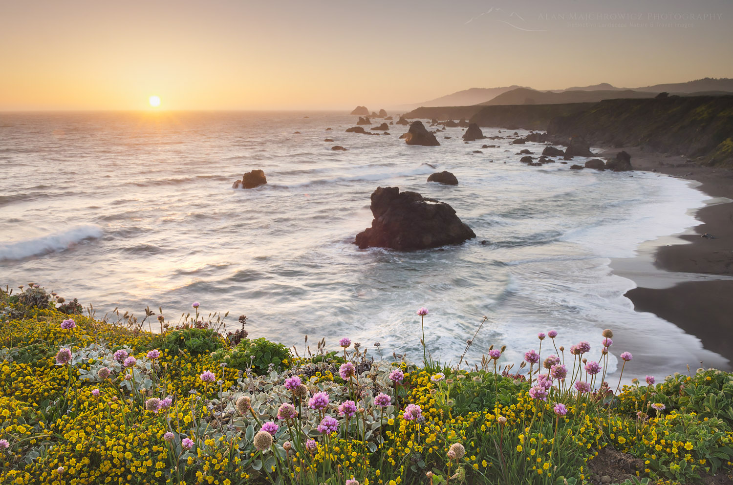
Sunset Sonoma Coast wildflowers, California

California’s Sonoma Coast

California’s Sonoma Coast

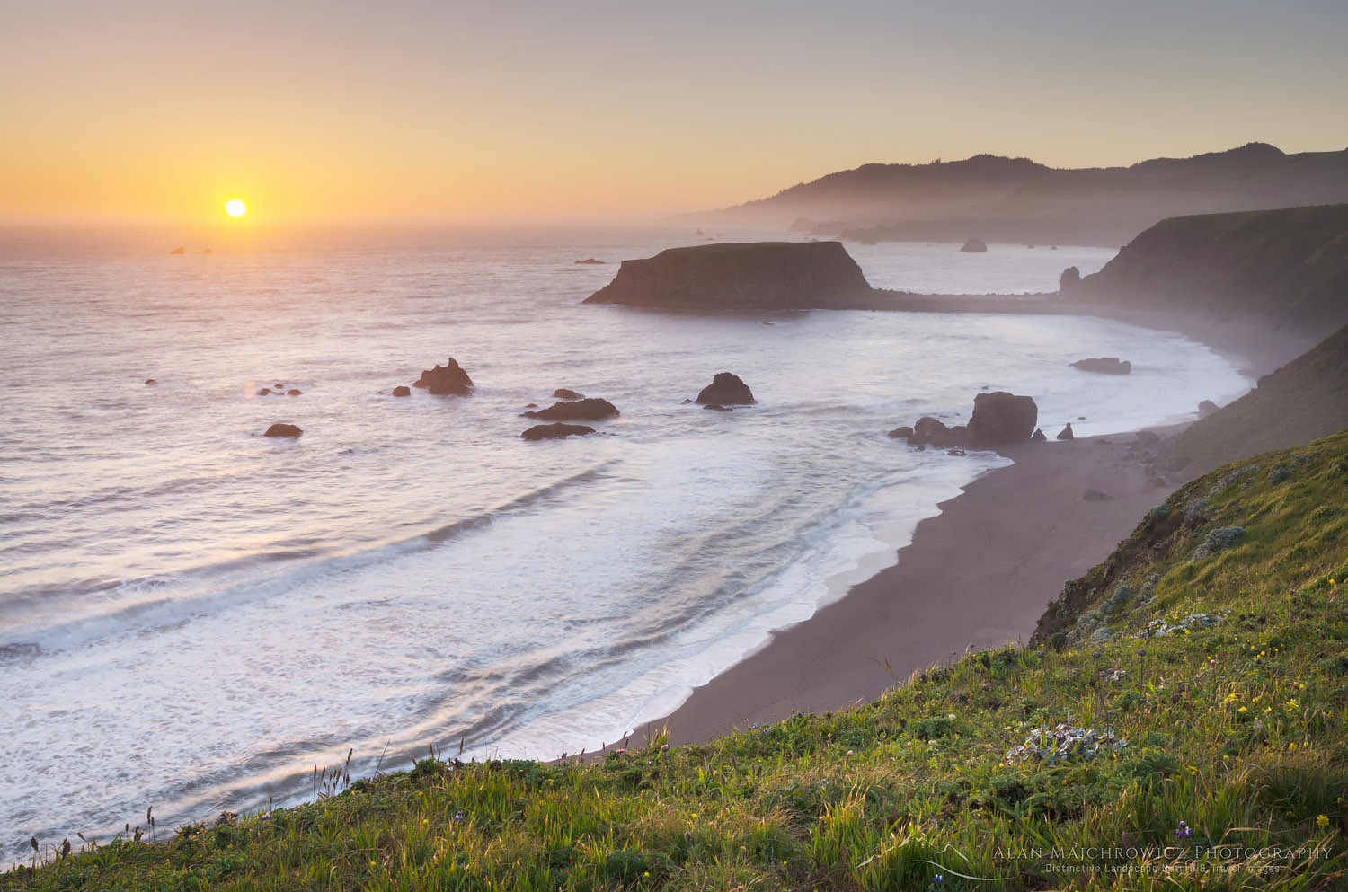
Sunset Sonoma Coast wildflowers, CaliforniaSunset, Sonoma Coast California  #60392  Purchase

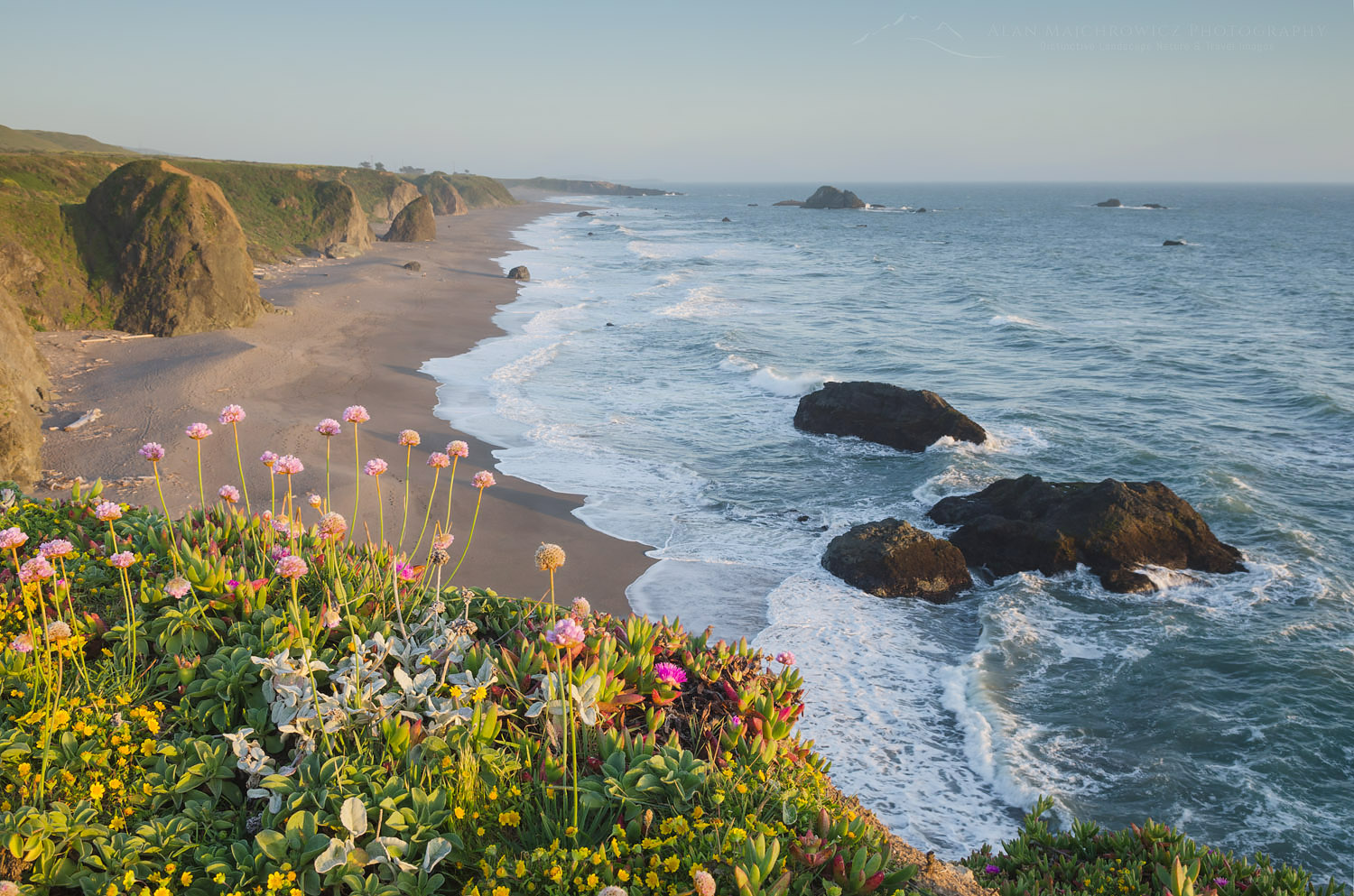
California’s Sonoma Coast stretches roughly from Bodega Bay in the south to the Mendocino County line in the north. In this post, I will feature areas of Sonoma Coast State Park, a highly scenic and popular area to the north of Bodega Bay. This was my second visit to the area and the first in which I was able to take time to appreciate and photograph the scenery. Visiting in the spring I wanted to take advantage of plentiful wildflowers along the coastal bluffs, and the greenery of surrounding hills. Although visiting during spring I avoided persistent coastal fog there were constant winds instead.

Sonoma Coast wildflowers, CaliforniaSonoma Coast California  #60377  Purchase

Bodega Bay

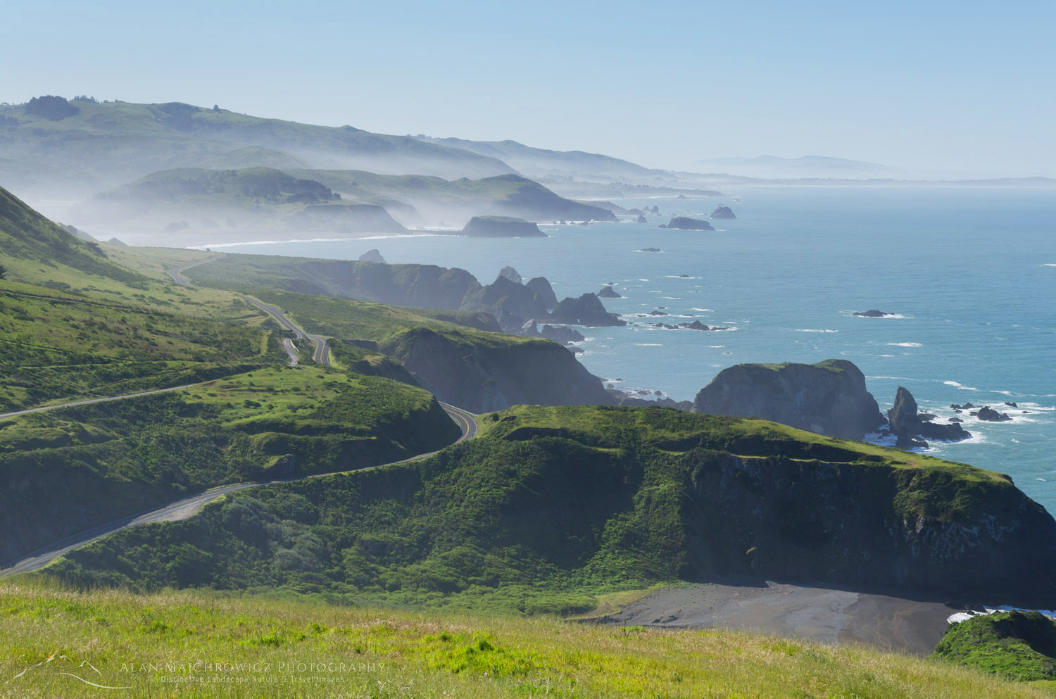
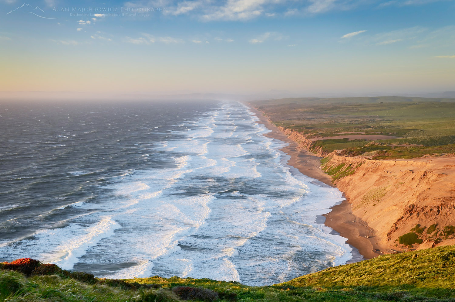
Iconic California Highway 1 runs the entire length, with numerous places to pull off to enjoy the view. The most dramatic view can be had just north of the state park. Here the highway switchbacks high up a headland. The entire coast to Point Reyes is visible from this point. Sonoma Coast State Park is comprised of several scenic sand beaches and rugged headlands. Being a close drive to San Francisco the park sees a large number of visitors from the metropolitan area. Bodega Bay, being the hub for all the activities, also has the claim to fame for having Alfred Hitchcock’s The Birds filmed there. I couldn’t identify any of the set locations on my visit though. I was too preoccupied with delicious Oyster Po Boy sandwiches from Fisherman’s Cove a local seafood venue.

California Highway 1 Sonoma CoastHighway 1 along the Sonoma Coast #60421  Purchase

Aside from the beaches and wonderful restaurants Sonoma Coast is a great location for watching migrating whales. While admiring the view from a bluff a local man pointed out to me a group making their way north. They were a fair distance off and hard to see even with binoculars. I had never seen whales, despite living many years in proximity to the coast, so this was pretty exciting. Goat Rock to the north has some of the most dramatic scenery and is a bit of an oddity. This headland was quarried back in the 1920s to provide building material for burgeoning San Francisco. As a result, Goat Rock in its present state looks more like a detached sea stack.

Sonoma Coast sunset CaliforniaSunset, Sonoma Coast California  #60303  Purchase

If you decide to visit this wonderful area I have a couple of essential tips. Make sure you book accommodations well in advance. I arrived on a weekday in the shoulder season and was only able to gain the last campsite by arriving early in the morning. Make sure you have enough time for leisurely exploring the area. At least three days, and preferably a week, would be best to see and photograph the sites. Lodging and food can be fairly pricey if, like me, your are from outside the area. State Park campsites all along the California coast start at $30 and can be as high as $50. For these prices there also is no guarantee of full facilities in good working order. Private campgrounds of course will cost more but may be better maintained.

Surf, Point Reyes BeachPoint Reyes Beach, just south of Sonoma Coast #60262  Purchase

Burney Falls, California

Burney Falls and Sonoma Valley California

Burney Falls and Sonoma Valley California

Burney Falls, CaliforniaBurney Falls #60182 Purchase

Last April I visited Burney Falls and Sonoma Valley California as part of a Spring photography tour. This tour encompassed Hood River Oregon the northern California coast and finally back to eastern Oregon. On the way to the California coast, I took the opportunity to make my first visit to these iconic locations.

Burney Falls, CaliforniaBurney Falls #60183 Purchase

McArthur Burney Falls State Park is the second oldest state park in California. Located in the Cascade Mountains northeast of Redding the falls are the centerpiece of the park. Created by both Burney Creek and springs issuing from layers of volcanic rock, the falls are an imposing site. Like many large waterfalls, Burney Falls can be difficult to photograph due to the constant mist created by the thundering water. Visiting at this time of the year there isn’t much colorful foliage around the falls so I decided to focus on details. Using a medium telephoto lens and long exposures, I found numerous compositions on the far side of the falls. The rest of the park is mainly forested with several hiking trails and a very large and pleasant campground. Unfortunately, since I was anxious to get to the coast I stayed only long enough to photograph the falls.

Sonoma Valley

Sonoma Valley VineyardsSonoma Valley Vineyard #60208  Purchase

My next brief stop on the way to the coast was the famous Sonoma Valley vineyards. Considered the birthplace of the California wine industry Sonoma Valley is home to some of the oldest vineyards and wineries in the state. Alexander Valley in the north was where I could leisurely drive along backroads to photograph the lovely scenery.

Along the way, I had to stop at Soda Rock Winery. There were some nice vineyards to photograph, and the imposing and whimsical Lord Snort guarding the entrance to the winery.  Showcased at the 2016 Burning Man Festival, Lord Snort is a metal sculpture by Bryan Tedrick. Visiting the tasting room, I felt very much out of my league among the lavish furnishings. Trying a white wine, I don’t remember what kind, the nice woman behind the bar talked up the complexity of notes, which of course just flew over my head. However, if this had been a distillery in Scotland it would’ve been a much different story!

Sonoma Valley VineyardsSonoma Valley Vineyard #60221  Purchase

Lord Snort Iron Pig ScupltureLord Snort Soda Rock Winery

Sonoma Valley VineyardsSonoma Valley Vineyard  #60213  Purchase

Liberty Bell Mountain Washington Pass

Washington Pass North Cascades

Washington Pass North Cascades

Liberty Bell Mountain Washington PassLiberty Bell Mountain North Cascades   #61304   Purchase

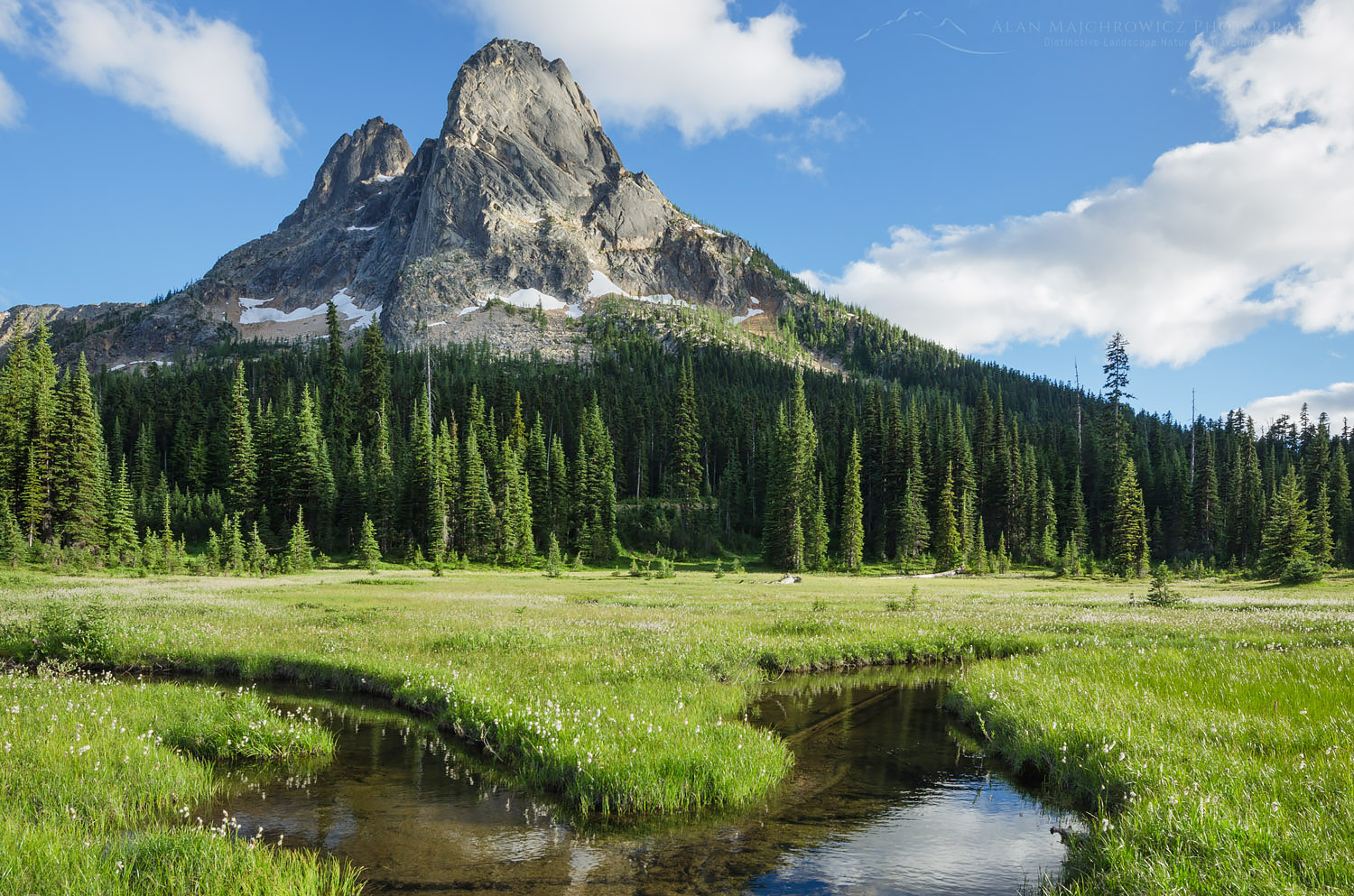
My last post featured a hike up to Maple Pass along the North Cascades Highway of Washington State. This post will feature the second part of that short trip. Not far up the road from Rainy Pass and the Maple Pass trailhead is one of the premier areas of the North Cascades, Washington Pass. Sitting at 5477′ this is the high point of the North Cascades Highway. It also features one of the best views of dramatic mountain scenery in the state accessible by vehicle. During the winter months, the pass closes due to deep snows and hazardous avalanche conditions.

Proudly guarding the pass is Liberty Bell Mountain and its attendant peaks, The Minute Man and Early Winters Spires. All of these and surrounding peaks are composed of a pinkish type of granite carved from the Golden Horn Batholith. The quality of the rock attracts climbers from all over the globe and in early spring ski mountaineers.

Kangaroo Ridge, Washington Pass MeadowsKangaroo Ridge from Washington Pass #61316   Purchase

The aesthetic beauty of the area also attracts photographers, me being one of them. Most visitors new to the pass generally head to the dramatic views of the overlook area. However I enjoy the peaceful solitude of the adjacent meadows and the wonderful compositions it offers. The meadows are the headwaters of State Creek and can be classified more as wetlands. Photographing on the spongy ground requires very light steps to protect the delicate plants. Another requirement is a willingness to get your feet wet and a tolerance for swarms of flying biting insects!

Liberty Bell Mountain Washington PassLiberty Bell Mountain North Cascades #61365
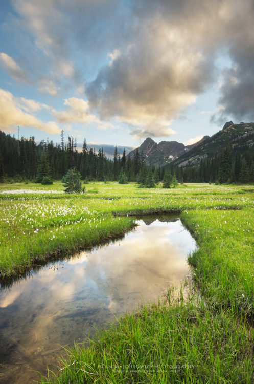
Autumn is also another great time to visit as the subalpine larches fringing Liberty Bell are turning gold. However, the sun is then at a lower angle and doesn’t illuminate much of the north face of the mountain. When the road opens in spring you can also get an idea of how the pass looks in winter conditions.

Washington Pass North CascadesWashington Pass #61343

Hikers on trail North Cascades

Maple Pass North Cascades

Maple Pass North Cascades

Hikers on trail North CascadesHikers on Maple pass Trail, North Cascades  #61268  Purchase

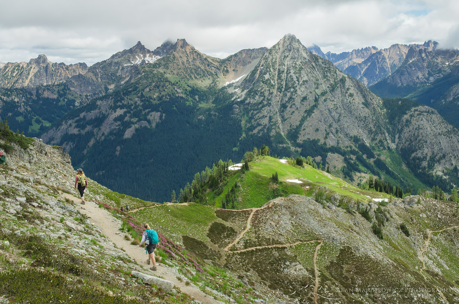
Last weekend I had the opportunity to visit a few of my favorite areas along the North Cascades Highway. The first being a wonderful day hike up to Maple Pass. It’s been quite a number of year since I did this hike, and since the trail was extended into a loop trip I was excited to check it out. I won’t get into the details of the trail except that it quickly gets you up into the alpine and offers some of the best views in the North Cascades. Being one of the first to the pass it wasn’t long before a steady procession of hikers appeared. I usually try to avoid weekend hikes due to the crowds but in this instance it was nice to meet lots of nice folks. In addition I was able to include hikers in some photos to add to my recreation files.

Hikers on trail North CascadesHikers admiring view from Maple Pass Trail, North Cascades  #61284  Purchase

As you’ll notice in the photos I mixed up the processing a bit from my usual style. Since these were all made during midday it seemed a good opportunity to try out a high key look. I’m a firm believer of photographing in all types of light and getting creative with different types of processing to fit the occasion. Beautiful dramatic evening light is great but you’re not stretching your artistic boundaries if that all you do. Of course my next post will most likely include some of that very style!

North Cascades seen from Maple Pass TrailNorth Cascades from Maple Pass  #61260  Purchase

Black Peak, Lake Ann North CascadesBlack Peak and Lake Ann, North Cascades #61302  Purchase

Maple Pass North Cascades

Mount Shasta

Mount Shasta Pluto’s Cave

Mount Shasta Pluto’s Cave

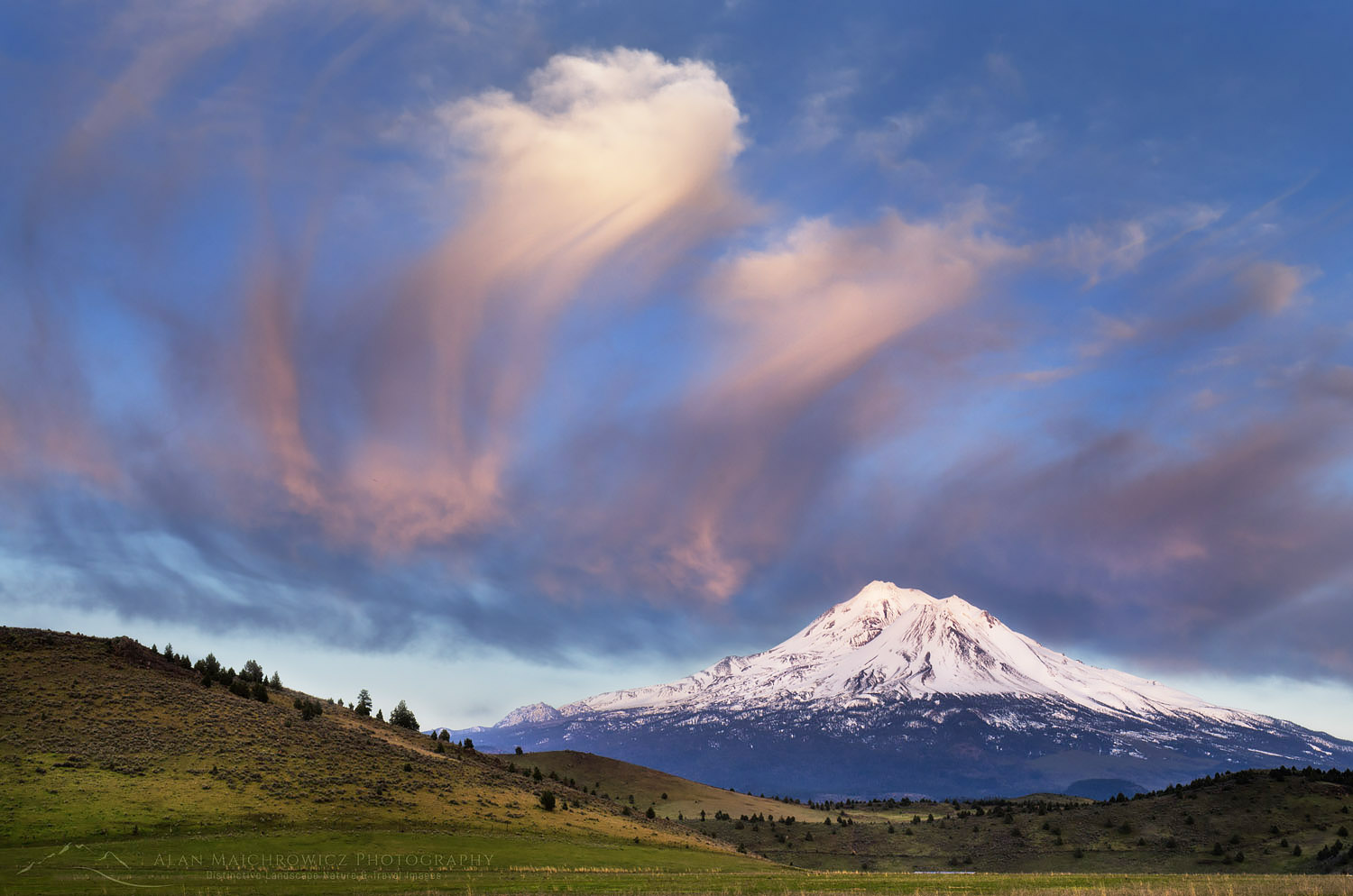
Mount ShastaMount Shasta #60134  Purchase

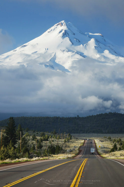
Mt. Shasta is one of the most strikingly beautiful mountains in the Cascades. At 14,179 feet it is the second highest in the range. It is also a sacred mountain of the Klamath tribe. On my way south to the California coast I made a point of setting aside a few days to photograph this beautiful peak. In the image above I was lucky enough to arrive in the area just in time to photograph the mountain while bathed in evening light. The next morning I headed to U.S. Highway 97 for a view of the mountain as a backdrop for the road. Fortunately the morning fog lifted just long enough to make this compressed view image.

Mount Shasta, U.S. Highway 97Mount Shasta from U.S. Highway 97 #60144  Purchase

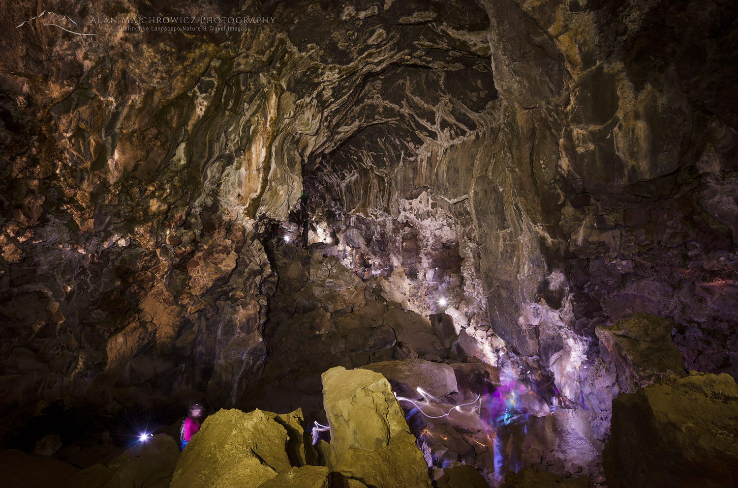
Pluto's Cave Mount Shasta CaliforniaPluto’s Cave  #60164  Purchase

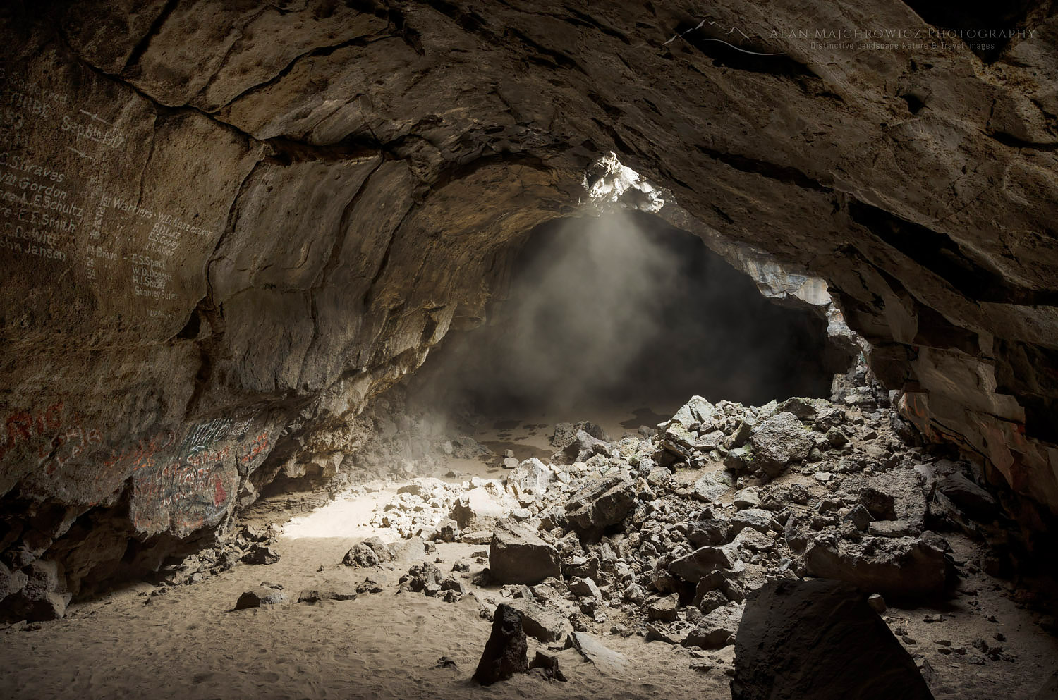
As an enthusiast of all types of caves I was thrilled to learn about and visit Pluto’s cave while photographing in the Mount Shasta area. This cave is really just a large Lava tube created by a past eruption of Mount Shasta.

While checking out the main chamber a group of people passed by to explore the further reaches of the cave. I quickly set up my camera in hopes of making an interesting image. Having no idea how long of an exposure it would take so I just took a guess by leaving the shutter open for 7.5 minutes. I also used my headlamp to “paint” light on the ceiling and walls.

The coolest thing about this image is that the group of people were there to meditate. On finding suitable spots they turned off their headlamps and the leader began singing Native America chants in total darkness. A wonderful experience I’ll never forget.

Pluto's Cave Mount Shasta CaliforniaPluto’s Cave  #60158  Purchase

Mount Shasta Pluto’s Cave


Lichens on basalt

Liking Lichens

Liking Lichens

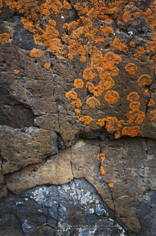
Lichens on basaltLichens #59874 Purchase

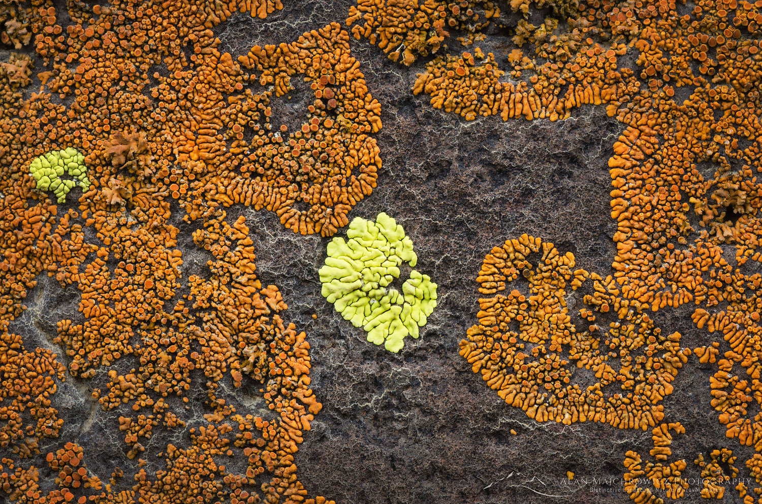
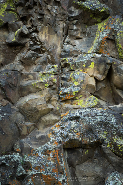
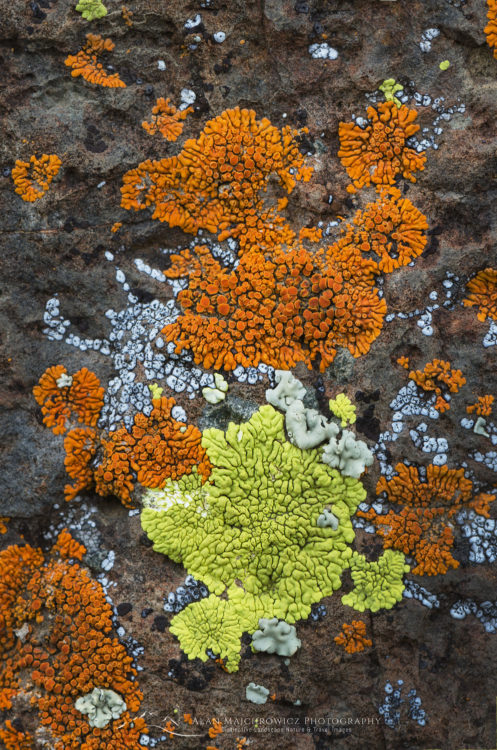
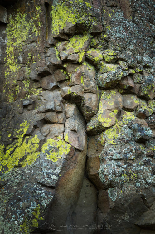
One of my favorite quirky subjects I love to photograph are lichens. Lichens grow just about everywhere but unfortunately are unappreciated by most people. They are some of the oldest organisms on land, going back perhaps 600 million years. They live in some of the most extreme conditions and are an important food source for animals such as caribou. For humans they are a natural source of antibiotics and pigments. Lichens are also an indicator of clean air as they will not grow in the presence of  pollutants.

During my recent visit to Cottonwood State Park in Oregon I saw some outstanding lichen colonies. A large outcropping of columnar basalt which remains in shade harbored a beautiful display in many striking colors. Juxtaposed against the interesting patterns and cracks of crystallized basalt, the lichens made a wonderful abstract study.

Admittedly this kind of subject matter isn’t appealing to everyone, but I had a great time picking out interesting compositions.

Lichens on basaltBasalt and Lichens #59895  Purchase

Lichens on basaltLichens #59869  Purchase

Lichens on basaltLichens and Basalt #59897  Purchase

Lichens on basaltBasalt and Lichens #59881  Purchase

Liking Lichens
John Day River Oregon

John Day River Oregon

John Day River Oregon

John Day River OregonJohn Day River, Oregon #59904     Purchase

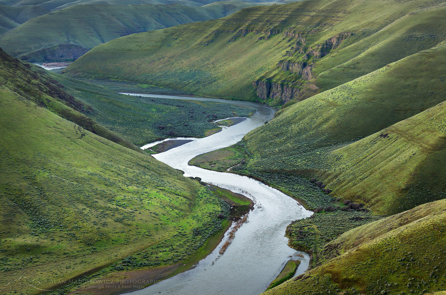
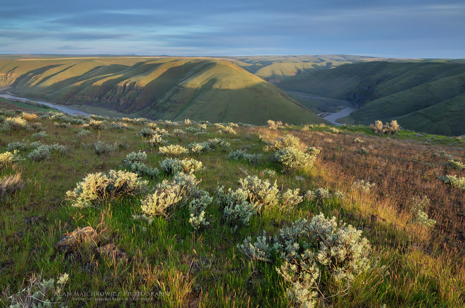
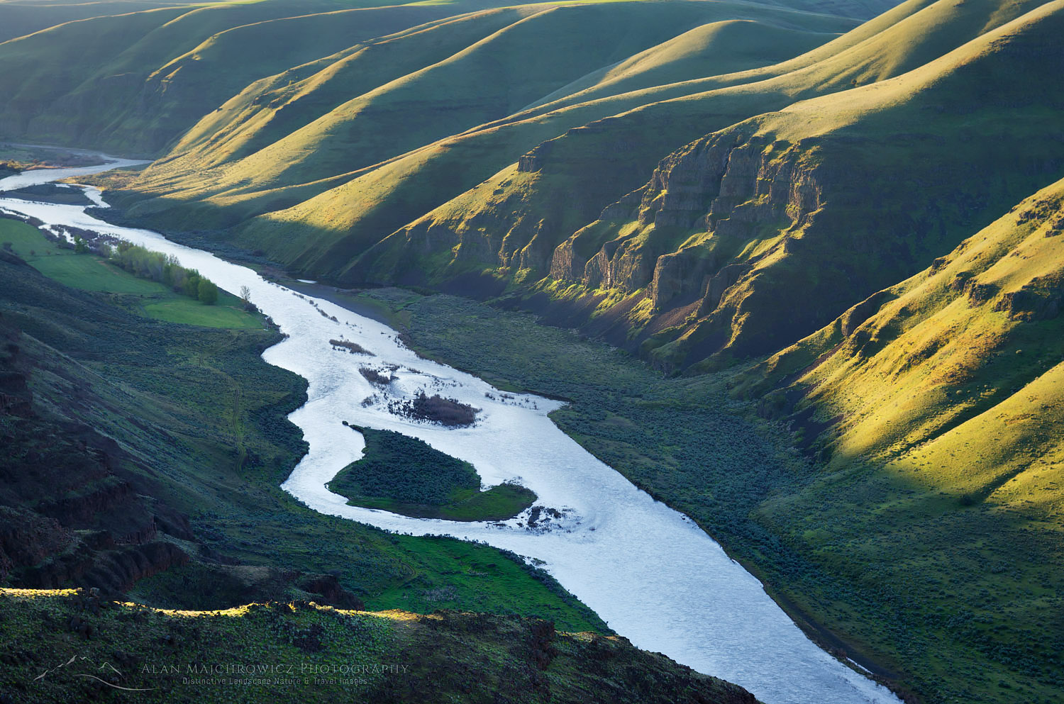
This post will begin a series of recaps from my recent spring photography trip. My first stop was Cottonwood Canyon State Park, along the lower John Day River Oregon. This is Oregon’s newest state park and it was a pleasure to visit. As you can see from the photos the surrounding country is part of the Coloumbia Plateau, with the John Day River cutting canyons through the flood basalt. The nature of this geology helps the river create many scenic winding turns and horseshoe bends.

John Day River OregonJohn Day River, Oregon #59852    Purchase

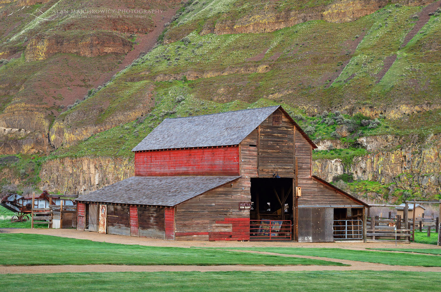
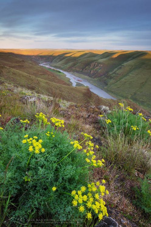
Visiting this area in early spring offers cool green hillsides sprinkled with a variety of wildflowers. Most notably Balsamroot (Balsamorhiza sagittata) and Desert Parsley (Lomatium laevigatum). Later in the season the hills will turn a golden brown, and the weather will be much hotter. The park was donated by a local ranching family and contains several remnants of its past, such as a picturesque red barn and some farming implements. A small campground is located right along the river where several nice riverside trails begin. If you’re not into natural history or photography the river is supposedly great for fishing and the spring runoff offers excellent rafting.

Red Barn Cottonwood Canyon State Park OregonRed barn Cottonwood Canyon State Park, Oregon #59841    Purchase

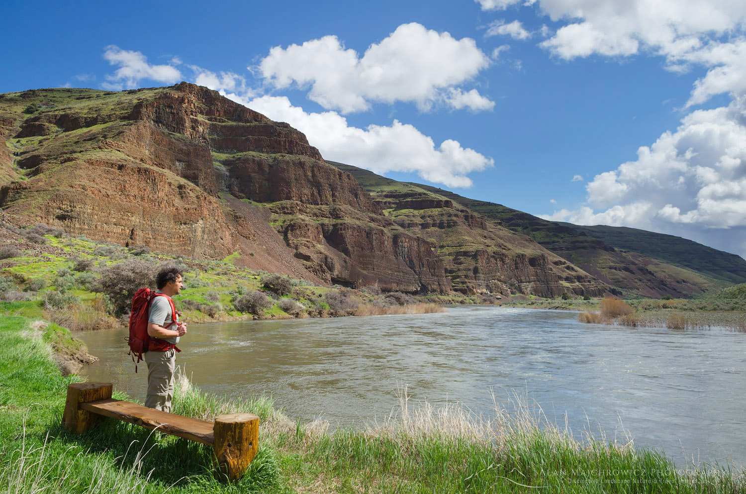
Hiker John Day River, Cottonwood canyon State Park, OregonJohn Day River Cottonwood Canyon State Park, Oregon #59797    Purchase

Photography, of course, was the main reason for my visit. The goal was finding some nice views of the river bends. This proved however to be a bit of a challenge as many of the best bends were inaccessible by road or foot. After scouring Google Maps I did manage to find a backroad close to the canyon rim with a nice view. My research showed the best horseshoe bend view is situated about an hour drive south of the park. The weather forecast didn’t look good enough to make the trip worth it though. That one will have to wait until my next trip to the area.

John Day River OregonDesert Parsley, John Day River, Oregon #59858    Purchase

A couple words of warning if you visit this quiet and special area. All unsurfaced roads can be impassable to vehicles after a rain, they turn into a gluey gumbo. Trust me on this, I once almost got stuck and had to wait a couple of days for the road to dry out before I could safely proceed. Rattlesnakes are common, and in spring ticks can be a problem. Also in late spring and summer the temperature can be very hot, with little shade to provide relief.

If you’d like to see more photos from this area you can search John Day River or Cottonwood Canyon State Park on my website. All photos can be licensed for editorial or commercial use or also be purchased as prints. Thanks for viewing and please pass this post along to your friends!

John Day River OregonJohn Day River, Oregon #59912     Purchase

John Day River Oregon