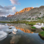
Green River Lakes Wind River Range
 Squaretop Mountain and Green River #67163 Purchase
At the North end of the Wind River Range is one of the most scenic and accessible areas in the Bridger Wilderness, Green River Lakes. The Winds are famous for its numerous trails winding through rugged subalpine terrain. Most of those trails start high and involve lengthy approaches to the most scenic areas. However, at Green River Lakes a hiker starts low and passes through a pleasant valley before climbing into the alpine.
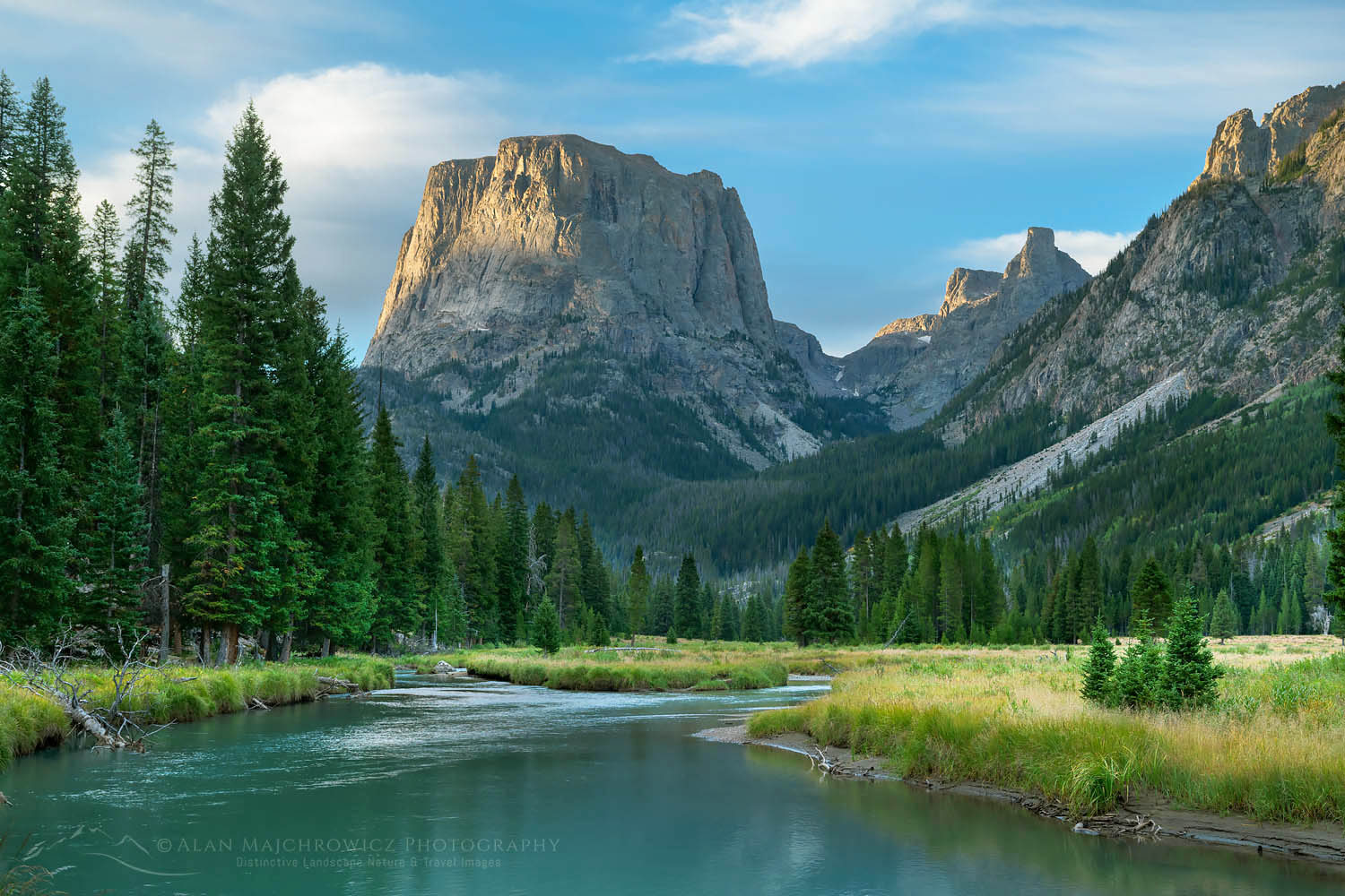
Dominating the Green River Lakes landscape is Squaretop Mountain, one of the most iconic mountains in the state of Wyoming. Only Grand Teton in Grand Teton National Park is arguably more recognizable. Squaretop immediately comes into view at the end of the access road. And it remains the focal point for the first six or so miles along the Green River trail.
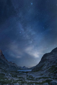
 Green River Lakes Wind River Range #66979 Purchase
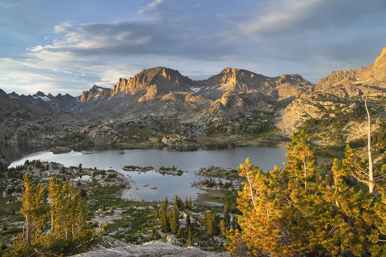
Following my nine-day backpacking trip to Island Lake and Titcomb Basin, this was to be my final destination in the Winds. After several lengthy backpacks over the past month, this last one would be short and easy.
The Green River Lakes trailhead is at the end of a 52-mile drive north from Pinedale. The last 21 miles are on a washboard gravel and dirt road. Adjacent to the large trailhead parking area is the Green River Lakes Campground, which has 39 sites. However, there are plenty of random camping sites available along the 21 miles of gravel road.
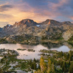
 Squaretop Mountain Wind River Range #66997 Purchase
Hiking the Green River Lakes/Highline Trail
The trailhead is the northern end of the Highline trail, which runs the length of the Wind River Range. It’s also the beginning, or end, of the increasingly popular Wind River Range High Route. The plan was to hike in only for the first five or six miles to the best views of Squaretop and Green River. At that location, I would set up camp and spend a few days photographing the area.
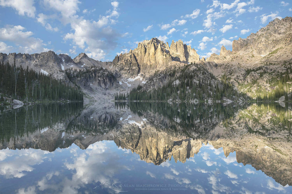
Starting at the north end of the larger of the two Green River Lakes, the trail follows the open eastern side of the lake. With only minor ups and downs, and unobstructed views the entire way, this section is very pleasant. After a couple of miles is a junction with the Clear Creek Trail and a large open area filled with gravel and willows. Then comes a short climb and the second Green River Lake is spread out just below. All of this makes for great hiking but the real treat is just ahead.
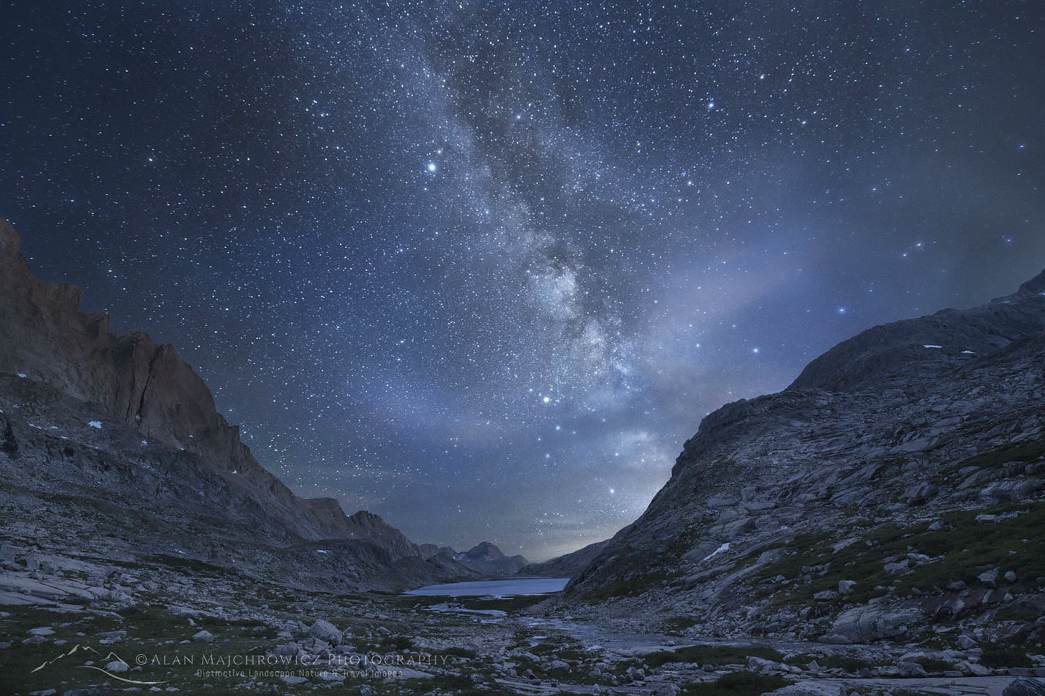
Soon after passing the southern end of the second lake, the trail begins to follow close to the twisting Green River. Its name is taken from the fact that the river is fed by glacial meltwater, coloring it an opaque green or turquoise. The Winds contain some large glaciers, located mainly on the east side of the Continental Divide. Although here on the west side of the range few are visible from trails. Being so far south in such a dry climate it is surprising to come across a glacier-fed river, similar in appearance to those seen further north in the Canadian Rockies.
 Squaretop Mountain and Green River #67170 Purchase
Along the Green River
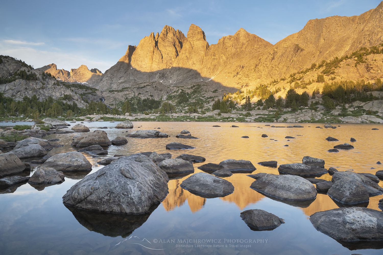
This area, where the river runs slow among many bends, was where I needed to be, and I began to keep my eye out for a suitable campsite. Getting an early start once again paid off big time. Just above the most scenic point along the Green River, I found an unoccupied site. I considered myself very lucky in this respect since this was the Friday of Labor Day weekend. There were sure to be lots of parties looking for a site close by.
After setting up camp I walked down to the river and knew I was in the ideal spot. Along the river it was evident by the trampled grass that it was a prime viewing area. I’m guessing most of those spots were where other photographers or photo tours/workshops set up shop. The reason why it’s so popular is very clear. With the Green River in the foreground Squaretop Mountain looming in the background framed by fir and pine trees.
 Squaretop Mountain and Green River #67138 Purchase
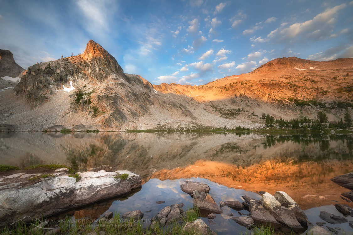
After a day hike a couple of miles further up I decided that the best spot for photography was where I set up camp. Due to weather and lighting conditions, I ended up spending three nights here. Like my previous backpacks in the Winds this summer the weather was just too good. Every day was warm and sunny, perfect for just about any outdoor activity, but not for landscape photography.
The first two days were lacking suitable clouds and light during the morning and evening golden hours. During this time I was entertained by an otter swimming in the river and some moose grazing in the meadows on the opposite side. However, on the morning of my last day, some approaching weather helped make the wait worthwhile.
 Bridger Wilderness Boundary Sign #67194 Purchase
Moving on to Grand Teton National Park
On Monday morning it was time to pack up and hike out. My adventures in the Winds were finally coming to a close, and the next half of my Rocky Mountains photo tour was about to begin. Now that the busy Labor Day weekend was over it was safe to drive north into Grand Teton National Park. Little did I know at the time, but there were only a few more days of good weather left. Fall storms would soon be rolling in, bringing lots of rain and even some snow.
Sitting at my desk writing this post on a rainy winter day, I have fond memories of my month of backpacking in the Winds and Sawtooths. I truly hope I have the opportunity to return soon, there is so much more to see and explore!
If You Go to Green River Lakes
Distance from trailhead to river flats: 5 miles
Elevation Gain: about 300′
Difficulty: Easy
Red Tape: As of 2019, no permits are needed
The Green River Lakes Trailhead is located 52 miles north of Pinedale, on the Green River Road. The last 21 miles are unpaved and can be rough in several places. Adjacent to the trailhead there is the Green River Lakes Campground, 39 sites $12 per night. This site doesn’t open until July 1. However, if the campground is closed there are plenty of free sites along the road.
Make sure you take along plenty of insect repellant. The Winds are especially notorious for their ravenous hordes of mosquitoes and flies. Although they weren’t too bad during my trip in mid-August. Also, be prepared for dramatic weather changes. I had great weather on my trip but the wind was brutal for several days.
The town of Pinedale makes a great base for multiple trips into the Winds. It has everything you’ll need, from good food and lodging to one of my favorite outdoor recreation stores, the Great Outdoor Shop. It’s stocked with everything needed for a successful trip, including a very knowledgeable and friendly staff. Don’t visit Pinedale without dropping in! Right next door to the great Outdoor Shop is the best place to go for a post-trip meal, the Wind River Brewing Company. They have excellent burgers and great brews!
 Squaretop Mountain and Green River #67130 Purchase
Leave No Trace
And now for a short lecture. As I’ve been saying in previous posts, don’t even think about visiting this or any other wilderness area unless you are prepared to strictly follow the guidelines of Leave No Trace (LNT). The Wind River Range and all other wilderness areas throughout the world are under incredible pressure from growing amounts of visitors. Please do your part to help preserve these precious areas for future generations!
To learn more about the principles and practicing LNT please take a few minutes to visit the Leave No Trace Center for Outdoor Ethics. Your children and grandchildren will thank you!
Seven Leave No Trace Principles
- Plan ahead and prepare.
- Travel and camp on durable surfaces.
- Dispose of waste properly.
- Leave what you find.
- Minimize campfire impacts (be careful with fire).
- Respect wildlife.
- Be considerate of other visitors.
Photo Gear Used On This Trip
Nikon D850
Nikkor Lens:
14-24mm 2.8G ED
24-70mm 2.8E ED
70-200mm 2.8E FL ED
Gitzo 1532 Tripod
Really Right Stuff B-55 Ball Head
Assorted Lee Graduated Neutral Density Filters
B+H Polarizing Filter
Vello FWM-N2 Remote Shutter Release
If you enjoyed reading Green River Lakes Wind River Range please share it with your friends and family. And make sure you check out more posts on the Winds:
Cirque of the Towers Wind River Range
Central Wind River Range Backpacking
Bonneville Lakes Wind River Range
Island Lake Wind River Range
Titcomb Basin Wind River Range
Indian Basin Wind River Range
Pyramid and Shadow Lakes Wind River Range
All photos appearing in Green River Lakes Wind River Range are available for Commercial Licensing and Fine Art Prints. Click on any image to purchase, or contact me for more info!
 On the Highline Trail Wind River Range #66332 Purchase
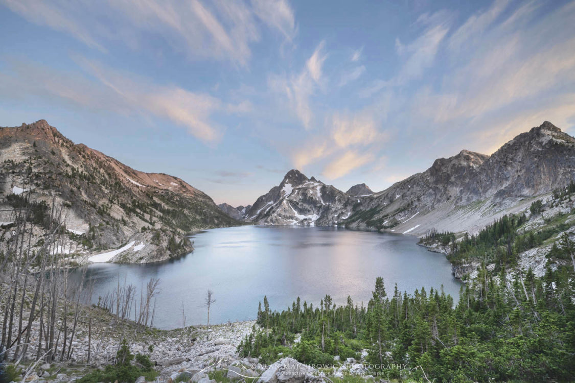
Green River Lakes Wind River Range


 Sawtooth Mountains Idaho")